

LiDAR: what it is, and how it is useful for photogrammetry
Contrary to pop culture impressions, lasers aren’t only destructive, planet-destroying beams. Lasers are one of the most precise ways to measure distances. This includes LiDAR, which is becoming more and more accessible in consumer markets. Pix4D's technology is about measuring from images, but LiDAR can also be incorporated into the workflow. Here’s how LiDAR differs from photogrammetry, but also how they can work hand in hand.
What is LiDAR?
LiDAR is an acronym for light detection and ranging, which is also known as 3D laser scanning. LiDAR was first used in the 1960s1 and is wielded for measuring distances based on laser light. It works by illuminating a target object or space with a laser light and recording the time it takes the laser light to return to the sensor to measure distances with high accuracy.
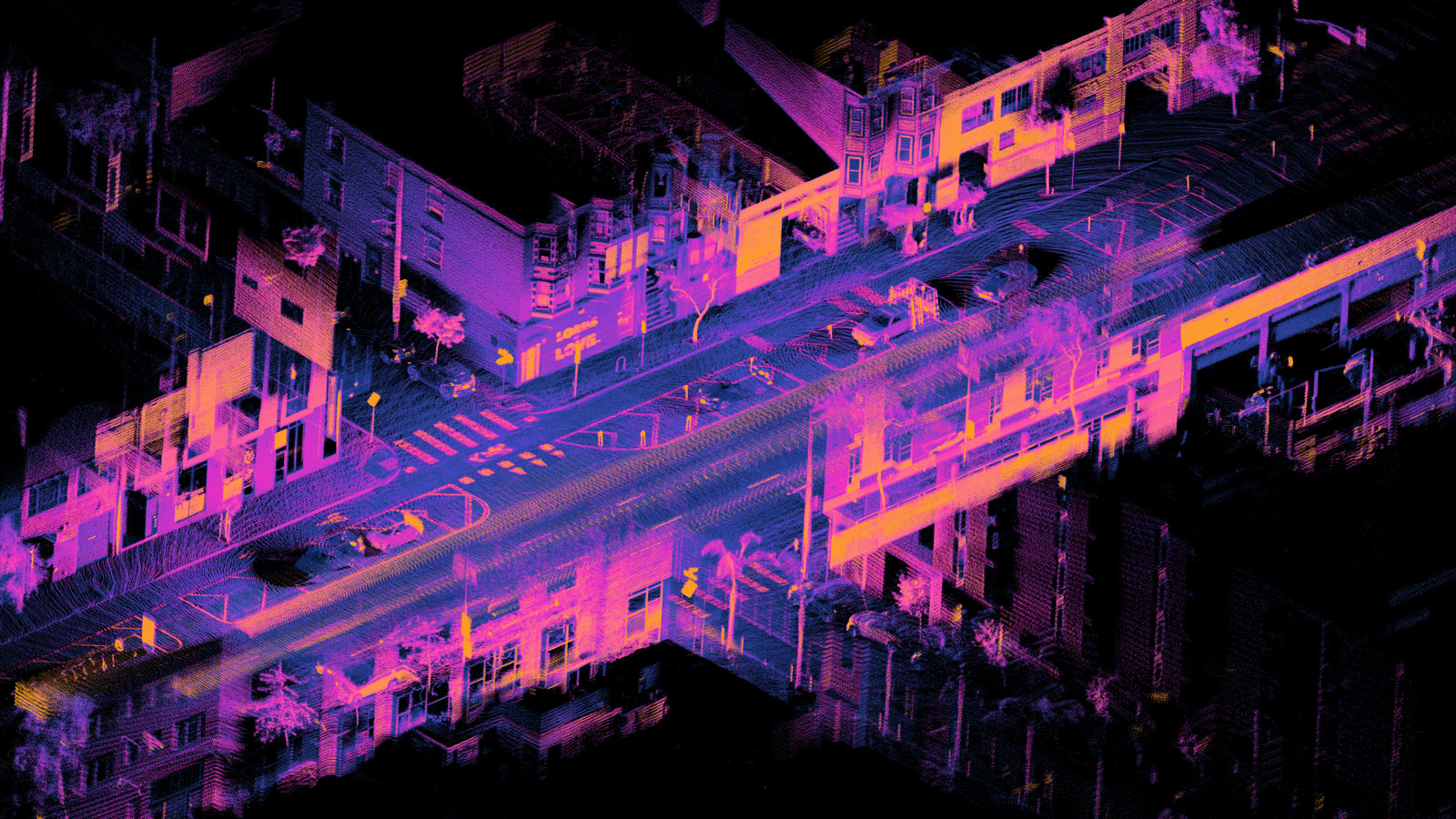
3D laser scanning is already in use in a variety of industries, with applications ranging from mobile to terrestrial and airborne data collection projects. Because laser scanning measures distances accurately, it is highly effective for making digital 3D recreations of space, objects, and landscapes. In this aspect it can compete with photogrammetry as a tool for digitizing reality. LiDAR methods produce a geo-referenced and non-colored 3D point cloud. This dense point cloud is highly detailed and often includes small objects, such as cables or wires, that photogrammetry may not recognize as easily. However, LiDAR can be expensive to perform, and it is often necessary to hire a specialized laser scanning company to gather data.
What is photogrammetry?
Photogrammetry is the process of measuring from images. The captured overlapping images are processed to generate precise models of space.Its key purpose is digitizing reality for surveying and mapping. Early photogrammetry relied on high vantage points or hot air balloons to gather aerial data.Nowadays there is a higher prevalence of using drones to collect surveying data alongside ground-level image capture. Photogrammetry is used in a variety of industries with a huge range of applications, from forensic crime scene mapping to use in precision agriculture.
What is the difference between LiDAR and photogrammetry?
Firstly, LiDAR has one big advantage over photogrammetry: it produces its own light. That means it is not affected by weather conditions, such as cloud cover and changing lighting conditions which can greatly disrupt aerial data collection for photogrammetry. Both terrestrial and aerial 3D laser scanning benefit from this, whereas photogrammetry using drones or handheld cameras does suffer in poor lighting.
Secondly, LiDAR can penetrate the spaces between pieces of foliage and pick up small details. The laser pulse will see in-between leaves and give a measurement straight to the tree trunk or ground beneath the tree, whereas photogrammetry depends on photos, reconstructing only what is visible at the surface.
However, LiDAR is often expensive. Photogrammetry can be performed, with varying degrees of accuracy, with a wide range of cameras including consumer ones rather than exclusive, high-spec professional tools.
In addition, photogrammetry benefits from a range of outputs, including colorized point clouds, textured meshes, and orthomosaics, while LiDAR only produces a point cloud.
How can photogrammetry and LiDAR work together?
LiDAR can be used to perform similar tasks to photogrammetry and can strengthen its outputs. The use of both techniques in combination means that LiDAR, especially terrestrial laser scanning, can add details that aerial photogrammetry data may have missed. Thus, when LiDAR and photogrammetry are combined they bring more detail to a project that may not have been achieved by either individually.
This is exemplified in PIX4Dsurvey, the new vectorization software bridging the gap between photogrammetry and CAD. It enables users to merge photogrammetry point clouds with point cloud data acquired with other technologies, including LiDAR. By providing access to both the original images and the point cloud, the vectorization and extraction of points, polylines, polygons and catenaries is made more accurate and faster than ever before. For complicated projects, e.g. with narrow objects such as powerlines, LiDAR can help fill in the gaps that photogrammetry data collection methods may miss. The software is able to use photogrammetry data in combination with terrestrial laser scanning.
Vectorizing an area breaks it down into polylines and polygons to define points of geometry. As a result, the final vector files derived from large point cloud data from photogrammetry and LiDAR are engineering ready.
Photogrammetry and LiDAR in action
LiDAR and photogrammetry point clouds are often massive files made of billions of points. Manipulating and seamlessly navigating this data has been a challenge that PIX4Dsurvey now solves, allowing users to handle these billions of points.
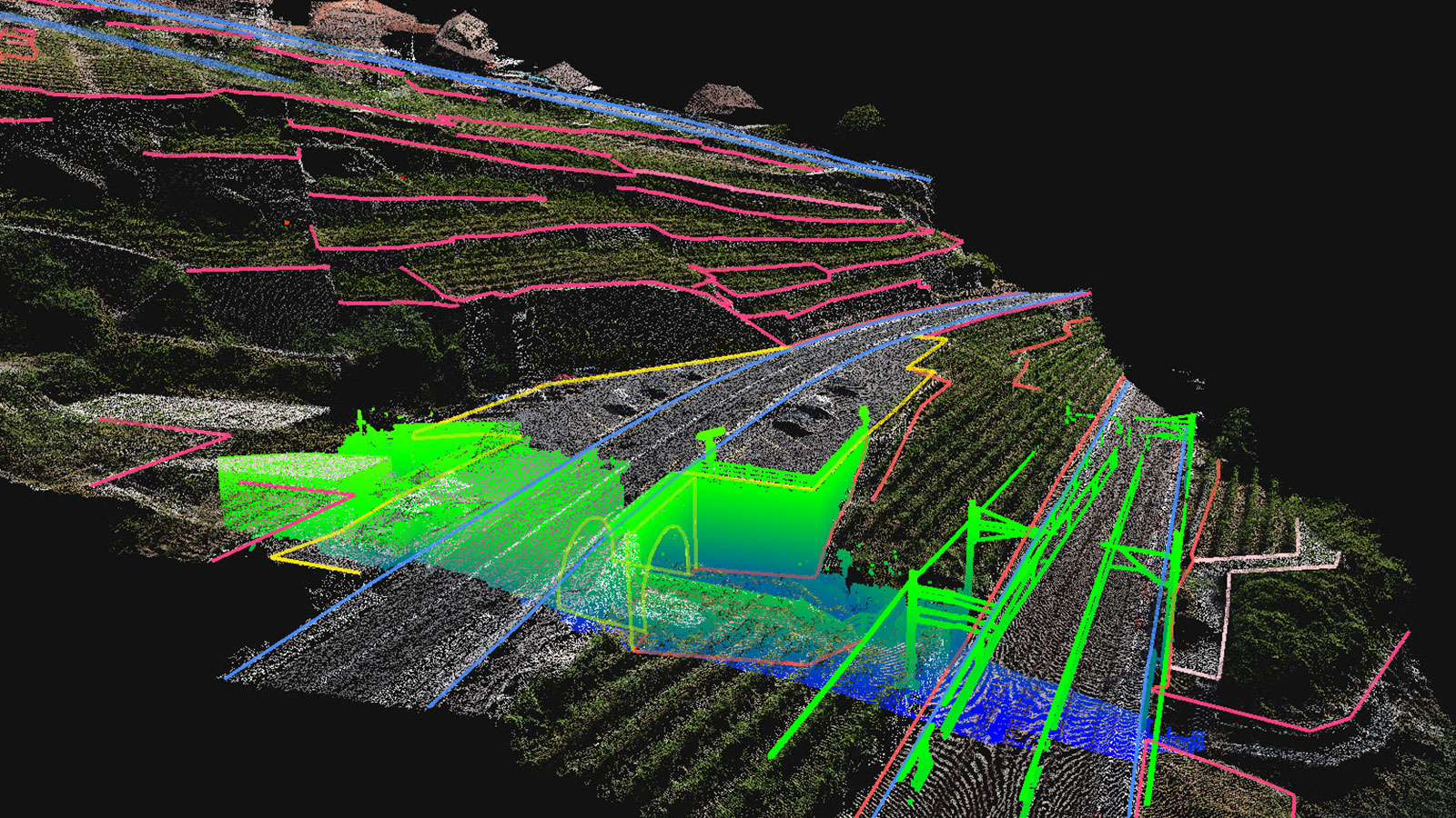
In the example below, a drone was used to collect aerial images of a stretch of railway track in Switzerland. The point cloud generated using photogrammetry captured many details of the scene but did not pick up the specifics of the cables on the track or the metal post supporting them.
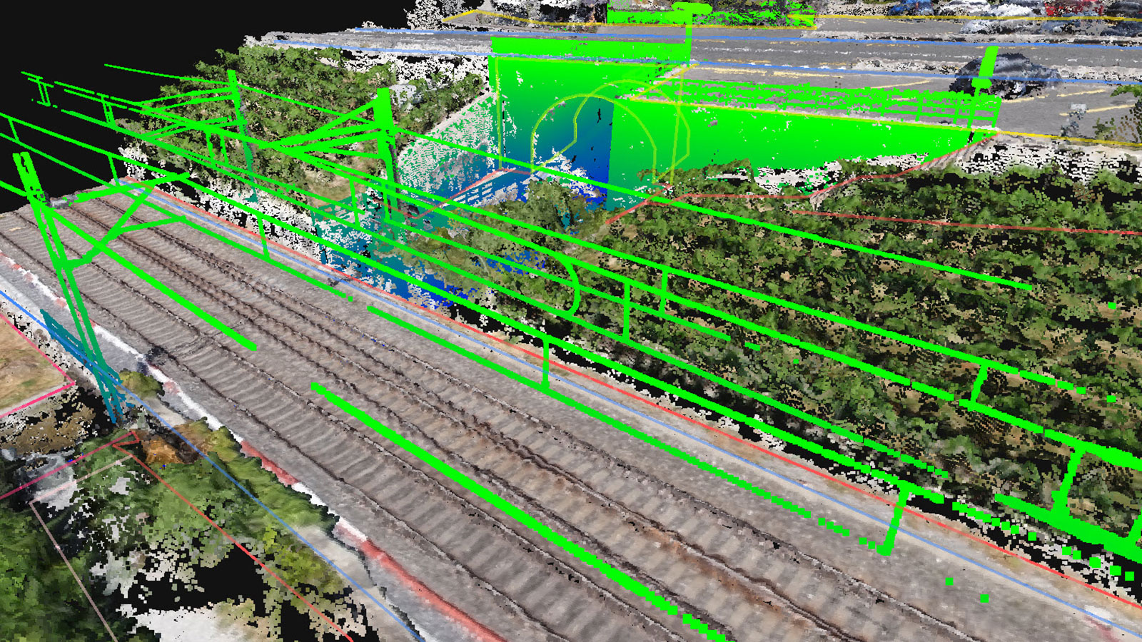
LiDAR data did record these details, filling in the gaps that the drone imagery had missed. As a result, a more complete model of the scene was generated, unlocking more information.
What's next?
LiDAR-equipped devices are becoming more widespread, making the technology avaiable to many by turning popular consumer products into devices ready for accurate 3D modeling. This is especially the case with the iPad Pro 2020 and the iPhone 12 Pro for which the PIX4Dcatch app has been optimized.
The workflow for terrestrial 3D scanning with PIX4Dcatch is simple: hold up the iOS mobile device and walk around to capture images of the area of interest. The scanning is done with real-time 3D meshing, giving live feedback about scene completion. PIX4Dcatch records the GPS and IMU data, allowing to generate scaled and georeferenced 3D outputs with PIX4Dmatic, PIX4Dmapper or PIX4Dcloud.
Meanwhile, PIX4Dmatic can now process both LiDAR and photogrammetry point clouds in the same project that have been produced with PIX4Dcatch. This update was introduced in PIX4Dmatic 1.19 in 2021. As a result, PIX4Dmatic users can choose between using the LiDAR point cloud, photogrammetry point cloud, or the fused point cloud to get the best from their results.
LiDAR’s transition into being accessible in the consumer market is an exciting development for 3D modeling. The pinpoint accuracy of 3D laser scanning in combination with the flexibility and varied applications and outputs of photogrammetry is part of the continued revolution in the surveying and mapping industry, ensuring a simpler access to critical information, more accurately than ever before.
References
| 1 | |
| "What is LiDAR", Back to top |
Header image credit: Daniel L. Lu


