

Applications
Crop scouting
Benefits
- Fast in-field drone mapping & on-demand satellite data included
- PDF Reports for record keeping and Share to Cloud for phone based scouting
- Analyze crop health with vegetation indices and Magic Tool for better crop management
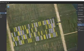
Trial plot management
Benefits
- Accurate processing of RGB & Multispectral drone data with RTK support
- Vegetation index calculator and elevation data for detailed crop insights
- Plot-level Statistics & Measurements ready for export as .csv, PDF
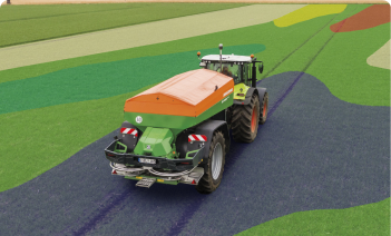
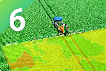
Variable rate application
Benefits
- Define application zones based on crop health analysis with drone or satellite data
- Prescription maps for Fertilizer, Growth Regulator and Crop Protection, compatible with Tractors, Sprayers & Spraydrones
- Distribute Inputs more efficiently to save costs and to increase crop health and yield
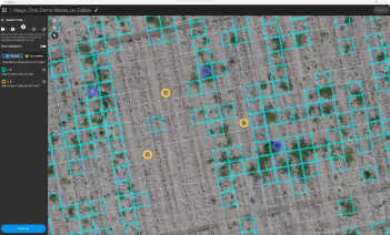
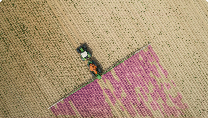
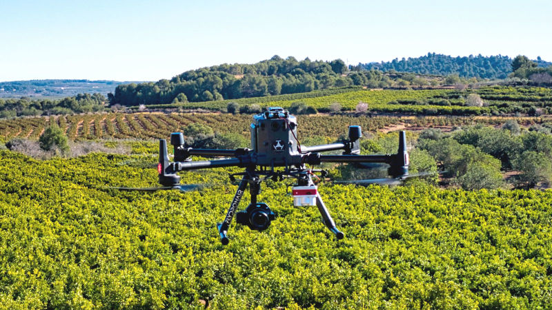
Spot spraying
Benefits
- Use AI help identify weeds and other areas of interest for precision application
- High-resolution spot spraying maps for tractors, sprayers, and spray drones
- Drastically reduce herbicide use and save money on every acre
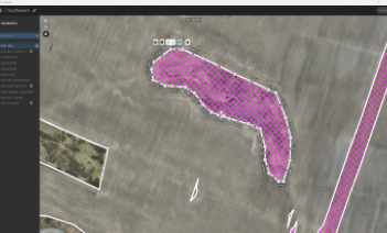
Boundaries, Measurements & counting
Benefits
- Map fields Boundaries, Obstacles and relief with RTK precision
- Create, edit, and measure annotations of points, lines and areas
- Export a field report with measurements as a PDF, .shp, .tiff or .csv file
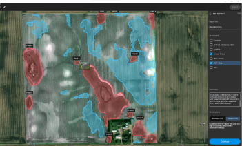
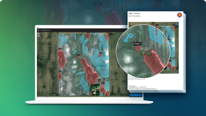
Reports & documentation
Benefits
- Use drones to save time and rely on proven results & accurate measurements
- Fast identification and quantification of damaged or impacted crops, manually or with our AI tool
- Customized PDF reports for agricultural insurance claims

More than just a map
The ultimate agriculture toolkit
In-field results
Create maps rapidly (no internet connection required) for faster decision making and action, without leaving the field.
Accurate maps
Get maps of your fields and crops at any stage using satellite and/or drone imagery.
Powerful Tools
From Images to insights, create crop health maps, field reports, spot spraying and prescription maps for you agricultural machinery.
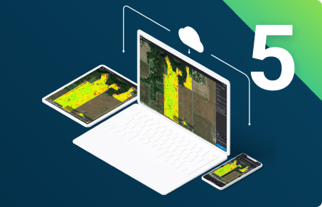
Easy Sharing
Share your data via PIX4Dcloud, as PDF report and in industry standard formats.
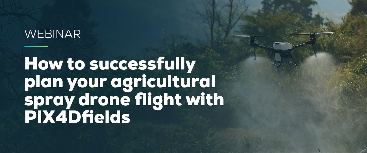
WEBINAR
How to successfully plan your agricultural spray drone flight with PIX4Dfields
Join us for a discussion on how to use PIX4Dfields RTK field boundaries and obstacle editing for spray drone applications, and talk about the importance of ensuring an efficient and profitable flight.
Watch now
Who can benefit and how?


Producers
- Farming
- Farm management
- Forestry
- Operations

Service providers
- Agriculture insurance
- Agronomy
- Ecosystems conservation
- Natural resource management
- Retail
- Turf management

Research and
Development
- Education
- Manufacturing
- Production

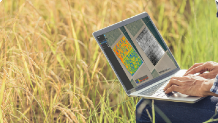
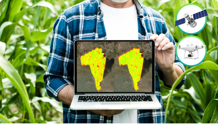
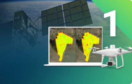
Remote Sensing
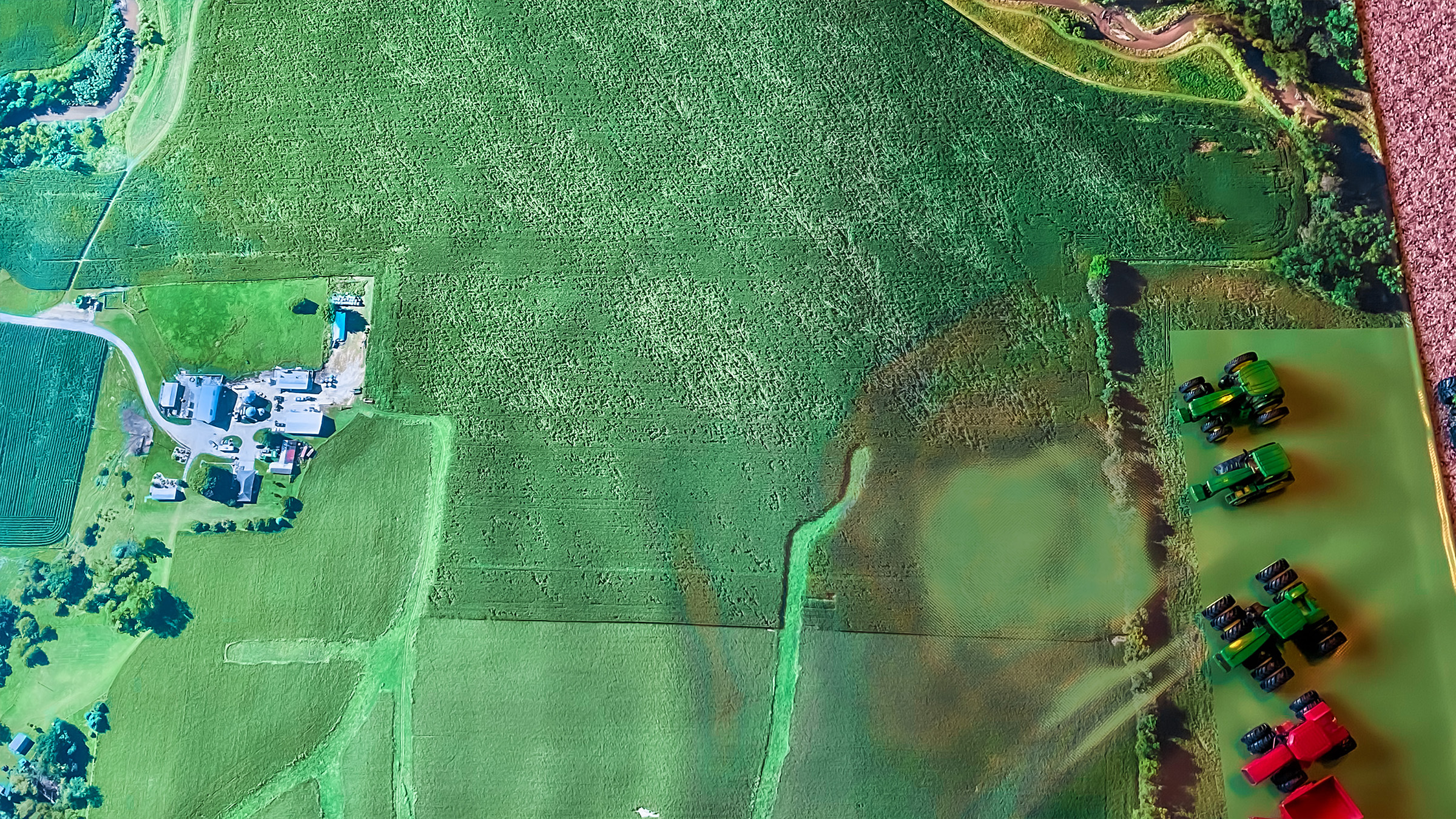
Collect images using a drone and any standard RGB or select multispectral cameras.You can also use Satellite Data Import to enhance your mapping experience with Sentinel-2 satellite data.
Process
Process imagery with the instant processing engine and get your maps directly in the field: 6.8 GB, 2948 images, 10 min (with the new radiometry module).
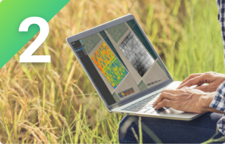
Scout
Generate precise orthomosaics, digital surface models, index maps, zones and accurate prescription maps.Trim your fields to a desired field boundary to create more targeted outputs.
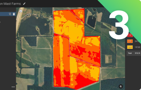
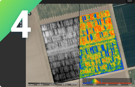
Analyse
Visualize and understand your crop growth stages and stress levels.Analyze and compare different layers of information for a full insight of your yield performance and use them to increase crop production and reduce costs.
Share
Share your maps with all project stakeholders for seamless collaboration using PIX4Dfields' PDF report tool or using the share to PIX4Dcloud feature.
Integrate
Download all outputs, results and insights and import them into the Farming Management Software of your choice in various industry standard formats.

Use cases about Precision Agriculture
How PIX4Dfields increased yields within one season in Spain
Multispectral images provide crop insights that can be analyzed with specialized agriculture mapping software PIX4Dfields
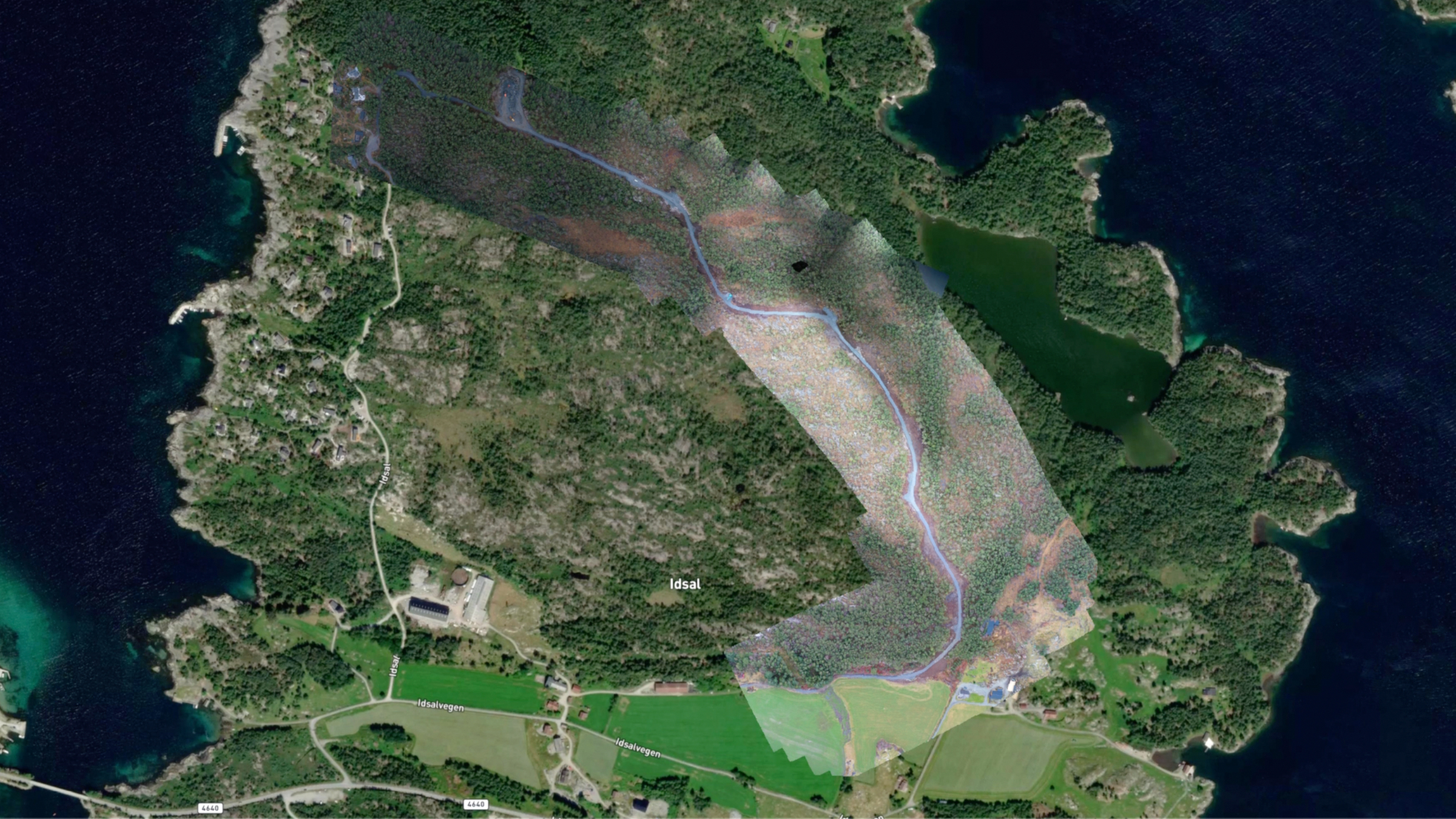
Designing a forest road project in one day with PIX4Dfields
A forestry service provider in Norway is reducing working hours and costs by managing a forest infrastructure project with PIX4Dfields
Aerial mapping of coastal ecosystems for restoration
How drone mapping a fragile coastal ecosystem is contributing to achieving the UN’s Sustainable Development Goals to fight climate change.
Pix4D solutions for Precision Agriculture


Advanced agriculture mapping software for faster decision making and action, at any critical stage, without leaving the field.


Programming modules to empower customization, automation and integration into any enterprise system workflows.