Designing a forest road project in one day with PIX4Dfields
According to the U.N. FAO, 37.1% of Norway is forested. The wild forestland is a key part of the country’s identity, but can be difficult to navigate and manage. There is a need for forest roads to be constructed in order to access specific forestry areas. This now requires special planning to reduce the impact on the forest whilst creating an efficient track through the woods.
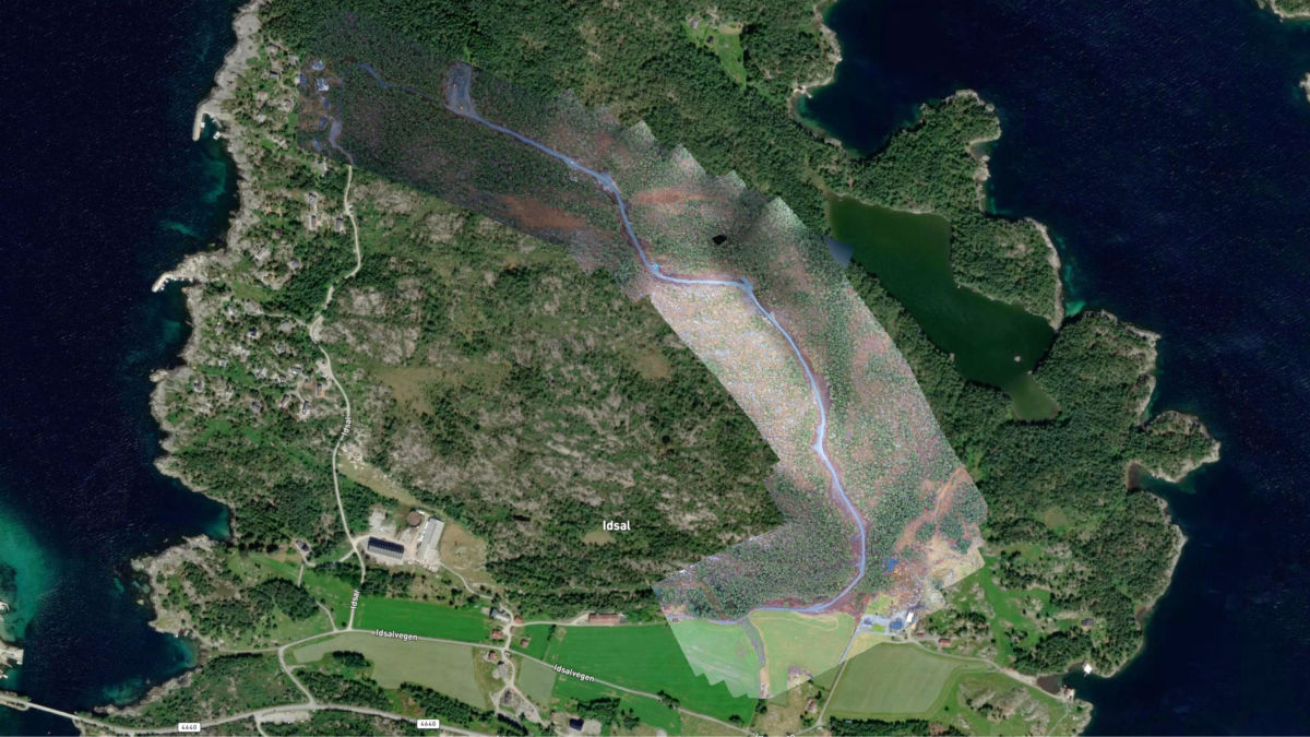
RS Skog AS, a forestry service provider in Norway, consists of forestry experts with a background in practical forestry, consultancy, business policy, road engineering and construction management, as well as silviculture. They are currently working on a project that aims for better access to forest resources. The main challenge of the project is the length of the road: it needs to be 2 kilometers long through a dense woodland. For the road’s construction management and documentation, the Norwegian team captured aerial data using drones and processed it with PIX4Dfields.
Project details
| Location | Norway |
| User | RS Skog AS |
| Software | PIX4Dfields |
| Hardware | DJI Mavic 2 PRo |
| Images captured | 600 |
| Outputs | Orthomosaic PDF report |
Revolutionizing forestry management planning and documentation
RS Skog worked on an infrastructure project that aims to ensure better access to Norway’s forest resources. The project aims to build a road as well as to improve felling and property value in the area to enable better use of the open land for grazing and forestry purposes.
The project required specific paperwork to get authorization and define RS Skog’s responsibilities during the project. PIX4Dfields played a major role in helping them to create 2D maps of the project location and documentation for their work. The project emphasis was speed and accuracy, with fast analysis of the plant life being critical.
The planning of a road project was mainly done with LiDAR data from the office. Then the team takes a trip out into the field and makes corrections. A major challenge is that in a forest road project, you have to make minor changes between when the forest in the road line (where the road is to be built) has been felled and before the excavator starts. This is due to the fact that you see changes in the terrain as a result of the forest being cleared. It always creates some challenges in projects of this stature.
How PIX4Dfields cut a 5 day project to 1
This project was set apart from RS Skog’s other work by the use of aerial mapping to speed up the entire workflow: it went from a typical 5-day turnaround to a 5-hour project including travel.
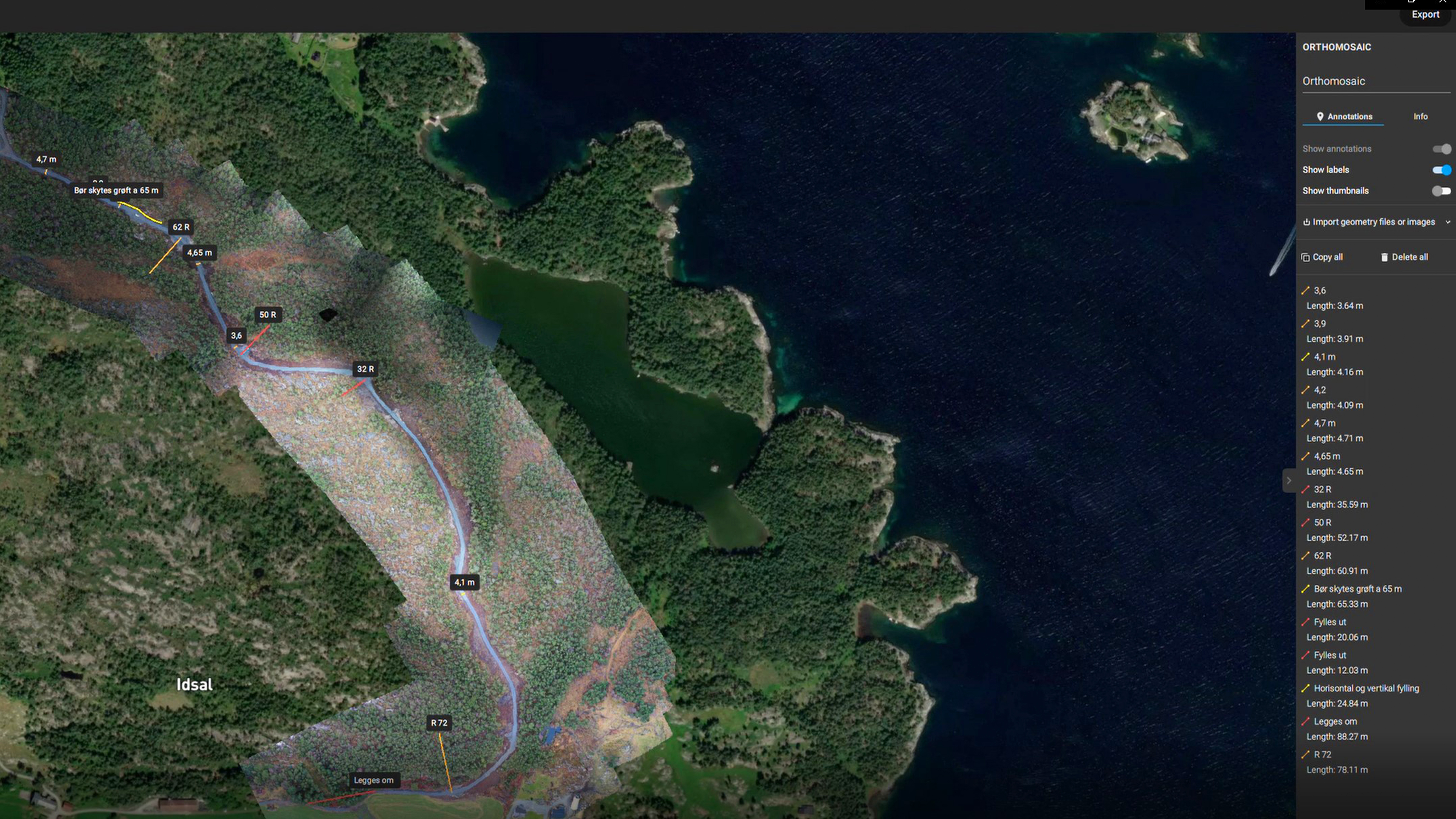
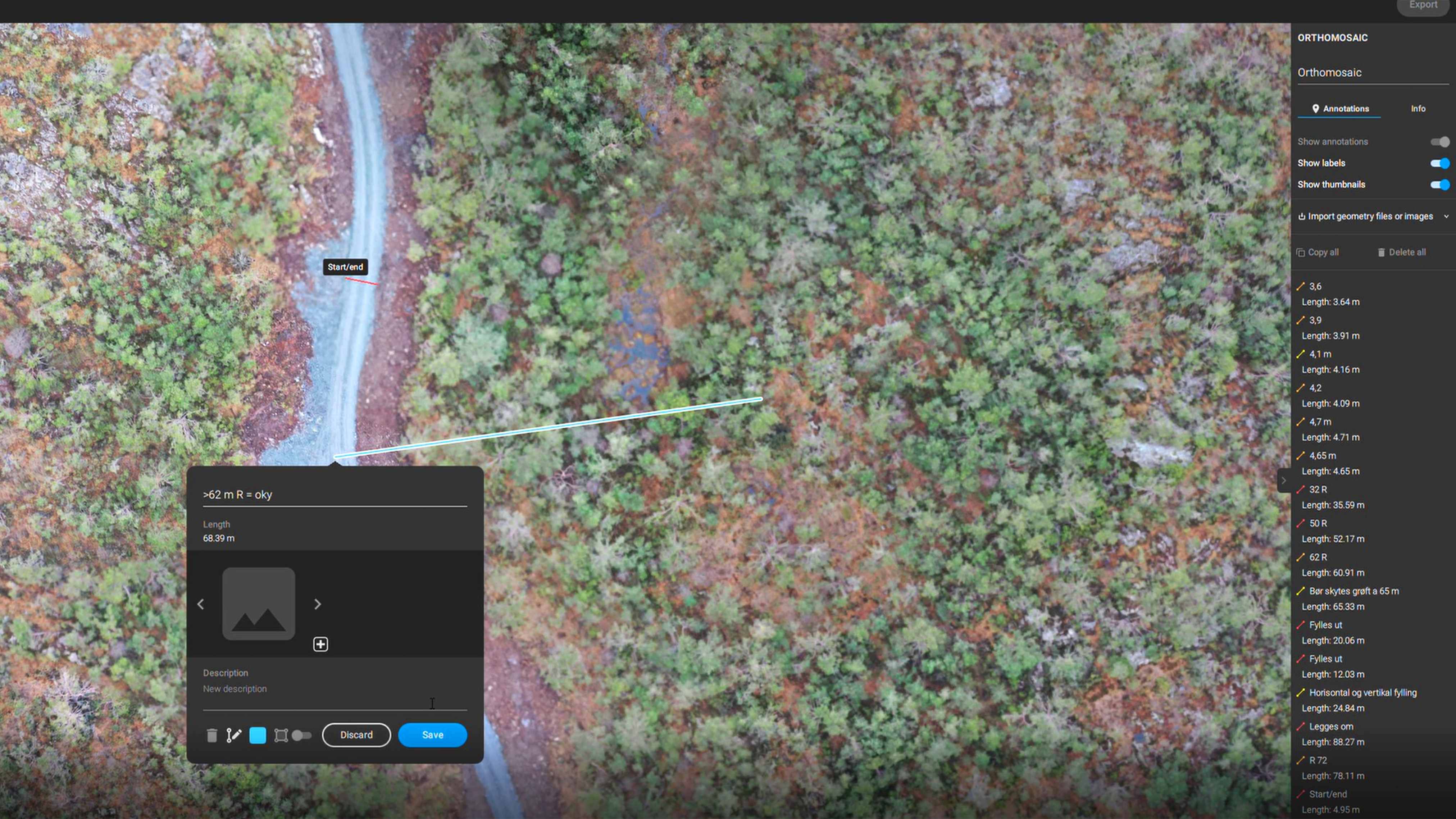
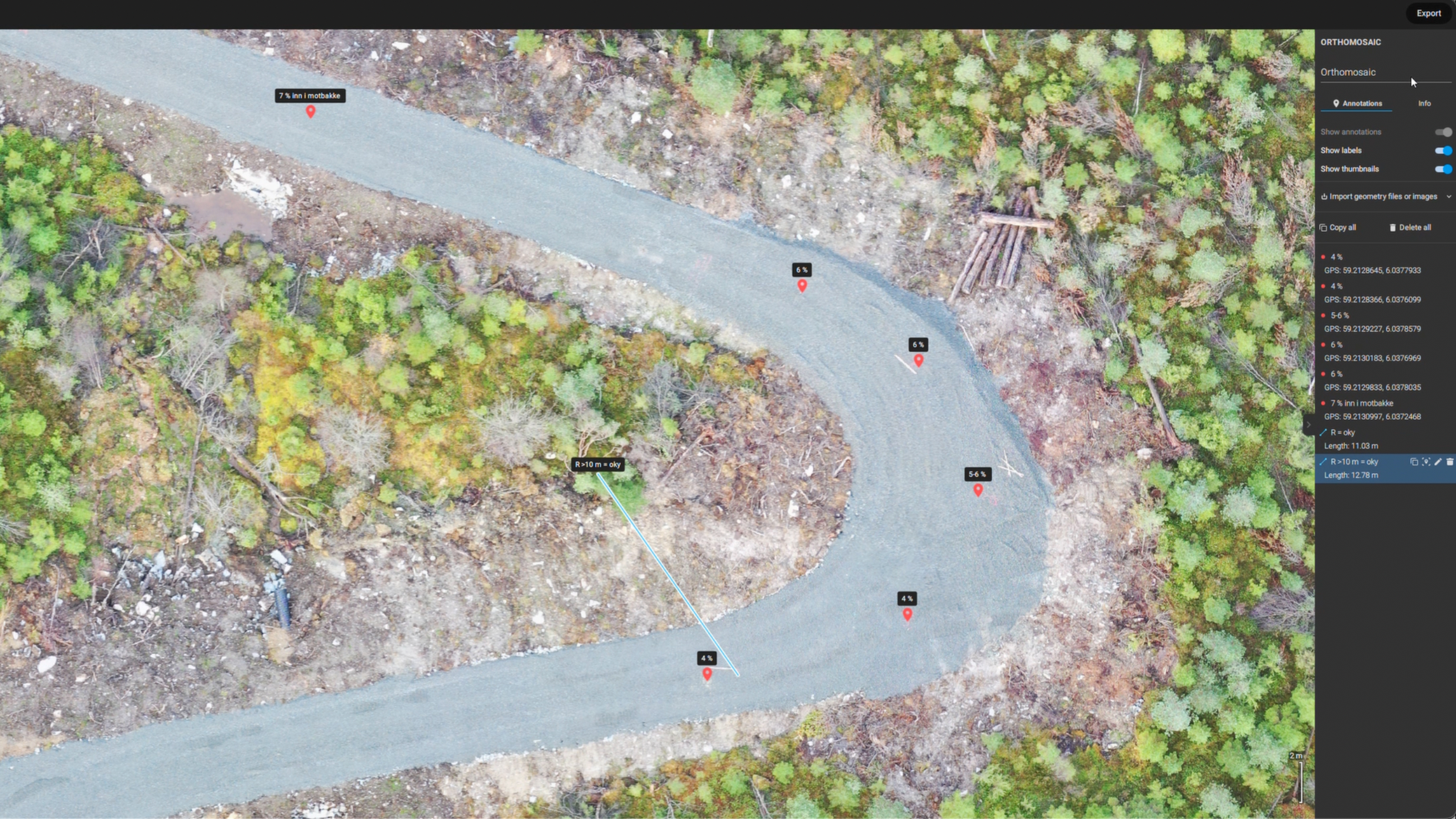
After the drone flight and data collection, images were ready for processing with PIX4Dfields in minutes. Then, with PIX4Dfields�’ annotations & measurements tool, it was possible to measure distances based on the orthomosaic images created in PIX4Dfields. In addition, the team could physically walk along the road line and take notes which could be added as annotations on the software. Finally, all of these important measurements and annotations were sent to the owner and municipality for reporting errors and documentation with PIX4Dfields’ PDF report. This report was created in minutes in the software and in a customizable format which is ideal for tracking progress.
Improving the forestry project management and control workflow
Using an aerial map to monitor crops with PIX4Dfields has revolutionized agriculture - and now is expanding to forestry management. The monitoring of open pasture space, forestry activities, as well as disease can all be done with PIX4Dfields, with the updated PDF reports similar to those already used in this project.
“The work with land control has been revolutionized with the use of PIX4Dfields and it has ensured better and more accurate control and documentation, while at the same time giving me a higher income.” Rasmus Hagalid-Stokkeland, RS Skog AS
The speed and precision of this workflow saw RS Skog AS save time and money, and keep track of important documentation, easily shareable to project stakeholders. The team highlighted the speed and precision of PIX4Dfields and the value it brought to their workflow by reducing costs and working time.