How PIX4Dfields increased yields within one season in Spain
Spanish farms are facing difficult changes in climate and challenges as the weather becomes more unpredictable and extreme. The need for precision agriculture is growing, as techniques that will optimize production whilst reducing chemical inputs will save farms money in the long run. Specific treatment plans will also create more eco-friendly practices.
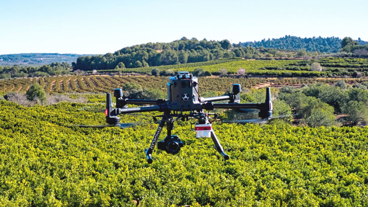
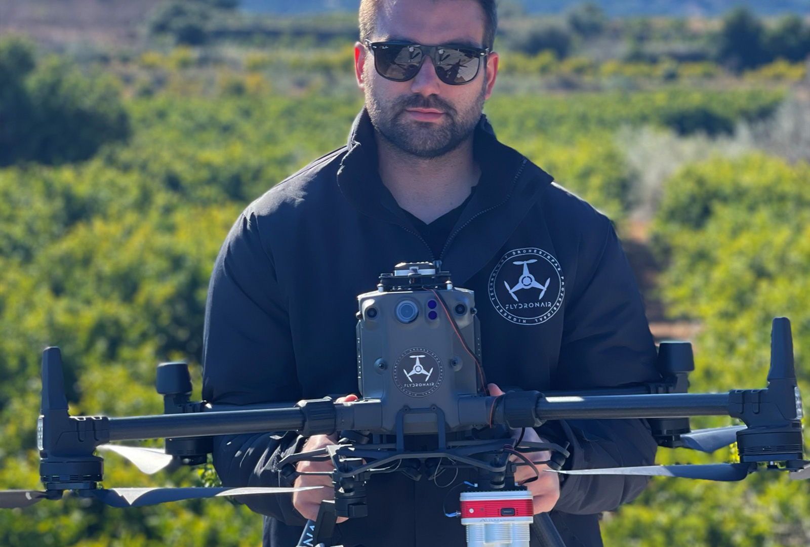
FLYDRONAIR is a specialized agriculture service provider working in Valencia, Spain. They use drones for remote sensing as well as aerial treatments, including spot spraying. They analyze a range of crops, including vineyards, fruit orchards, horticultural crops, grains, and more, in addition to agricultural research projects.
FLYDRONAIR was hired to work on a farm that had not used precision agriculture or been analyzed for 20 years. The plan was to fly over the farm with a drone and process the imagery in PIX4Dfields, using both RGB and near-infrared data. FLYDRONAIR aimed to use the outputs from PIX4Dfields to analyze complaints of excess water on the farm, the poor spread of nutrients, and to plan and execute aerial treatments to optimize yields.
Project details
| Location | Spain |
| User | Flydronair |
| Software | PIX4Dfields |
| Images captured | 5736 |
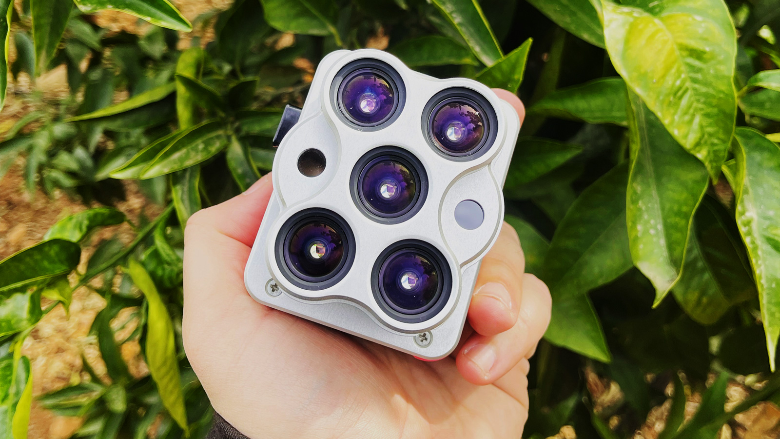
| Hardware | DJI Matrice 30 RTK Zenmuse P1 Micasense Altum |
| Area surveyed | 5 hectares |
| GSD | 3.46 cm (Altum) 0.75 cm (P1) |
Using drones for precision agriculture analysis
The FLYDRONAIR team arrived on-site and prepared their drone and cameras for the project. Due to using a specialized RTK drone, FLYDRONAIR knew they’d easily be able to ensure the accuracy of their results. Precise geolocational data is important for farming because accurate maps can be uploaded directly to equipment like to apply treatments. Thanks to PIX4Dfields being an offline software program, FLYDRONAIR knew they would be able to provide results from their analysis on the day of data collection.
The terrain was very uneven, which caused FLYDRONAIR to create a specific flight plan with lots of image collection. This would maximize overlap between photos and help ensure that the uneven ground would not distort the final orthomosaic or cause problems during the generation of the vegetation indices. The weather was a factor, so the team waited for a day with ideal flying conditions - overcast with no rain or wind - before collecting data.
Analyzing drone imagery with agrotech
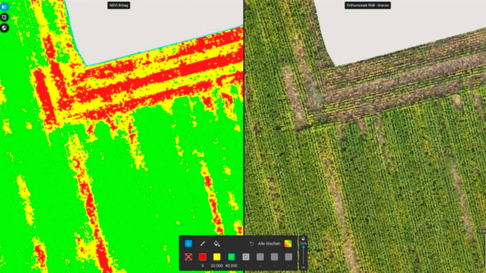
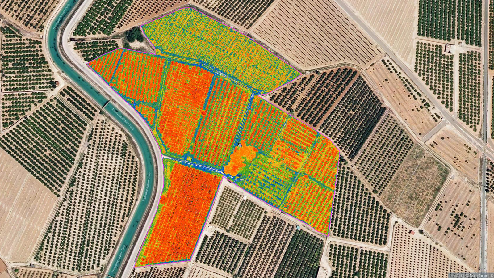
Once the data had been collected and processed in PIX4Dfields, FLYDRONAIR began their analysis. They identified an aquifer in the center of the farm, which was causing waterlogging in the soil. FLYDRONAIR also identified plant stress in orange trees with vegetation indices, which created a reflectance map. The plant stress was clearly visible which meant FLYDRONAIR could prescribe a treatment plan as soon as possible. Finally, FLYDRONAIR identified a lack of nitrogen in all of the plants, which was treated with fertilizers. The fertilizer application increased the yield within the same season as the first time the drone was used.
Modern aerial imagery for agriculture
There are a huge range of uses of drones for agrotech. The farm was able to solve issues for individual crops as well as the wider problem of the aquifer causing waterlogging. Identifying the nutrient deficiency in the field helped FLYDRONAIR come up with a fertilizer prescription map that could be uploaded to a tractor for immediate use.
PIX4Dfields was selected for this project because it is an intuitive software that is known for its speed and reliability, explains FLYDRONAIR CEO Pedro Lucas.
“PIX4Dfields is a fast and dynamic processing software that allowed us to process a large volume of images with great results in a short period of time,” - Pedro Lucas, FLYDRONAIR
This farm will now be able to operate more effectively and optimize their yields according to the needs of the crop. The agricultural drone services provided by FLYDRONAIR had an immediate return on investment for the farm owner. The water stored in the aquifer was progressively extracted to make the most of the natural resources available to the farm and optimize consumption, which helped the overall soil quality too. PIX4Dfields could even be used to help level the field in the future if the uneven terrain poses a challenge to ongoing farming efforts. In the meantime, the orange crop is already showing improvements thanks to the direct intervention of FLYDRONAIR.