
PIX4Dmatic 1.19: combined LiDAR and photogrammetry workflow
PIX4Dmatic is just under a year old and is already capable of more than we could have imagined. Alongside processing datasets with over 10,000 images, the software has seen significant updates and impressive use cases over the past 12 months. This latest release has a plethora of new features, with the most exciting being the ability to process both LiDAR and photogrammetry imagery in the same project so that a single 3D output has access to data from both dense and depth point clouds, with the option to fuse or filter them. This means PIX4Dmatic is now fully compatible with PIX4Dcatch. But that’s not all! There are new licensing options and a promotional sale available for PIX4Dmatic (and PIX4Dsurvey), and a brand new language available for users: Spanish! Find out more about all the changes we have made to make your work easier in this blog or check the product page and feature list.
Combining LiDAR and photogrammetry data
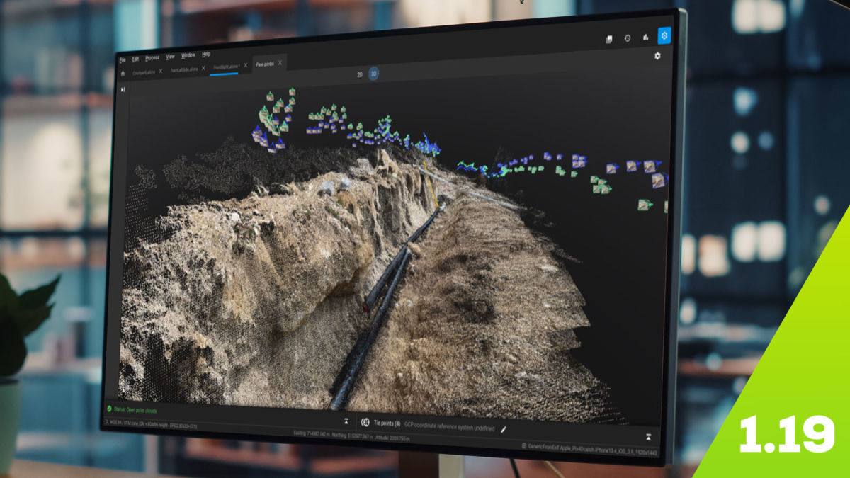
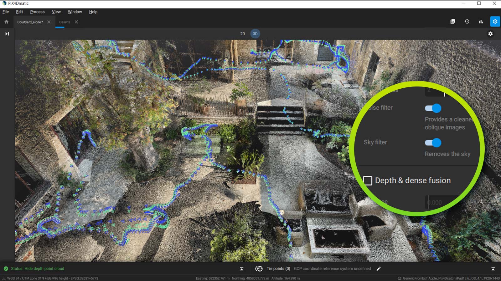
In an industry first, PIX4Dmatic can now fuse both depth and dense point clouds. PIX4Dcatch captures both LiDAR and RGB images from mobile devices (LiDAR is available on the newest iPhones and iPads). The two sets of data can be merged in PIX4Dmatic to get results enhanced by both inputs.
A crucial challenge this solves is the issue of GPS and IMU drift on mobile devices. This is caused by the real-time position/orientation estimation of the ARKit of a mobile device, which does not always match the actual position. This means that LiDAR scans of the device will be misaligned and hence result in inaccurate data. PIX4Dmatic solves this issue by computing more accurate geolocation and orientation data in the photogrammetric processing. This accurate data is used to align the LiDAR scans and enables the LiDAR data to be accurate too. In some cases where even the photogrammetry processing needs some improvements, PIX4Dmatic enables the addition of new data for processing through Manual Tie Points (MTPs), which enforce the correct alignment between photogrammetry and LiDAR data. Once both the LiDAR and photogrammetry point clouds are created, PIX4Dmatic provides options to merge both point clouds into one, or to export each separately. This ensures you have control over the data from beginning to the end of the process. Another way of ensuring accurate position and orientation data is to use the RTK rover. Both these options make the LiDAR sensor of your mobile a device survey-grade tool. PIX4Dmatic offers a unique combination of LiDAR, photogrammetry and Manual Tie Points (MTPs) to provide the best of both LiDAR and photogrammetry.
This ability is the first of its kind, meaning that PIX4Dmatic users will have the advantage of working with both depth and dense point clouds that are not affected by drift.
Complete support of data collection to photogrammetry workflow
As a result of this point cloud fusion, PIX4Dmatic can officially support datasets captured by PIX4Dcatch in their entirety. Users can gather data with their mobile devices and process it in PIX4Dmatic. For further analysis beyond generating a 3D model, it can be seamlessly imported to PIX4Dsurvey which now provides volume measurements and can handle point clouds with both LiDAR and photogrammetry datasets.
Additionally, users can choose how to use their point clouds according to what they are analyzing. If the LiDAR point cloud does not enhance a model, only the dense point cloud can be used. Alternatively, the depth point cloud from LiDAR or PIX4Dcatch can be selected if it renders better results. Of course, with this new release, the option to fuse these two point clouds is always there, giving users more flexibility and versatility in how they use their data.
Licensing changes and a new language!
Due to customer demand and the sheer volume of updates made to PIX4Dmatic, the product is now available for sale with perpetual or one-time cost licenses (OTC). This option is ideal for users who will consistently be working on surveying projects and need the product at all times as an alternative to the monthly or annual subscriptions. PIX4Dmatic can be bought as a standalone product or in a bundle with PIX4Dsurvey, and both have sales with promotional offers available until the end of 2021.
Finally, we have added Spanish to PIX4Dmatic! This means users who are more comfortable in Spanish can work in their native language. The software is currently available in English, Japanese, and Spanish.


