
Using drones to empower agricultural support services
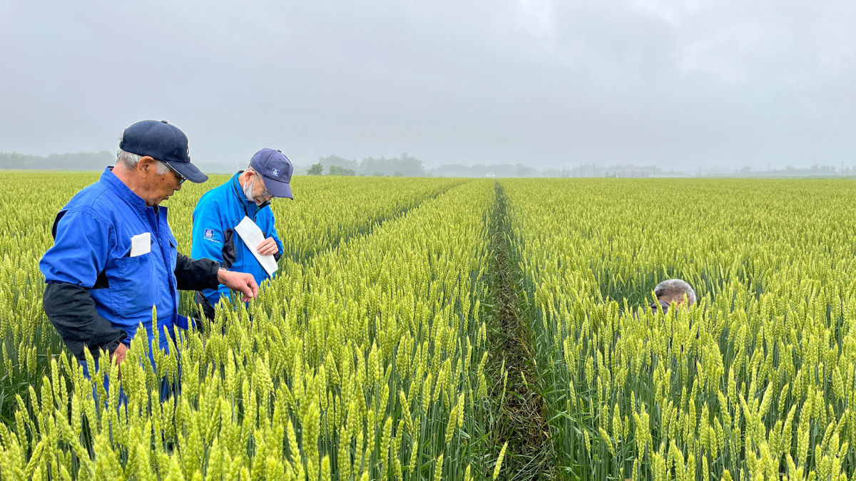
Earlier this year, PIX4Dfields was used in Fukagawa City, Hokkaido, to assist in field leveling to improve crop yields. In parallel with that project, the Pix4D team has been working with Mr. Muikaichi and Mr. Komori of Northern Innovation, a local company. Together, they flew drones and processed the imagery with PIX4Dfields. Mr. Kanamine, who has been providing cultivation guidance throughout Japan for more than 30 years at Meikyo Shoji, will analyze the results and offer advice to the farmers. In this interview, we talked to the team about how they used drones and PIX4Dfields to analyze a wheat field.
Project details
| Location | Nakazato, Japan |
| User | Northern Innovation |
| Software | PIX4Dfields |
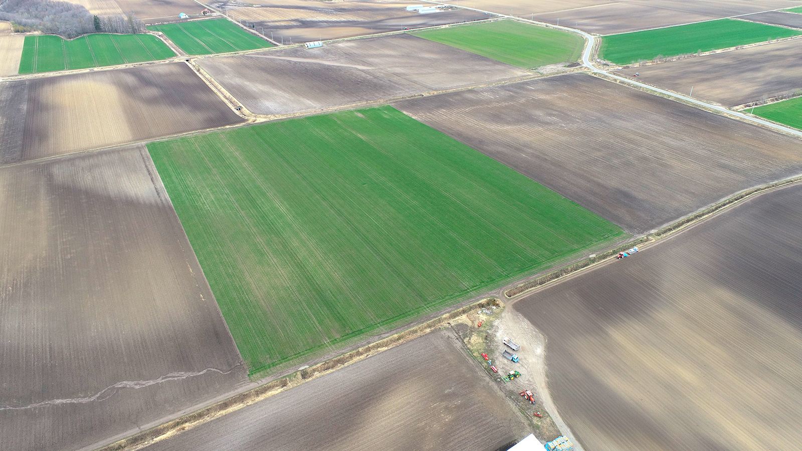
| Area mapped | 5.12 hectares |
| Hardware | DJI Phantom 4 Multispectral |
| Target crop | Wheat |
Visualizing uneven growth for efficient cultivation guidance
At first, Mr. Kanamine was skeptical about what could be done with aerial drone images for agriculture. When he actually tried it, he was surprised to find that the distribution of growth in a large field was mapped with considerable accuracy.
“What is difficult as a cultivation advisor is that I cannot check a customer's entire field and check the growth status in a limited amount of time. Conventionally, we usually give cultivation guidance by checking the growth of a part of the field from which I make an estimate about the overall state of the entire field. With PIX4Dfields, however, the distribution of growth in a large field is shown on a map, so it is easy to know which part of the fields to check.”
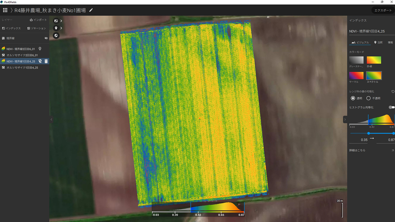
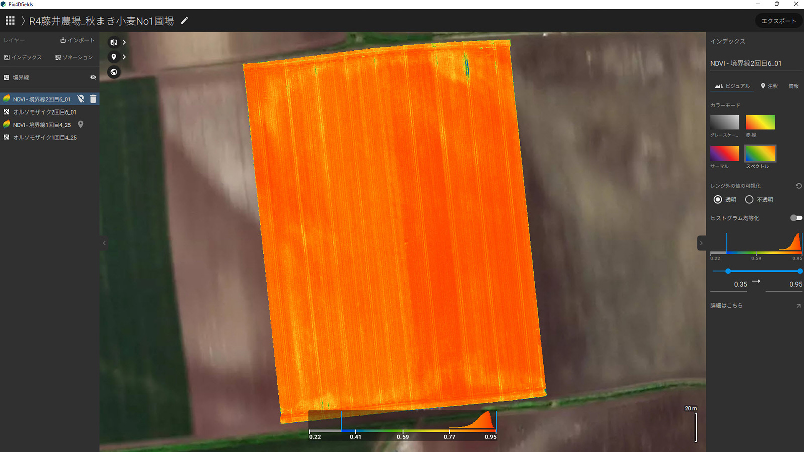
The team were using the DJI Phantom 4 Multispectral to gather data for this field. The multispectral sensor means the camera can pick up multispectral data and pick up light that is invisible to the human eye. These sensors will detect details about how a plant reflects specific colors of light to analyze the crop's overall health. This is possible thanks to vegetation indices, a way to interpret multispectral data into color-coded plant health maps. For this project, they focused on the NDVI index.
“In this project, the fields were color-coded according to their growth status. The less well-grown areas are more blue, and the better-grown areas are shown with red tones. When we actually checked the wheat plants, we found that the height of the crop in the blue areas differed from those in the orange areas by about 5 cm.” explains Mr Kanamine.
How can multispectral imagery be used to guide fertilizer application in agriculture?
Mr. Kanamine explained how vegetation indices are used in modern agriculture. “We also found a relationship between the number of wheat stalks and the NDVI value displayed. When the field was divided into three areas according to the degree of growth and analyzed, it was found that the higher the NDVI value, the higher the number of stems in the area. Low stem density reduces production, but too high a density can cause the wheat to collapse under the weight. Therefore, PIX4Dfields also helped us to fertilize the crops based on the number of stems and maintain an appropriate application density. ”
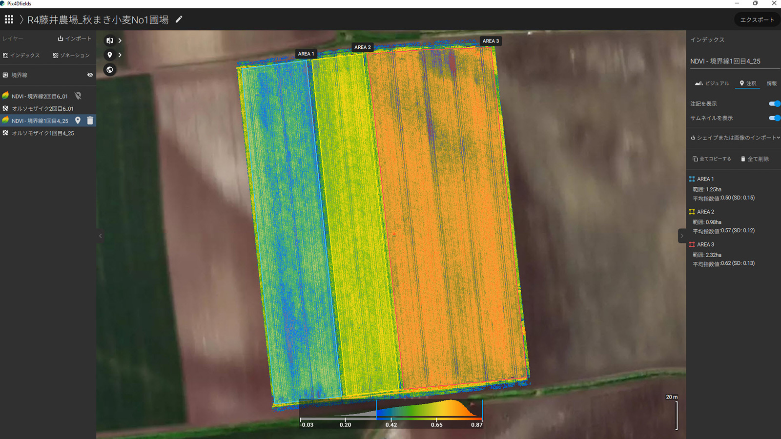
The entire field was divided into three areas for fertilization according to growth conditions. AREA 1, 2, 3 from left to right.
“We actually adjusted the amount of fertilizer according to the growth stage of each area, and after two months, the uneven growth of the entire field was reduced.”
After fertilizer application, the unevenness was reduced and growth conditions became more uniform across the field.
“It is essential to check the crops in the field for cultivation guidance. On the other hand, if we can get a view of the crops in the field through a videophone, we would be able to provide cultivation guidance remotely while viewing the analysis map with PIX4Dfields," says Mr. Muikaichi.
Now, with the latest release of PIX4Dfields 2.0, this data can be accessed remotely thanks to the built-in satellite imagery that PIX4Dfields users can use to scout their fields.
What makes PIX4Dfields easy to use?
Mr. Muikaichi, who had been using other companies' photogrammetry software for surveying purposes, was surprised at how easy it was to use PIX4Dfields for the first time.
“I was just amazed at the speed of the processing. I can work offline, so I can take pictures with the drone and process them on the spot. Another important point is that it can be used even on a PC with low specs." Mr. Muikaichi, Northern Innovation
"I had never used photogrammetry software for agriculture before and thought it would be difficult to learn how to use it, but when I actually tried it, the display screen was easy to understand even for beginners, and I was able to use it without trouble from the first time."
To conclude, we asked Mr. Muikaichi whether he thinks he will continue to use PIX4Dfields and drones in smart agriculture. He said, "I believe that services like this project, which provide cultivation guidance based on aerial images taken by drones, are in great demand. In fact, we have received requests from other farmers to do the same thing. I would like to continue to use PIX4Dfields and accumulate knowledge in the future.”


