Mapping 100ha+ rice paddies with PIX4Dfields
With demand higher than ever, farmers, agronomists, and researchers are investigating new technologies to optimize rice crop production. The focus is on increasing yields while keeping the quality at a high level.
In recent years, it has become necessary to develop a technology that can remotely sense a wide range of farmland with a drone in a fast and accurate way. “Appropriate topdressing is necessary for stable high-yield and high-quality rice," says Dr. Guan at National Agriculture and Food Research Organization (NARO) Kyushu Okinawa Agricultural Research Center.
NARO and Fukuokakyushu-KUBOTA Corporation are working on the development of wide-area remote sensing technology for rice using drones. With the main focus being on the analysis and image processing speed, Dr. Guan and his team used PIX4Dfields for the verification test. They used a standard laptop for visualizing the situation of rice cultivation on the spot without needing an internet connection.
Project details: In-field visualization
| Location | Tosu City, Saga Prefecture |
| Institutions | NARO Fukuokakyushu-KUBOTA |
| Hardware | DJI M100 X5 MicaSense RedEdge-3 camera |
| Software | PIX4Dfields |
| Images | 27,825 multispectral 2,752 RGB |
| Image size | 1280 × 960 pixels |
| Area | 110 ha |
| Processing time | 1 hour 40 minutes |
| Output | Orthomosaic, index map |
| GSD | DJI X5: 2.9 cm MicaSense RedEdge: 7.8 cm |

Evolution of smart agriculture in Japan
NARO is Japan's largest agricultural research institution, with approximately 1,800 research staff members. Fukuokakyushu-KUBOTA is a sales company of Kubota Co., Ltd., which mainly sells agricultural machines, and has business in Fukuoka, Saga and Nagasaki prefectures.
The scale of agriculture demand continues to increase as our global population spikes. In Japan, the farmer population is declining, and the amount of fields one farmer must manage is increasing. And with that, there is an emerging need to develop new technologies around remote sensing and precision agriculture. To help that happen, NARO, Fukuokakyushu-KUBOTA and many other Japanese institutions have formed a consortium and are conducting research on remote sensing of agriculture.
The aim of the research is to increase the efficiency of remotely sensing a wide agriculture area, and use the data analyzed in a short time to increase yield in the entire community.
Analysis of agriculture data on the spot with Pix4Dfields
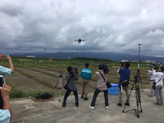
In a field in Tosu City, Saga Prefecture, the team conducted a demonstration test where they aerial photographed more than 100 hectares of rice paddy fields.
What is a paddy field?
A paddy field is a flooded parcel of arable land used for growing semi aquatic crops, most notably rice and taro. Its name is derived from the Malay word "padi", which means "rice plant".
To capture the data, the team flew a DJI M100 mounted with an X5 RGB and a MicaSense RedEdge-3 multispectral camera. For this type of analysis cameras need to be high-performance and high-precision in order to capture the crop’s growth.
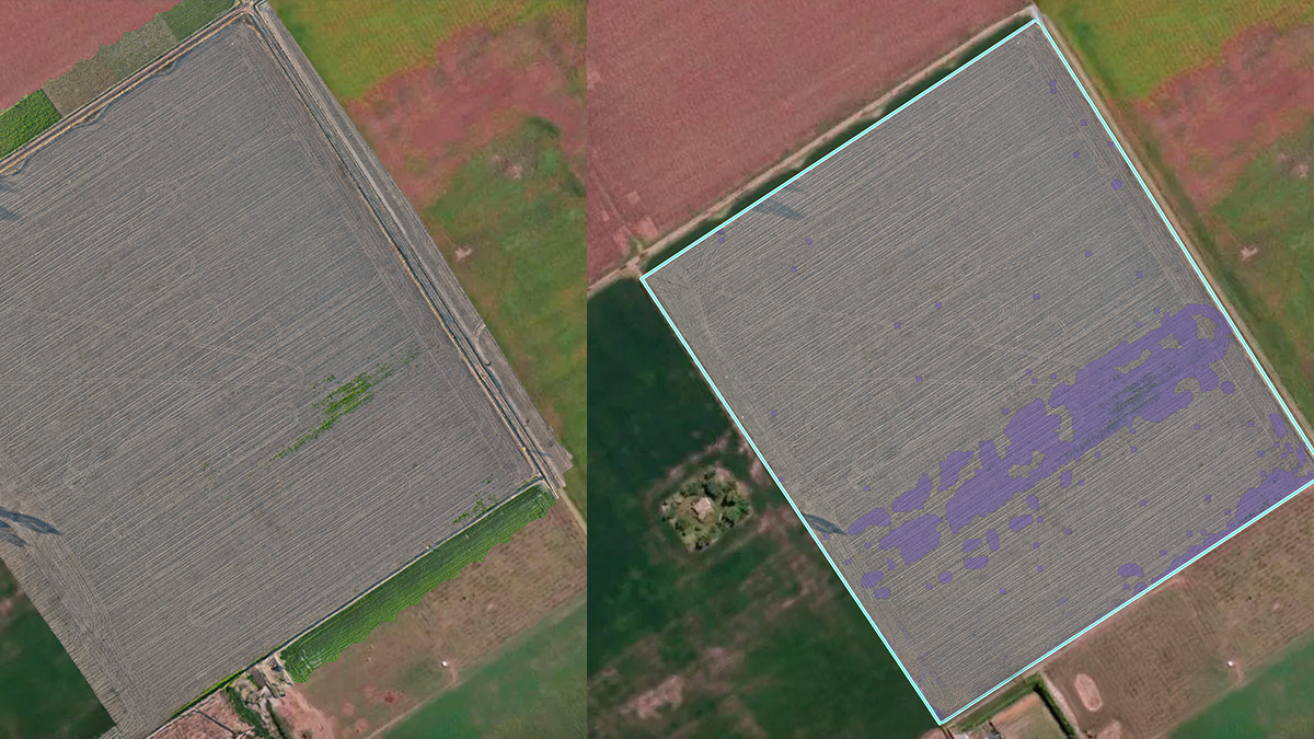
The second part of the test was visualizing and analyzing the data in PIX4Dfields. The software processed 110ha worth of data in less than two hours - a shorter time than was expected. The team was able to generate an aerial view (orthomosaic) of the rice fields and different vegetation index maps (NDVI, etc.) while still on site and in-field.

The benefits of using Pix4Dfields
Radiometry matters
PIX4Dfields is continuously being developed to meet the needs of the agriculture industry, focusing on reducing the speed of processing while incorporating the highest radiometry standards backed up with years of scientific research.
Continuous improvement of the project
Throughout the demonstrations, which started in July 2019, the team used PIX4Dfields versions 1.5 - to 1.6. The tests will continue until March 2020. “Since we started with the tests, PIX4Dfields has been updated regularly with new features like the new radiometry module and the full ground sampling distance (GSD) control,” states Dr. Guan.
The test emphasis was placed on the speed of 2D mapping considering there has been a serious problem for users who process large amounts of data.
With the GSD control feature in PIX4Dfields, users can now choose the maximum file size for the orthomosaics, which gives us the freedom to specify the level of detail we want to see while still keeping the processing speed at a high level
Mr. Suetsugu, Fukuokakyushu-KUBOTA.
Best practices for digital agriculture
The tests demonstrated that high-quality, accurate maps and orthomosaics can be created quickly in the field.
From mapping storm damage, to isolating struggling plants, to precision application of fertilizer - PIX4Dfields and agricultural drone mapping is another tool which can help shape the future of agriculture.
| We would like to thank the members of NARO and Fukuoka Kyushu Kubota for their cooperation in preparing this article. In addition, PIX4Dfields was adopted as analysis software in this case, and the product feedback from the users of NARO and Fukuoka Kyushu Kubota reached the Pix4D team. |
¹FAO database 2019. Back to top


