
Identifying flood debris in sugarcane fields with drones
The flooding in Australia in Feburary to March 2022 caused widespread damage, with farmland particularly affected. Some agricultural regions saw significant soil erosion on farms caused by the flood damage. The New South Wales government asked Fire & Rescue New South Wales (Fire and Rescue) to assist sugarcane farmers in finding debris in their fields with remotely piloted aircraft systems (RPAS). While this article was being completed, the Fire and Rescue team was already hard at work dealing with the latest series of flooding events in Australia.
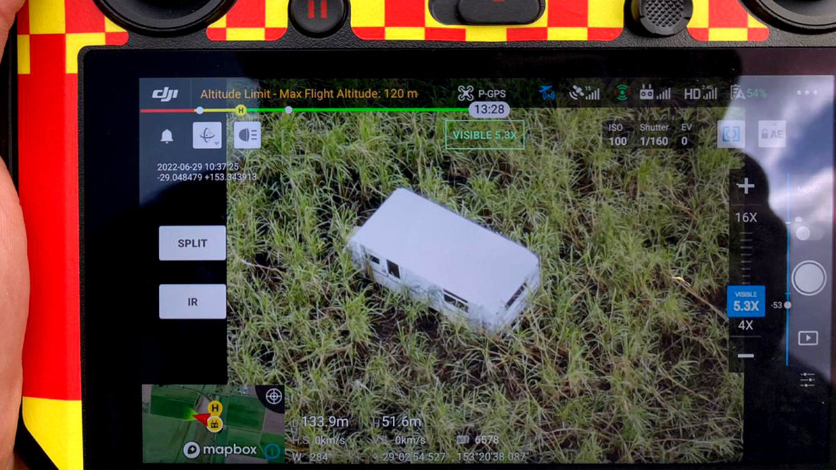
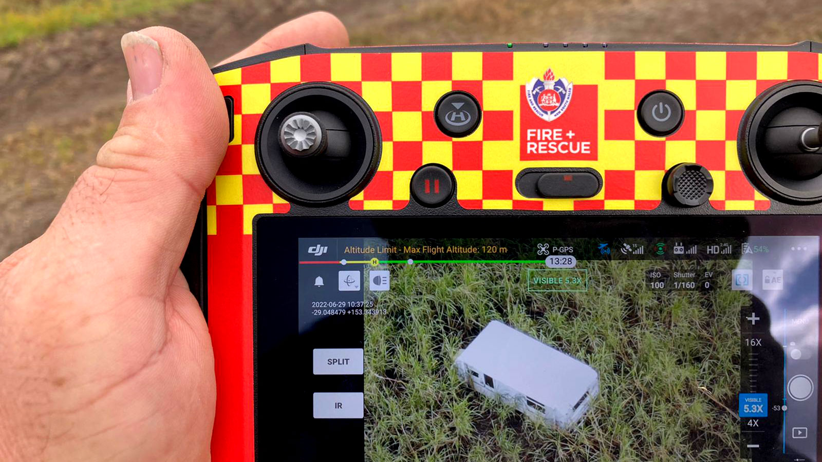
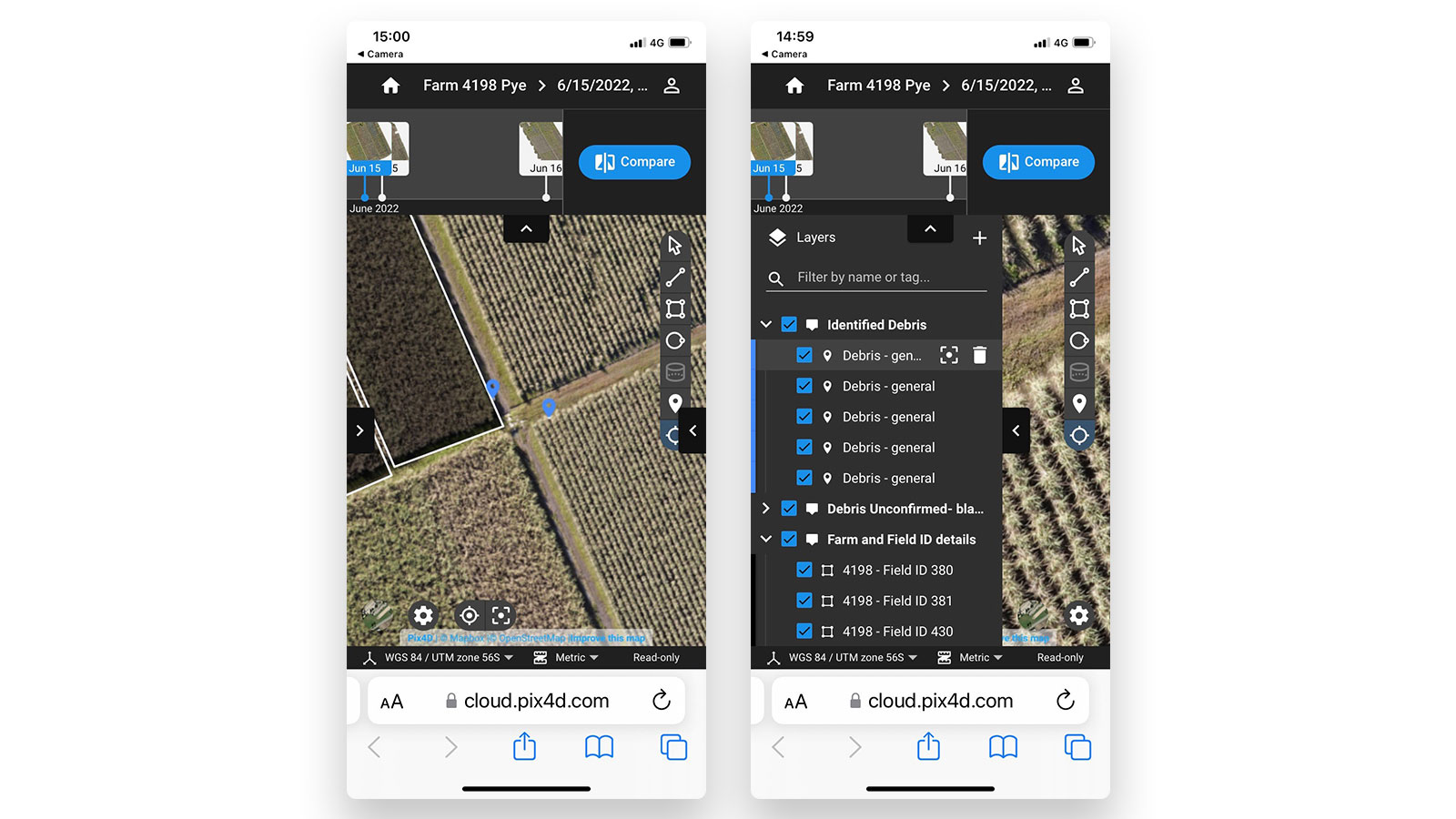
The mission for Fire and Rescue was to identify debris in sugarcane fields that had been deposited as a result of the 2022 floods. Identifying the debris would help the authorities plan cost-effective, agile solutions for removal. The farmers needed relevant information to develop their own plans to remove or evade waste during the harvest. Fire and Rescue needed to answer the questions of “what is the debris”, “where is it”, and “how big is it”. The debris they found ranged from fridges to washing machines, gas cylinders to shipping containers, and even a swimming pool. For their operations, they used a combination of fast-mapping software for emergency response, PIX4Dreact, along with PIX4Dcloud Advanced for detailed project analysis.
Project details
| User | FRNSW |
| Location | New South Wales |
| Software | PIX4Dreact PIX4Dcloud Advanced |
| Hardware | DJI Mavic 2 DJI M300 |
| Area surveyed | 5,000 hectares |
| GSD | 7 cm |
| Crop affected | Sugarcane |
Fast mapping for disaster assessment and damage control
The Fire and Rescue team needed to move fast to avoid the hard deadline of the harvest season. The flooding had damaged communication infrastructure which meant there was a lack of network connectivity in remote areas. The team found this to be a challenge while they worked over 8 weeks to gather data and return it to farmers.
The first step was to pinpoint debris. Once it had been identified, the Fire and Rescue team would classify the debris according to its size, hazard level, etc. This method of post-event disaster management was similarly deployed in the Australian wildfires in 2020.
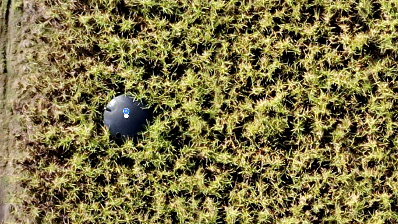
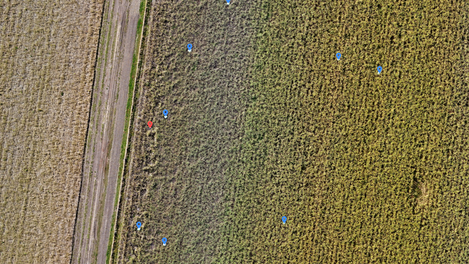
Fire and Rescue set out and gathered preliminary data with PIX4Dreact. They would use this to scout fields. If they found elements of debris, they would re-fly the scene to gather more data. They needed to gather data and rapidly process 2D maps, or orthomosaics, where they could annotate and identify debris on 210 sugarcane farms across 5,000 hectares. The team needed fast mapping to complete the initial surveys and found there were 13,500 potential debris deposition areas spread across surveyed farm land.
The image files were initially processed with PIX4Dreact. The orthomosaic files would be made available to the office-based team who uploaded the files to PIX4Dcloud Advanced for verification, analysis, and dissemination. Of the 210 farms, 101 had debris that was spread across 1,000 hectares. PIX4Dcloud is an online photogrammetry platform that is specialized for project management and tracking, with a focus on construction. The team wanted to use PIX4Dcloud Advanced to classify debris according to its type. After analysis, the debris assessment reports were compiled and sent to farmers. The entire process had a turnaround timeframe of 2-3 hours from debris detection on the software to fully complete analysis. This did vary according to the farm size and quantity of debris.
Benefits of drone mapping for disaster management
Farms impacted by the debris faced a threat to harvest equipment. Any damage or destruction of these vital harvest assets would devastate farmers and cause them to miss the optimal harvest window, resulting in a lower overall crop yield across the harvest region. The importance of Fire and Rescue’s work was significant.
Over 8 weeks, the FRNSW team located and identified 13,500 debris items, which they compiled in over 100 PIX4Dcloud Advanced projects. The team were impressed with the workflows they created with Pix4D software in challenging conditions. The upload speeds were slow in the field with PIX4Dcloud due to poor network connection, which is why generating preliminary maps to obtain the orthomosaic with fast-mapping software PIX4Dreact was so important. These helped assure the team they had the best available orthomosaic for debris identification and analysis.
The software also coped well with mapping vegetation. Some photogrammetry software can struggle to accurately recreate highly vegetated regions, however Pix4D software has successfully been used in multiple environmental monitoring projects, ranging from monitoring reforestation efforts in Malawai to massive scale drone mapping in the Amazon rainforest.
FIre and Rescue commented on the ease of analysis with PIX4Dcloud Advanced and the sharing functionality as a major strength. The ability to share findings with team members via a link was incredibly helpful, as well as producing reports with accurate maps for the farmers. The PIX4Dreact results were quick to create thanks to the GPU accelerated processing (a result of the PIX4Dreact 1.4 release).
“Pix4D aligns really well with how we work - stand-alone, rapid mapping solutions for our RPAS-trained firefighters, responding to time-critical incidents in the field, through to cloud solutions and desktop applications to support the more advanced processing and analysis requirements of the Data Systems GIS Technical Team." - Katherine Tuinman-Neal, Fire and Rescue
The Fire and Rescue were able to successfully complete their mission and assist local sugarcane farmers. This was incredibly important in the recovery effort from the flood, and a further example of how drone mapping can be used for emergency response and public safety operations. The wide applications of the software gave Fire and Rescue full control over their project and findings so that they were able to work quickly and effectively to provide all the data to local farmers before the harvest season deadline.


