Helping to protect the rainforest in Peru with drone mapping
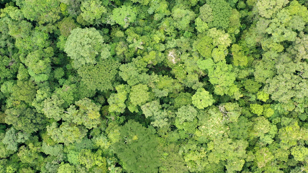
The Amazon rainforest is nicknamed the “lungs of the earth” because it is a vital source of oxygen for the entire planet as well as the home to millions of species of animals and plants. Like many wilderness areas, it is under threat from human activities. Just 2.8% of the world’s terrestrial surface is still “wild” or mostly intact. In an effort to stop this number from shrinking further, Wilderness International is buying unique, intact natural areas in Peru and Canada to ensure those few remaining areas will be physically and legally protected.
Wilderness International is an NGO based in Canada, Germany, and Peru. Through their local teams, they purchase land in ecologically significant areas. These purchases are refunded or refinanced by donations, meaning that Wilderness International needs to show great transparency with their donors to show the real and tangible impact of their support.
After the land is purchased, teams from the non-profit organization (NGO) visit to collect scientific datasets and high quality imagery to assess the exact size, health, and safety of the forest. Mapping the tropical rainforest is an incredibly difficult challenge due to the dense vegetation and limited access. To preserve the delicate ecosystem they operate in, teams take all the necessary measures to not impact the forest. To do so they use drones from Quantum-Systems to survey the rainforest from the air, and software from Pix4D to process the images collected.
In Peru, the NGO is gathering data for 3000 hectares, looking at RGB, multispectral, and LiDAR data. The objective is to analyze plant health with the multiband data, as well as create normal orthomosaics. Those orthomosaics will also be shared with donors of Wilderness International so they can see the exact section of the rainforest that they have sponsored.
The benefits of using drones and aerial mapping are:
- Monitor vegetation health and assist conservation efforts
- Provide transparency and be accountable to Wilderness International donors
- Check for illegal logging on the Wilderness International land
Project details
| User | Wilderness International |
| Location | Peru |
| Software | PIX4Dmatic PIX4Dfields |
| Hardware | Quantum-Systems Trinity F90+ |
| Images captured | 30,000 |
| Processing time | 18 hours per 10,000 images |
| Outputs | Orthomosaic Vegetation indices |
Identifying the best hardware and software to map large areas
The plan to map the rainforest areas purchased by Wilderness International first began in 2005 when the organization was founded and realized that aerial images would be ideal for creating minimally invasive forest maps. In 2021, Pix4D was contacted to assess whether our software was up to the challenge. By mapping 3,000 hectares with high resolution cameras mounted on drones, the final dataset would be at least 20,000 images. Pix4D agreed to support this preservation project and provide them with a PIX4Dmatic license, as this software is designed to handle large datasets. PIX4Dfields was also provided for looking at specific sections and conducting multispectral image analysis of the tropical rainforest’s health.
Using photogrammetry and drones in the Peruvian rainforest
To collect the dataset, a team set out with UAV and remote sensing expert Martin Herkommer from Quantum-Systems in the summer of 2021. Together, they traveled to the heart of the Amazon in Peru, along with several conservationists who wanted to study the wildlife living there.
On-site, the first step was finding a take-off space in the dense vegetation for the fixed-wing Quantum-Systems Trinity drone to be launched. They found a space near a river to take off. Thanks to its 90-minute flight time, the drone can embark on long flights to capture RGB, multispectral images, and LiDAR data. The drone is also equipped with PPK so it can gather accurate geolocational data thanks to its connection with a GNSS reference base station.
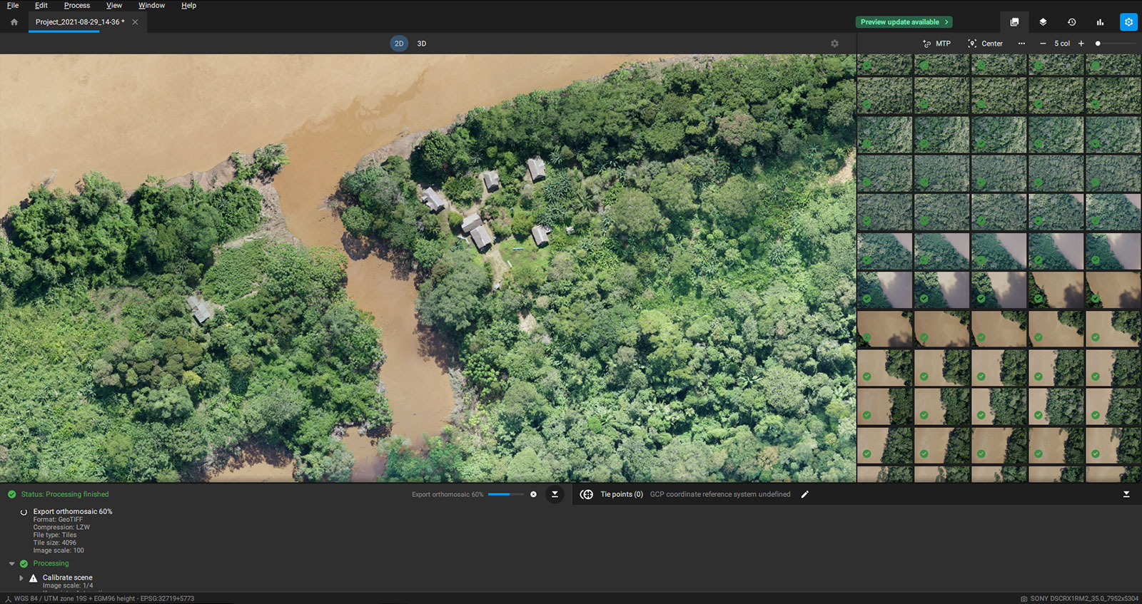
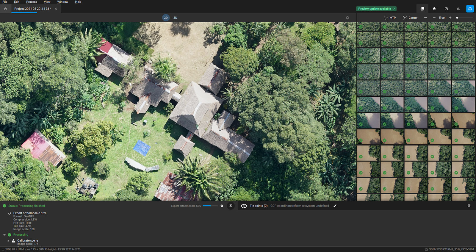
Processing drone imagery of the Amazon
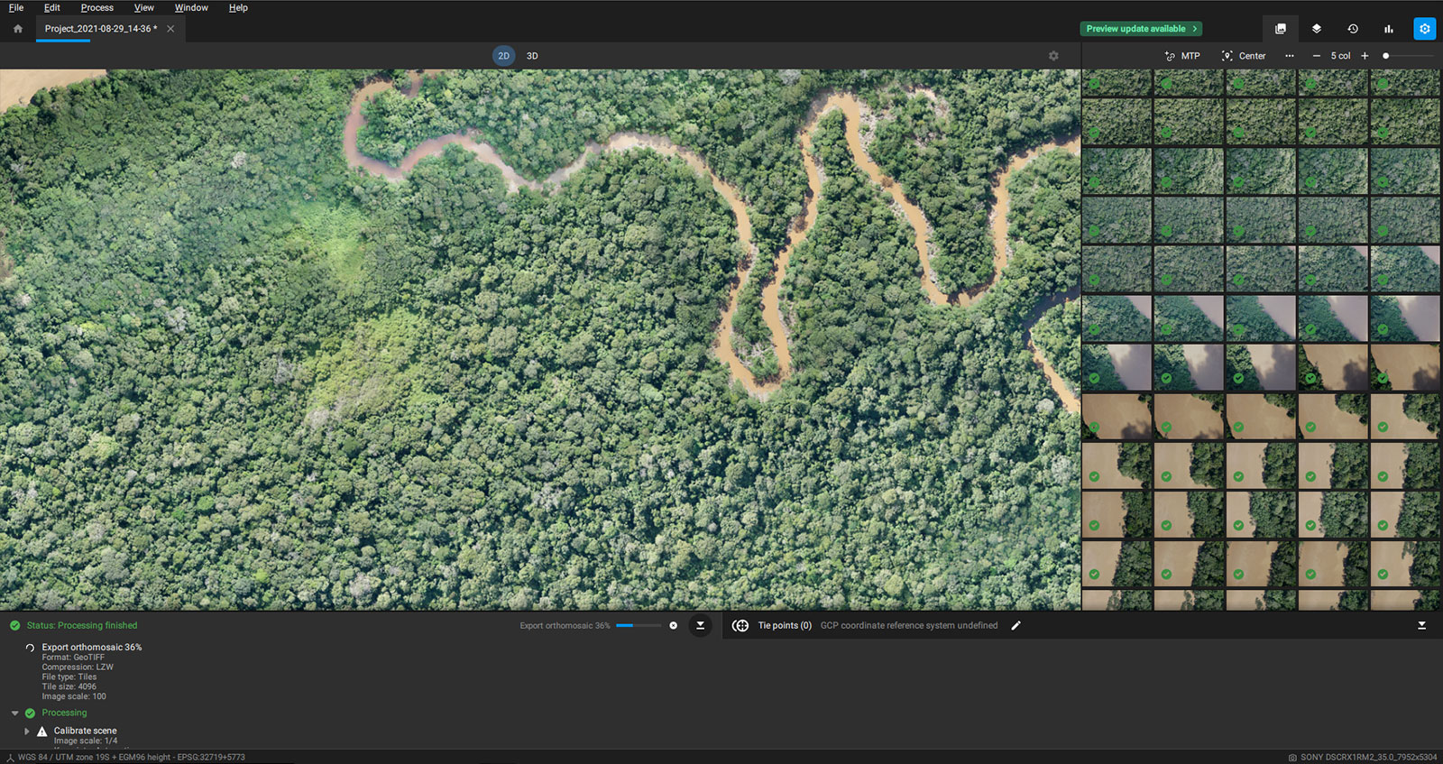
The dataset totaled 30,000 images. The RGB images were imported to PIX4Dmatic to create a 2D map. This type of dataset can be challenging due to the inconsistent shapes in a forest canopy. The data processing was done by splitting the 30,000 images into three sets of 10,000 images, each of which took 18 hours to process. The orthomosaics PIX4Dmatic created were used to identify specific regions of the forest that were sponsored by particular donors, who could then receive a high quality orthophoto of the exact coordinates of the space they sponsored. The level of detail captured with a PIX4Dmatic orthomosaic is part of why the software is so useful for detailed terrain analysis for conservation projects.
PIX4Dmatic was custom-designed to handle large datasets, which is why it was selected for this project. Recent releases include the accelerated hardware processing option, which can make densification more than twice as fast. The high resolution of these images made the dataset even larger, but PIX4Dmatic managed to create orthomosaics successfully.
“We were able to collect a huge dataset of very high quality, and connected the drone to a base station at our camp to make sure the images were geotagged, which ensures the accuracy of the final map,” - Martin Herkommer, Quantum-Systems
The multi-spectral images were imported to PIX4Dfields, which can analyze how plants reflect green light. Measuring these light reflections will tell researchers about the health of plants, their age, and can be used to create vegetation indices to learn information about the forest that is invisible to the human eye. Conservationists can use this data to analyze planting projects or restoration efforts.
Finally, the outputs from both pieces of software were used to identify any illegal logging on the land purchased by Wilderness International that they could report and prevent from happening again with improved protection measures around the area.
Replicating drone-mapping workflows to preserve other sites
With aerial surveys, Wilderness International is helping to protect the Amazon in Peru. Thanks to the success of their drone map, they will be replicating this workflow at another conservation site in British Columbia, Canada, where they have purchased 450 hectares of temperate rainforest. Buying these properties of land makes protecting them easier for Wilderness International and also means they can check the land with drones without needing special permission beyond the normal local flight regulations.
With the processing power of PIX4Dmatic, Wilderness International is protecting forests and monitoring their health on an impressive scale. Now, as donors receive certificates with georeferenced maps of the land they sponsor, they too are contributing to an amazing cause and helping fight climate change.