Quality meets speed in digital agriculture [Webinar]
Agriculture is almost as old as humanity, yet as the climate changes, the industry is facing a new challenge. Farms must find a way to increase production while preserving the environment.
But achieving sustainability while still increasing farm profitability is a tricky balancing act. Using new technologies for recording and comparing crop's natural rhythms and changes over time can help you better understand crop needs and prepare for the future.
Watch the on-demand webinar recording
Sustainability is a tough problem. So we've teamed up with some of the best in the industry. In our free webinar, together with MicaSense and Indigo Ag we presented:
- Why accurate data and fast processing matters in agriculture
- Sustainability and The Terraton Initiative
- Sensors and data quality requirements
- Data processing and analysis technology
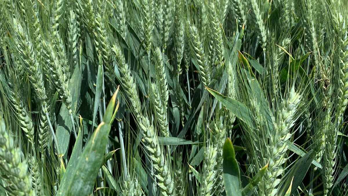
- Real examples from the industry like: Early scouting, Germination and stand counts, Irrigation support, Nitrogen regimen, Disease detection, Soil investments, Harvest support and Assessing crop damages
Your questions - our answers
We had a great pool of questions asked during the webinar so we wanted to share some of them here which we didn't have time to answer during the live Q&A.
Can Pix4Dfields be used offline?
Yes. Pix4Dfields is an advanced agriculture mapping software which can process RGB and MSP images instantly while in the field without an internet connection. Internet connection is only required to activate your license or while using the data synchronization feature.
Can these technologies also be used for forestry?
Yes, Pix4Dfields is used in forestry applications. RGB images are helpful for detailed assessment of the forest structure, while multispectral imagery gives a deep understanding of the tree condition. The generation of vegetation indices that are available by default in Pix4Dfields such as NDVI, NDRE, LCI, etc allows our users to uncover healthy and unhealthy trees. Custom indices can be created depending on the available bands from your imported images.
Does Pix4Dfields work for crops of citrus, avocado and nut plantations?
Pix4Dfields is crop agnostic. Many of our users have used Pix4Dfields with crops like prunes, pineapples and citrus. An example of a use case with prunes can be found here.
Plus, Pix4D agricultural technology has worked with large scale plantations in Chile, orchards in the USA and pineapple farmers in Mexico. For the latest information see our blogs here.
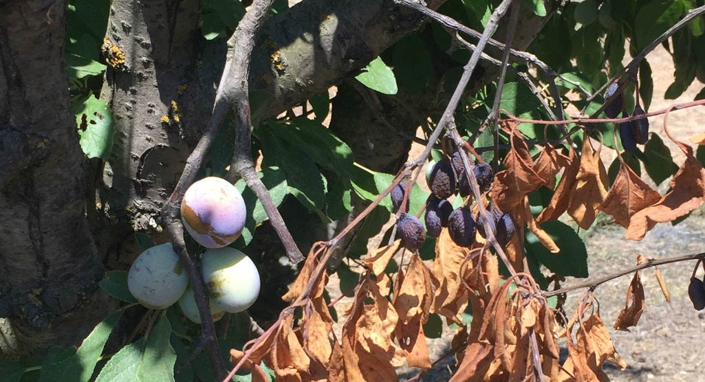
Do you have examples of how drone images have helped evaluate damage from pests or diseases?
Pix4Dfields has been used for a variety of crop types and crop issues. In the UK to help farmers and their service providers assess animal damage to oilseed rape (canola). Pheasants/wild bird damage was successfully mapped and measured to provide evidence for insurance and reactive measures.
Floods or pest damage can decimate a season’s profits. Therefore, our users use Pix4Dfields to quantify the damages and and get verifiable proof that they can use for insurance compensation.
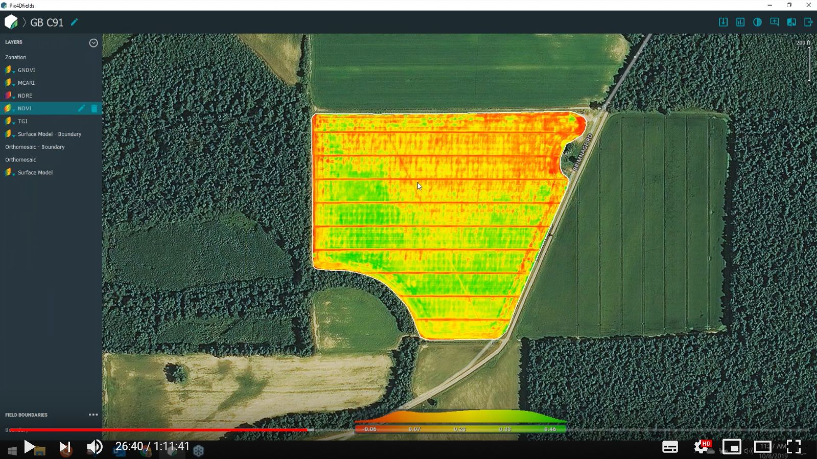
Is it difficult to calculate the needed fertilizer in [kg/ha] for a specific zone in Pix4Dfields?
Using Pix4Dfields zonation tool it is possible to assign fertilizer values to a specific zone. The zonation tool is available after creation of an index map in Pix4Dfields. As a user, select from between 2 - 7 zones. Rates can then be assigned to each zone using the prescription table.
Variable rate application saves money and reduces wastage by spraying, fertilizing or seeding the appropriate amounts per unit of area. This can result in improved yields, crop quality and overall improved management and efficiency.
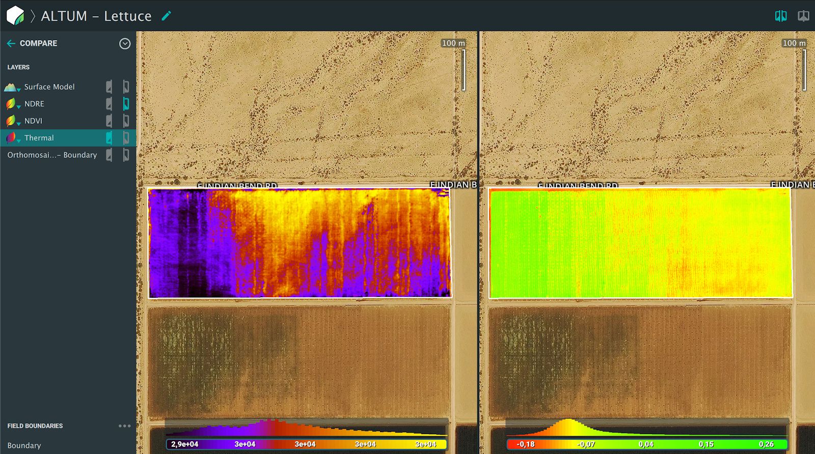
Does Pix4Dfields support the MicaSense Altum camera?
Pix4Dfields supports a wide range of cameras including the MicaSense Altum. To visualize the thermal band you need to go to the Index generator and select thermal.
Is it necessary to always use the calibration target before and after flying?
Pix4Dfields only take into account one set of images from the calibration target. We recommend to take them before the flight. Most cameras take up to three different set of images, we will select one of them for further radiometric correction.
The calibration target is used as the ground truth for the reflectance. Then, the downwelling light sensor (DLS), will use the illumination information to adapt to in flight variabilities. For more on Radiometric correction in Pix4Dfields see our Support article.
How do you time the flights correctly? Is it possible to fully assess a farm in on a weekly basis?
In theory, yes. In practice, maybe.
Conditions for flight are a factor. Firstly it must be safe to fly (for example, no storms or high winds). This is also important for the actual assessment - if the wind is too strong, the crop will be blurry in images captured. When flying with a multispectral sensor, avoid scattered cloud and shadows - overcast or constantly sunny weather is ideal.
Depending on the farm/field size and the equipment chosen to fly, it is possible to assess the majority of fields during the season on a regular basis.
What is the optimal height for flying when using Pix4Dfields?
There is not one specific flight height that works for every case.
The flight height (distance from the area/object to be mapped) is related to the accuracy of your final results. The closer you fly to the area of interest, the higher the spatial resolution, or ground sampling distance (GSD). You can find a useful tool for the computation of the GSD on our Support site.
More of your questions answered in our webinar
Tune into our free on-demand webinar recording for more on how new technologies can support sustainable agriculture, today and into the future.