
A year of Pix4D Cloud updates
In the last couple of years, the unique Pix4D hybrid solutions has been empowering unprecedented workflows, offering both desktop and cloud processing platforms to generate mapping outputs, control, analyze and share projects.
We’re excited to sum up what we’ve been working on this year with Pix4D Cloud. Read on to learn about the latest feature developments, improvements and updates.
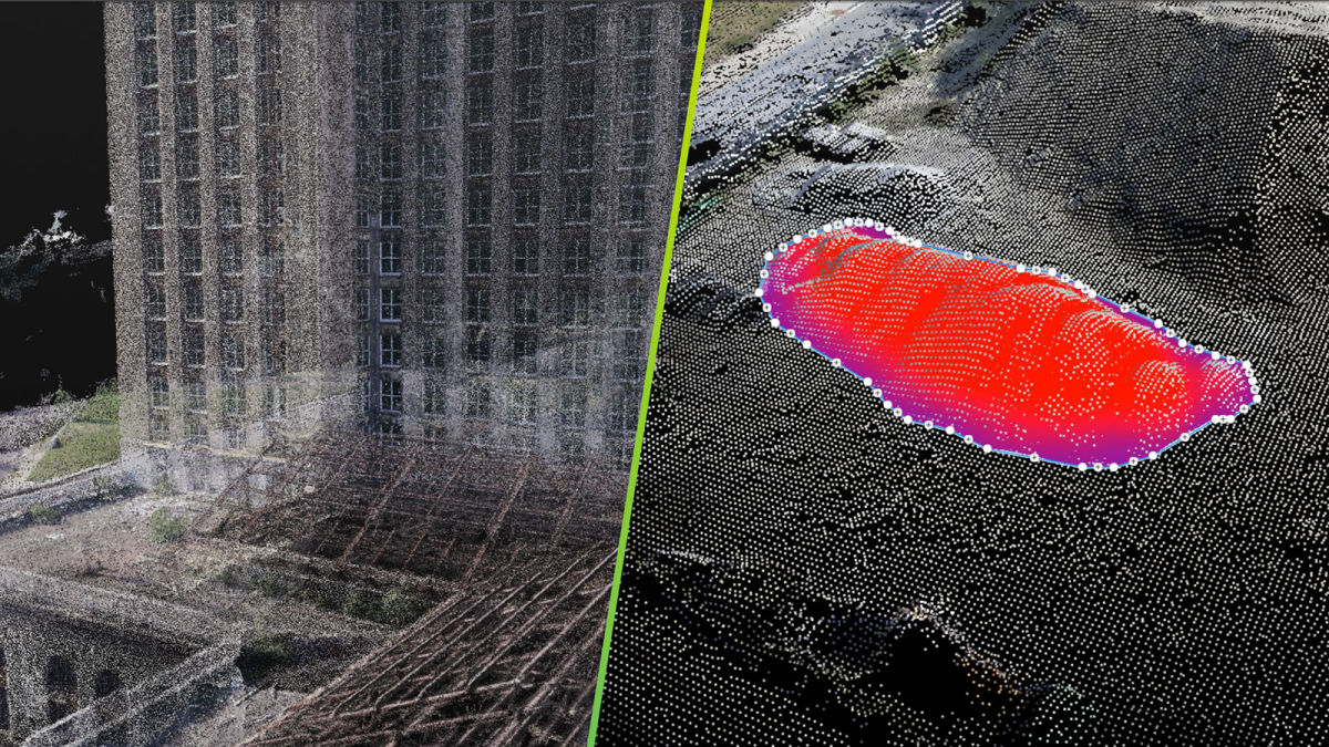
1 Viewing point clouds on the cloud
Point clouds are the simplest and most accurate way to represent the position of an object in a digital 3D environment. This simplicity makes them the most preferred 3D data representation type in diverse surveying and engineering projects.
In 2018, we made the point cloud available in Pix4D Cloud. With the 3D point cloud viewer, visualizing and accurately measuring complex or large projects is easy. You can use the point cloud with all new projects which are processed or uploaded on Pix4D Cloud.
We’ve added more point cloud settings to give you more control over your project, introducing fixed point size, complementing the default adaptive resizing option.
You can adjust the point cloud settings in the point cloud attributes on the right panel.
2 Onsite inspections went virtual
The Pix4D rayCloud is popular because of its intuitive display of the connections between the 2D original images and the reconstructed 3D object space.
This year, we made this iconic feature available on Pix4D Cloud.
Locate and identify points of interest in the 3D model or point cloud then inspect all of the images that contribute to the point in the reconstruction. Add comments and pin the images with detailed information.

3 Extended analysis with volume calculations
No matter the shape or complexity of the volume you need to measure, the Pix4D Cloud tool allows flexible and accurate measurements in your 3D point cloud, 3D mesh, and orthomosaic. It’s as easy as ABC.
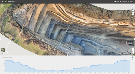
4 Fast elevation profile generation
Elevation profiles or cross-sectional views are a useful tool whether you are planning earthworks or designing roadways, outlining utility and telecommunication infrastructure projects or mapping natural hazards, or even measuring crop height.
Now that elevation profiles are offered within Pix4D Cloud, there is no longer need to take an additional step with other software.
5 Synchronized 2D and 3D annotations
On Pix4Dmapper Cloud, annotations and measurements, including elevation profiles and volumes, are fully synchronized across 2D and 3D views.
Whether they are created in the 2D or 3D view, they will be preserved in and synchronized with the other one.

6 New look
Pix4Dmapper Cloud’s interface has been refreshed, with the left menu representing the point cloud and 3D textured mesh as layers. Over on the right of the screen, metric coordinates are displayed for markers in addition to the latitude and longitude. Plus, toggle easily between 2D and 3D views with the button at the bottom of the screen.
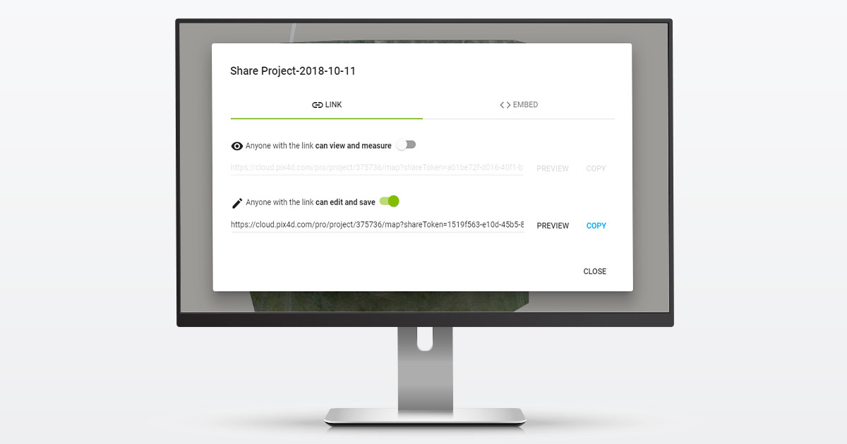
7 Edit or view-only permission access for clients and collaborators
Pix4D Cloud now allows your team to save edits, measurements and annotations on your projects, even without a Pix4D account.
8 CAD and image overlay for construction professionals
Pix4Dbim Cloud offers an improved CAD and image overlay tool to efficiently compare the as-built situation to the design. Learn more here.
Have questions about the latest updates, features, and capabilities? Get in touch with our team for answers.


