The power of custom settings and cloud processing
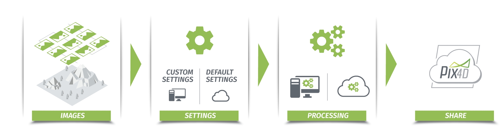
The Pix4Dmapper hybrid solution offers both desktop and cloud processing to generate mapping outputs such as digital surface models (DSMs), 2D maps and 3D textured mesh.
Add ground control points to improve both global and relative accuracy, or apply processing areas to highlight the area of interest of your Pix4Dmapper cloud projects, and more.
First in class
Pix4Dmapper is one of the first hybrid solutions in surveying and mapping industries. “Hybrid” means more than just the ability to work on either desktop or cloud. It's the ability to seamlessly work with a project across different platforms.
Desktop, cloud and back again
As a professional user, you may prefer processing images using the desktop software as you can have more control of the project. Take one of the most used features – adding ground control points (GCPs) for example. Pix4Dmapper desktop interface allows you to easily import and edit those points. You can easily view errors and adjust the point location on corresponding images in real time, which you cannot do with Pix4D Cloud.
However, with the desktop version, you may find it complicated to share the output with your client. In the past decades, geospatial data was mainly used by people in the industry. Due to the popularization of drones, the acquisition of aerial images is easier and much more efficient, meaning a lot more data has been collected. With Pix4Dmapper, the generated output is accessible to almost everyone. You no longer need to download tons of unfamiliar software just to open and visualize georeferenced maps or models. Now, you simply send a link to clients so they can view the entire project in their browser, complete with all your annotations.Since both of our desktop and cloud solutions have their strong points, we see no reason to force our users to choose one over the other. With Pix4Dmapper hybrid solutions, you are able to process projects with customized settings and share them easily.
Why go hybrid?
Custom settings for better results
The Pix4Dmapper hybrid solution allows you to apply preferred settings to cloud processing.
You can indicate the image scale and targeted number when finding image key points, adjust the weight of imported geotags and choose the corresponding calibration method.
These customized settings have a direct impact on the quality and efficiency of your cloud-processed projects. For example, by increasing the image scale, assigning a larger targeted number of key points or using geotag-assisted searching, you force the cloud processing to find more features in difficult projects. By changing the scale, density, and minimum matches in point cloud densification, you can generate a better-described digital surface model.Improve both global and relative accuracy with powerful cloud computing
The hybrid solution is especially important if you want to improve the accuracy of your cloud projects. All you need to do is to create a desktop project and run initial processing (which makes it easier to find the right locations for marking points), import your ground control points (GCPs) or check points and mark them on corresponding images, or add manual tie points (MTPs) to improve some problematic regions.
Once you reoptimize and upload the project to the Cloud, the marked points will be taken into account for processing, and the accuracy of them will be displayed in the quality report. With the accurate ground truth, you will obtain your mapping outputs with the centimeter accuracy as you expected.
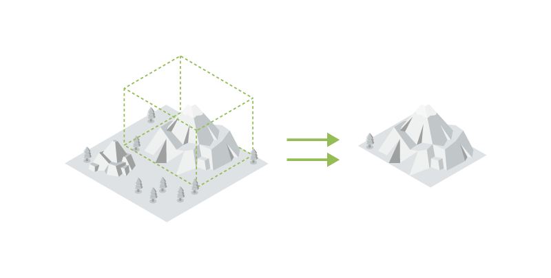
Clip areas of interest for efficient processing
Not all of your clients need to see all of the data, all of the time.
A common use of our hybrid solution is processing and sharing a selection of a dataset. Simply define a processing area in Pix4Dmapper Desktop and upload the project to the cloud. Pix4Dmapper Cloud will generate all outputs only within the region you indicated. This allows efficient processing and highlights the area of interest to your clients.
Your data, faster
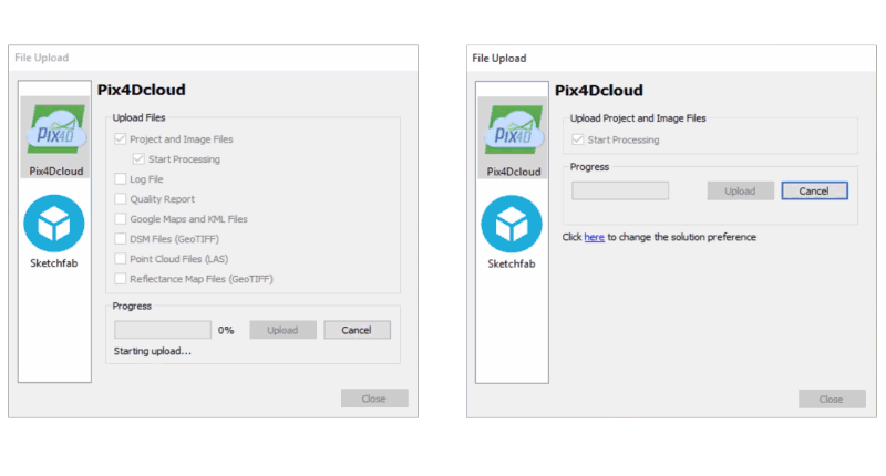
Even with so many custom control options in Pix4D Desktop it's still easy to sync a desktop project with the Cloud. Since Pix4D Desktop version 3.2, uploading images and project settings from desktop to the cloud is 10 times faster. It only takes a couple of minutes to upload a project of 150 images. The high-speed uploader smoothens the hybrid workflow and completes the solution.