From cm to mm: a new frontier in accuracy
In recent years, fixed-wing vertical take-off and landing (VTOL) drones, payloads*, and photogrammetry solutions have been increasingly adopted by professionals in surveying and construction. Advancements in drone technology, smartphones, and imaging have contributed to the shift toward digitization in these industries.
Despite these advancements, data capture with fixed-wing VTOL drones still faces significant limitations in accuracy and reliability. These issues are primarily caused by constraints on the drones' safe flight height and speed, as well as the standard capabilities of the payloads they carry.
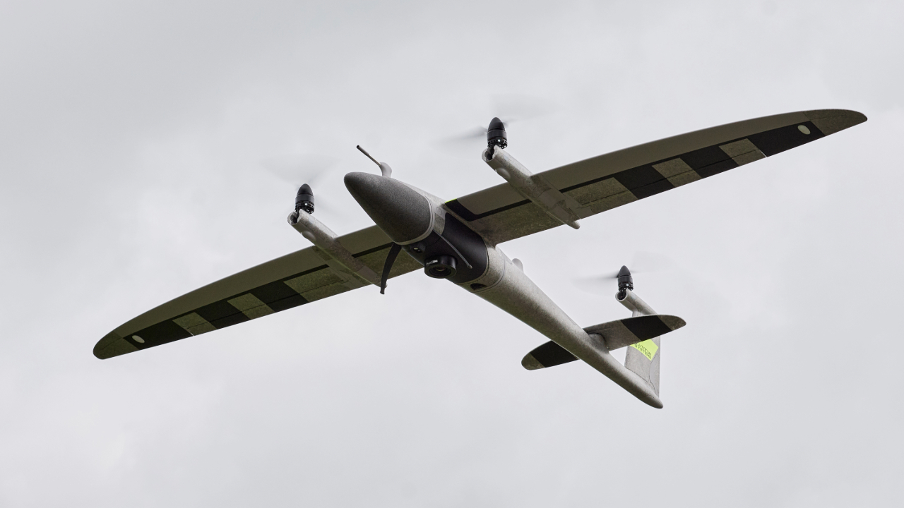
However, Phase One and Pix4D have addressed these challenges by demonstrating the potential of VTOL drone technology (specifically the Quantum Systems Trinity Pro) to push the boundaries of data accuracy. They achieved sub-1cm absolute accuracy at a safe, sustainable, and efficient flight height, marking a significant breakthrough!
*Payloads are the extra weight carried by a drone, for example, cameras or sensors.
Equipment and project set up
Drone: Quantum Systems Trinity Pro (PPK) Payload: Phase One P5 80mm lens Software: PIX4Dmatic
Flight details and conditions: Height: 60m / 200ft Conditions: Cloudy day Drone cruise speed: 18 m/s Total number of images capture: 3660 Flight time: 45min
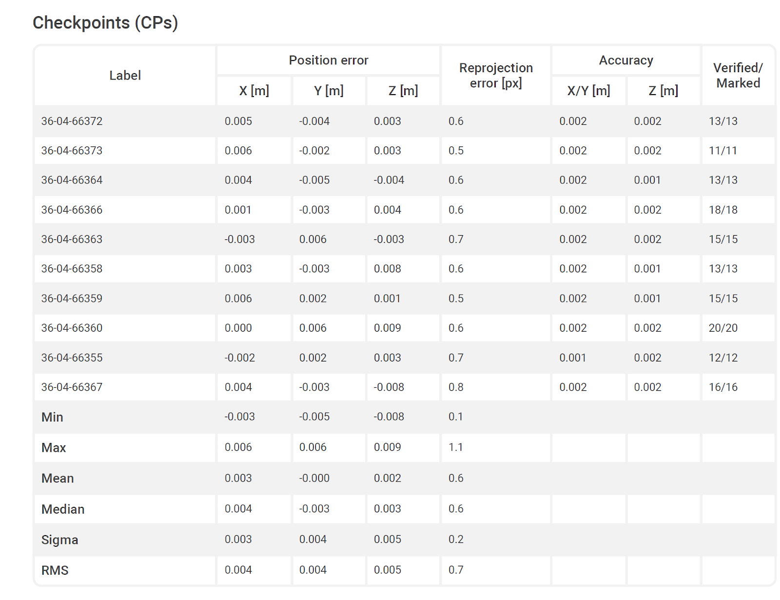
Instruments: Total station, Trimble S7 Robotic Number of GCPs: 3 Number of checkpoints: 10 GCP and checkpoint accuracy: <= 2 mm. in XYZ-coordinates Coordinates: ETRS89 / UTM zone 32N + DVR90 height - EPSG:25832+5799 [DVR90]
Project results
GCP mean RMS 0.036 mm Check point mean RMS X / Y / Z 0.004 m / 0.004 m / 0.005 m
Phase One and PIX4Dmatic
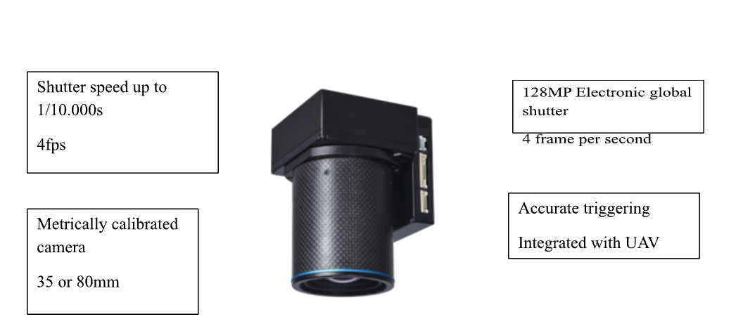
Phase One P5 is a light, metrically calibrated, ultra-high-resolution camera (128MP) designed for fixed-wing UAVs such as Quantum Systems Trinity Pro which provides consistent superior imaging even in complex operational environments such as high contrast lighting conditions, windy days, and complex terrains/morphology.
PIX4Dmatic is a fast and powerful photogrammetry software tailored for professional drone and terrestrial mapping. It efficiently processes large datasets, handling thousands of images while maintaining survey-grade accuracy, making it a crucial tool for data analysis and decision-making for surveyors and project managers.
Despite the large number of high-resolution images, the Proof of Concept demonstrated that the calibration process (aero triangulation) is highly efficient, with a processing time of just one hour.
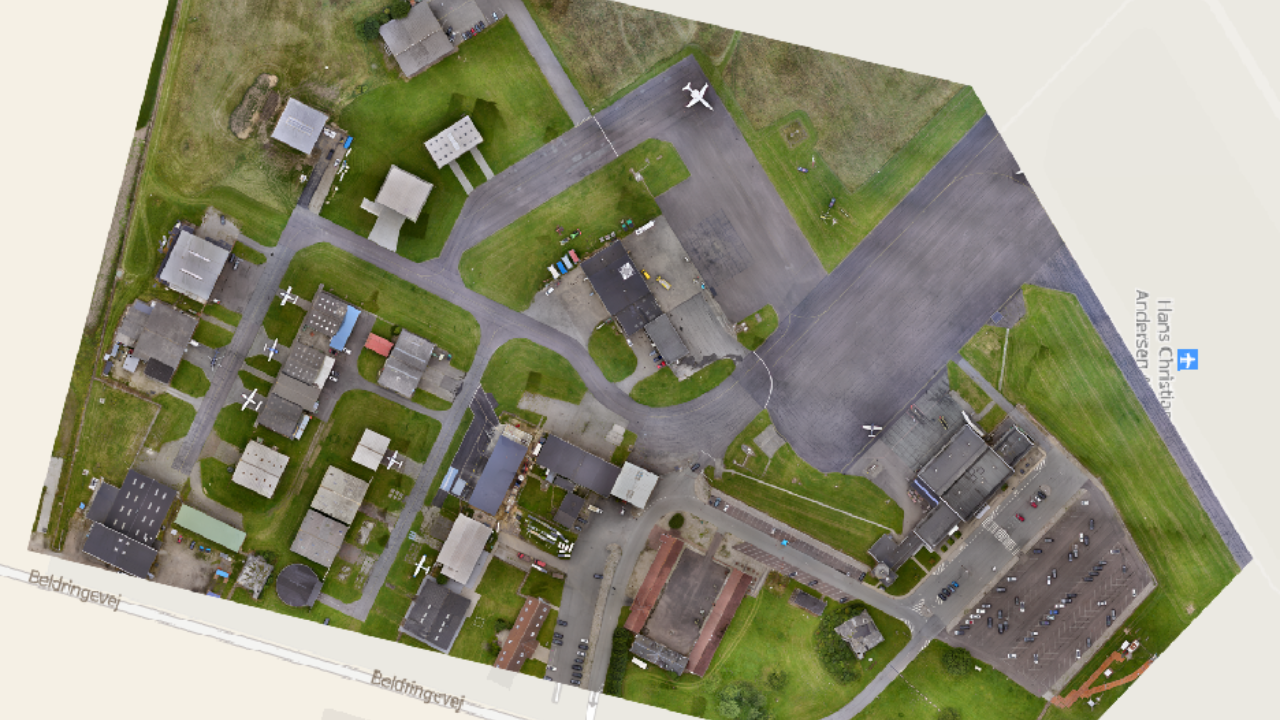
In this Proof of Concept, Phase One and Pix4D have demonstrated how a new standard is being set for rapid data collection with superior accuracy, providing surveyors and mapping professionals with powerful tools to capture and deliver precise geospatial data quickly with reliability for complex and demanding projects.
About Phase One:
Phase One is a global leader in digital imaging technology. The company provides unrivaled imaging quality for a wide range of applications, from professional photography to heritage digitization, industrial inspections, aerial mapping, security and space.
For more than three decades, Phase One has developed core imaging technologies and a range of digital cameras and imaging modules, setting new standards for image quality in terms of resolution, dynamic range, color fidelity and geometric accuracy.
Disclaimer: the above is intended as a Proof of Concept and not a scientific publication.


