

To the point: 3D point cloud on the Pix4D Cloud
Point clouds are the simplest and most accurate way to represent the position of an object in a digital 3D environment. This simplicity makes them the most preferred 3D data representation type in diverse surveying and engineering projects.
From now on, you can view all the new projects you process on or upload to Pix4Dmapper Cloud and Pix4Dbim Cloud as point clouds. With the 3D point cloud viewer, visualizing and accurately measuring complex and large projects is easy.
Geolocated data in the cloud
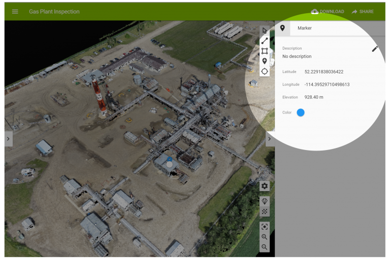
Get the latitude, longitude, and elevation of each point. The point cloud viewer on Pix4D Cloud gives you access to geolocated data, with the exact 3D position of your markers
You can export the full 3D coordinates of the markers as .csv and GeoJSON files. You can also export the 3D position of the lines and polygons you drew in the 3D view as a GeoJSON file.
Precise visual reference
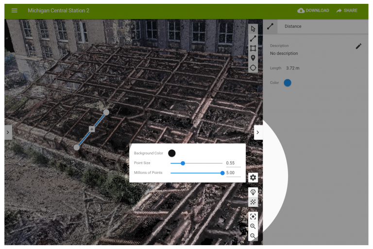
The point cloud visualization offers you a precise visual reference that improves your clicking accuracy.
Adjust the size of the points and the density of the point cloud to gain even more control—ideal for pulling out precise measurements, drawing lines and polygons, or adding markers to pinpoint critical elements.
Smooth display and navigation of large projects
Run through the dense point cloud without compromising browser performance. The level-of-detail (LOD) data structure enables smooth display and navigation and becomes particularly handy when working with large projects. You get better-defined detail as you zoom-in into the area of interest.
Accurate reconstruction, flexible, in-depth visualization and contextual information
You need a simple photogrammetry workflow. We brought the core accuracy of Pix4D photogrammetry software to our cloud platform and we are building the tools to facilitate your work.
To give you in-depth visualization, we created the virtual inspection tool and to help you add contextual information to communicate your findings, we added a wealth of annotation tools.
To allow you to overlay plans on your 2D maps on Pix4Dbim cloud, we designed a New CAD Overlay tool. Learn more here.


