Is thermal mapping the future of landmine clearance?
Landmines are a “weapon of mass destruction in slow motion.”¹
There are an estimated 110 million landmines in the world, with more produced and deployed every year. It’s not an issue which is going away any time soon, as buried landmines can stay active for more than half a century.²
A new way of using drone mapping technology may make landmine removal easier, faster, safer and cheaper.
Landmines and UXOs: an old problem needing new solutions
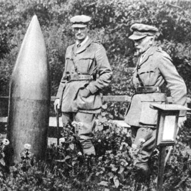
UXOs, or unexploded ordnance, or explosive remnants of war are general terms for artillery projectiles and bombs which did not explode when deployed. UXOs can outlast a conflict by centuries. Around 60 bombs from the Second World War are found in the UK alone each year, and a UXO from the American Civil War caused a death in 2008.³
By sheer volume, the greatest number of UXOs are landmines. Today there are an estimated 110 million landmines lurking in 58 countries.²
More than 20,000 people are killed, mained or injured by UXOs each year. 80% of landmine casualties are civilians, and most deaths occur in peacetime.³ By design, UXOs are difficult to spot, and some landmines include anti-handling devices which make them even more difficult to remove.
The 1999 Ottawa Treaty banning landmines has been signed by 162 countries. Still, between 5 and 10 million landmines are produced each year, and some experts believe 10 landmines are placed for every one removed.
A new way to remove landmines with thermal drone mapping
Most mines deployed since the middle of the 20th century have reduced metal content. Plastic-bodied landmines are difficult for metal detectors to locate, meaning the traditional “beep and prod” method of landmine detection produces a lot of false positives, wasting valuable time and slowing down life-saving work.
“It’s a real challenge to detect plastic-bodied landmines,” explains Dr. Tim de Smet of Binghamton University. “These mines contain almost no metal, so standard detection methods don’t work.”
But the same liquid explosives which make plastic-bodied landmines so deadly also make it possible to locate them using thermal cameras.
“Plastic landmines do not retain temperature very well, so are cooler than the geological background in the early morning hours,” says Dr. Nikulin, Assistant Professor of Energy Geophysics at the Department of Geological Sciences and Environmental Studies at Binghamton University.
Project details: The Butterfly Catcher
| Institution | Binghamton University |
| Team members | Department of Geological Sciences and Environmental Studies Jasper Baur, William Frazer, and Jacob Abramowitz |
| Hardware | FLIR Vue Pro R camera 3DR Solo quadcopter UAV DJI Phantom 4 Pro |
| Software | Pix4Dcapture - drone flight planning app Pix4Dmapper - photogrammetry software |
| Test location | Chenango Valley State Park, New York, USA |
| Area | 10 x 20 meters |
| GSD | 1.2cm |
Proof of concept: detecting landmines
The test which could potentially change post-war landscapes around the world was carried out in a parking lot.
“A former parking lot,” explains Dr. de Smet. “The low grass and rubble is actually really environmentally similar to where the PFM-1 landmines were dispersed in Afghanistan.”
“Toy” landmines in Afghanistan
The PFM-1 landmine is often called a toy, or butterfly landmine. Weighing in at just 75 grams, they are aerially deployed, and glide to the ground with the help of their distinctive “butterfly” wing.
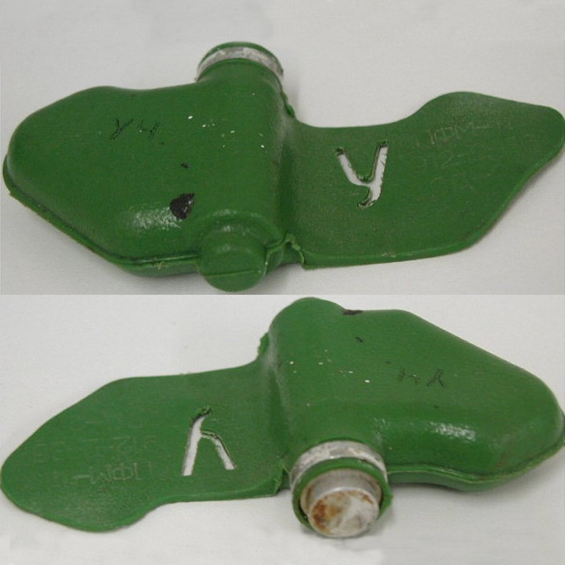
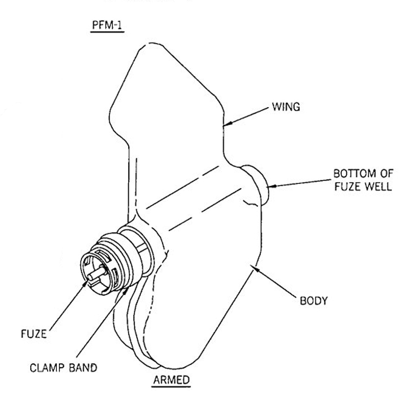
It’s estimated that over a million of these UXOs still litter Afghanistan.
Ground-penetrating radar and seismic surveys can be used to clear these landmines, but are dangerous for the operators, as the equipment is heavy and toy landmines will explode with as little as 5 kilos of pressure.
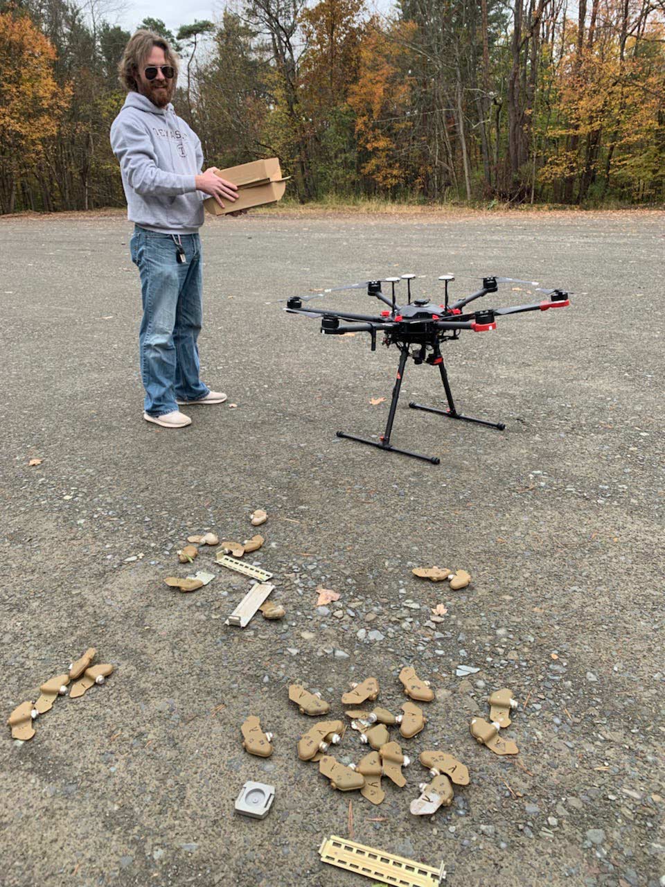
The team scattered 18 inert mines plus their casings over the test area. Over the study period, the mines were arranged in four different orientations to see how their placement affected their detection.
To keep ensure repeatable results, Drs. de Smet and Nikulin and their undergraduate student team plotted their drone flights with the free Pix4Dcapture app.
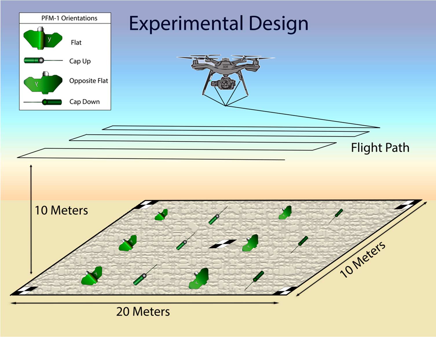
The team launched their drone from the side of the 10 by 20 meter “minefield” every 15 minutes to pinpoint the optimal moment for detecting landmines.
Back on campus, the drone images were pre-processed to produce 14-bit raster datasets, and then reconstructed into orthomosaics with Pix4Dmapper.
Landmine detection from the air
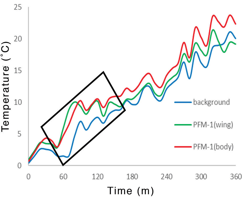
The early morning flights detected between 65% and 85% of landmines in the test.
The thermal infrared FLIR Vue Pro R camera detects the amount of infrared radiation emitted, instead of the visual light captured by a typical camera. An object's physical properties, including size, composition, shape and density affect its thermal behaviour: the rate at which it heats or cools.
The landmines head up much faster than the surrounding rocks, and can easily be spotted by their distinctive shape and thermal signature.
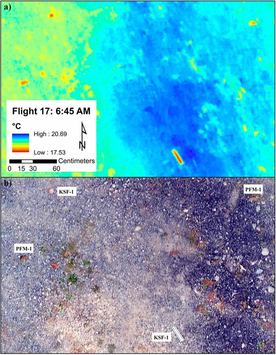
For that reason, where and how the landmines were placed did not appear to affect the detection rate.
“That’s promising as PFM-1’s are dispersed randomly, and can move after they are placed - they can be carried along by flooding, for example,” explains Dr. de Smet.
Is this the future of landmine clearance?
A problem as massive and as widespread can’t be solved with a single camera, and Dr. de Smet and the Binghamton University team don’t hesitate to list its drawbacks.
The trial area was carefully chosen to be an ideal testbed: while it was similar to real-world conditions, the real world is seldom ideal.
If a landmine is buried, or too close to confusing geographical objects such as rocks or trees, it may still be obscured. The method may have limited potential in urban areas, or areas of dense vegetation. “But most PFM-1s were deployed in mountain passes during the Soviet–Afghan War,” explains Dr. Nikulin. “They were intended to block access to remote, high-altitude areas, so they are actually in places which are really favorable for remote thermal detection.”
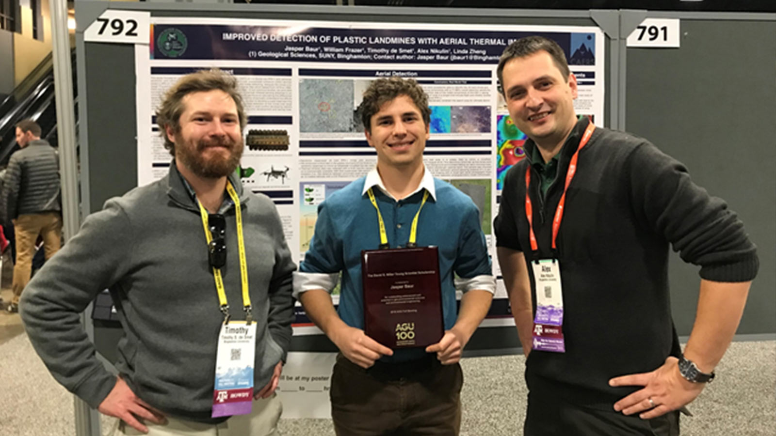
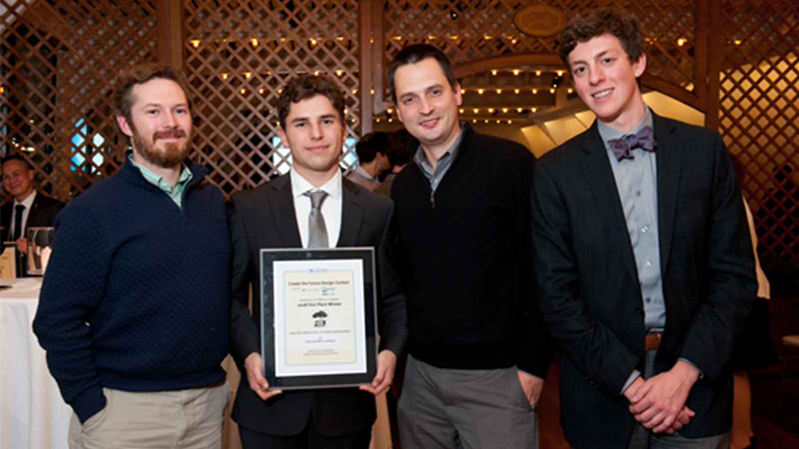
Before the team works on their ultimate target area of mountainous Afghanistan, additional field trials are needed. Still, the international community is taking notice: the team won the 2018 Tech Briefs Create the Future Design Contest in the Aerospace and Defense Category, and the work was also highlighted by Popular Mechanics.
“Thermal cameras and drone mapping won’t replace manual clearing of mine fields,” says Dr. Nikulin. “But it’s a low-cost, out-of-the-box technology that can help detect mine presence and minefield orientation. That in turn dramatically constrains the area which needs to be cleared.”
The technique is still in its infancy, but has the potential to save many lives for decades to come.
References
| ¹ Landmines: A Deadly Legacy, Human Rights Watch, 1993 ² care.org ³ en.wikipedia.org Lead image by Pierpaolo Lanfrancotti on Unsplash Back to top |