Solar farm inspection with drones and thermal mapping
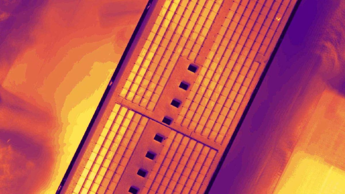
Infrared imaging from drones is increasingly used for creating thermal maps, in particular of solar panel installations, to perform temperature measurements, quickly detect anomalies in each panel, and to better target maintenance efforts and improve the efficiency of operation. Drones are already being used to inspect solar farms, but thermal outputs highly increase the accuracy of the inspection.
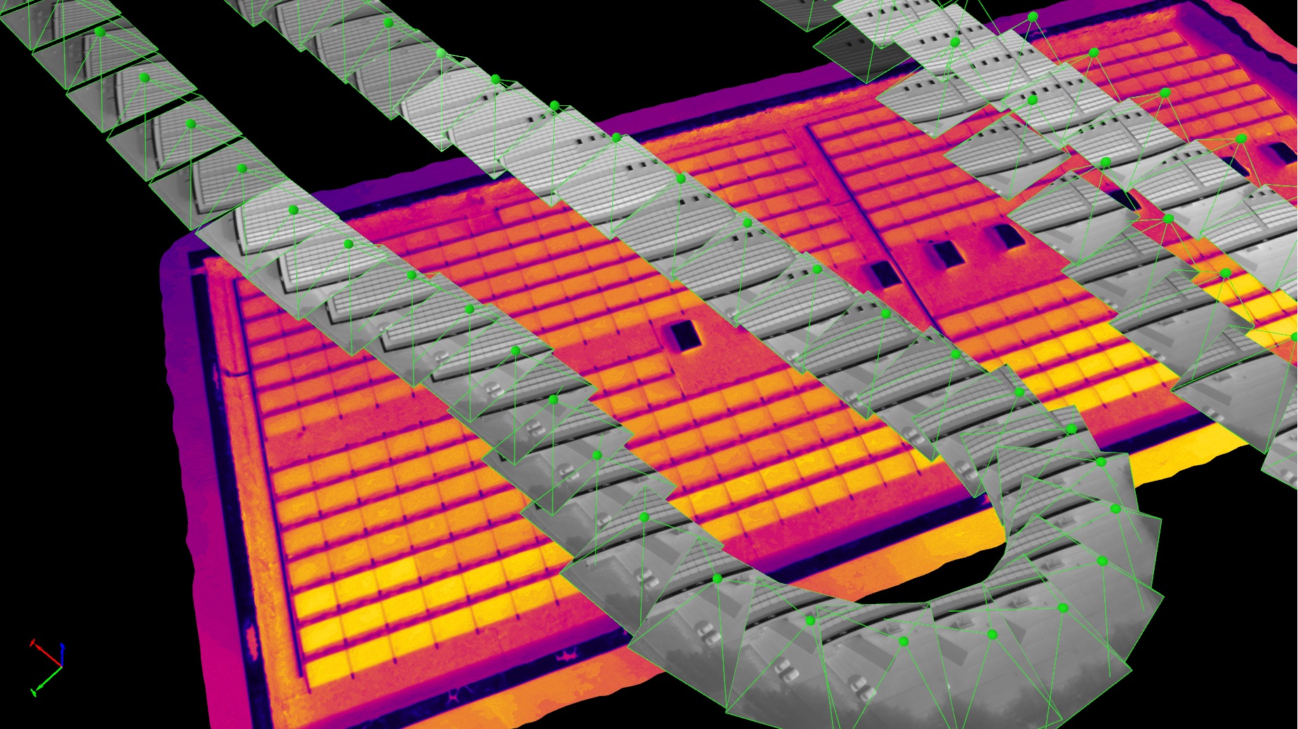
The company contacted drone service company Oblivion Aerial SA to investigate why one of the solar panels on its roof wasn't producing the expected energy amount. Based on the temperature difference in the thermal map, created using a FLIR Vue Pro thermal camera and Pix4Dmapper photogrammetry software, exact problems and locations could be noticed.
Project details
| Company | Oblivion Aerial SA. |
| Country | Switzerland |
| Industry | Solar panel inspection |
| Project Date | October 2016 |
| Project Manager | Damiano Maeder |
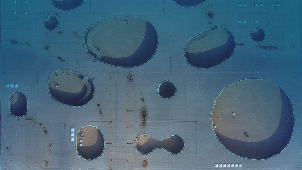
| Project Size | 1,600 meter2 Rooftop |
| Software | Pix4Dmapper photogrammetry software |
| Number of Images | 211 |
| GSD | ~10 cm |
Inspecting the solar panels using thermal maps
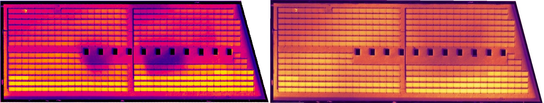
Two issues were found in the first inspection. A large region of the rooftop had a higher temperature, which indicated possible connection issues for the inverter. Upon receiving this information, the client decided to shut down the power supply for the detected region and recheck the connectors. This issue normally happens when connectors are oxidized, due to high humidity and low-PH weather conditions.
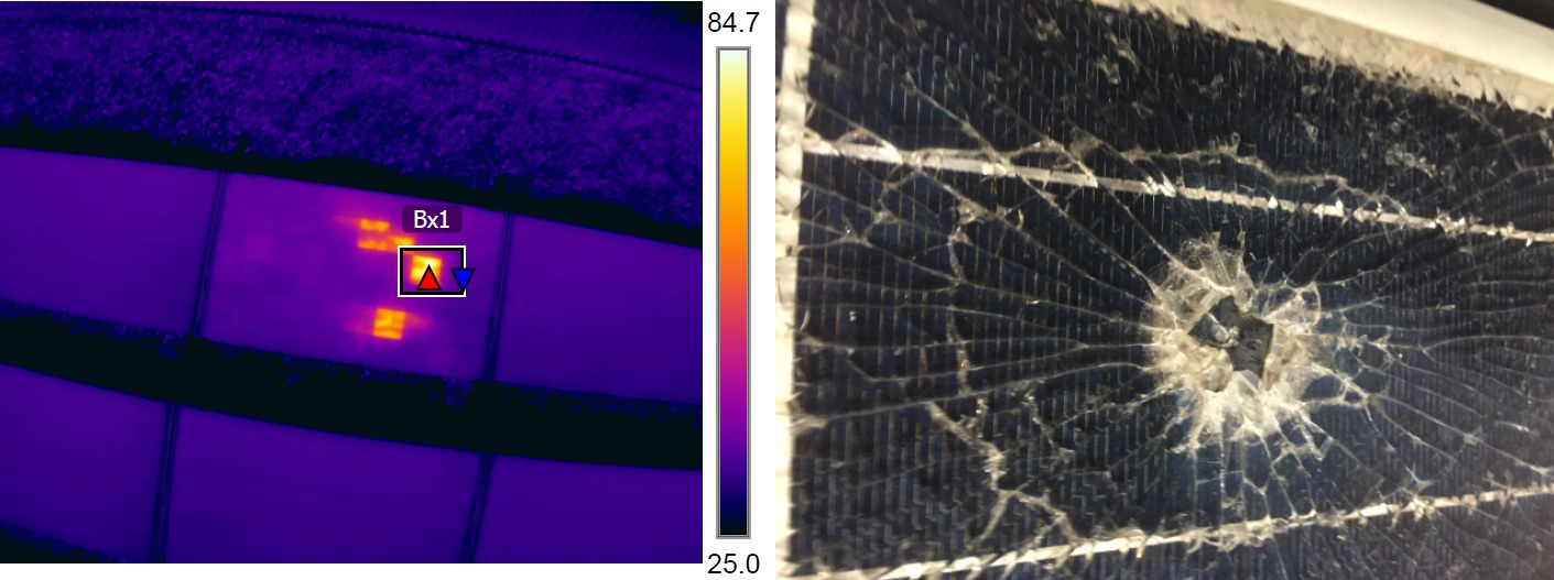
The other problem was a hot spot. The thermal output helped the company estimate the cause of the hot spot. For example, a large temperature difference between a hot spot and surrounding modules (32 degrees Celsius for this project) may indicate a broken module, while a smaller difference can simply be dirt or soil covering the module.
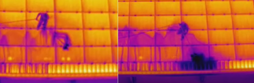
A second inspection was conducted while the installation was connected to the inverters. There was clearly a misconnection between multiple groups of modules. The issue was resolved by replacing the connectors.
Drone's equipment for capturing thermal imagery
Do drones have thermal imaging?
Aerial thermography is one of many drone applications. When equipped with a special thermal camera, drones can translate thermal energy (heat) into visible light in order to analyze a particular object or scene.
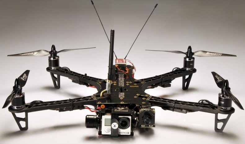
A quadcopter multi-rotor drone equipped with a FLIR Vue Pro (640) thermal camera, 9mm focal length, was manually flown to acquire NADIR images, which were captured every second.
The first inspection was conducted with 211 images with a rough resolution of 10 centimeters. However, the second inspection included only 11 images, which took less than five minutes to process. Despite being so quick to process, the results gave the client sufficient information for the quick examination after the replacement work.
How to capture thermal images with a drone?
For a better reconstruction of the solar farm in a thermal project, follow these recommendations during the image acquisition:
- Have a very high image overlap: 90% front and side.
- The resolution of the images should be at least 640x480 pixels
- The images do not suffer from motion blur, so please avoid increased flight speeds because it may cause blurred images.
Analyzing the solar panels using thermal maps
From the first inspection result, we can see some dark regions, which were affected by the camera calibration during the flight. Each thermal image was manually adjusted for constant reflectance values. Along with some on-site temperature sampling, a high accuracy thermal map was created in Pix4Dmapper.
For this project, some issues were found apart from the major connection problem. An overheated cell indicates a possible damage on the north-west side, and some scattered dirt coverage which resulted in minor temperature rise.
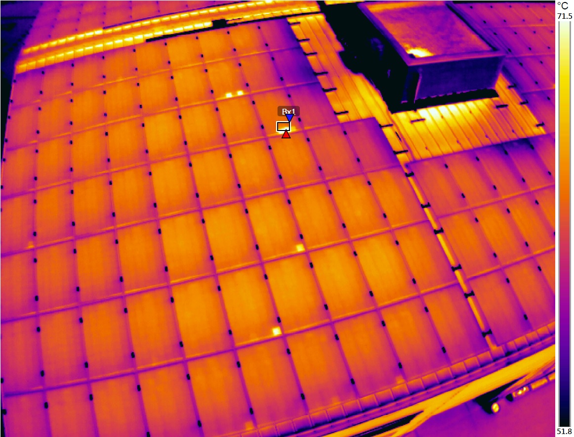
This gives information on location and condition of solar modules. The output can be overlaid with other existing building data for further analysis, and archived for repetitive monitoring.
Advantages of thermal mapping
The most obvious advantages of using thermal mapping with drone technology is the speed and flexibility of response, such as hot spot detection, and hot spot type estimation, based on the information thermal images provide. This information cannot be gleaned from color images. The ease of locating problematic modules over a huge area is an obvious benefit, over a large area of modules that look exactly the same.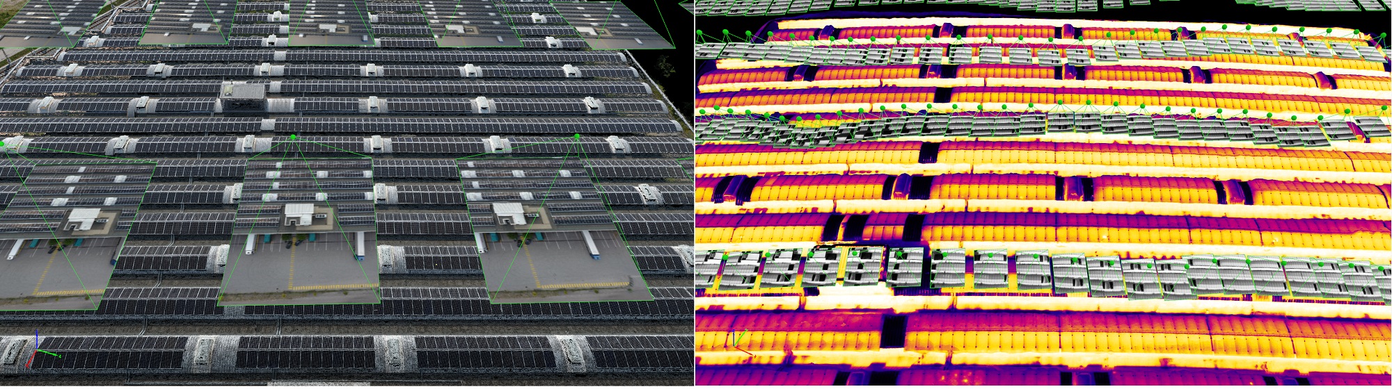
Thanks to Pix4Dmapper, it is now easy to process thermal images, perform accurate temperature measurements, and orientate through an entire installation without the risk of having the wrong location of malfunctioning modules or problematic components.