The construction of Bogotá’s first metro line
The first metro line project is underway in Bogotá, Colombia. With no existing public transport system, the concept of the "Metro de Bogotá" has been debated for 80 years and is a crucial infrastructure project for the city. Overcoming various socio-political and economic hurdles, a contract was signed in 2019, and construction finally began in 2021 on the first metro line, the “ML1!”
The "Patio Taller" project
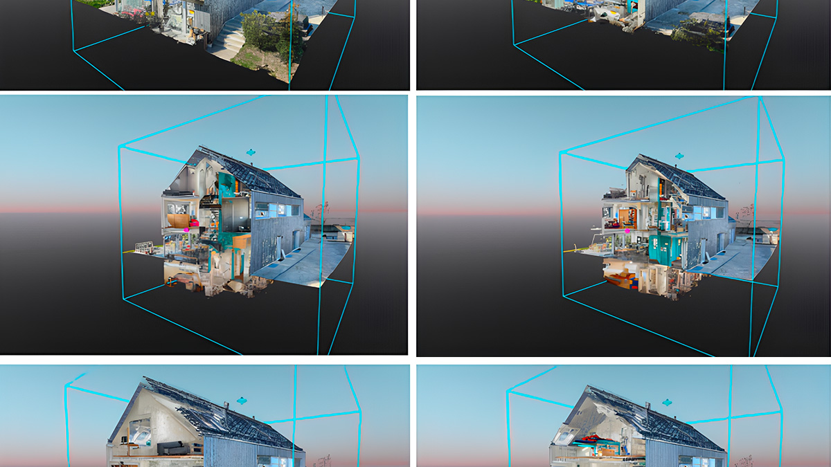
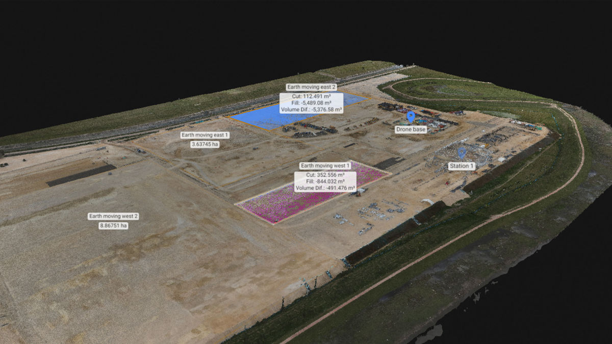
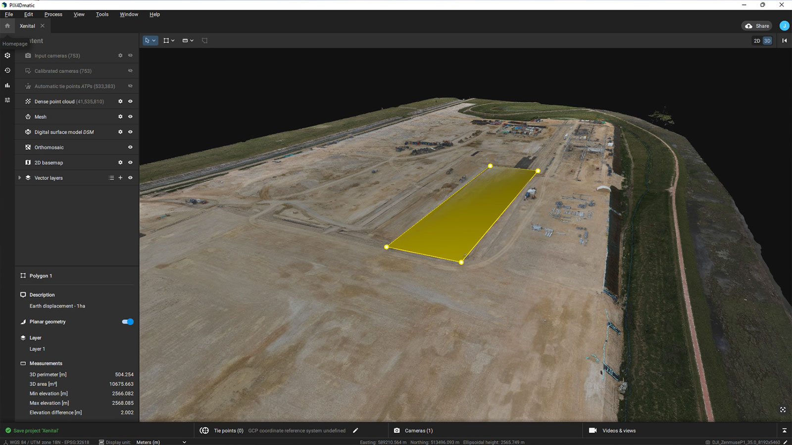
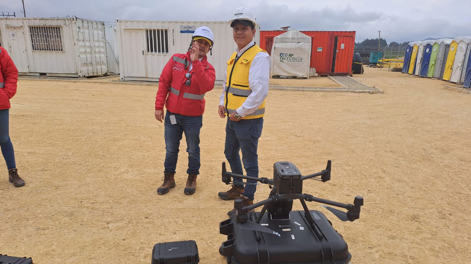
The "Patio Taller" is the train depot, a crucial component of the metro system where trains converge and layover to ensure proper functioning and safety. Xenital, a Bogotá-based civil engineering company, is overseeing the construction, which involves the excavation of 1.2 million cubic meters of earth. They used drones, LiDAR technology, and Pix4D for a topographic survey of the soil. Photogrammetry allowed them to facilitate remote monitoring, tracing, and inspection of projects worldwide, eliminating the need for inspectors and developers to be physically present at the site.
Conventionally, this process takes significantly more time. In the case of the Patio Taller project, analyzing and calculating the soil to be excavated was required daily, and estimating the compensation for this soil was very complex. As a result, the project experienced delays and budgetary setbacks during its development.
The project develops with the help of Xenital and Pix4D
A complaint was filed regarding the delays, which allowed Xenital to demonstrate the time and speed at which the project work could be completed using photogrammetry and Pix4D.
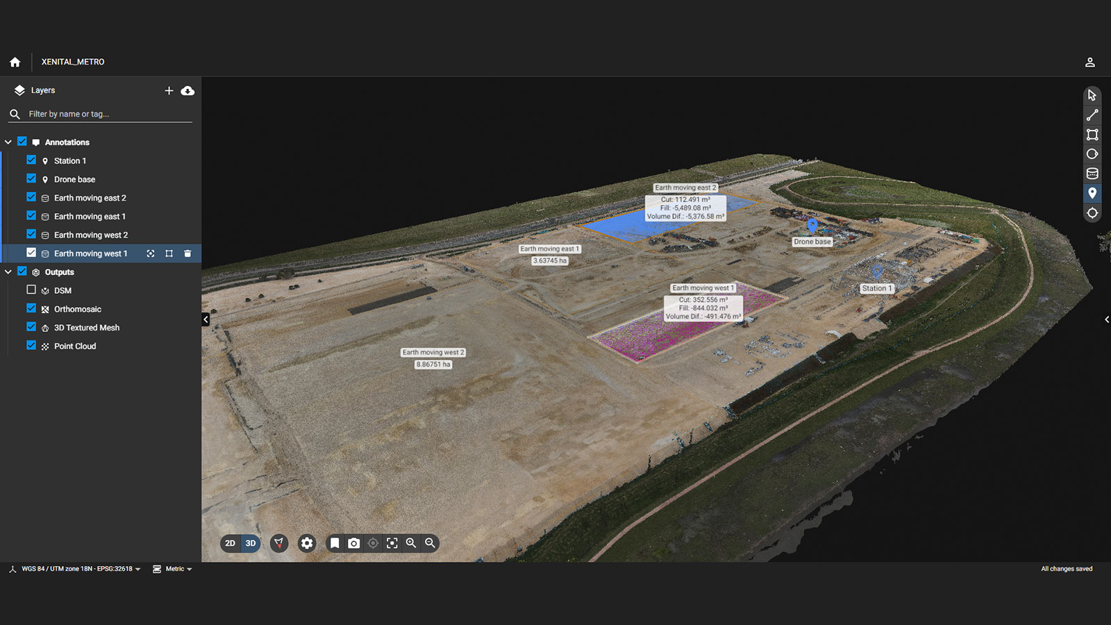
Xenital used a DJI Matrice 300 with the Zenmuse P1 camera to capture the terrain, which took around 45 minutes of flight time to complete. Then, with Pix4D, they were able to process the dataset in less than two hours. Implementing photogrammetry streamlined the process by more than 500%, providing error rates of less than 1%.
It was possible to deliver calculations for the volume of soil to be excavated on the entire construction project in less than a day. These sorts of calculations would usually take about 20 days, according to Xenital! With software such as PIX4Dmatic, large datasets can quickly be processed, easily uploaded, and shared to PIX4Dcloud.
PIX4Dcloud for construction
PIX4Dcloud Advanced is specifically designed to tackle common industry challenges, such as calculation delays and volume uncertainties. This technology allows for meticulous daily land monitoring and volume measurements. The precision achieved with photogrammetry and PIX4Dcloud helps to accurately compensate trucking contractors, saving both time and money. Features like Timeline and Volume Comparison not only streamline traditional processes but can also be invaluable for tracking and documenting site progress, allowing for early identification of potential errors and thus avoiding costly rework.
Project details:
of images753 images with 45MP

How photogrammetry impacted the project
CEO Sebastián Uribe noted several impacts that Pix4D had on Xenital's project. It allowed them to gather and process the data on-site and provide calculations for the project in a short time. It enabled the company to carry out a pilot with the management personnel in charge of construction, presenting the benefits of acquiring spatial information through state-of-the-art technology. Finally, it facilitated monitoring the work at a time when it needed to advance.
“Pix4D processes information with ease, and delivers projects with results that satisfy customer expectations.” - Sebastián Uribe, Xenital CEO
Xenital found Pix4D the most effective way to process the information with the equipment they had, with the speed required, and with a user-friendly interface for the team. They used Pix4D as they are most familiar with this software and have found it vital for their work. Currently, Xenital is applying for a contract for the whole topography of the Patio Taller for 12 months and will continue using photogrammetry and Pix4D to assist in the construction of Bogotá’s first metro.