Construction disputes: saving €80,000 with PIX4Dcloud
This is part two of an interview and use case series with Isachsen Gruppen. The first interview, on taking advantage of drone mapping in construction, was published March 2023.
Disputes are a familiar part of construction that many professionals try to prevent. The Global Construction Review estimates around 73 billion USD were tied up in claims and disputes across international big construction in August 2021. The impact of a dispute is costly - not just in terms of monetary compensation, but also the time spent trying to find a resolution. Avoiding disputes, or catching them before they develop further or even reach court, is of paramount importance for constructors, contractors, and site managers.
Recently, Pix4D spoke to Trygve Almquist, discussing how aerial mapping can play a crucial role in preventing or resolving disputes at an early stage. The use of drone technology in construction has seen a significant return on investment for Isachsen Gruppen, as they have saved thousands of euros on solving disputes early and effectively.
What are the benefits of drones in construction?
- Fast communication and reduced unnecessary site visits
- Streamlined planning with detailed project visualization
- Improved trust between parties, ensuring proof of work and payment
- A long-term record of work can be used for quality control
- Disputes are solved early on with clear evidence
- Advertizing to clients using previous work and ongoing projects
Project 1: saving 80,000 Euro on stockpile measurements
Stockpile measurements and movements are part of a wider system - one piece of the cog in a machine. A site owner or manager needs to have accurate records of how much material is on-site, how much needs to be delivered, and how much has been moved. All of these moving parts result in bills that need to be verified.
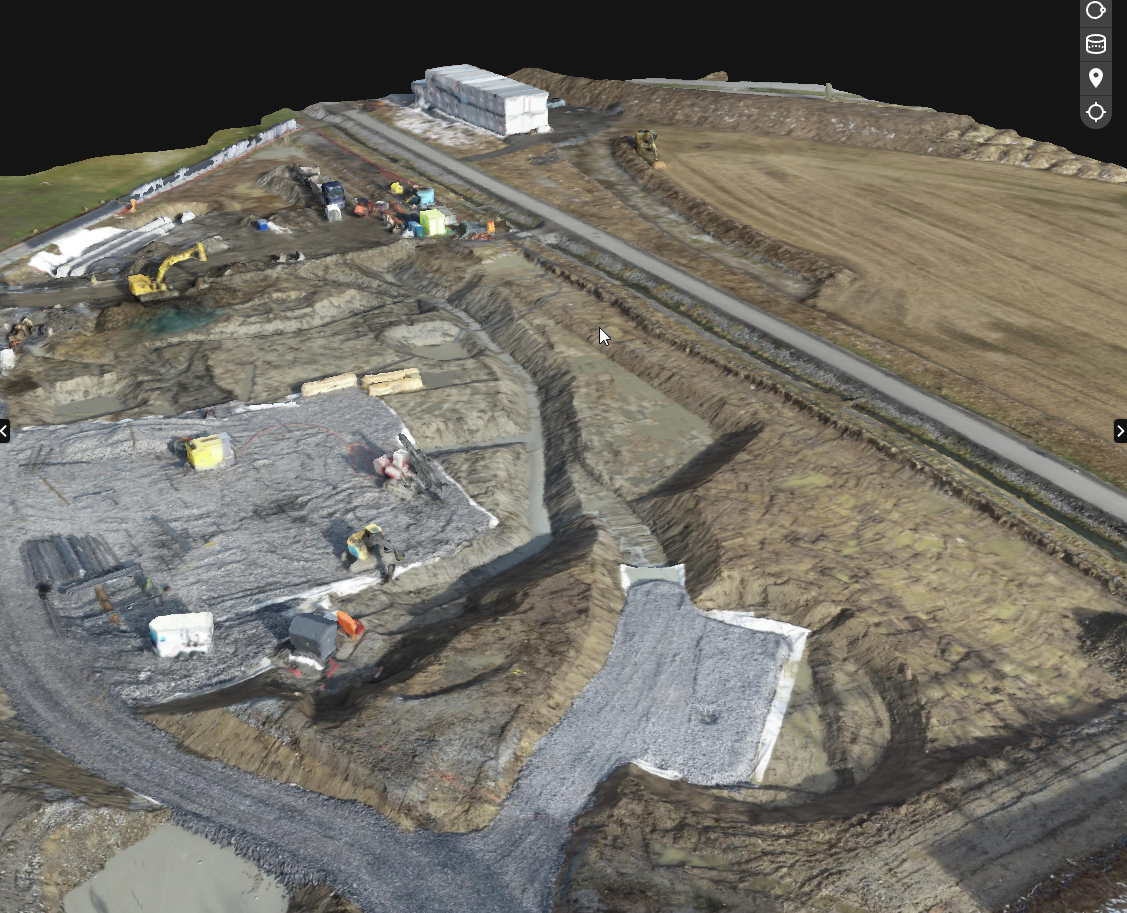
Isachsen was working on a site where they were asked to move a stockpile, after which they billed the client. The client contested the bill as they believed that Isachsen had not moved such a large quantity of material.
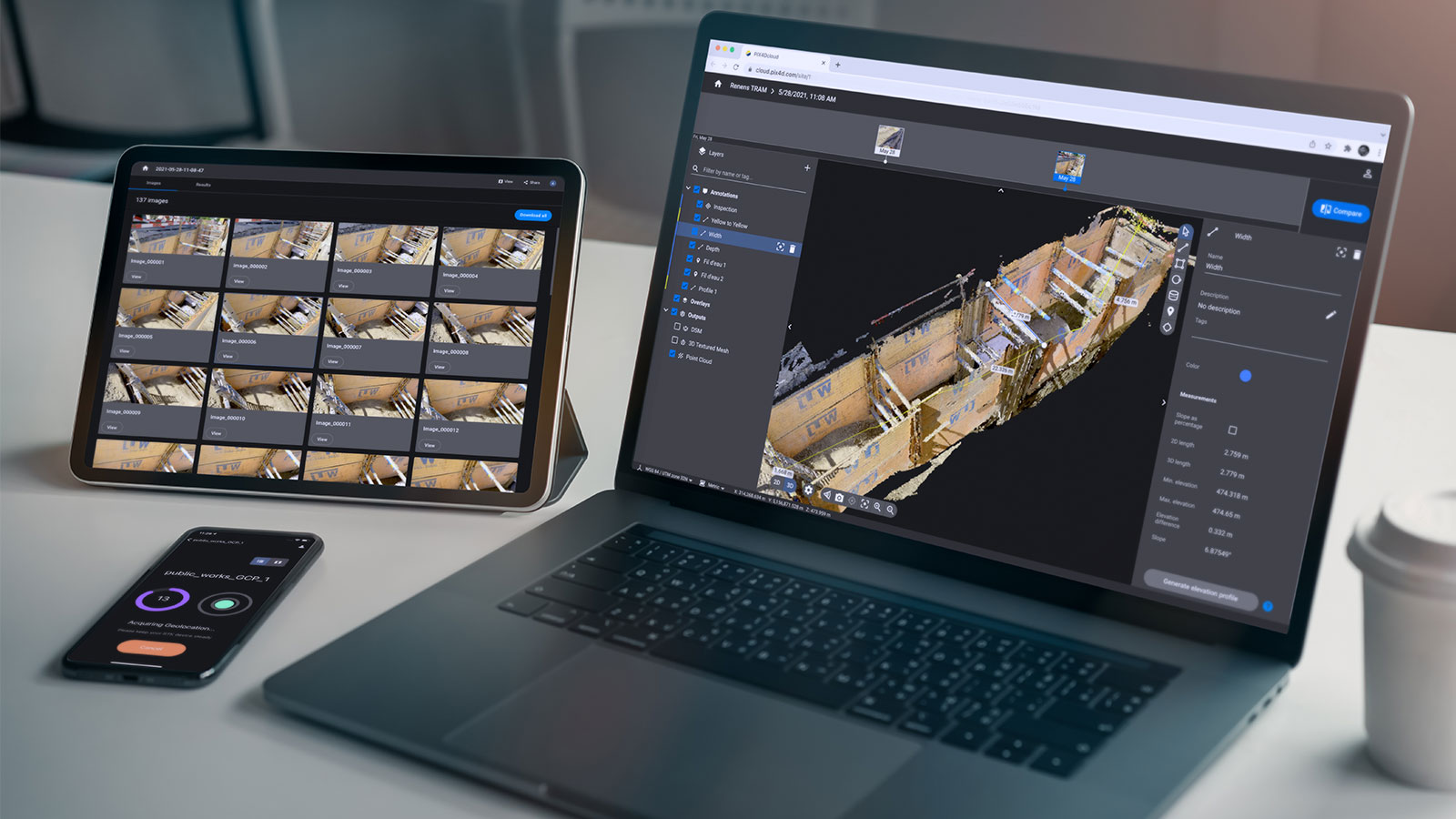
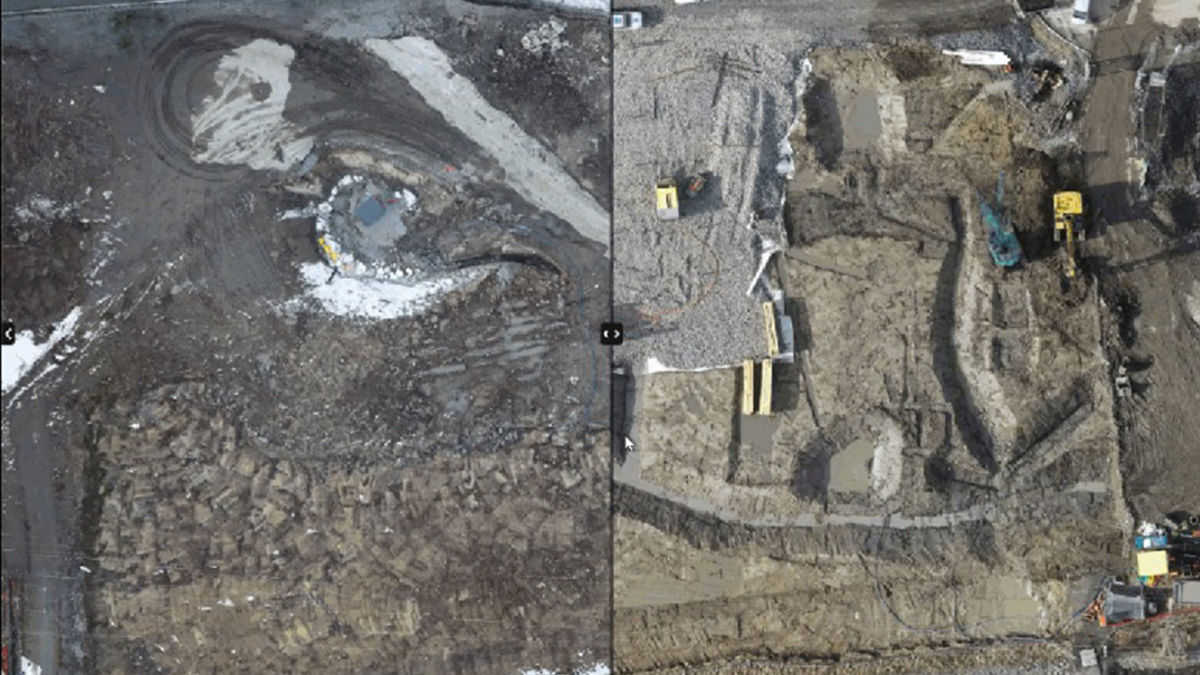
To address the issue, an Isachsen surveyor examined the project on PIX4Dcloud Advanced , utilizing the timeline tool to track the stockpile before and after transportation. Volume measurements and annotations were applied to highlight changes, and the surveyor provided conclusive proof by sharing screenshots directly with the client. Finding and analyzing the stockpile on PIX4Dcloud took less than 5 minutes, allowing the surveyor to promptly share the results. The problem arose from the stockpile being larger than indicated in the client’s records, resulting in a greater quantity being moved than initially anticipated.
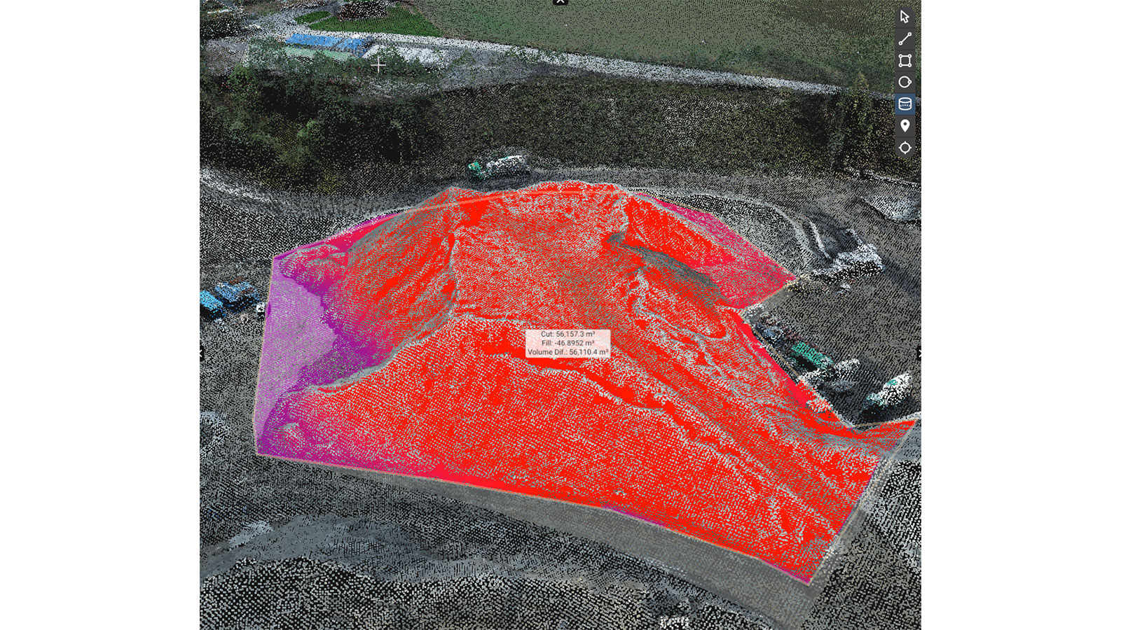
The project manager on this site estimated that the cost of identifying this problem early and solving it saved 80,000 Euros! Because Isachsen frequently gather aerial data with drones and record it with PIX4Dcloud Advanced, they had all of the necessary information to solve the dispute before it escalated.
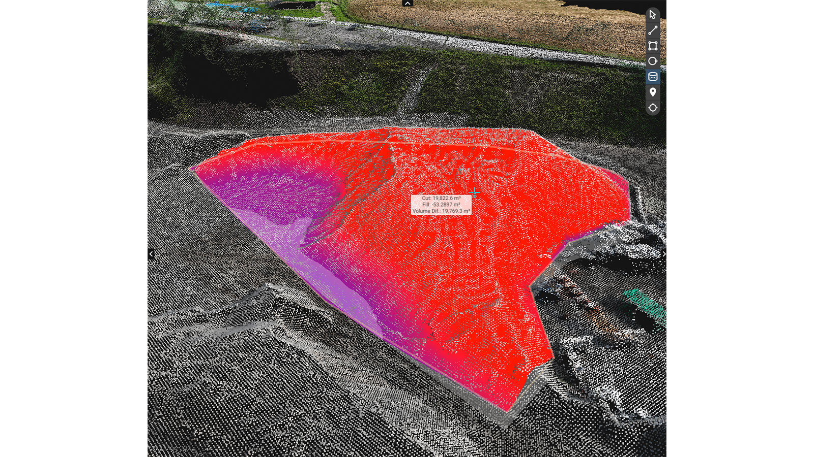
Project 2: analyzing why a manhole installation failed
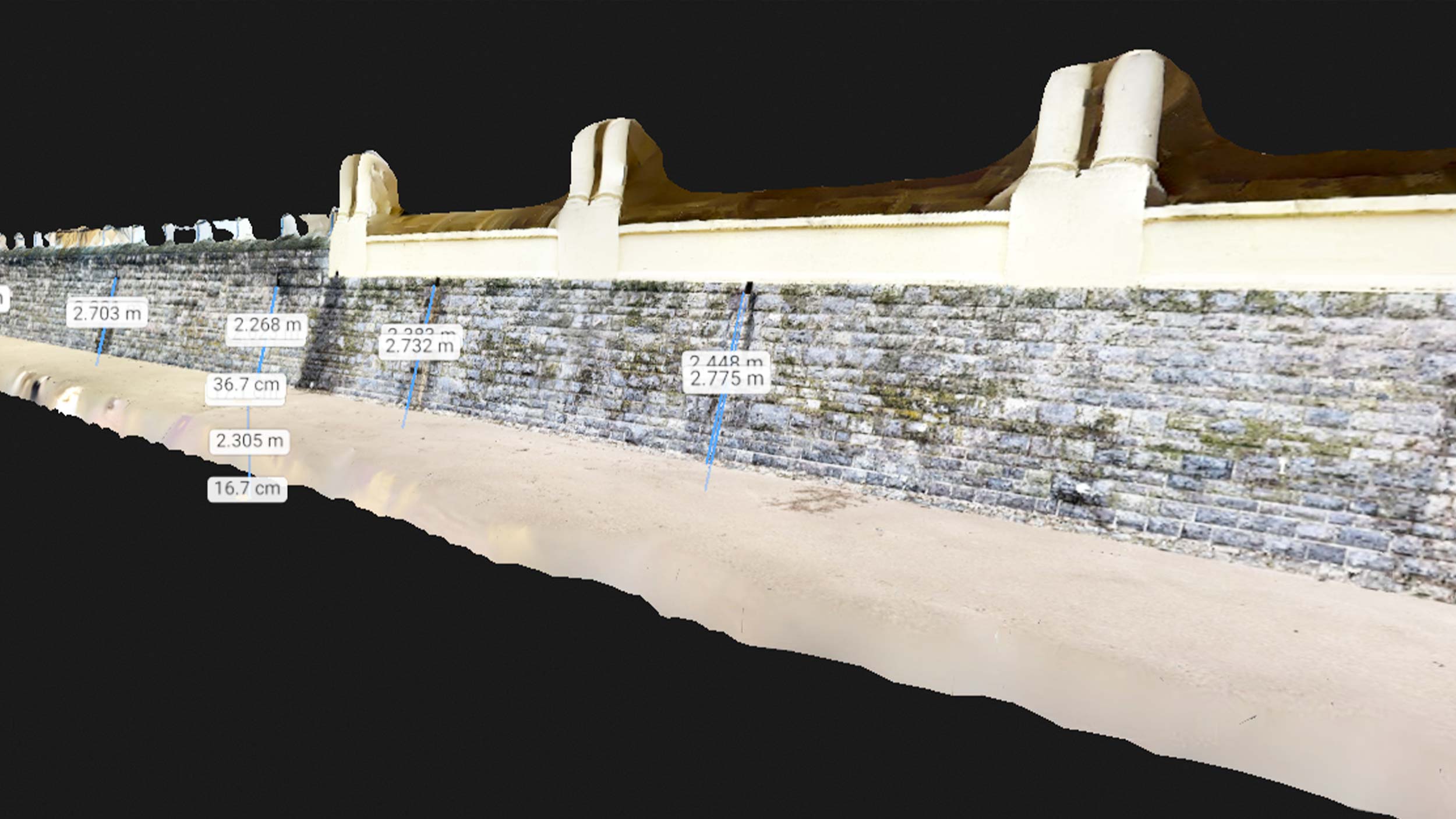
Isachsen received a call from a client: two manholes that were installed alongside a road had begun to sink into the ground. The client believed that Isachsen had not done the adequate groundwork, causing the problem. The manholes were sinking down by 18 centimeters, which is a huge gap and would be costly to repair. The client wanted Isachsen to redo their work.

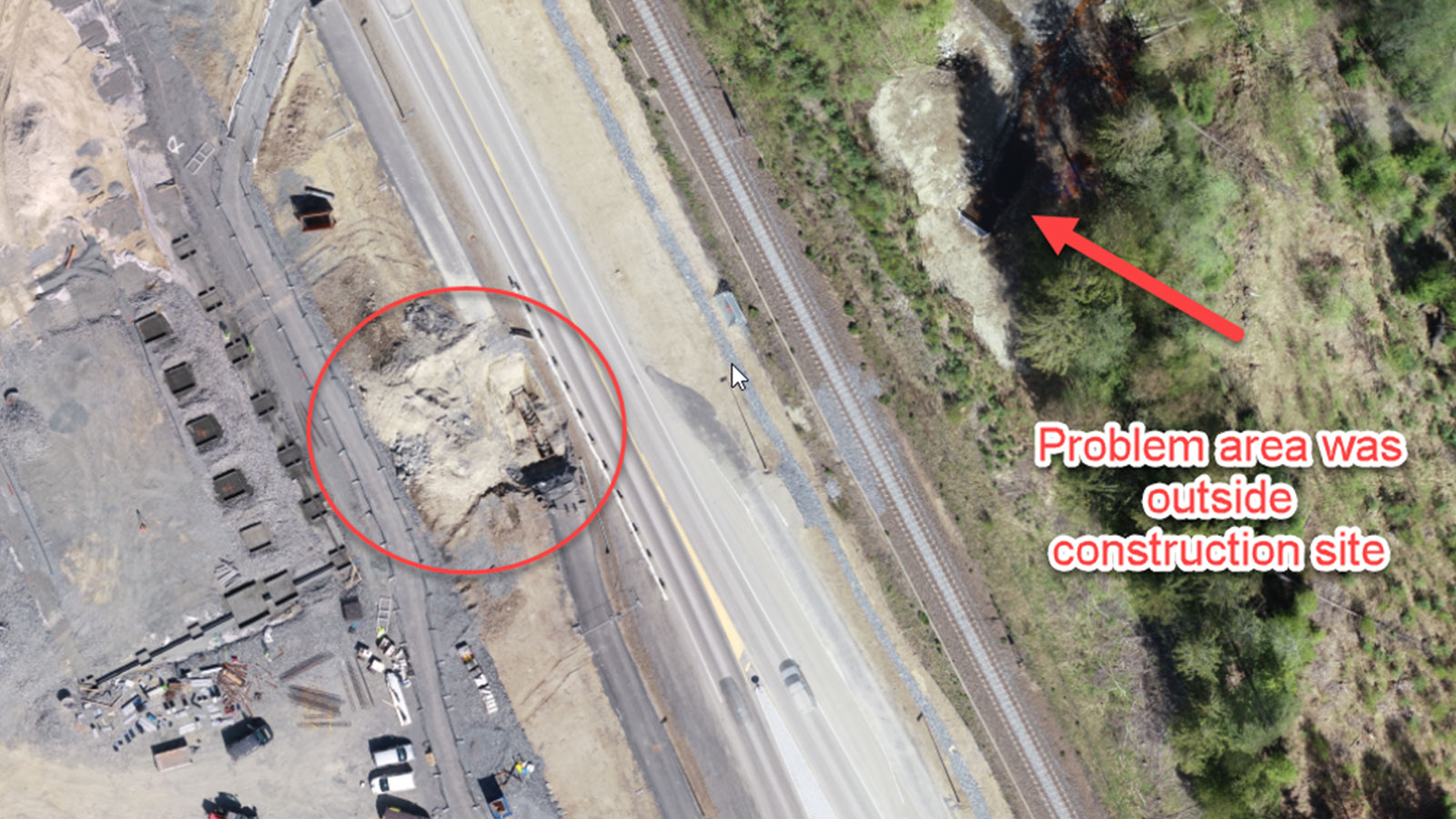
However, the team from Isachsen knew they had done a good job. As the team was flying once per week, the project had been well documented and chronologically ordered in PIX4Dcloud Advanced. Thanks to the Timeline functionality, it was easy to find the manhole project and track its construction. They checked the laying of pipes in the area and the backfill. With their analysis, the Isachsen surveyors could see that constructors had used gravel and correctly compressed the ground around the pipe and manholes. The earth had been put back with 50 cm of leveling and compression on each layer to prevent sinking. This meant that the manhole failures could not be attributed to Isachsen’s work. The surveyors from Isachsen investigated further and identified that a drainage issue on the other side of the road was causing the sinkage.
After the cause was identified, Isachsen shared their results and proof with the client. This saved Isachsen 15,000 - 20,000 Euros for covering the re-work and, thanks to their proven quality of work, they were hired to fix the problem. There is a clear return on investment from drone mapping, as it helped Isachsen resolve a conflict and secure further work thanks to their comprehensive records and results.
Reflecting on aerial construction mapping with PIX4Dcloud
The projects outlined by Trygve highlight the usefulness of drone mapping in construction with real-world benefits. The savings from these two examples amount to almost 100,000 Euros - and these are two small examples. Trygve is now used to hearing people discuss PIX4Dcloud projects in the office as colleagues and teams use the technology across the company. They are also importing the projects to AutoCAD to consolidate design and as-built elements with ease. The results of PIX4Dcloud analysis are used in every stage of construction, from breaking ground to advertising their capabilities to invoicing clients.
Isachsen Gruppen was an early adopter of drone technology for construction, and there has been a clear ROI for their faith in the tools. Thanks to aerial maps and specialized photogrammetry software, they are now making savings of both time and money that are setting them apart from competitors in the industry. With time, this specialization will only grow.