Climate action: tracking coastal erosion with Pix4D
In the face of climate change, sea levels are anticipated to rise, increasing coastal flooding and erosion and putting people and infrastructure at risk. By 2050 sea levels are already predicted to rise by around 0.3 meters - this means they will rise as much in the next 30 years as they have risen over the whole last century! Needless to say, monitoring the rise of sea levels in coastal areas is paramount.
The Wales Coastal Monitoring Centre
The Wales Coastal Monitoring Centre (WCMC), a public sector organization funded by the Welsh government, monitors erosion on the coastline around Wales. Their coastal monitoring program supplies evidence to coastal management authorities so they can make informed decisions to mitigate the risks associated with rising sea levels. They are based near Cardiff and contract commercial surveying companies to collect data as well as collect data themselves – they can have up to 20 surveyors on beaches at any one time!
Surveying sediment: a community effort
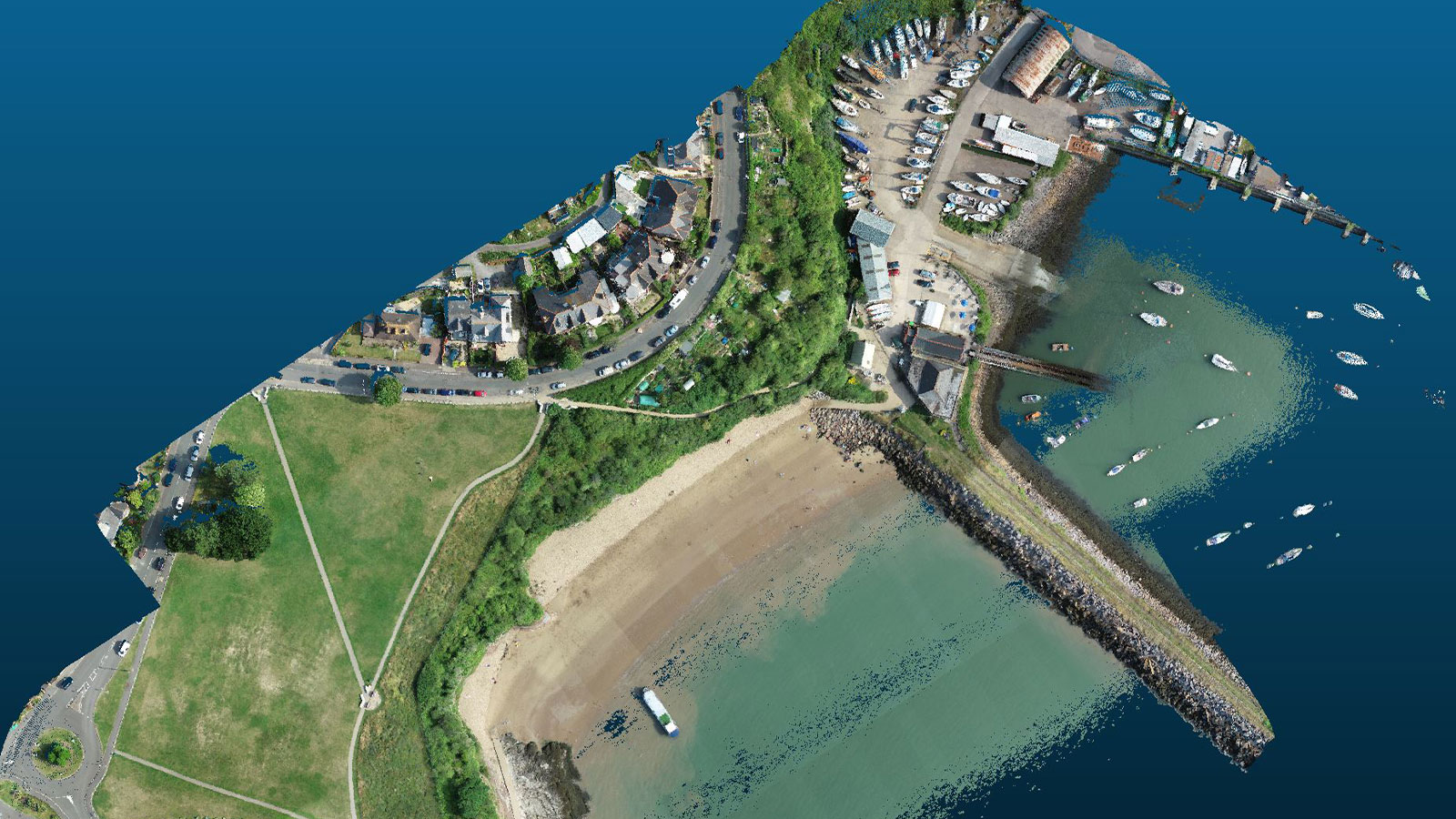
WCMC conducts annual baseline surveys across Wales, using drones to capture the full extent of the beach and processing the data from the surveys with Pix4D. Using their smartphones and PIX4Dcatch, they’ve also been capturing the sea wall at Whitmore Bay in Barry to monitor the condition of the structure – as well as measure the height of the sediment against the sea wall. This is to assist in the CoastSNAP citizen science project they are rolling out over Wales (CoastSNAP relies on the public taking photos at installations along the coast to provide data on the effects of climate change).
WCMC hopes that scanning with the PIX4Dcatch app will provide a ground truth for estimating sediment height from a single photo position. Through monitoring coastlines with photogrammetry, WCMC aims to collect enough data to inform national and local level government decision-making on FCERM – Flood and Coastal Erosion Risk Management in Wales.
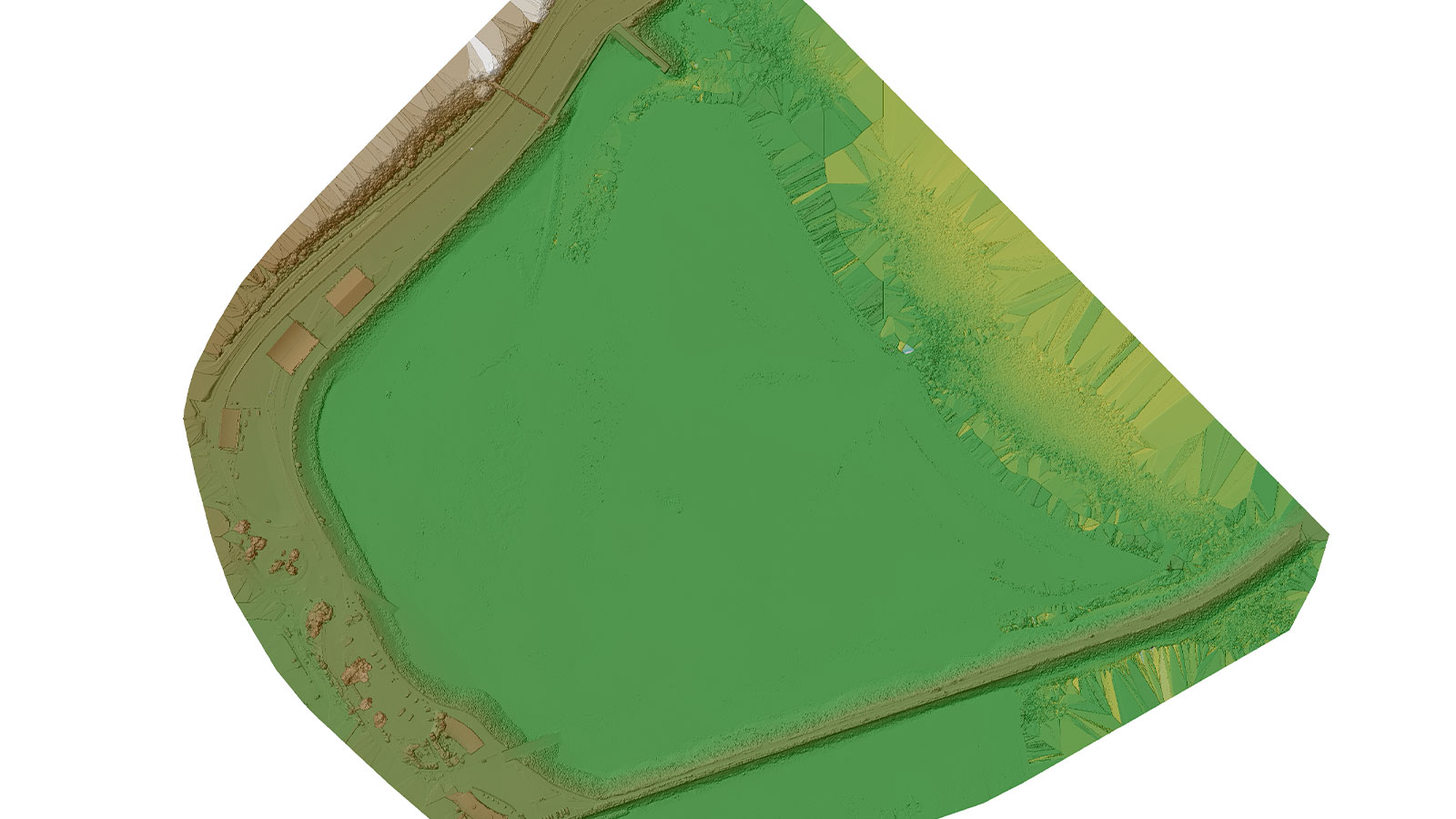
Once they have built up a series of these surveys, they wish to see trends in erosion and accretion of beaches. PIX4Dcloud’s comparison mode comes in handy here, enabling users to analyze and compare different datasets over time, either in 2D or 3D.
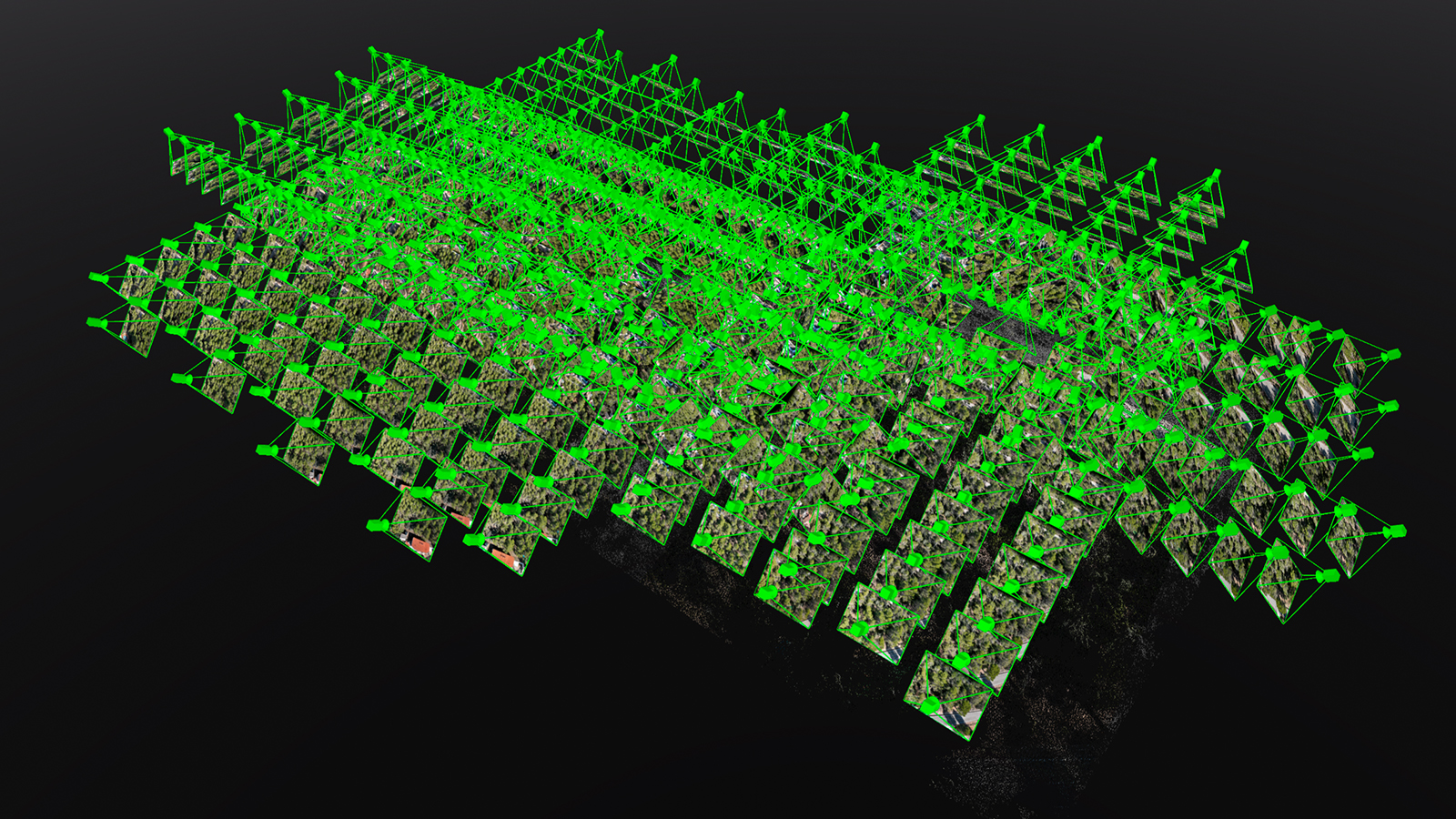
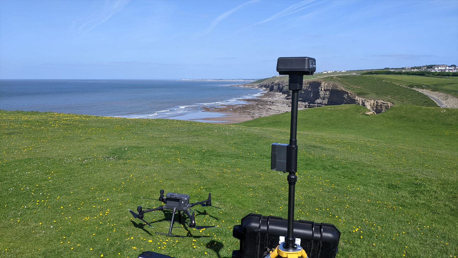
Data collection with drones
WCMC conducts topographic profile surveys on many beaches across Wales bi-annually, collecting survey-grade elevation data along two or three profile lines down the beach. This is done to produce a cross-section of the sediment levels.
Traditionally, this would have been done with a GNSS receiver and taken multiple days to capture a single beach. With drone surveys and photogrammetry, however, they can capture all this data in just half an hour! And with Pix4D, WCMC has achieved the required high standard of accuracy.
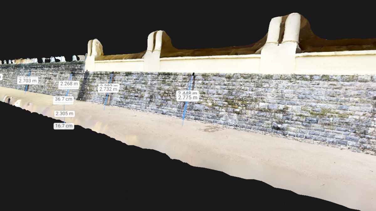
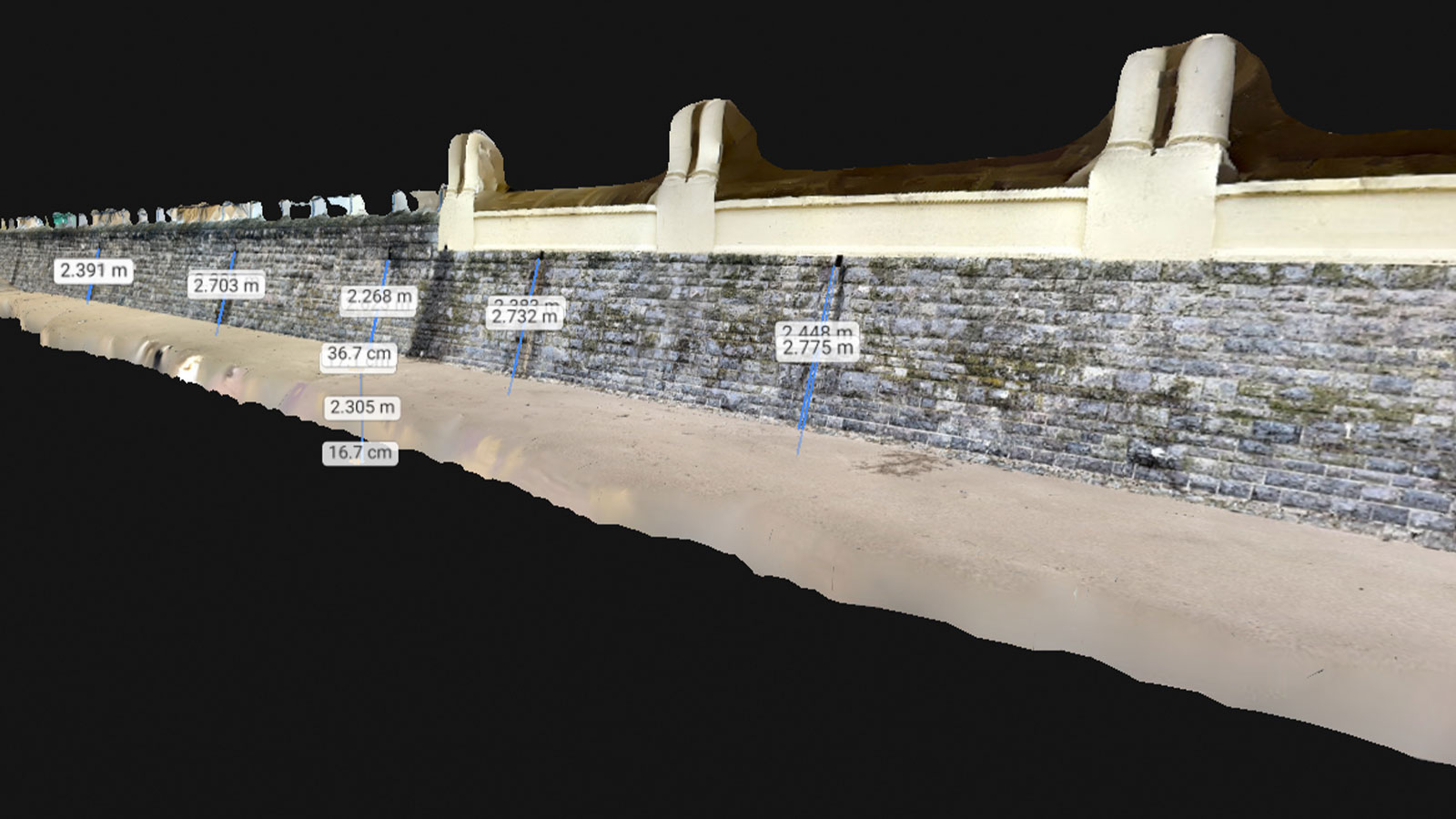
PIX4Dcatch for coastal asset inspection
Traditionally, inspecting sea defenses and flood defenses for damage has been purely image-based and subjectively given a score. For example, someone would assess if there are any large cracks in the walls, the structures are being undermined, or if the waves are regularly breaking over the top of the defense (overtopping). This is subjective and opinion-based, and features can be missed.
Pix4D allows high-accuracy surveys to be visualized for our analysis and sharing with our stakeholders. We can assess coastal processes of large coastal frontages several kilometers long and look at fine detail on coastal defenses like cracks in a wall. - Gwyn Nelson Programme Manager, Wales Coastal Monitoring Centre
Capturing the data with PIX4Dcatch and then uploading it to PIX4Dcloud lets WCMC carry out these sorts of inspections with ease and allows stakeholders to inspect sites that are prone to damage without having to leave the office. Additionally, they can use the tools in PIX4Dcloud to see the volume, length, and height of any damage or how far the sand levels are from the bottom of the structure.
They do not have the computing resources to process data every time they survey, and uploading to PIX4Dcloud has saved them time and resources. They found the “out of sight out of mind” approach to processing on the cloud extremely useful for surveying coastal defense asset conditions. WCMC considered other software but settled on Pix4D. They especially found the extensive online support documentation and videos combined with user experience useful for first-time photogrammetry users.
Project details:
of imagesAround 10,000 captured with PIX4Dcatch, between 20,000-30,000 with drones
per dataset 500-2500 depending on the size of the beach
The impact of photogrammetry on coastal erosion monitoring efforts
The biggest challenges they face are airspace restrictions, avoiding the disturbance of sensitive habitats, and the weather. However, they have successfully used PIX4Dcatch in adverse weather conditions to inspect the condition of coastal assets.
WCMC hopes that with the strategic, repeatable, and standardized data collection afforded by photogrammetry, they can inform their stakeholders on the trends of erosion and accretion on the Welsh coastline. This information can then be used as evidence to inform on flood and erosion risk management decisions.
Pix4D has benefited their surveys in multiple ways:
- Greater spatial coverage
- Reduced health safety risks to surveyors in the intertidal zone
- Superior outputs (density and quality) over legacy GPS survey data
- Standardized report generation is easy to interpret and pass on to other users
- Ability to template processing options – tailoring to needs, improving workflow efficiency
- Outputs such as orthomosaics are beneficial to stakeholders due to visualization
WCMC plays a vital role in attempting to mitigate and monitor the effects of climate change on coastal areas, helping to safeguard them against the threats posed by rising sea levels. Through their innovative use of technology such as drones and Pix4D, they not only collect crucial data but also use it to supply stakeholders such as national and local-level governments with insights to inform decision-making, ultimately contributing to the management of Wales’ coastline for future generations.