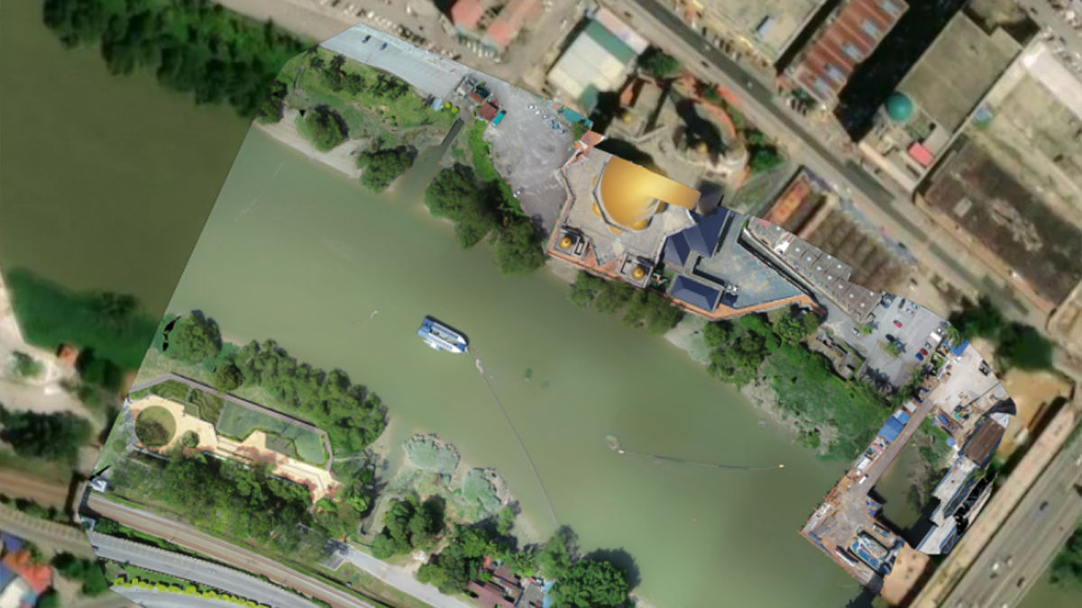
The Ocean Cleanup at work with Pix4D in Malaysia
Pollution worldwide is clogging up our rivers and getting swept into major waterways, eventually ending up in the Ocean. This is a problem that strikes at all levels of the ecosystem, damaging delicate habitats and balances in the natural world. It’s not just nature that is affected - our own waste can get caught in boat motors or cause problems for infrastructure. 2 million tons of plastic waste end up in the oceans annually - but it doesn’t have to. There are ways to prevent waste from washing into different water bodies.
The mission behind The Ocean Cleanup
The Ocean Cleanup is a non-profit organization founded in 2013. They have projects around the world that are focused on intercepting trash before it reaches the sea, as well as cleaning up what is already in the oceans.
In the data monitoring team of The Ocean Cleanup, David Higgins is operating out of Australia to work on projects across Oceania and South East Asia. The Ocean Cleanup deploys Interceptors to remove waste, and these systems are carefully monitored according to flood levels, rain patterns, and changes to environmental conditions.
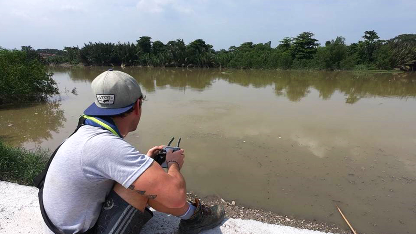
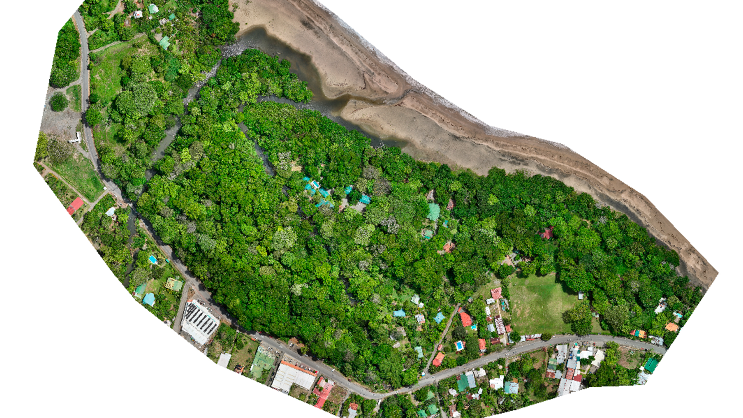
However, during the Covid pandemic, the teams were separated by travel restrictions and quarantine periods. This is where drone mapping and photogrammetry came in. A local pilot could travel to the river sites, fly a drone, and share the data online with the analysis team in Rotterdam. Thanks to PIX4Dcloud, this drone imagery was then converted into 2D and 3D maps of the areas. David could see the exact condition of the river in terms of pollution and how channel geomorphology was influencing its behavior. This workflow became a routine part of The Ocean Cleanup’s analysis and helped them to better plan their Interceptor deployments.
Project details
| Location | Oceania & South East Asia |
| User | The Ocean Cleanup |
| Software | PIX4Dcloud |
| Number of sites | 8 |
| Hardware used | DJI Phantom 4 Mavic Pro Mavic Air |
| Images per flight | 5 - 600 |
Drone mapping for environmental protection
So how can you set up a drone mapping workflow that can assist environmental monitoring and protection projects?
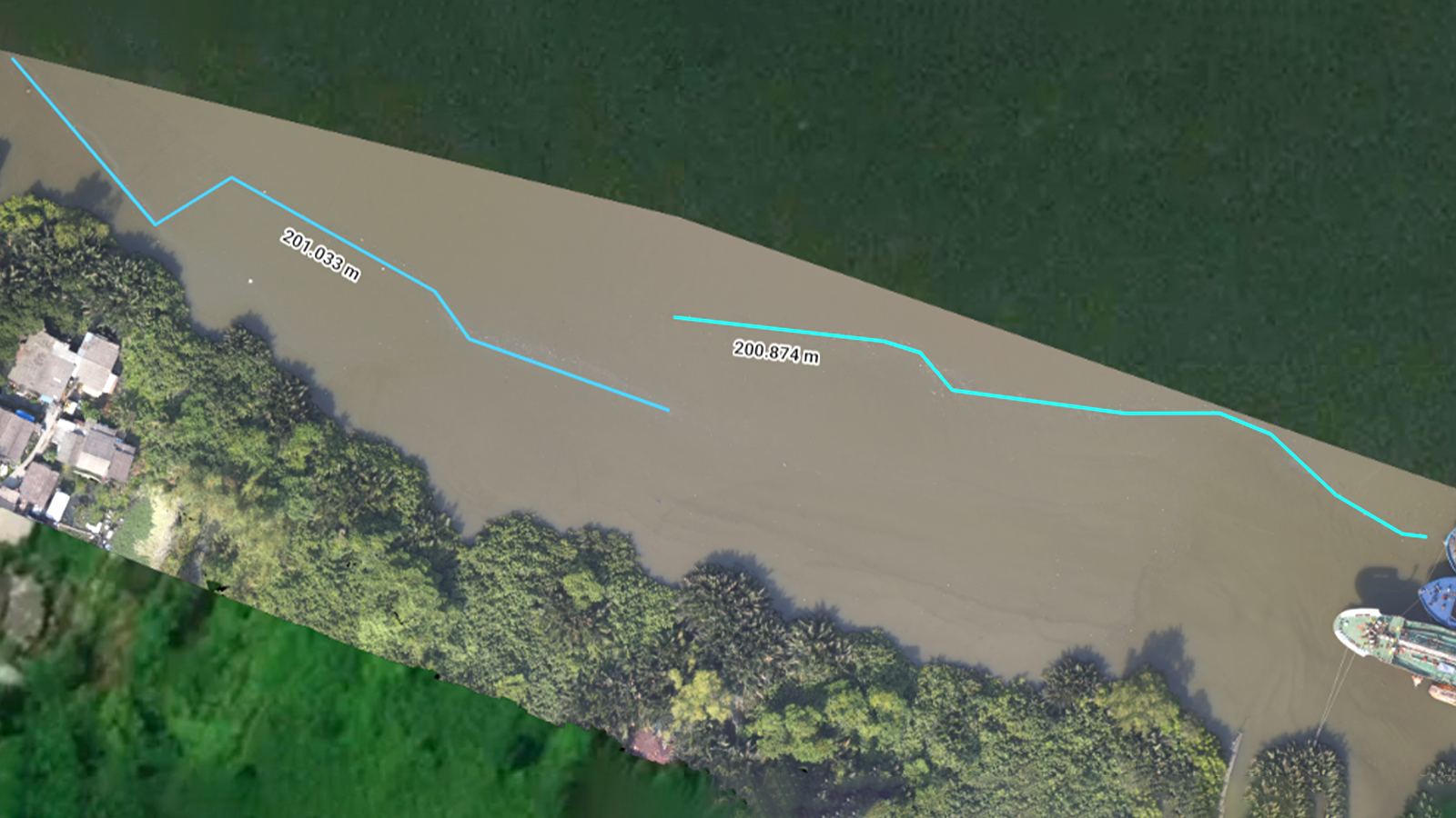
When The Ocean Cleanup selects a new site along a river, they initially use Google Earth to find an approximate appropriate location. Then, they visit the place with drones. A pilot will fly the area and gather aerial data with the drone to get site awareness. The results are then processed with PIX4Dcloud to get a 2D orthomosaic of the site. This map will be used to annotate, measure, and plan the next stages of the field assessments and project.
The Interceptor Original, the primary technology deployed in rivers by The Ocean Cleanup, uses a barrier and conveyor belt to divert plastic to the shore from the stream. There are various configurations of these systems that can be deployed according to the shape and size of the river. The team uses maps from PIX4Dcloud to help them decide which model to install.
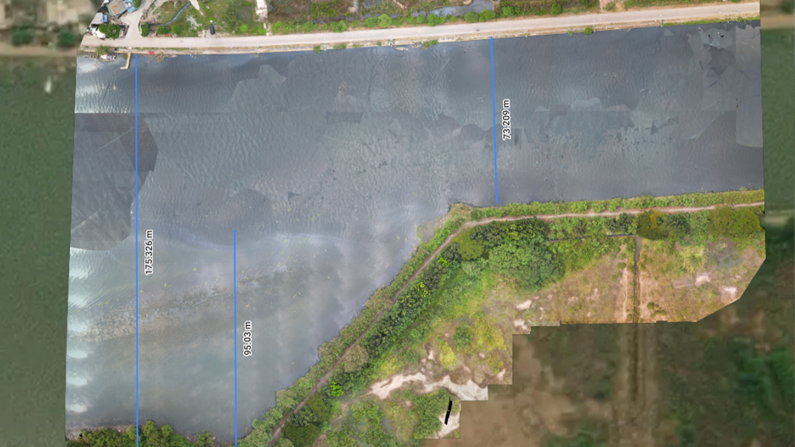
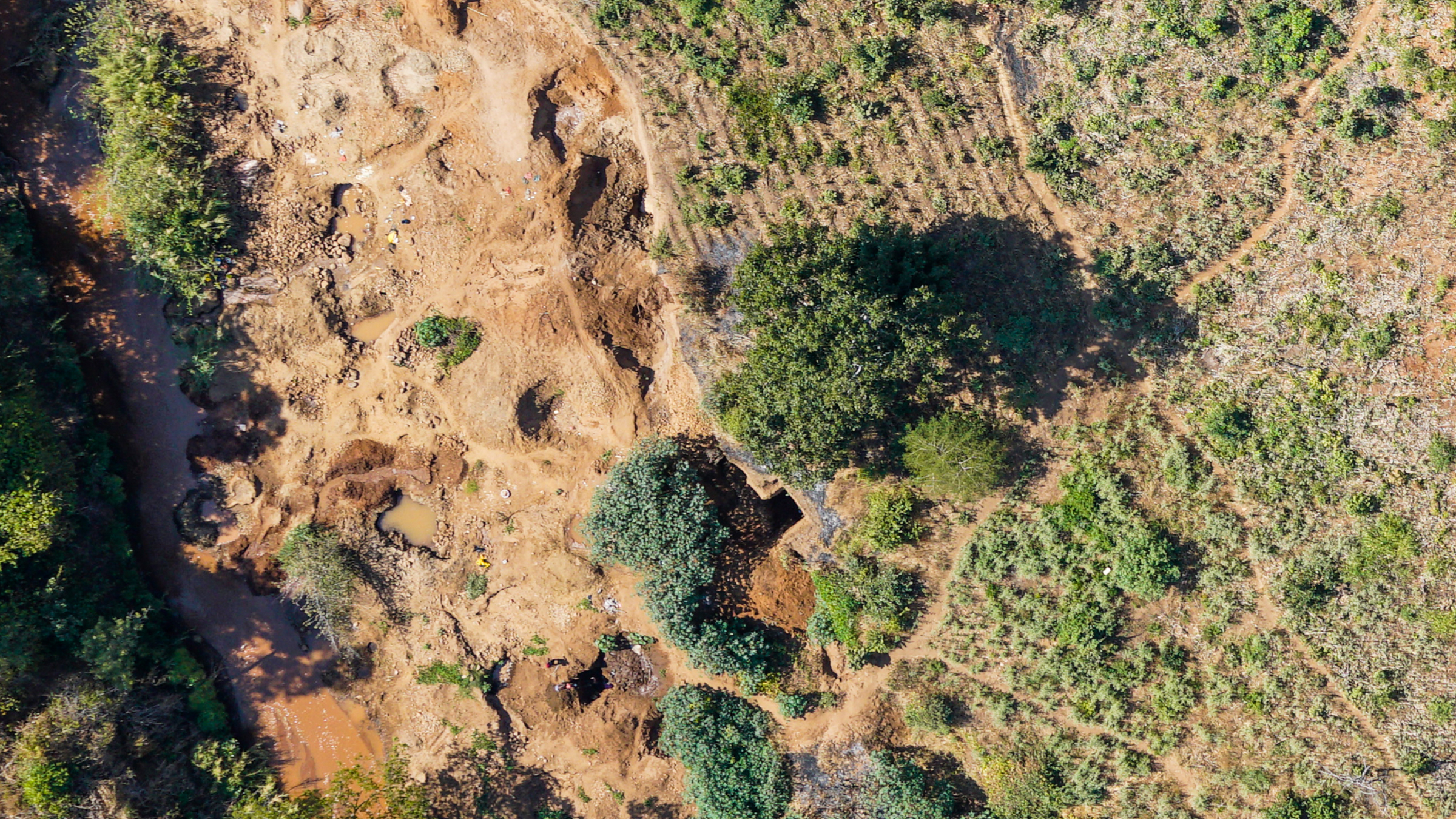
PIX4Dcloud is also used by the team for volume calculations. Over the course of rainy and dry seasons, plastic waste will build up in sections and then be washed away in a flood. The Ocean Cleanup team can measure the build-ups of waste to help them calculate how much is washed away during flood events. This assists their wider research projects associated with analyzing and preventing further marine pollution.
Obstacles to drone mapping
There can always be challenges to drone mapping projects. In these Ocean Cleanup ones, they are working with rivers. The changing course of the water can be quite problematic for the team, resulting in a need for frequent, reliable surveys.
In addition, the river bed and shore can be very varied terrain. The drone needs to fly high enough to get overlap between images to capture enough data for use in processing. This is a challenge for drone pilots as there are strict drone laws in some of the countries they work in, requiring a careful balance between flying high enough to gather the right data and ensuring they stay within drone control regulations.
Making a success out of drone mapping
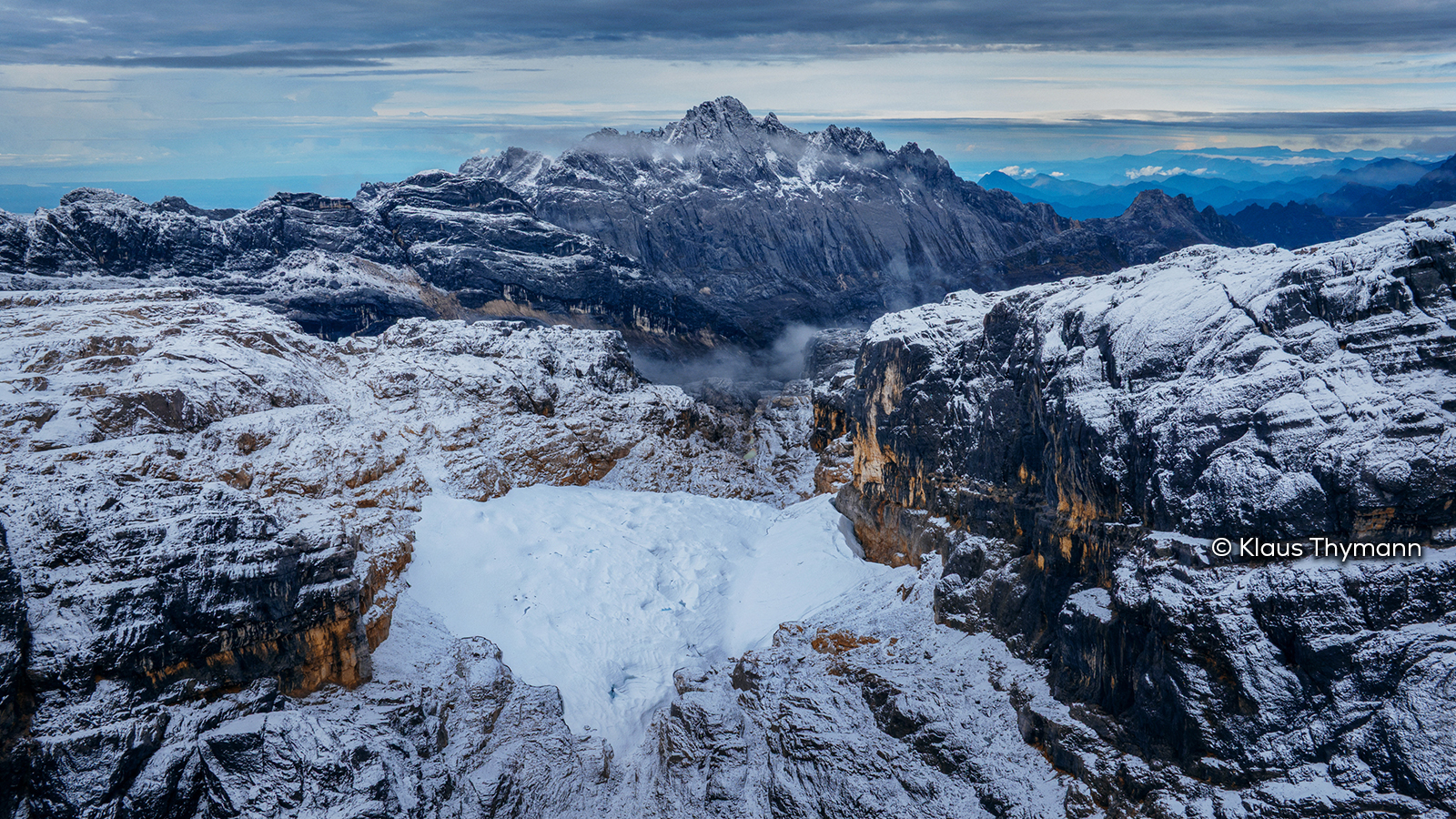
Using drone mapping for conservation and environmental protection projects is a growing methodology. Pix4D technology has been put to work in mapping the Amazon rainforest in Peru, identifying endangered species in Portugal, and tracking reforestation efforts in Malawi. The benefits of an aerial perspective that can be accurately measured, analyzed, and shared are appealing to people across the globe.
Although The Ocean Cleanup started using this form of drone mapping as a result of Covid restrictions, they are now implementing Pix4D mapping technology across their projects around the world, including Jamaica, the Dominican Republic, and Guatemala.
Aerial mapping provides more information about a site than is available on the ground and is helping The Ocean Cleanup deploy new equipment as well as monitor their current trash interceptors.