
How aerial photogrammetry is helping conservation projects
All of us are familiar with the term “reforestation” - the idea of planting trees to capture carbon and encourage forest growth. Many environmentalists are now also using the term “rewilding” - the process of restoring habitats to an uncultivated state, which fosters biodiversity. This helps sustain the longterm impact of restorative projects. Many organizations are using cutting-edge technology to assist in these efforts, whether they are using drones to map reforestation efforts or using aerial maps to analyze local ecosystems like wetlands.
Mossy Earth is an environmental organization committed to rewilding and reforestation projects around the world. Three specific projects are using images captured by drones to identify protected species or habitats to inform their efforts. The three projects are:
- Portugal - the restoration of seacliff plants:Euphorbia pedroi and Convolvulus fernandesii are endemic species found on the Portuguese coast that do not exist anywhere else in the world. They are threatened by an invasive plant called the Ice plant or sour fig and by people walking the coastlines. Aerial maps created with drones are being used to identify the ice plant and remove it, as well as locate the endemic plants to alert park authorities to areas needing protection.
- Benin - high rates of desertification: Preventing the expansion of the desert is a challenge, and the Mossy Earth Project is hoping to use termites to help their fight. Termites create large nests called termite mounds that can retain nutrients and water in the soil, which helps the nearby plants cope with harsh conditions.
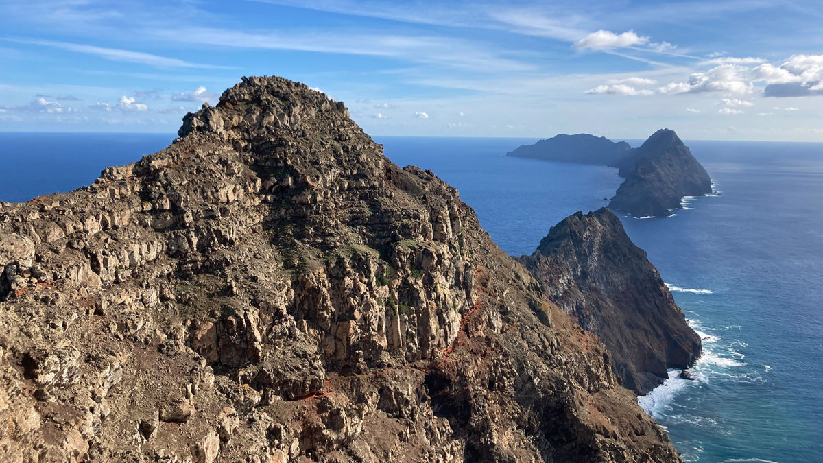
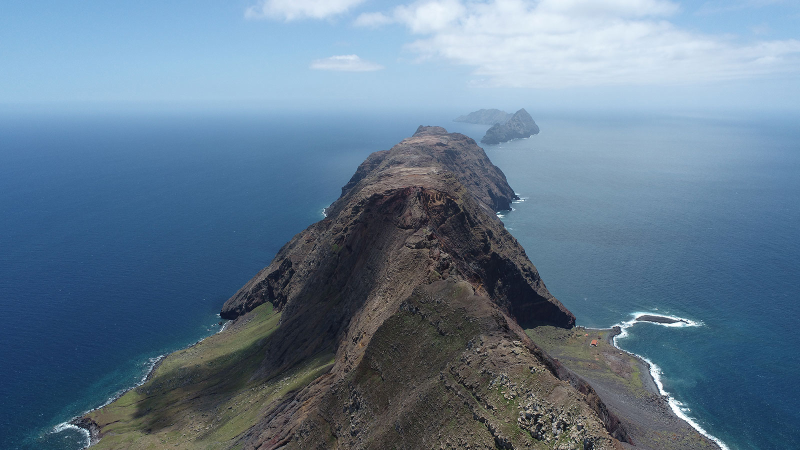
- Madeira - searching for endangered snails: the beautiful volcanic islands of Madeira host 4 species of snails that were thought to be extinct. After 100 years without confirmed sightings, they have been rediscovered on the island of Deserta Grande. They live near a specific species of fern, which Mossy Earth is using to locate habitats for the snails and help protect them. These mollusks are also at risk from invasive species - in this case, goats and mice.
Tiago de Zoeten, a conservation biologist, has been involved in all of these projects and shared the challenges with us, as well as how drones can help the environment.
Project details
| User | Mossy Earth |
| Location | Cabo Espichel, Portugal Benin Madeira Island (Portugal) |
| Software | PIX4Dmatic PIX4Dmapper |
| Hardware | DJI Phantom 4 Pro V2 |
Using drones for conservation
Mapping cliffs with drones in Portugal
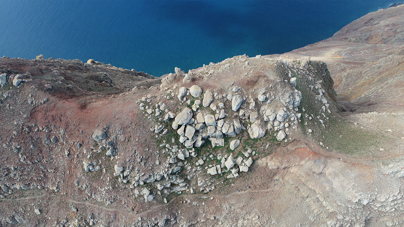
The cliffs that are the subject of the Portugal project only stretch across 15 kilometers, and include some national parkland. The ice plant thrives in this environment, outcompeting the native species. However, it has a very specific color and shape, which means it can be identified using high resolution images. A drone operator from Mossy Earth can take photos and use specialized photogrammetry software to analyze the terrain and filter according to color to spot the ice plants. To actually remove the ice plant, Mossy Earth counts on the help of local volunteers, including cavers and rock climbers in the area. They are hoping to create buffer zones around the known habitats of the endemic plants, so that at least this part of the coastline is protected from the ice plants.
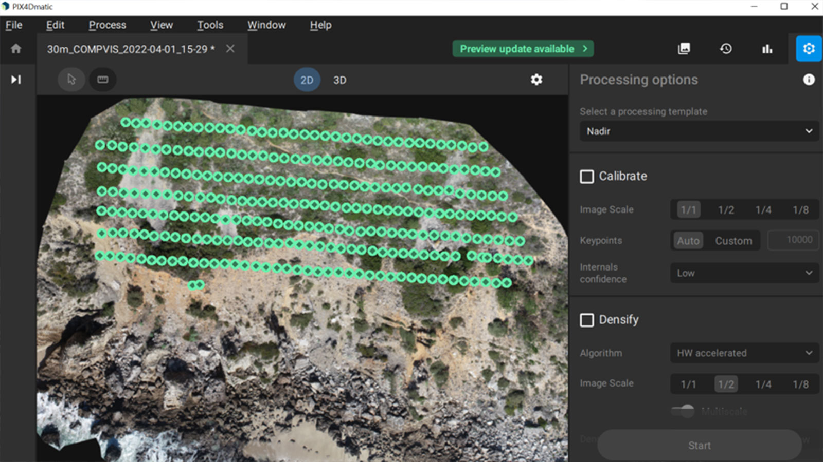
The data collection will continue until December 2022. They will mark the locations of ice plants as well as the native species. They started out using PIX4Dmapper to process results, but now are using PIX4Dmatic. This is because PIX4Dmatic is better for larger scale projects and has specialized features such as sky filtering to reduce the impact of noise on the final point cloud. Mossy Earth will be continuing to test different resolutions and methods to analyze the cliff face with drones, with help from the Pix4D Support team to improve their facade reconstruction.
Identifying termite mounds with aerial surveys
This is a brand new project by Mossy Earth and is being completed in collaboration with a local university in Benin. They are aiming to see how effectively drones and photogrammetry can spot termite mounds. These nests are credited as “holding back deserts” because they retain moisture. A recent study found that when drought conditions caused a 30% decline in vegetation, the plant life around a termite mound survived.
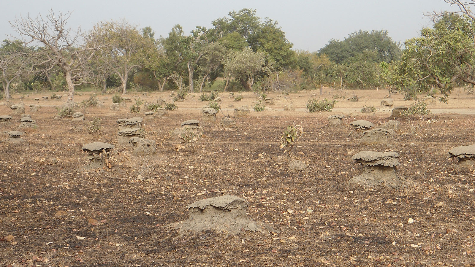
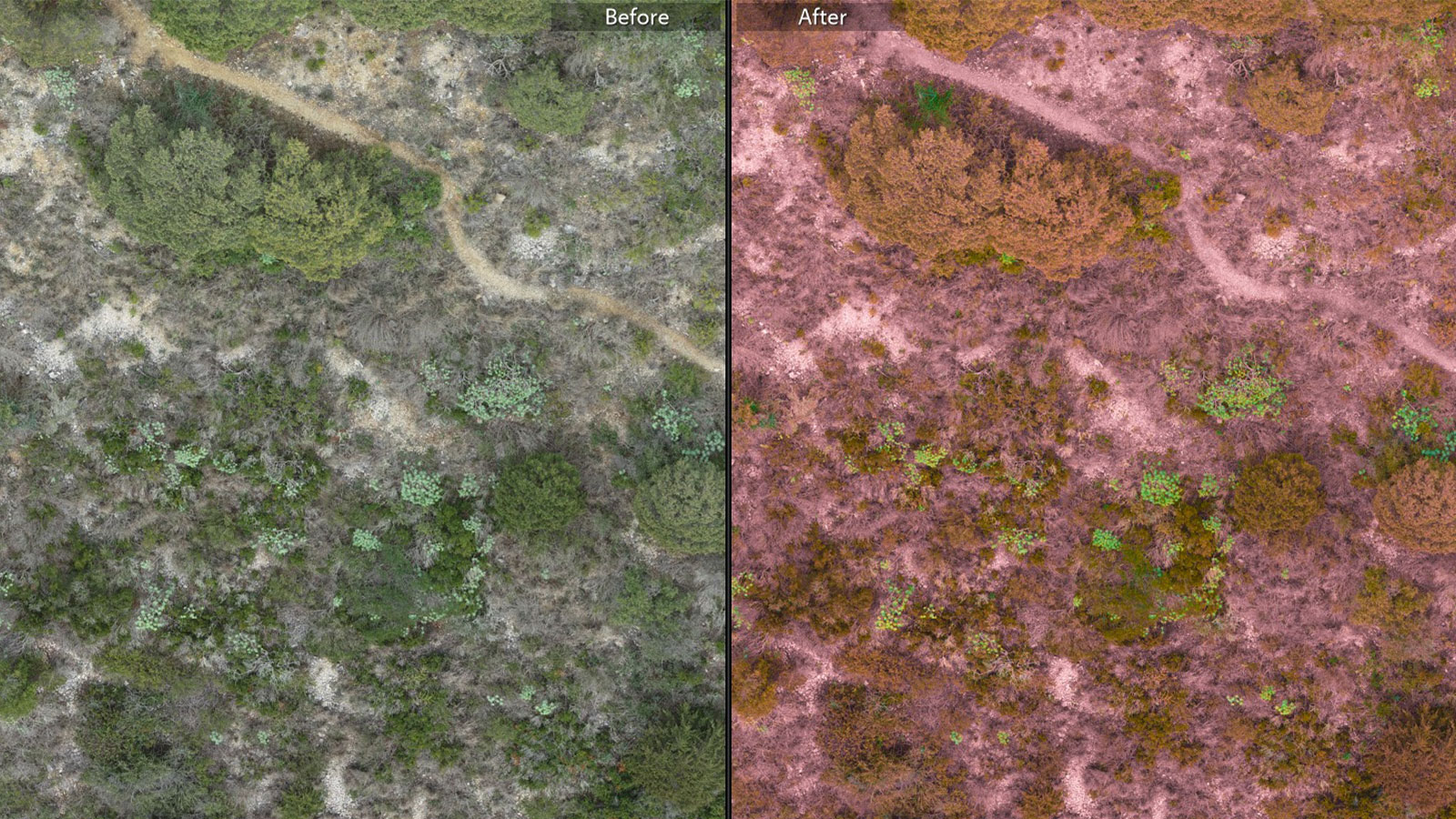
The ultimate goal of this project is to develop ways to use termites to restore ecosystems and make them more resilient to climate change. At this stage, Mossy Earth is using aerial images to locate termite mounds and analyze their health to understand how they are affecting the surrounding vegetation. Specific species of these insects will create huge mounds that can be over 5 meters tall - about 17 feet. This makes it possible to identify them with maps from PIX4Dmatic - rather than having to record the coordinates of individual mounds with extensive fieldwork! During processing, PIX4Dmatic can create point clouds that specifically identify points with high vegetation, which helps get consistent results even for datasets with complex terrain like a desert or forested area.
The slow process of snail protection
Snails are not often headlining animals in the fight for conservation, but they play an important role in ecosystems in breaking down organic material. After 100 years without a confirmed sighting, a passionate group of rangers and scientists managed to re-discover 4 species of these snails. However, the initial estimates suggest there could be less than 50 individuals of each species living on Deserta Grande. Mossy Earth wants to help monitor the status of their populations, protect the environments they’re in, and eventually, transport some to Chester Zoo and Bristol Zoo in the UK for captive breeding programs.
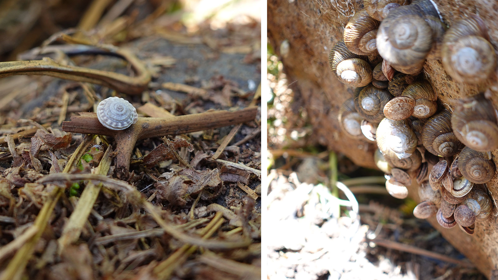
The snails’ habitat is rocky and exposed to the elements of the coast, which was a challenge for Tiago and the team to access. First, they had to reach the island via boat and then hike to the known snail habitats. Then they looked for the snails - some of which are very small - under rocks and plants. This ongoing project includes collecting individuals for the breeding project, monitoring the remaining population, and collecting field environmental data.
Photogrammetry software is used in this project to create maps of the Desertas Grande island. 2D orthomosaics can be used to search for specific plants that the snails are known to live near. Tiago can also share his knowledge of the island with other conservationists by using the 3D model to point out known locations of the snails and places the team has or has not searched.
Positive impact of drones in conservation
The projects covered by the Mossy Earth Project are critical to protecting native habitats and part of the wider fight against climate change. Their focus on non-flagship species helps prevent smaller ecosystems from being forgotten, which will have an impact of bigger ecosystems in the end as well.
“Aerial surveying is allowing us to bring powerful photogrammetry software to our projects and get very useful outputs, helping to make a difference to our projects wherever they are.” - Tiago, Conservation Biologist
The models and orthomosaics created by Mossy Earth can be shared, analyzed, and annotated. This is very useful for getting consultations from specialists and environmentalists around the world. The cooperation from local authorities is also streamlining the entire process, as drones can be subject to local regulations. As Mossy Earth continues their work over the next few years they will be able to check back on their progress with the outputs from Pix4D software and see the impact of their work.


