PIX4Dcloud and river management: drone mapping to save time
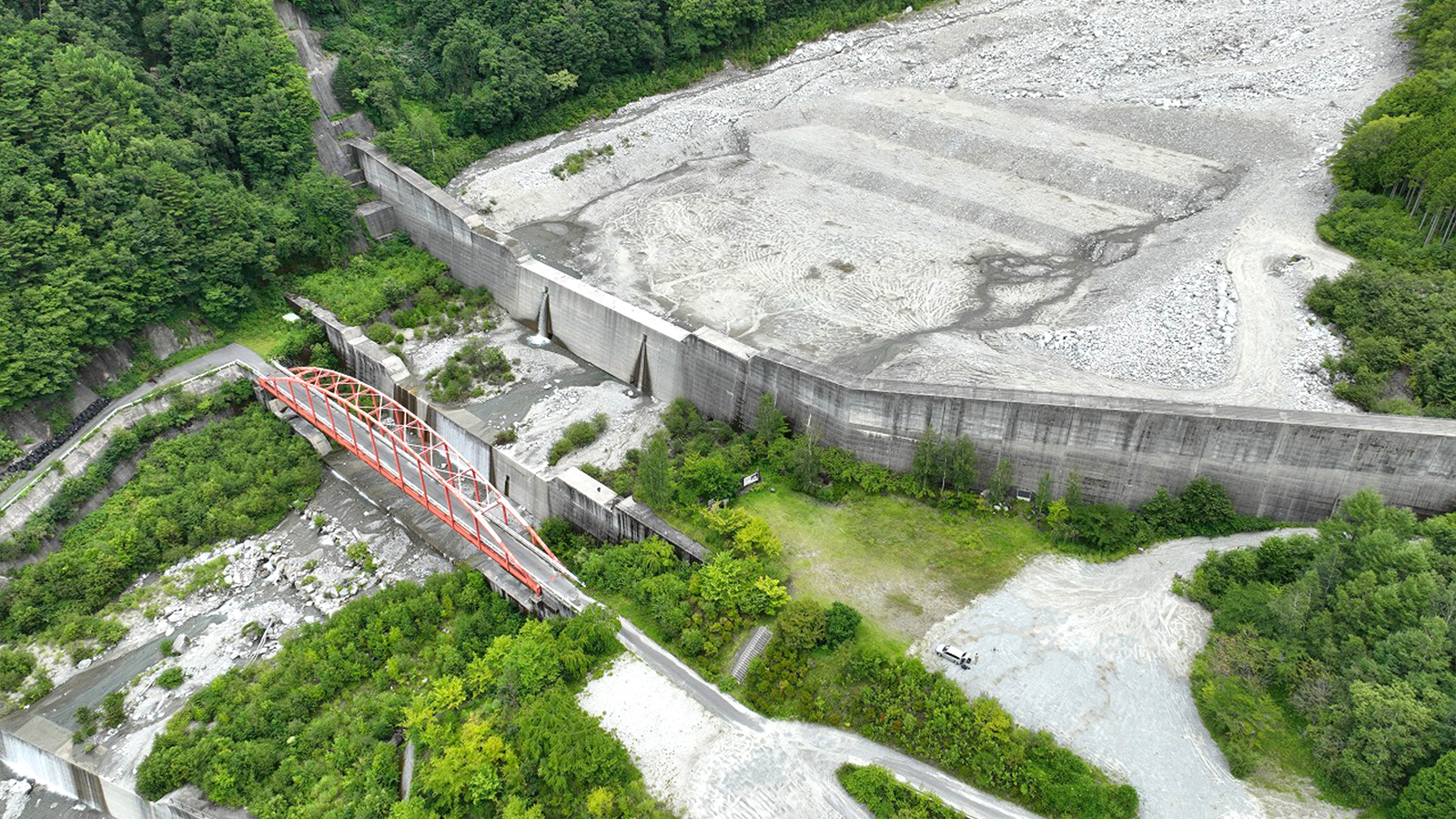
Erosion control weirs play an important role in preventing and mitigating damage downstream by holding back mudslides in the back pocket. The Namegawa River in Nagano Prefecture is a rapid river with active sediment transport which results in frequent mudslides and thus, requires regular stone removal. As a result, it was necessary to find a more efficient method of stone removal, and the Tajimi Erosion Control National Highway Office asked SANEI CONSULTANTS to create a stone removal plan.
SANEI CONSULTANT, a construction consulting company based in the Tokai area in Japan, used PIX4Dmapper and PIX4Dcloud to study how to remove stones accumulated upstream of the Namegawa River 1st Erosion Control Weir (Tajimi Erosion Control National Highway Office).
We asked Mr. Kondo and Mr. Takizawa of SANEI CONSULTANT how they used PIX4Dmapper and PIX4Dcloud to streamline their work.
Why did you use 3D models instead of 2D maps?
"In the past, the condition of deposited sediments was mostly understood by using 2D data obtained from topographic and cross-sectional surveys. However, it is difficult to grasp the spatial understanding of the site with 2D topographic maps and transects, and we decided that 3D data, which facilitates better spatial understanding, was the best way to achieve a common understanding of the site among the parties concerned.
On the other hand, 3D data is large in volume and difficult to share with external parties. In addition, the software options that allow the client to directly view the 3D data (point cloud) are limited, but it can be easily shared using a browser.
In this case, we proposed a method to understand the trend of sedimentation conditions using PIX4Dcloud that meets the above conditions and solves the challenges they pose with high shareability and online processing.
We considered point cloud processing software from other companies, but since they did not have functions specialized for sharing point clouds, and furthermore, the system charged per project, we decided that it would not be cost-effective."
Project details
| Location | Nagano Prefecture, Japan |
| User | SANEI CONSULTANT |
| Software used | PIX4Dcloud PIX4Dmapper |
| Hwardware used | DJI Matrice 300 RTK |
| Area surveyed | 16 hectares |
| Total images captured | 600 |
| Processing hardware | Intel Xeon W-1270P, CPU @ 3.8 GHz 64GB RAM, NVIDIA QUADRO RTK 5000 GRAPHIC |
How did drone mapping improve your project's efficiency?
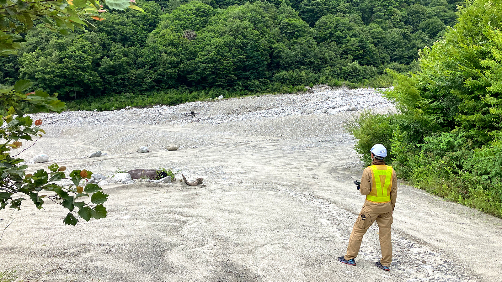
"We started by using a drone to take aerial photos of the sediment accumulation at the 1st Namekawa erosion control weir, and PIX4Dmapper was used on-site to create a 3D model. The drone and PIX4Dmapper reduced the work time to half a day (including preparation and cleanup), compared to the conventional planar, cross-sectional surveys, which take one to two weeks to acquire data with a total station. In addition, compared to conventional surveying (plane, longitudinal, and transverse surveying), the number of measured points acquired was far greater, enabling the construction of a highly accurate terrain model.
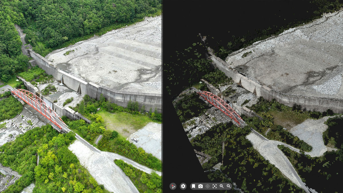
After processing with PIX4Dmapper, the project was uploaded to PIX4Dcloud, and a link for sharing was created. Now, the client can view the 3D data on a PC or mobile device via the link. (The link can be deactivated at any time on the part of the data owner.)
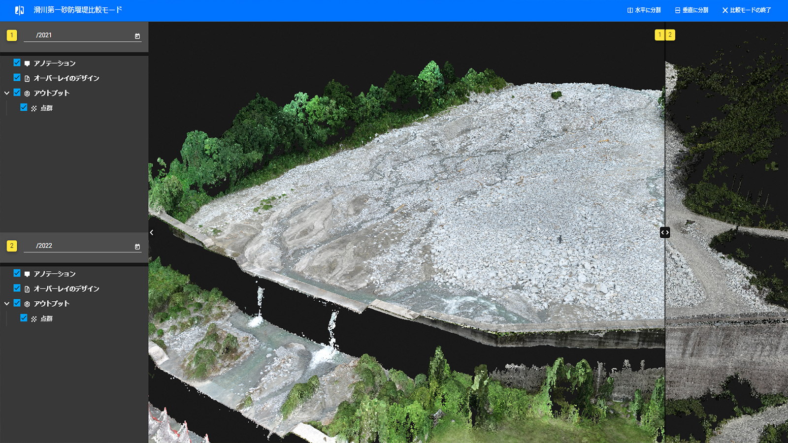
Data on PIX4Dcloud Advanced can be viewed on a timeline, making it easy to retrieve and compare historical data. The client has also commented on how easy it is to understand the status of the sand deposits and post-excavation conditions.

PIX4Dcloud's comparison function was used to monitor the weir over time which makes it it easy to show changes, and the information conveyed is much more comprehensive than in paper reports. As a result, the amount of time and effort required to prepare reporting materials has also been greatly reduced."
Moving forwards with drone mapping for river management
SANEI CONSULTANT used PIX4Dcloud and PIX4Dmapper to create accurate models of this erosion control weir and impress their client. The positive feeback from their client, especially as consultants, is a great boost for the company's activities.
"PIX4Dcloud is a necessary tool to share the same information with your customer. It does not require a high-performance computer and can be viewed on an ordinary PC or smartphone, making it easy to use and share." - Mr. Takizawa, SANEI CONSULTANT, Nagoya Branch
As SANEI CONSULTANT continue to work on projects that include diverse infrastructure elements such as roads, bridges, and erosion control eqiupment, the company can rely on aerial mapping to get results that will improve the efficiency and productivity of their work.