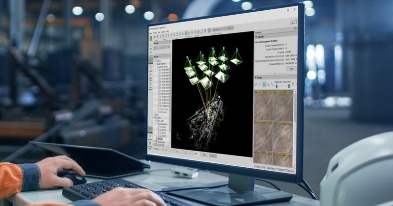
Accurate topographic surveys using the power of photogrammetry
Applications
Combine mobile LiDAR and photogrammetry data
With PIX4Dmatic you can leverage the benefits of both photogrammetry and LiDAR data from mobile devices. Process LiDAR data from mobile devices and RGB image outputs from PIX4Dcatch for a full terrestrial workflow.


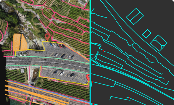
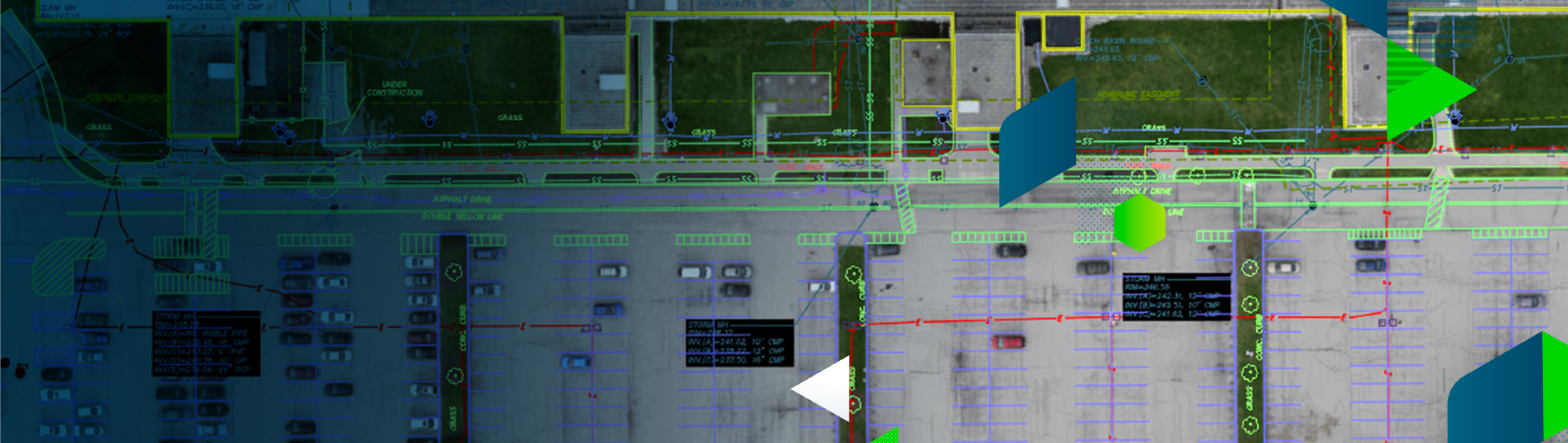
Vectorize and export to CAD
Vectorize your project using PIX4Dsurvey’s extensive vectorization toolkit with manual and semi-automated tools. Assign your objects to layers and export them separately or together for a smooth transition to your preferred CAD or GIS software.


Project management & communication
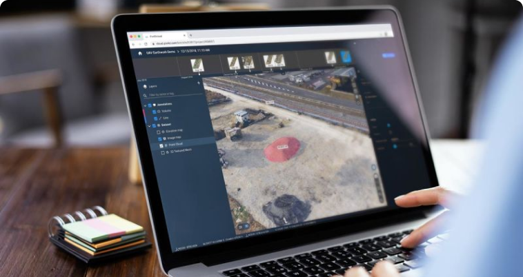
Enhance collaboration between colleagues and clients with online sharing links. Speed up your job securely and easily using our secure cloud solution.


Map, model and measure in 3D
Explore example data sets
Use cases about photogrammetry and drone mapping
Lights, camera, action! Surveying a film studio in the UK
Construction for a new film studio is underway! PIX4Dmatic and PIX4Dsurvey are providing aerial maps and surveys to stay on-schedule.
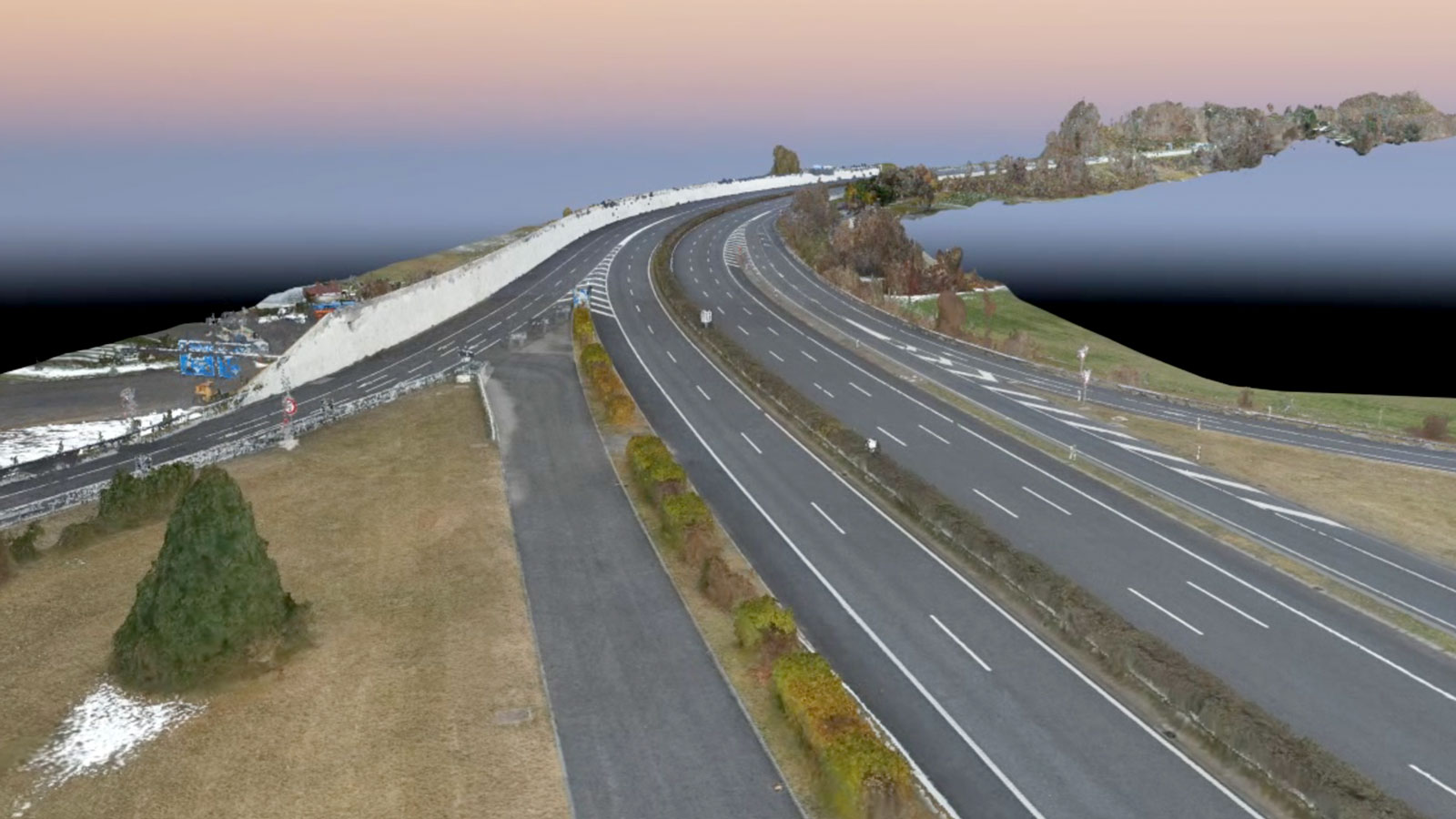
Using drones to survey a motorway without stopping traffic
A motorway in Switzerland needed to be inspected - but it was on a viaduct in the mountains. Discover how aerial drone maps helped.
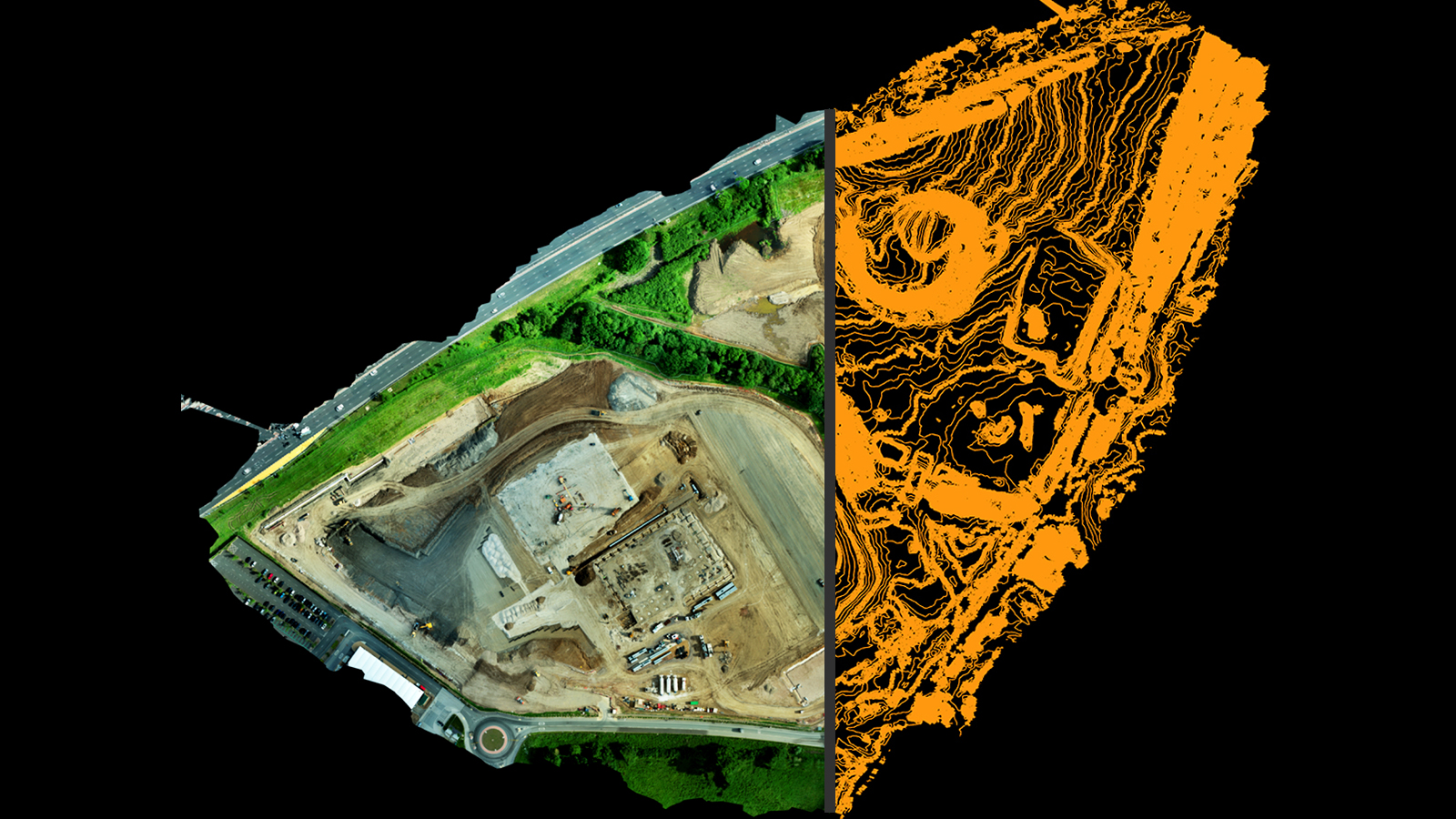
Mapping 300 acres at a former manufacturing facility
An old computer chip manufacturing plant in Hudson Valley, New York has been left empty. Before new redevelopment, the site was surveyed.
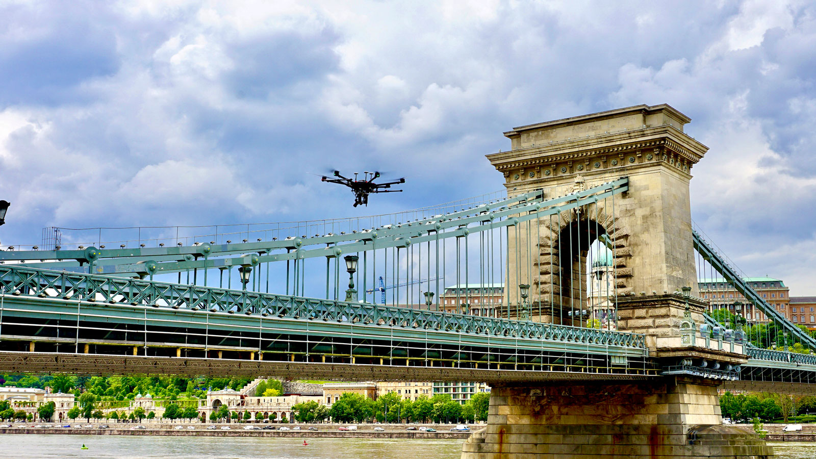
Széchenyi Chain bridge: modeling a national monument
Two companies partnered up to create a 3D model of the famous Chain Bridge in Budapest with photogrammetry software PIX4Dmapper
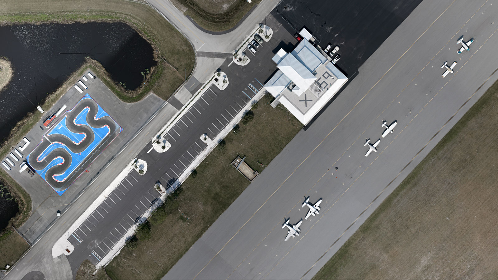
Drones and airplanes: surveying an active airport
Mapping an active airfield can be incredibly dangerous. Quantum-Systems worked with Air Traffic Control to survey without startling pilots.
Drones take off in Ukraine's mining industry
In an effort to improve worker safety and boost efficiency, the largest mining company in Ukraine launched a first for the country: drones.