

Cartographie et arpentage à l'aide d'images de drones, de LiDAR terrestre et de photogrammétrie
Logiciels avancés de cartographie et d'arpentage
Applications
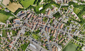
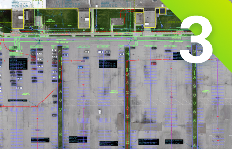
Cartographie
Avantages
- Obtenir des résultats de qualité
- Réduire les coûts opérationnels en passant moins de temps sur le terrain
- Mettre à jour en permanence vos cartes, modèles et projets


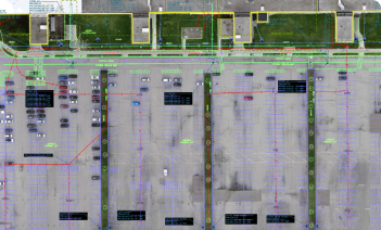
Arpentage
Avantages
- Effectuer des levés topographiques de haute précision
- Combiner les données LiDAR et photogrammétriques
- Intégration aisée des données dans les logiciels de CAO ou de SIG

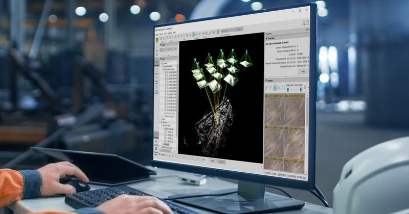
La cartographie et la modélisation photogrammétriques sont plus accessibles que jamais
Produire des produits de qualité tels que des cartes et des modèles en 3D à partir d'images

Augmentez votre productivité
Utilisez la cartographie par drone pour réduire les coûts en passant moins de temps sur le terrain. Améliorez vos résultats en combinant les données aériennes et terrestres.
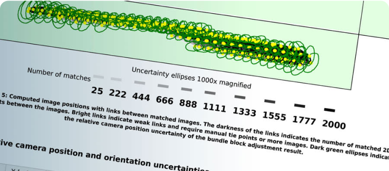
Obtenir des résultats précis
Garantissez la précision de vos résultats. Utilisez les GCP et le support des drones RTK pour géoréférencer vos donn�ées, tandis que le rapport de qualité et les outils d'édition vous permettent de contrôler votre projet.

Amélioration de la collaboration
Tirez parti de l'intégration de nos produits et de notre nuage sécurisé pour faciliter la communication entre les équipes et les lieux de travail. Partager les résultats par le biais d'un lien.

Capture
Capturer des images aériennes et/ou terrestres ou des données LiDAR.

Numériser
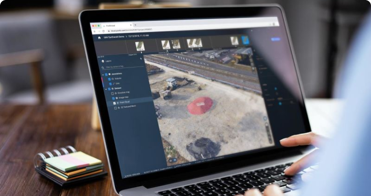
Transformez vos images en cartes numériques précises et en modèles 3D.
Contrôler, mesurer, vectoriser
Évaluez et améliorez la précision de votre projet, mesurez les distances, les surfaces et les volumes et extrayez les éléments clés vers la CAO ou le SIG.

Partager
Partagez de manière sélective et sécurisée les données et les informations relatives aux projets avec votre équipe, vos clients et vos fournisseurs en utilisant des formats de fichiers standard.
Éducation
Nous proposons des licences de recherche et de cours aux établissements d'enseignement. Profitez d'une offre spéciale pour introduire la photogrammétrie dans votre cours.
DécouvrirProfessionnel
Faites passer votre travail à la vitesse supérieure. Utilisez la photogrammétrie pour offrir de nouveaux services et vous démarquer de vos concurrents grâce à des résultats précis et rapides. Choisissez le produit qui vous convient le mieux.
DécouvrirEntreprise
Utilisez nos produits pour votre entreprise. Incorporez-les à vos plateformes ou personnalisez nos algorithmes pour votre usage. Découvrez des offres personnalisées pour votre entreprise.
DécouvrirCartographier, modéliser et mesurer en 3D
Explorer des exemples de données

Les produits Pix4D pour la cartographie et l'arpentage


Logiciel de photogrammétrie de nouvelle génération pour la cartographie professionnelle par drone et terrestre


Plateforme en ligne pour la cartographie par drone, le suivi des progrès et la documentation du site