
Variable rate application for a wheat crop with PIX4Dfields
Modern farming has moved far beyond solely relying on the experience of a farmer with little external support. Now, cutting-edge technology is used to provide growers with more knowledge to inform their decisions. One of the best innovations, in terms of environmentally-friendly farming and optimizing crop yields, is variable rate application. This is the process of applying treatment plans and fertilizers to a crop according to the health of plants across the field, rather than a blanket treatment. It is a way to tailor application to where it is most needed. This saves resources and helps boost the yields without wasting expensive treatments.
Nesrin is an agricultural engineer working at Paksoy Technical Services, who provide agricultural services for hardware companies including senseFly and DJI. Nesrin processes drone maps for farming with PIX4Dfields, which is a specialized mapping software for agriculture. They were asked by Nergistepe Tarim Makinalari, an agricultural machinery manufacturer in Turkey to assist on a farm. The founder of Nergistepe, Hulusi Ozbasatak, is an Agricultural Machine Engineer who manages a farm with 30 - 50 members of staff. His crops include cotton, wheat, sunflowers, and maize, which he was farmed for 37 years. Ozbasatak also founded Soke Toprak Tarim, which sells fertilizer and agricultural chemicals. Ozbasatak contracted Nesrin’s services to analyze a wheat field and create a variable rate treatment plan based on a farm map created with drones.
The key benefits of using drone mapping for agriculture in this project were:
- Fuel savings thanks to reduced application
- Fertilizer savings
- More environmentally friendly farming practices
Project details:
| Location | Adyin, Turkey |
| User | Paksoy Technical Services |
| Software | PIX4Dfields |
| Hardware | DJI Phantom 4 RTK |
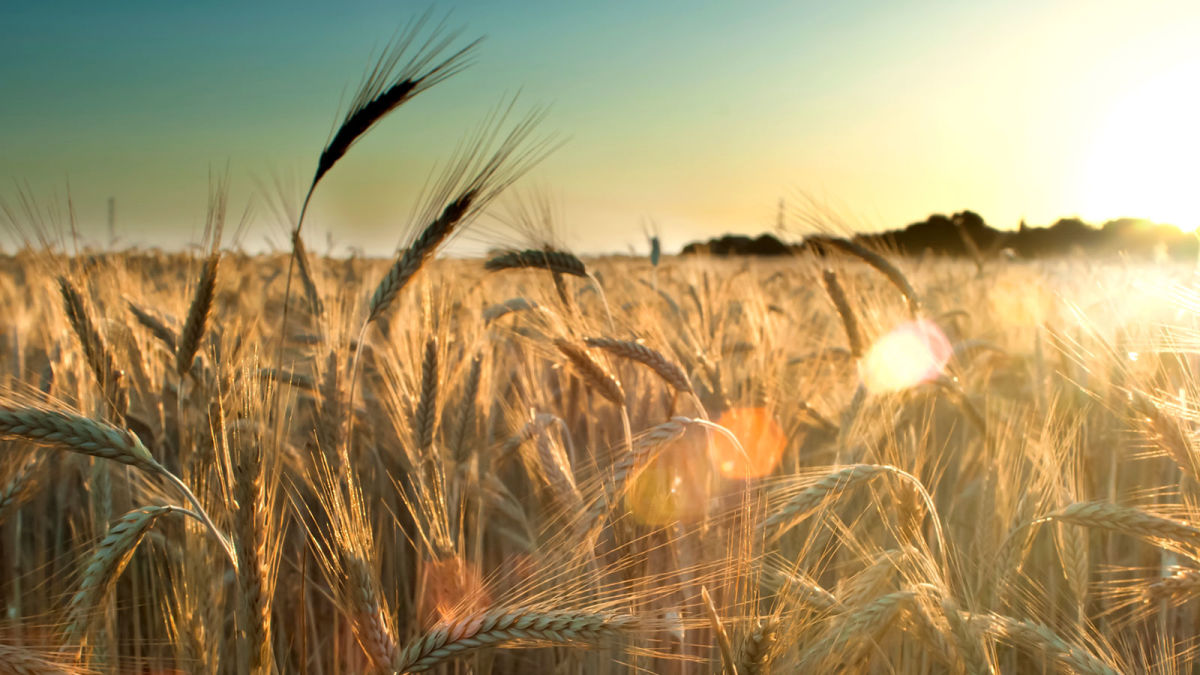
| Crop surveyed | Wheat |
| Area surveyed | 40 hectares |
Using drones to plan variable rate applications
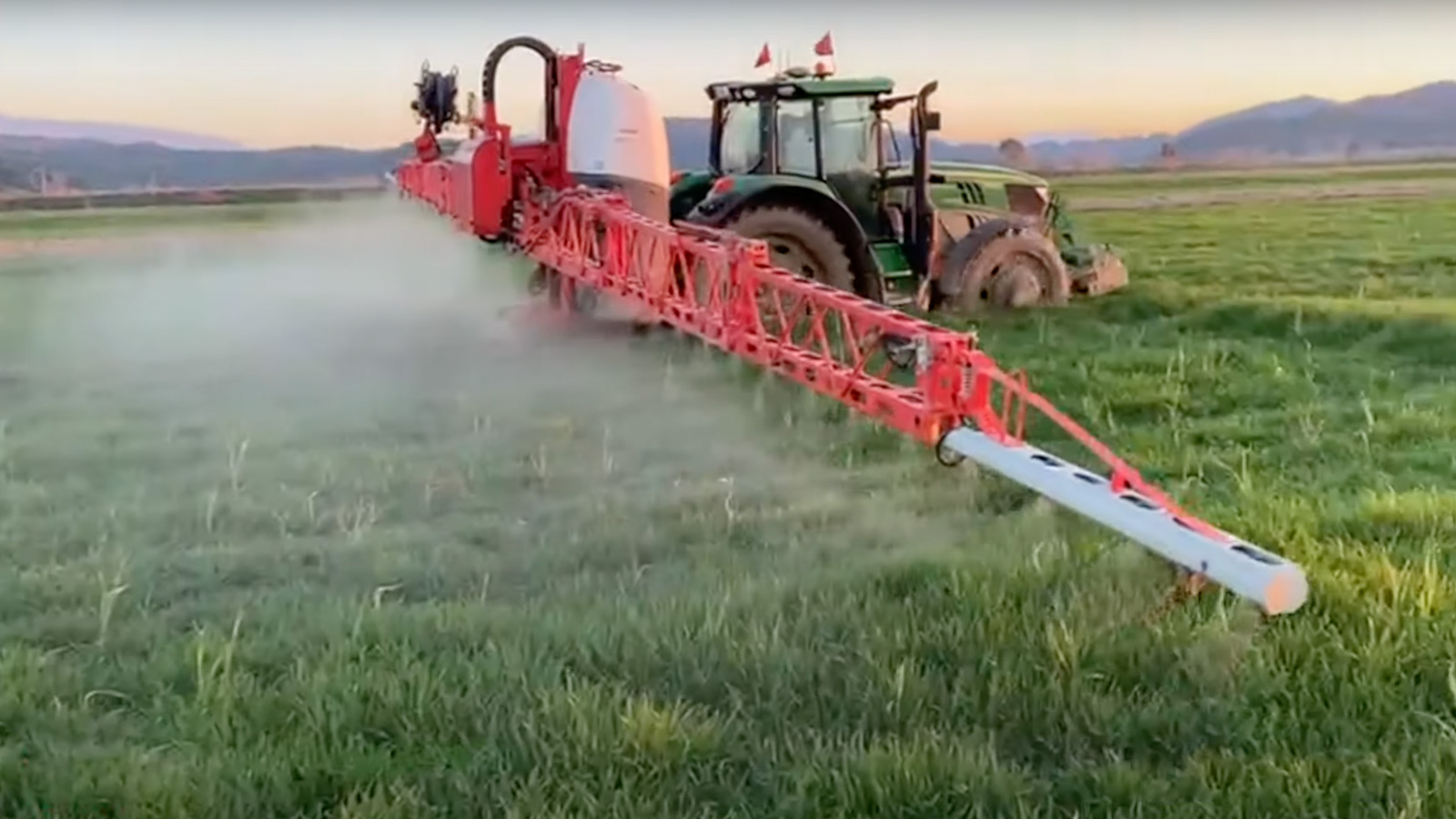
PIX4Dfields is a specialized software product that uses images captured by drones to create maps for use in agriculture. Before it can provide its outputs, users need to capture data with a drone. Firstly, Nesrin flew over the farm with a drone to collect photos and geolocational data. The photos would be used to create vegetation indices with PIX4Dfields through processing. The indices analyze how plants reflect light on a near-infrared spectrum. When a vegetation index identifies changes within how a plant reflects light, this can inform a farmer that a plant is not doing well or that a crop is diseased. This will enable farmers to plan variable rate prescription plans that will only target the relevant areas of a field. This is especially prescient today, as the conflict in Ukraine has caused the cost of fertilizer to sky-rocket. Saving resources is more important than ever and is made easier with precision agriculture practices.
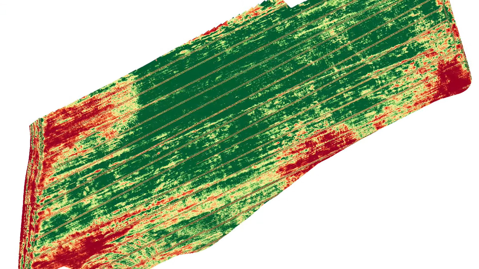
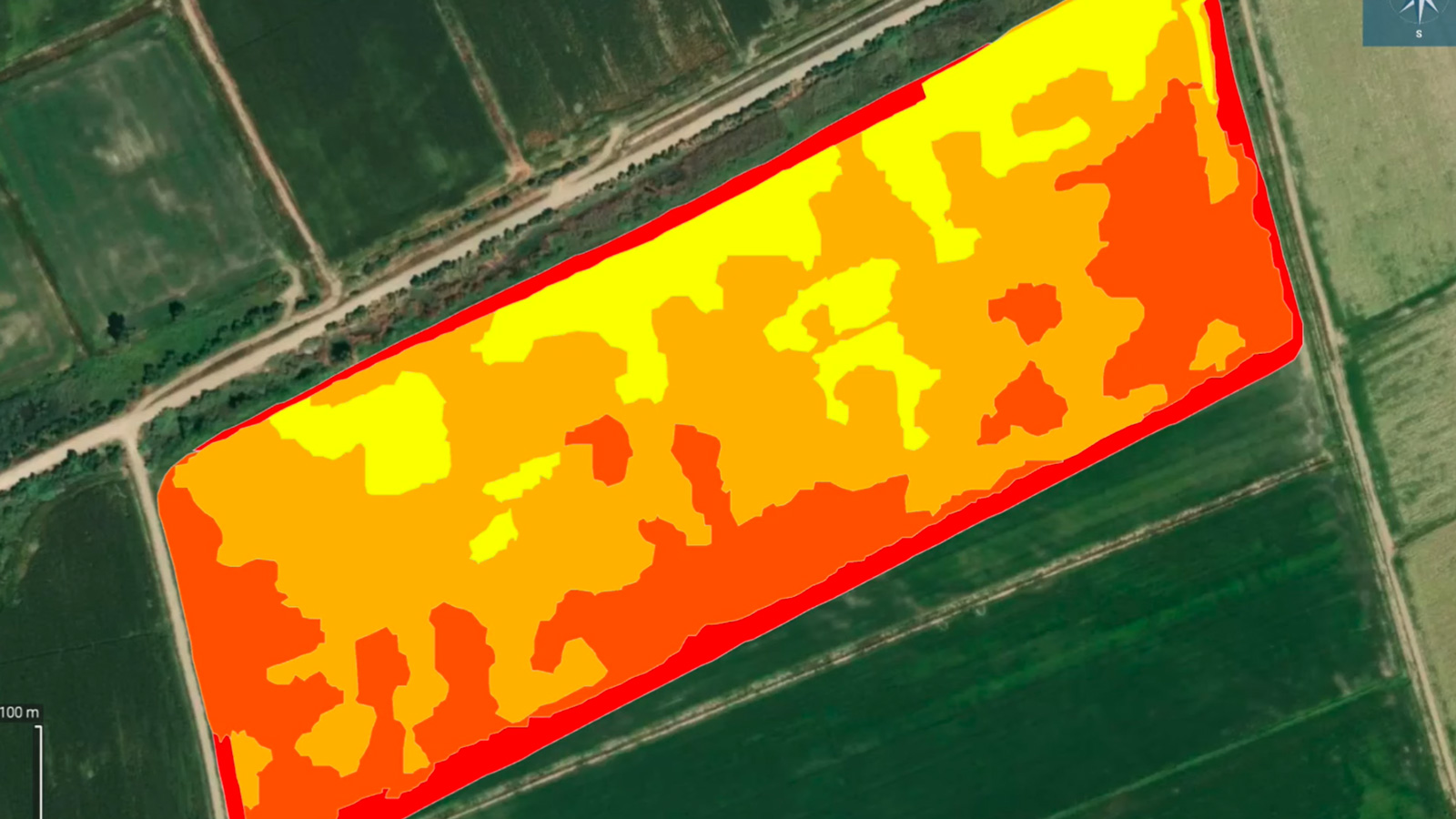
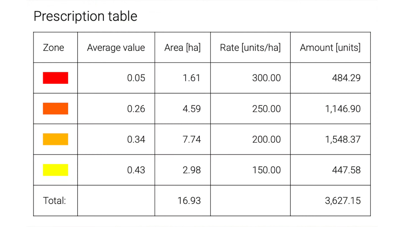
Once the multispectral, or NIR, imagery had been analyzed with PIX4Dfields, the software creates a chart that can be used as a prescription map - a stepping stone for planning how to apply treatment to a field. The map takes into account the exact boundaries of the field to minimize waste. Initially, Nesrin had an issue with importing the field boundaries, but they contacted the Pix4D Support team for help and the problem was soon rectified. Nesrin used the plant health map to plan the spread of chemicals and applied maximum distribution precision and spreading homogenously. The plant health map was exported as a shapefile to a tractor to help automate the application process.
Why use PIX4Dfields?
In this project, Nesrin was responding to an urgent request by their client, who asked for Nesrin’s advice in choosing the best solution for variable rate applications. Nesrin suggested PIX4Dfields for a variety of reasons, including that the software can be used offline with results available in minutes. This makes it much easier to process datasets for farmers as it does not require a return-trip to the office. All they need is a laptop in the field with PIX4Dfields pre-downloaded. An offline workflow offered the best agricultural practice for this crop.
“PIX4Dfields is the easiest and the most practical software to create prescriptions based on the plant health maps. We use the software to execute variable rate applications, which we are the first ones to achieve in Turkey.” Nergistepe Tarım Makinaları, Paksoy Technical Solutions
As a result of using PIX4Dfields in this project, Nesrin saved money and fuel, as well as enabled more environmentally friendly farming practices. This practical solution made Paksoy Technical Services so happy that they have since become an official Pix4D distributor, assisting others in using Pix4D solutions to make agriculture better across Turkey.


