
Spreading the word: how does precision agriculture work?
Precision agriculture saves agronomists and farmers money, time, and resources. Using localized treatment plans rather than blanket spreading a product has been proven to be more effective at boosting yields whilst cutting costs and protecting the local environment. In some cases, it has cut down ripening agent costs by 20% and provided a 93% accuracy rate in crop yield forecasting.
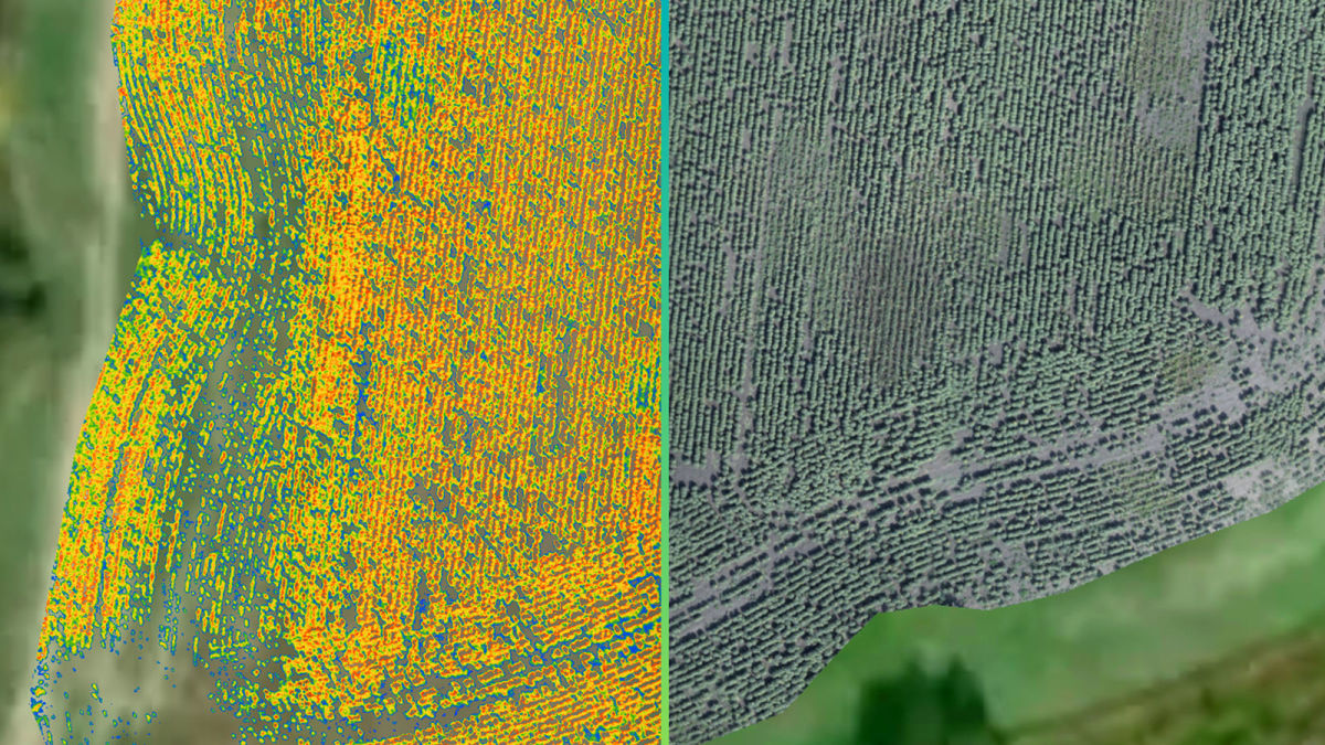
ABZ Drone, based in Hungary, has been working with drones in agriculture to bring effective techniques to agricultural workflows. Recently, they showcased how to use drones to make a crop treatment plan to local farmers. They used a drone to capture aerial images of a sunflower field, which were processed in PIX4Dfields to analyze the health and condition of the plants as well as identify potential animal damage, which is a major concern for crop insurance claims.

ABZ Drone wanted to identify issues in the field and show how the drone and specialized photogrammetry software PIX4Dfields could help meet their individual requirements. They brought multispectral and RGB cameras to the field to gather and analyze imagery. They then wanted to import the prescription map into the Trimble autopilot system of John Deere tractor to prove how the entire workflow can be seamlessly connected. Having specialized machinery is already part of the process for using precision agriculture, so adding drones increases the farm’s capabilities and savings.
Project details
| User | ABZ Drone |
| Location | Hungary |
| Software | PIX4Dfields |
| Area covered | 4 ha |
| Images | 115 |
| Outputs | Orthomosaic, VARI index, zonation map |
| Processing time | 20 minutes |
How can you use drones in agriculture?
ABZ Drone was trying to answer the question of why would you use drones in agriculture. What value does it bring? Is there a clear return on investment (ROI)? We have seen an ROI for using drones for fungicide treatment, but how could the farmers in Hungary apply this technology in their own fields? As an official Pix4D reseller, ABZ Drones knows all the specialized tools they need for getting the most out of PIX4Dfields, which is designed to provide insights to growers and agronomists about their field to help solve problems and plan treatments with maximum efficiency. They are an ideal source of knowledge for advising farmers on bringing precision agriculture to their fields for the first time.
The focus for this demonstration was on using multispectral imagery, which requires a specific type of camera. Looking at the way a plant reflects light with one of these cameras give insights into the health of a plant or crop, whether it is affected by diseases, under water stress, or growing slowly. Analyzing the status of an entire field with these special filters, or indices, is the first step to creating a treatment plan. The treatment plan can be imported to application hardware - such as the navigational system of a tractor. The tractor can then apply the treatment to where it is most needed in specified quantities. The map that it uses to do this is called a Zonation map.

ABZ Drone work with drones capable of carrying specialized payloads for industries ranging from Agriculture to construction to telecommunication. This includes using spot spraying to treat plants in fields. As a Pix4D reseller they have access to extensive support and research on how to get the best out of the drone mapping agricultural software.
Proving the value of drones
Once the data was collected, the team imported it to PIX4Dfields. As it is desktop-based software, there was no need for an internet connection and as a result, the ABZ Drone team could process the images in the field. The processing time was just 20 minutes, after which the team could analyze and explain the findings - the 2D orthomosaic as well as the multispectral imagery map.

Then, they integrated the findings with third-party software to calculate a prescription plan. Thanks to the accuracy of the map in PIX4Dfields, it provided data that is geolocated and can therefore be imported to planning software. With the Zonation Map, the team then sent the results to the navigation system of a John Deere tractor. Using this georeferenced technology in farming equipment is now common practice as it ensures the field is used to maximum efficiency by avoiding the tractor deviating from a planned track.
Spreading precision agriculture
Increasing uptake of precision agriculture techniques is an exciting development in farming. Not only is it cheaper for growers, but it empowers more environmentally friendly farming practices. Reducing the amount of chemicals applied to a crop prevents them from being washed into local ecosystems and causing chemical pollution, encouraging eco-friendly agriculture.
“PIX4Dfields, with its ease of use and speed, allows farmers to process images taken with a drone even in the field and import them into traditional agricultural equipment” - Barna Becze, ABZ Drone
A live demonstration like this one by ABZ Drone proves to growers and farmers how the technology can be used, with a hands-on approach effectively merging theory and knowledge with in-the-field experience.
ABZ Drone has also run a webinar based on this project that had many attendees as farmers that learn from live-demos or webinars are more confident about using the products after they have seen them at work and understand the workflow. In-person demos or workshops run by the Pix4D Training team and authorized resellers give users an interactive chance to learn how to get the best out of their fields.
Overall, the project by ABZ Drones was a successful practical demonstration of the impact drone technology in helping farmers improve their productivity and decrease their impact on the soil which in turn encouraged local growers and agronomists to integrate drones and photogrammetry into their workflow to reap the benefits in their harvests.


