
Optimizing the ROI of fungicides with NDVI imagery
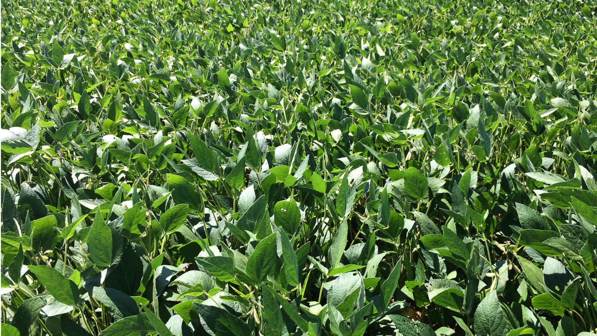
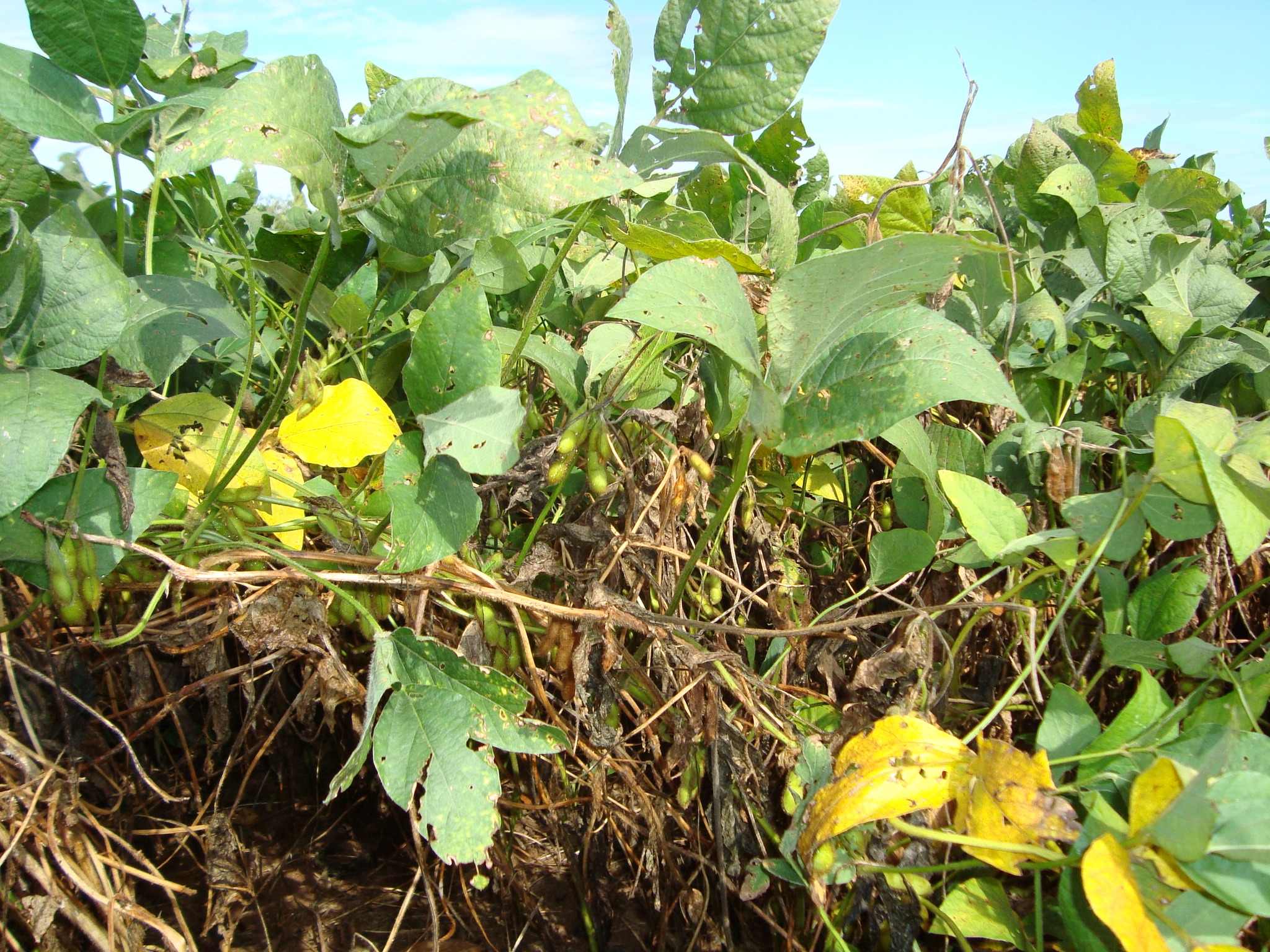
White mold, the bean enemy
White mold (more properly known as Sclerotinia sclerotiorum) is a significant disease affecting many crops, including dry edible beans and soybeans.
The fungus can have a big impact: generally, each 10% increase in disease incidence on mature plants corresponds to a loss of 2–5 bu/ac. (133–333 kg/ha)¹.
The cost of chemical controls is high, meaning growers must weigh their expense against the potentially large yield losses that white mold may cause. However, not every acre of crop justifies fungicide application.
In a single-rate management plan, loss seems inevitable: a farmer will either suffer the yield losses in the face of high application costs, or reduce ROI by applying the product to acres that don’t require it.
Mapping may provide a solution.
Given the high-density and vigorous crop canopies that white mold favors, Normalized Difference Vegetation Index (NDVI) maps are a useful tool to estimate where to spray a protective fungicide to optimize the return on investment.
The prescription approach enables growers to apply fungicides at rates that are appropriate to the disease potential.
Ontario-based Deveron UAS Corp. conducted a series of surveys in southwestern Ontario in August 2018 for the purpose of generating variable-rate prescription maps used to apply fungicides. A variety of soy and dry edible bean fields were imaged. Deveron was responsible for the logistics, collection, processing, and delivery of all the drone imagery used in this project.
| Organization | Deveron |
| Project members | Veritas |
| Location | Ontario, Canada |
| Project date | August 2018 |
| Hardware | senseFly eBee drone, Parrot Sequoia camera |
| Software | PIX4Dmapper |
| Project size | 257 acres |
| Number of images | 5,968 |
| GSD | 12.25cm |
Data capture with Parrot Sequoia and senseFly eBee
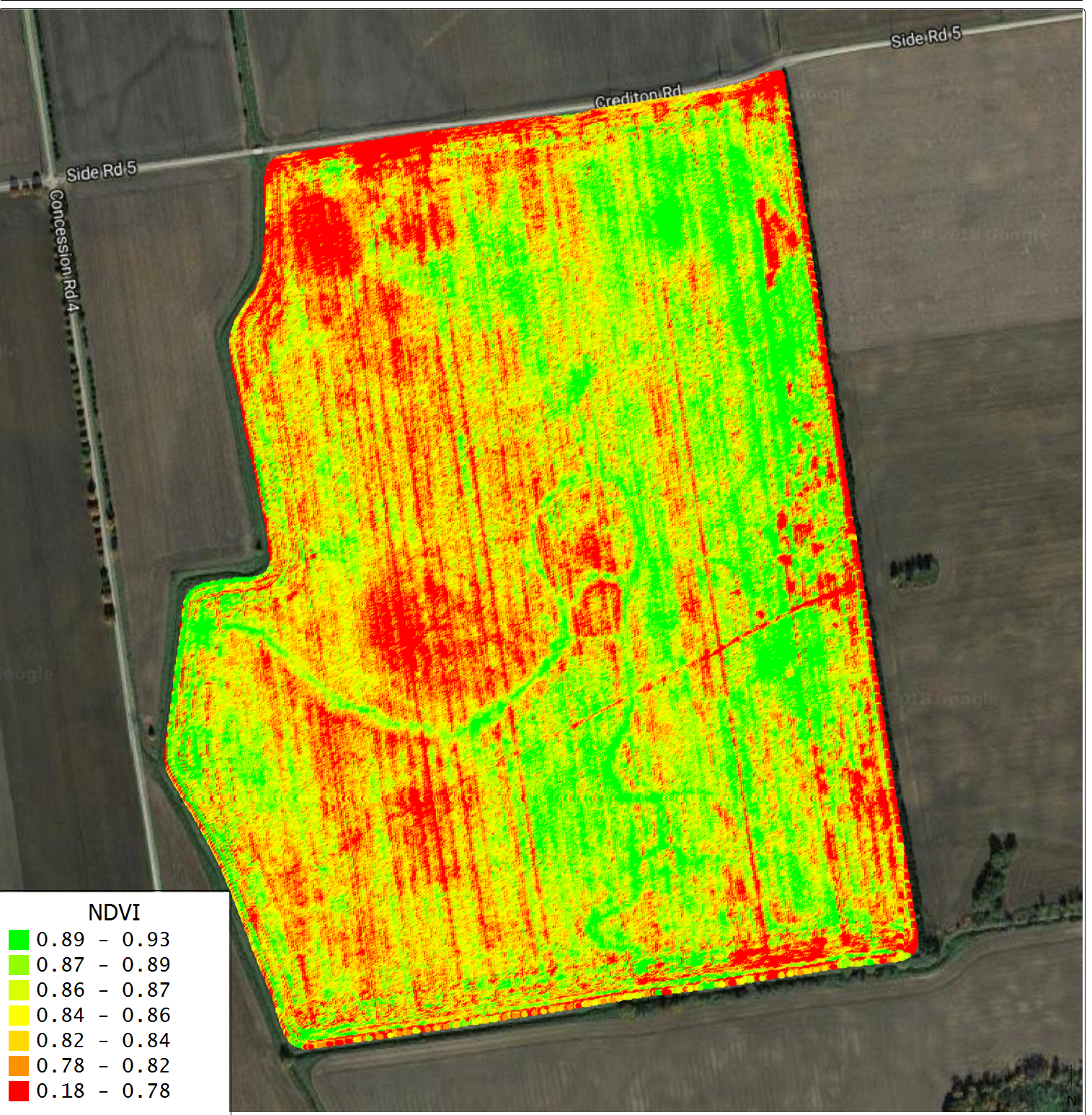
Deveron used a fleet of senseFly eBees equipped with the Parrot Sequoia to fly the field. The example field is 257ac (104ha). There were 5,968 images captured at a GSD of 12.25cm per pixel. The imagery was captured between 10:00am and 4:00pm using a parallel flight plan at 75% lateral overlap, 80% longitudinal overlap.
After processing the multispectral images in Pix4D a NDVI map was immediately sent to Veritas to generate the prescription. Two rates of fungicide were applied, a single-rate according to the product label and a zero-rate. The rates correspond to roughly 50% of the acres in the field, respectively.
| While Pix4Dfields has automated prescription maps, the team chose to use Pix4Dmapper and outsource the prescription mapping to ensure the output fit their existing workflows. |
Fighting the white mold with Pix4D NDVI and Veritas prescription map
Pix4D software was used for image processing as well as for generating NDVI maps which were used by Veritas to create the prescription map. The time from data acquisition to delivery of the prescription map was 48 hours.
Veritas added Veriblock check-blocks in each fungicide rate zone, which will be used to validate the profitability and yield responses to the fungicide.
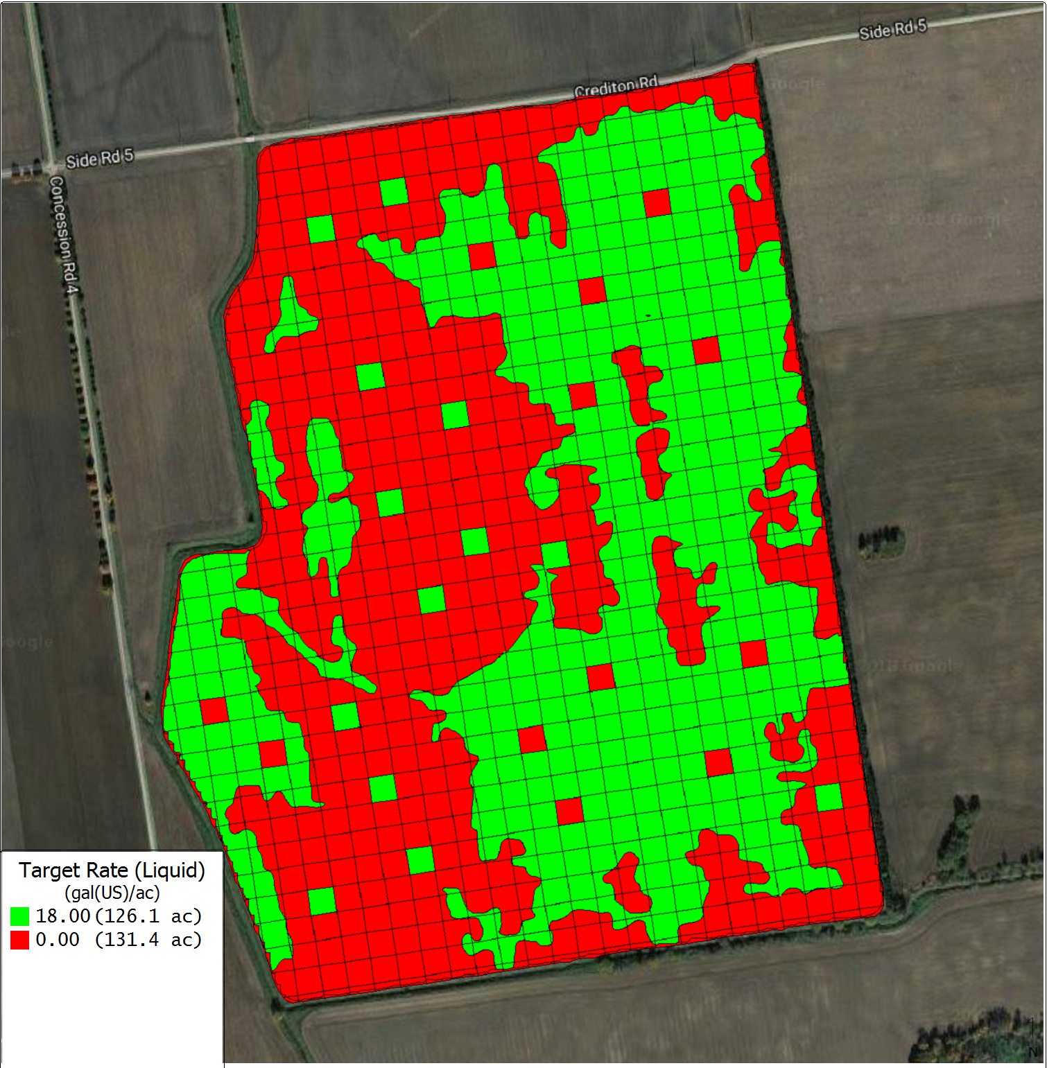
The grower received the prescription during the recommended crop development stage of early- to mid-bloom, within the 48 hour delivery time promised by Deveron. The prescription was compatible with the Hagie ST16 sprayer used to apply it.
Initial field scouting indicated that disease incidence was not increased by reducing the acres the fungicide was applied to. Complete analysis of the ROI will be conducted following bean harvest.
Advantages of drone imagery and Pix4D
Pix4D simplifies the image processing workflow so data can be turned around rapidly, and with little interaction with the pilots. The automated radiometric calibration workflow further reduces the processing burden and improves data quality by eliminating opportunity for error.
Compared to satellite imagery, drone imagery strikes a balance between the detail captured on the ground and the speed at which large areas can be surveyed. Pix4D enabled Deveron to capture data beneath the clouds where satellite data fails to show anything and the user usually needs to wait for the next re-visit.
NDVI maps provide more information to the grower to make more targeted spray decisions. The prescription mitigates the risk of yield loss that can occur if a grower cannot justify the upfront cost of spraying for an unknown number of high-risk acres.
Conversely, there are acres that do not require additional protection due to lower yield environment and disease potential, so this management plan reduces the overapplication of fungicide in line with an integrative pest management (IPM) strategy.
Special thanks
| Special thank you to Deveron UAS Corp. for sharing their story with us. |
References 1 Peltier, A.J., C.A. Bradley, M.I. Chilvers, D.K. Malvick, D.S. Mueller, K.A. Wise, and P.D. Esker. 2012. Biology, Yield loss and Control of Sclerotinia Stem Rot of Soybean. J. Integr. Pest Manag. 3(2): 1–7.


