PIX4Dreact 1.5: high-resolution maps & location improvements
The latest update for PIX4Dreact offers you high-resolution snapshots, support for uploading markers to PIX4Dcloud, the option to display location in degrees, minutes and seconds (DMS), clickable zoom buttons, holes and sub-polygons for area markers, as well as support for thermal cameras.
Get high-resolution maps for large format printing
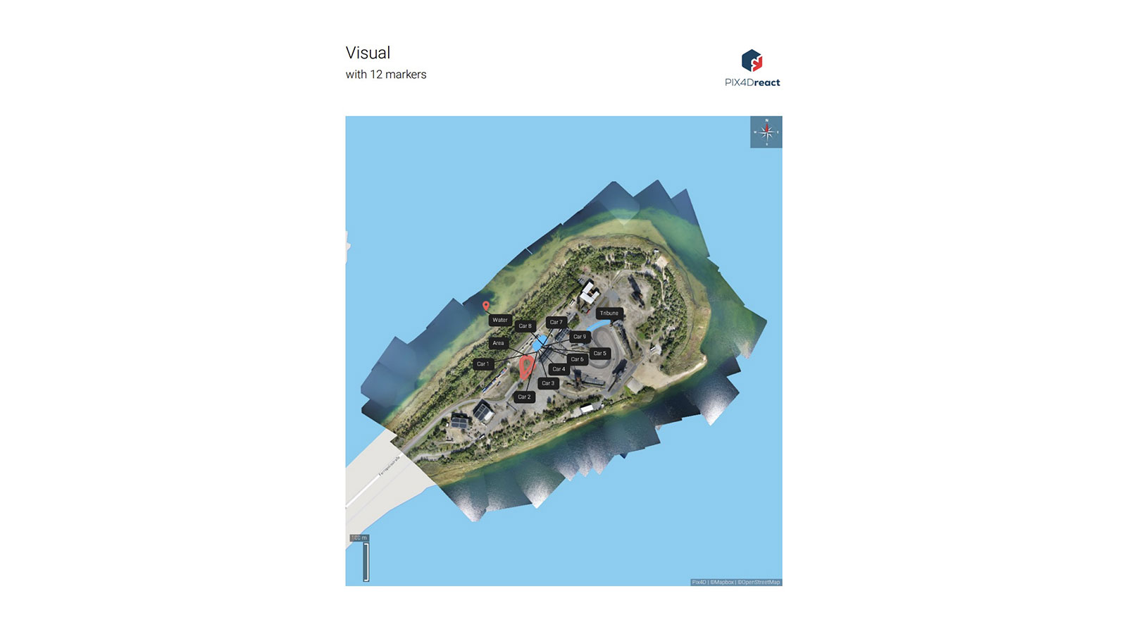
PIX4Dreact is designed to meet the needs of emergency response teams in all scenarios that require speed, accuracy, and fast response. With this new update, it is possible to export either the current view of the map or the full map of the area of interest, including any markers. Export as a high-resolution JPEG to use for large-format printing, adjusting the file’s size according to your needs.
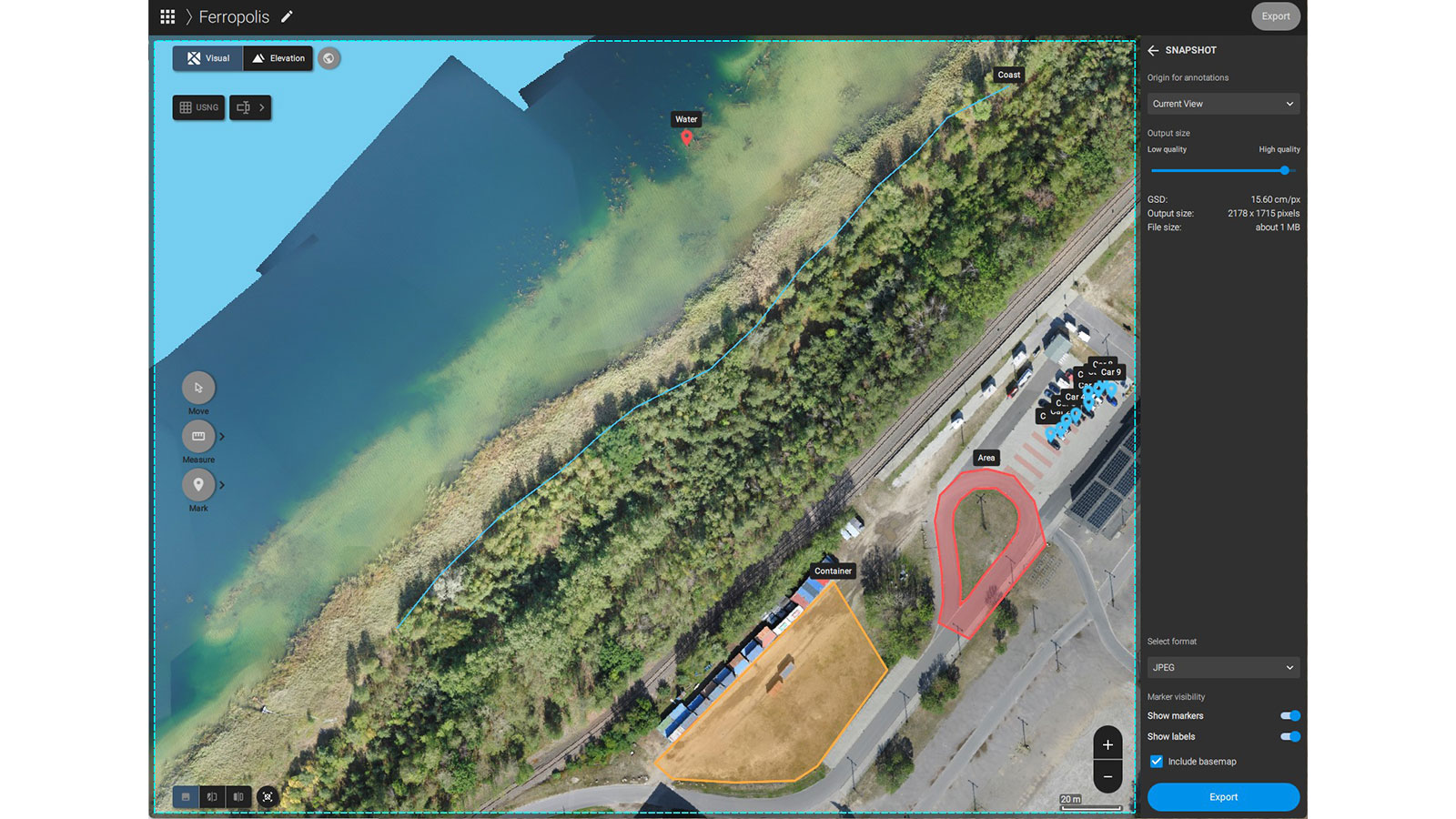
Share to PIX4Dcloud annotations
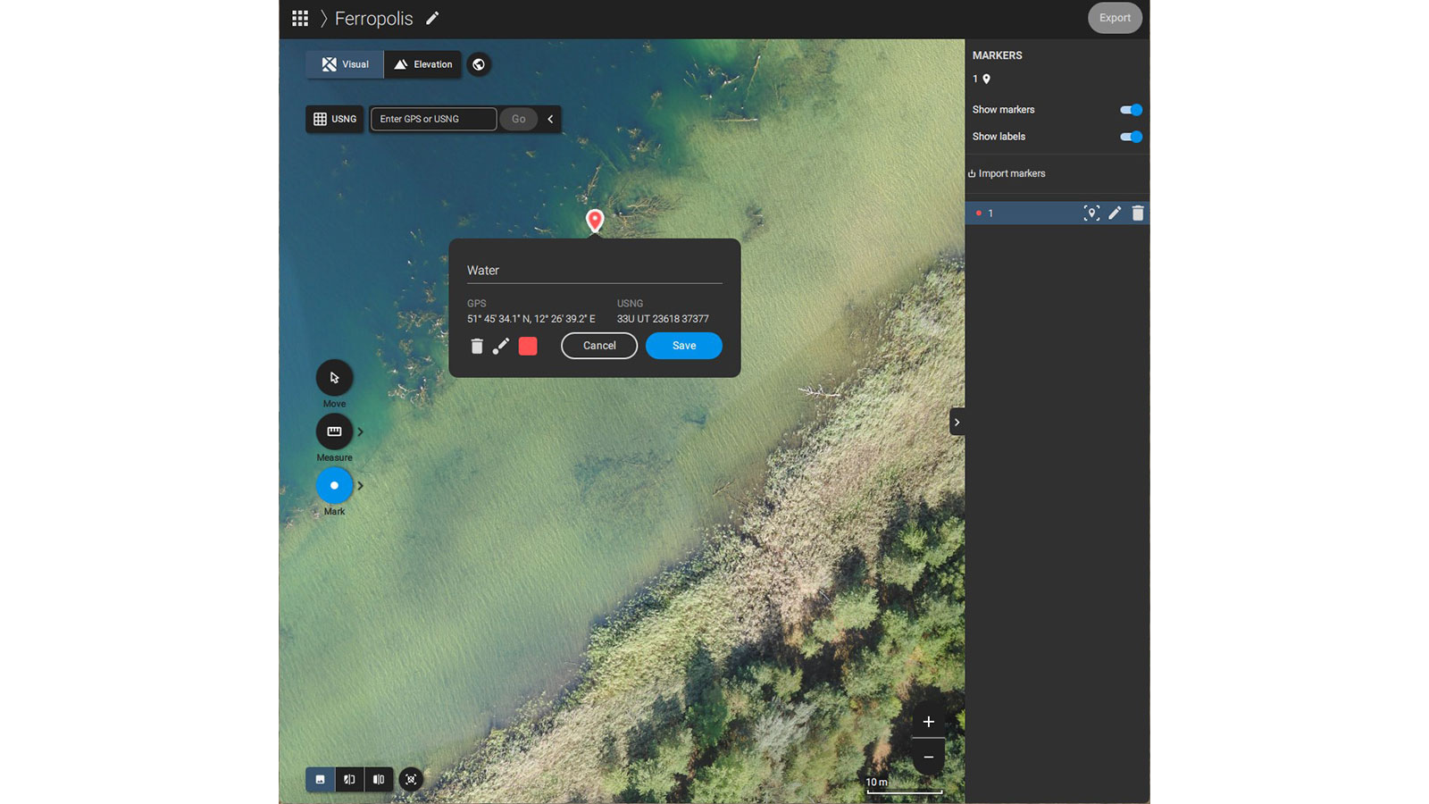
Getting up-to-date and reliable information fast to the right people is of utmost importance during an emergency. Now it is possible to upload point, line, and area annotations to PIX4Dcloud with the Share to PIX4Dcloud feature!
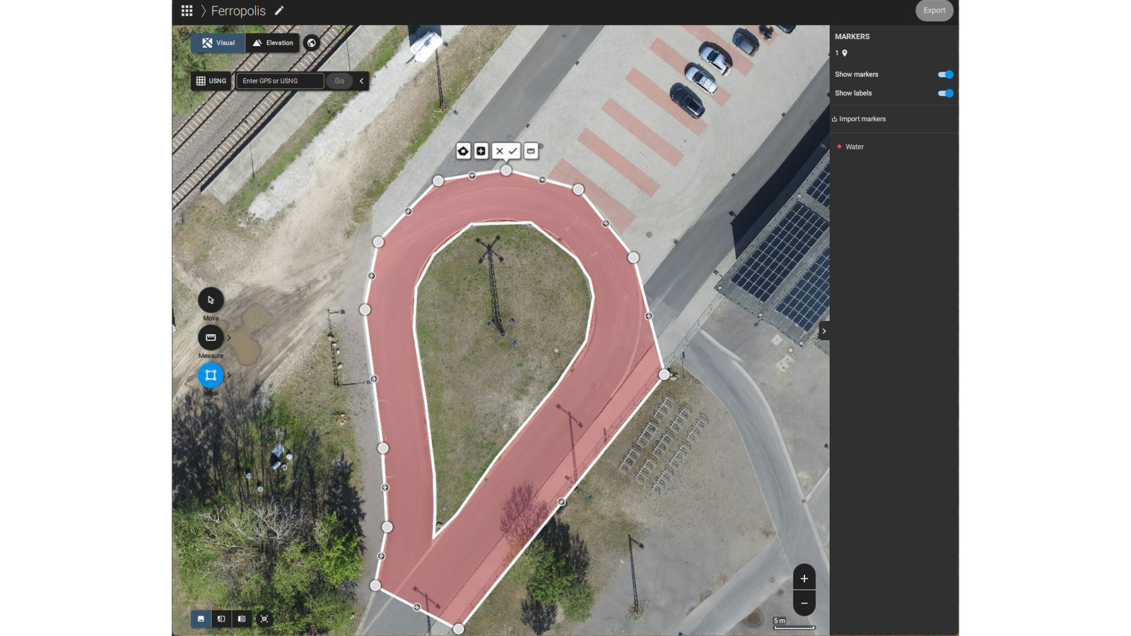
Annotations with holes and sub-polygons are now also possible! Create area annotations with cut-outs as well as annotations with multiple sub-polygons. Get more detailed info when it comes to situational awareness or area investigation by classifying objects of the same class with just one area annotation, like cars and burned or damaged areas.
Emergency response teams can also take advantage of the improved label placement in PIX4Dreact’s PDF report. Get and share reports with detailed and accurate data and keep track of important information when every second counts.
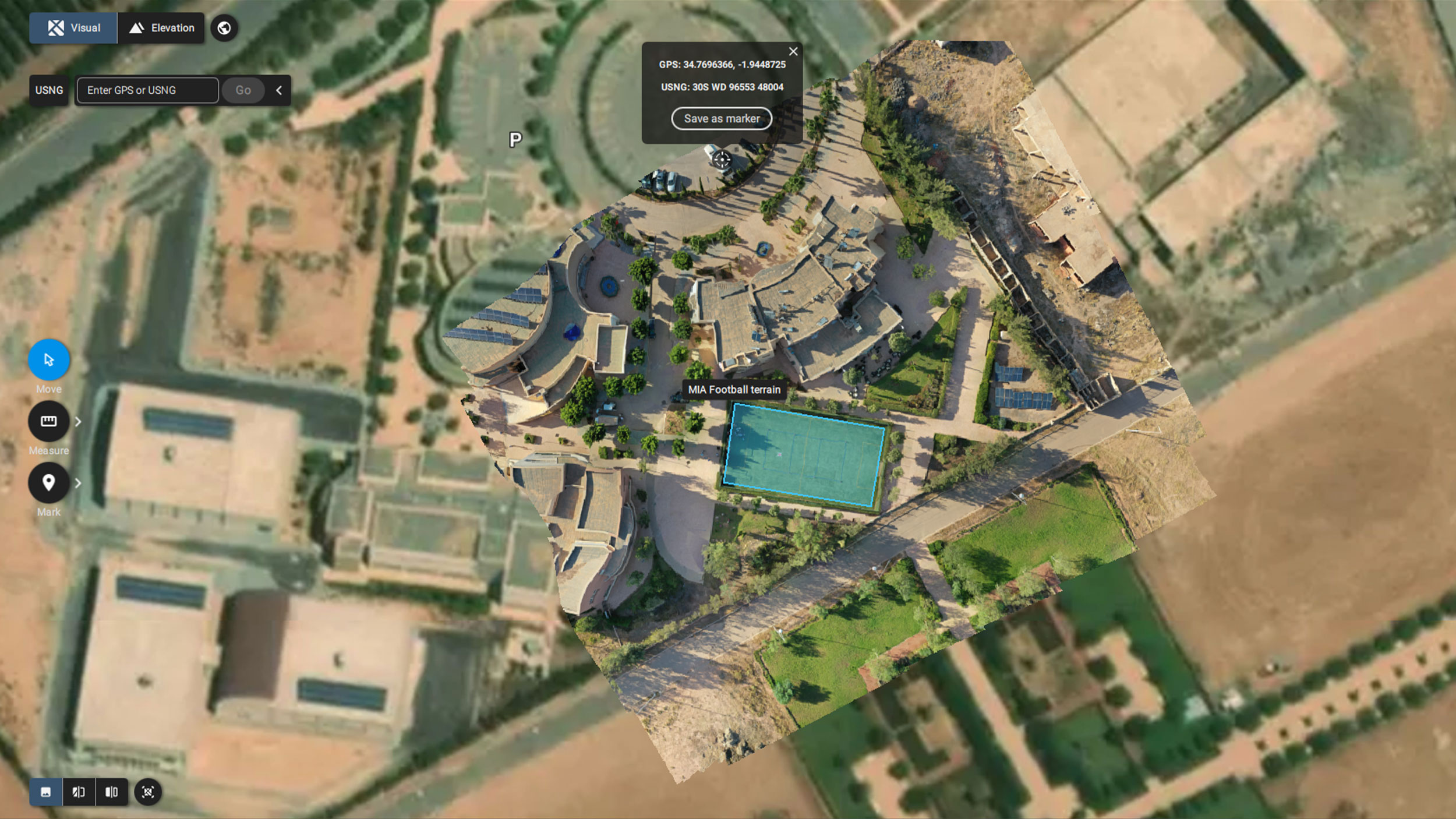
DMS coordinates location display
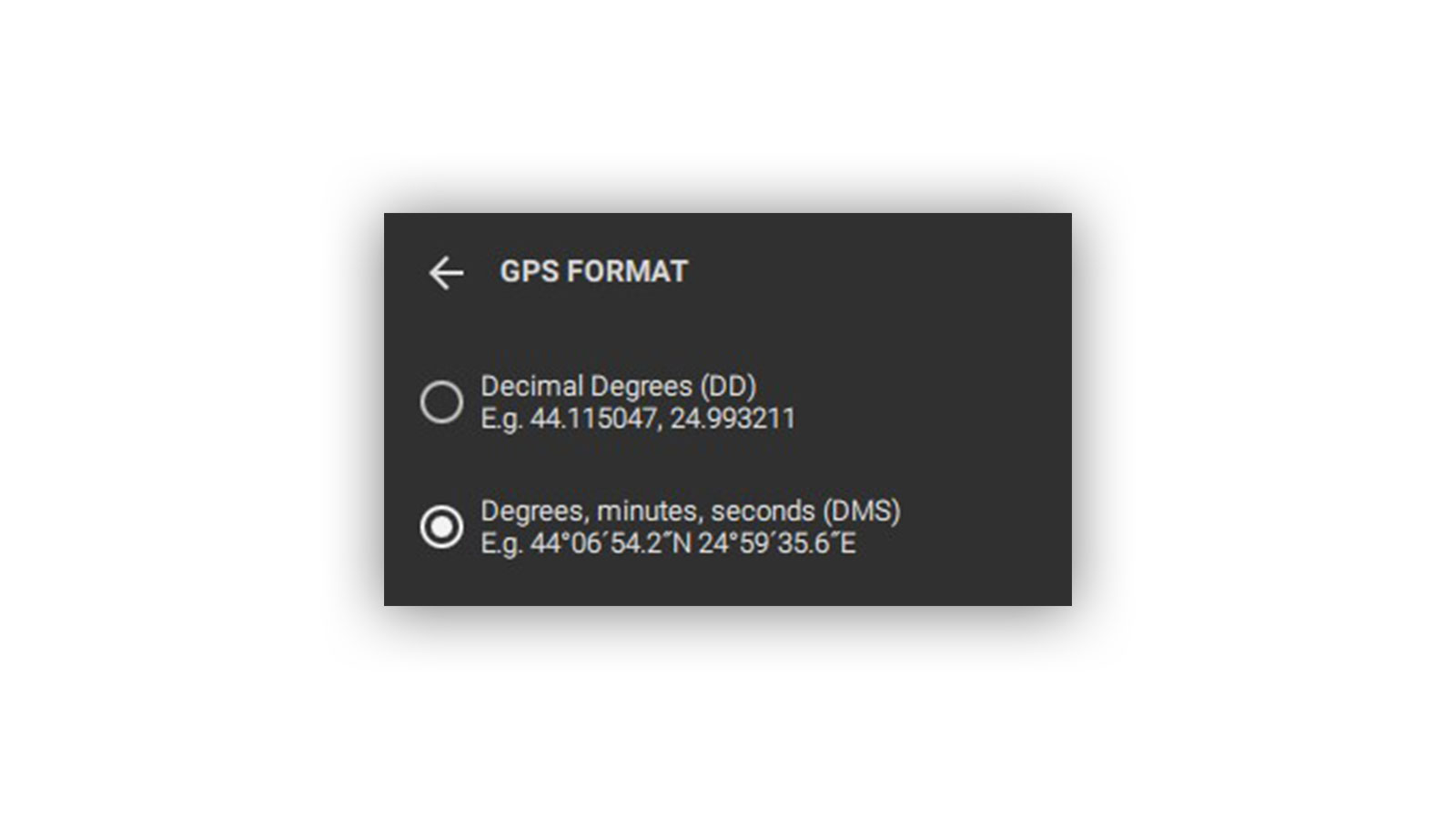
When it comes to search and rescue teams (including maritime), precise and up-to-date location is of utmost importance in order to act quickly and effectively. PIX4Dreact 1.5 offers the option to change the display of coordinates from Decimal Degrees (DD): 41.40338, 2.17403 to Degrees, minutes, and seconds (DMS): 41°24'12.2"N 2°10'26.5"E.
Clickable zoom buttons and new cameras support
PIX4Dreact is developed to facilitate the work of emergency responders, humanitarian aid professionals, and decision-making teams. With the new clickable zoom buttons, it is now easier to zoom in on the map and area of interest, even if you are using a touchscreen or just the trackpad of a notebook without a physical mouse. Finally, the latest update also includes support for many high-demand cameras such as the DJI Mavic 3 Thermal. Find out more in the detailed changelogs.
PIX4Dreact 1.5 supports using drones for good in emergency response and public safety. The latest updates offer valuable insights and facilitate the work and mission of the people and teams contributing to the greater good.