Building a custom photogrammetry platform with Pix4Dengine
For many companies in technical industries, there is a desire for specialized software that is finely tuned to the needs of a service provider. At Pix4D, the photogrammetry software on offer ranges from surveying to telecommunication inspections and agricultural analytics, and Pix4Dengine gives users the ability to tailor the power behind Pix4D to their specific projects.
NTT Comware, a subset of the Nippon Telegraph and Telephone Corporation in Japan, is a system integration company. Focused on IT services, NTT Comware work both within the NTT group and with external clients. They use drone mapping to provide inspections of varying structures including towers and buildings. For the specialized nature of their work, they use PIX4Dengine Cloud API.
PIX4Dengine Cloud API is a set of programming modules that allows users to take advantage of Pix4D’s powerful algorithms and tailor them to suit their own needs. The PIX4Dengine Cloud API option means NTT Comware can build its own photogrammetry software with the API without needing a specialized team on-hand, enabling full automation of image processing on Pix4D’s cloud services to produce 2D and 3D maps and models. The PIX4Dcloud interface, or a custom interface created by NTT Comware themselves, can be used for their project visualization.
Building customized tools for specific applications
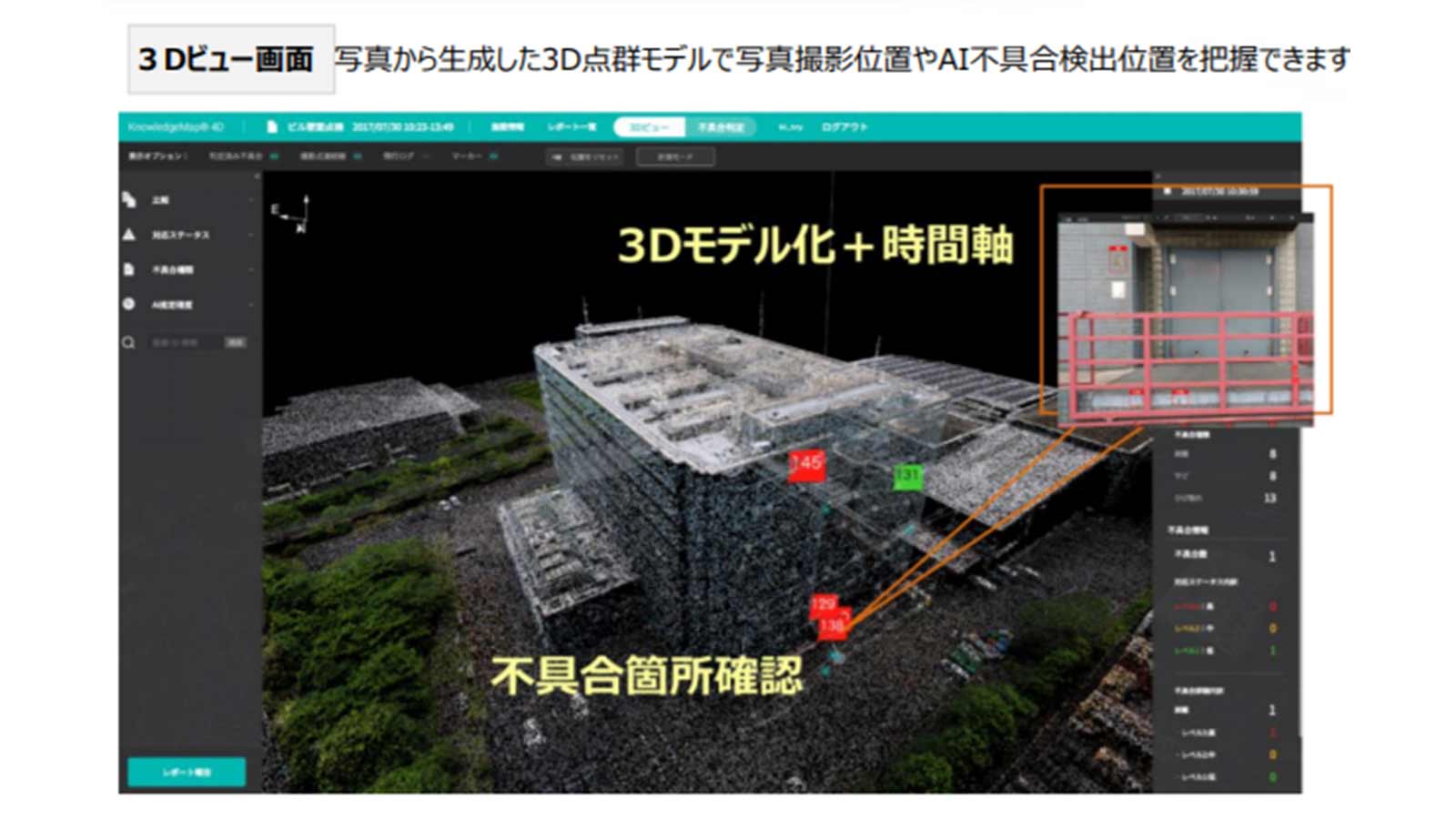
Using PIX4Dengine Cloud API, NTT Comware developed their product KnowledgeMap® 4D and started providing the service to clients in August 2019.
This product now helps complete visual inspections, along with record changes by comparing previous maps with the newest drone map and identifying differences. KnowledgeMap® 4D has an integrated AI that coordinates with NTT Comware’s Deeptector working on image recognition to help detect defects or faults. Having AI built-in to software can save both users and clients time and money.
The power of automation with PIX4Dengine
NTT Comware have recognized several benefits to working with PIX4Dengine Cloud API:- Photogrammetry outputs are highly valued by clients, so NTT Comware’s results using photogrammetry outpace their competitors
- PIX4Dengine has seamlessly been incorporated into the NTT Comware product
- PIX4Dengine Cloud API is a substantial and powerful set of algorithms, capable of doing everything required by the NTT Comware team and saving them lots of work
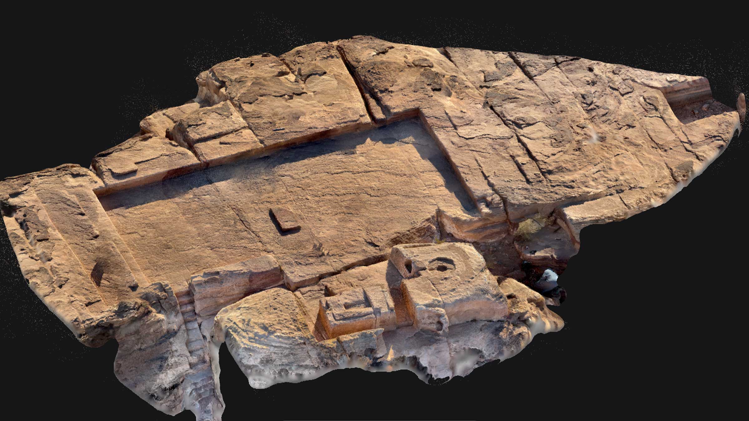
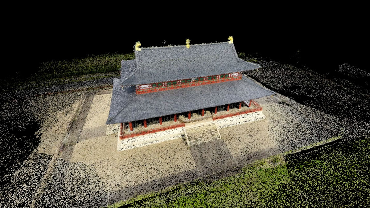
Modeling the Heijo Palace Historical Park
A recent project undertaken by NTT Comware was at the Heijo Palace Remains Historical Park to survey Heijo Palace, which was the capital of Japan 1,300 years ago. At its height it was a center for industry, academia, and government. Using drone surveying can help preserve cultural heritage sites without damaging them, especially for larger structures like this palace.
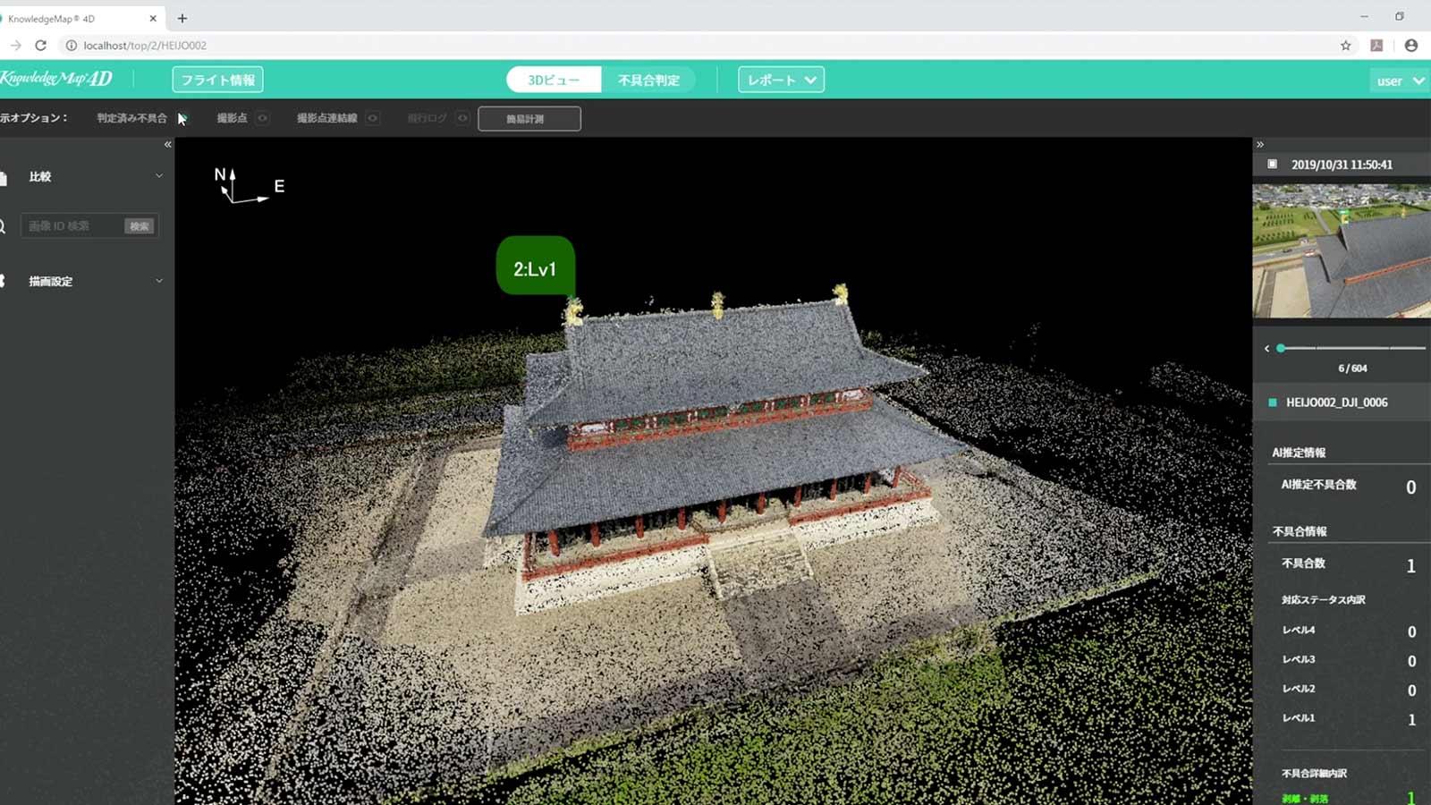
NTT Comware showcased their work using photogrammetry to create a 3D model of the building’s infrastructure using AI image analysis in KnowledgeMap® 4D.
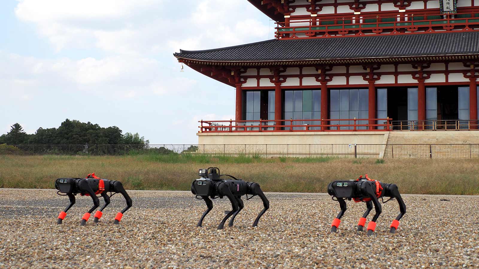
In addition, from 2020, NTTcomware’s team have worked on combining technologies such as images and LiDAR data collection using quadruped robots, AI image analysis, and visualization of digital twin virtual spaces to inspect equipment in areas that are difficult for humans to inspect. This enhances image data, as LiDAR can pick up on details missed by drone data collection. In the question of LiDAR vs photogrammetry, NTT Comware found they benefitted best by combining the two.
The total area of the park was 132 hectares including structures such as roads, trees, and ponds. Accurate measurements will be used to contribute to maintaining the park, which is why NTT Comware’s accurate inspection and model are critically helpful to preserving this cultural heritage site.
“KnowledgeMap® 4D was developed with the aim of realizing simple visual inspection and diagnosis in digital space based on the acquired information such as photography with drones or sensor data. By utilizing PIX4Dengine, we were able to smoothly incorporate photogrammetry technology into our solution”. - Mr. Hino, NTT Comware
By leveraging PIX4Dengine, NTT Comware was able to run an automated photogrammetry surveying workflow within their platform and incorporate it into their overall project results. Going forward, KnowledgeMap® 4D will evolve and be adapted to suit the needs of the new fields NTT Comware will work in.