Enhancing prison safety and security with PIX4Dmatic
The benefits of photogrammetry extend beyond just mapping. Photogrammetry can directly contribute to public safety as an emergency response tool. It can aid in effectively assessing and responding to critical situations, which can be done with aerial mapping and drones, or terrestrial scene reconstruction with PIX4Dcatch and vidoc RTK rover. While these strategies highlight photogrammetry as an effective tool to assist with emergency response, it is just as useful with planning in advance for emergency situations.
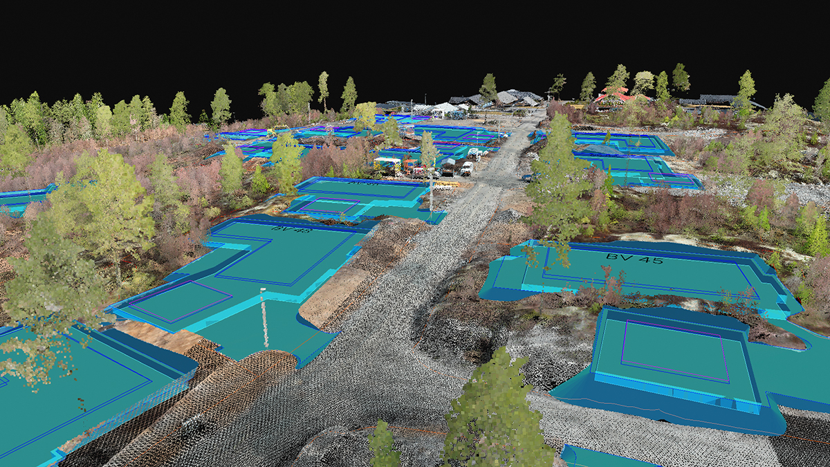
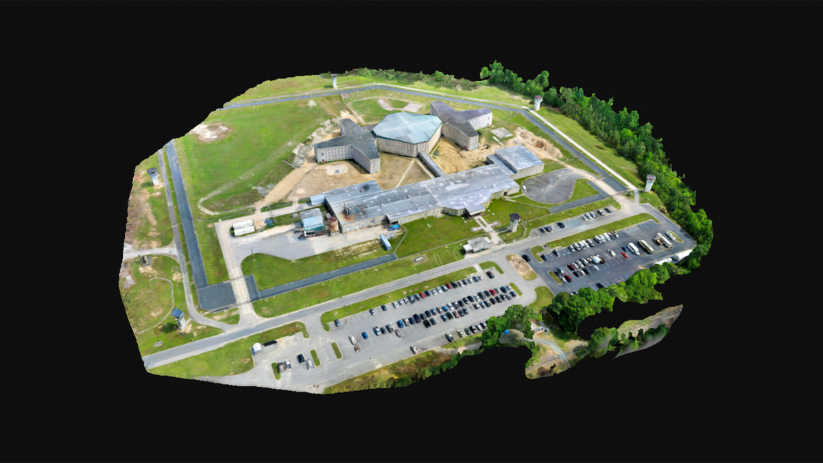
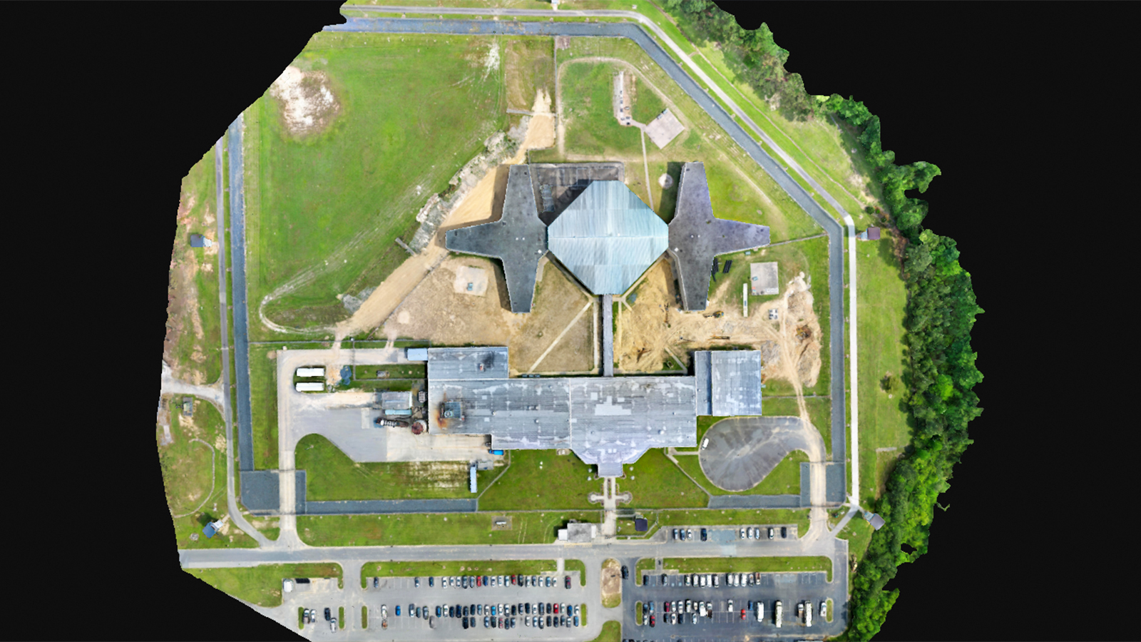
A prison in North Carolina required a reliable and accurate aerial map of its facility to assist with safety and security. Using photogrammetry, they obtained highly precise 3D representations of their premises with relative ease. These maps contain important information that will be used to assist prison staff with safety planning and emergency response situations.
Public safety professionals use drone mapping
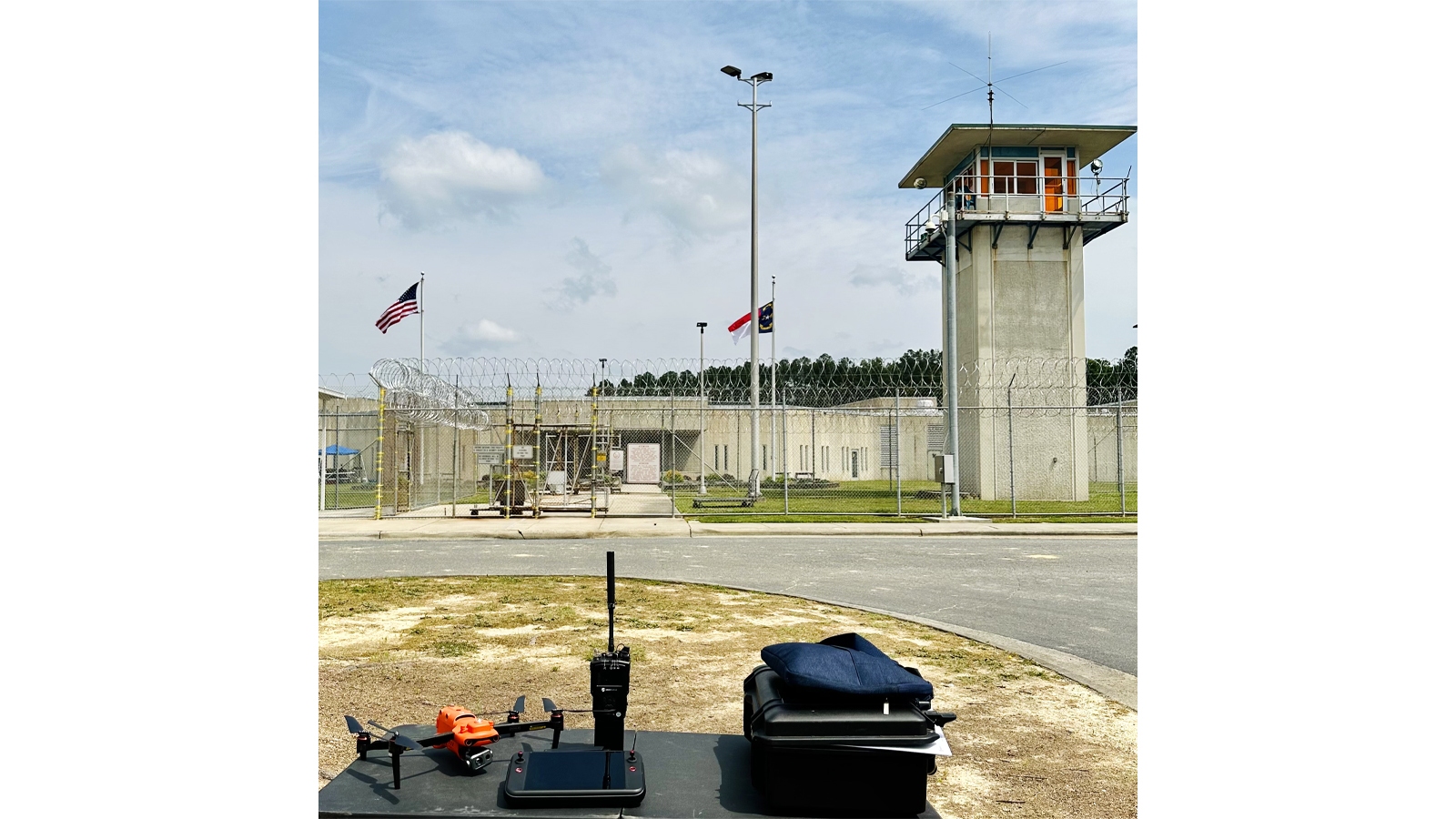
The Southern Correctional Institution in North Carolina approached Jon Denotter and the Public Safety UAS (PSU), asking them to help create an updated aerial map for their facility. PSU is an organization of experienced public safety professionals, with decades of first responder and aviation experience.
Offering tailored training and specialized courses in drone operations, including mapping, PSU aims to provide practical, hands-on instruction for using drones in the public safety sector. Given PSU's focus on public safety - particularly within correctional institutions, tactical operations, and schools - they were the ideal choice for this project.
Aerial maps and prison security
How does an aerial map of a prison assist with public safety and security? Firstly, it assists with surveillance of the building and perimeters by providing comprehensive coverage to the security staff. It also plays a vital role in emergency response, providing crucial information such as evacuation routes, access points, and locations of critical infrastructure within the prison.
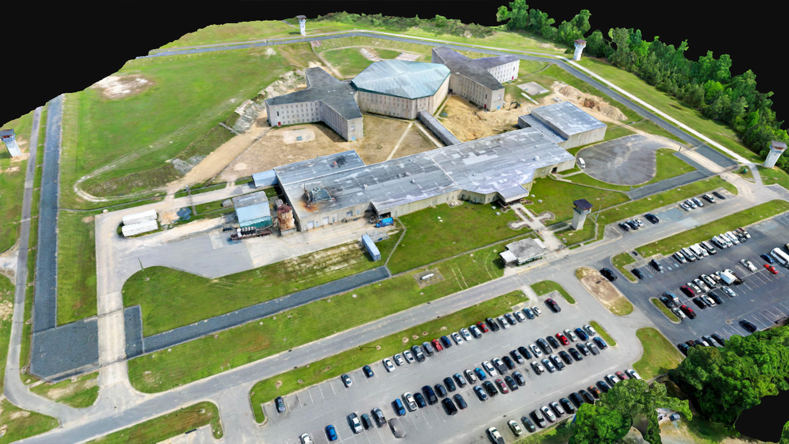
Beyond security and emergency response, the aerial map will also provide operational benefits, such as moving around personnel and inmates, and facility management. Additionally, the aerial map will provide insight for counter drone detection and mitigation strategies, to help prevent illegal drone flights from attempting to enter and drop off illicit items.
Project details
| User | Public Safety UAS (PSU) |
| Location | North Carolina, USA |
| Software used | PIX4Dmatic PIX4Dcloud |
| Hardware used | Autel EVO Pro V3 640T Enterprise RTK drone |
| Total images gathered | 1200 |
| Area surveyed | 853,000 square feet |
| Processing hardware | 2021 HP Laptop Processor Intel(R) Core i5 64-bit operating system, x64-based processor 16.0 GB (15.8 GB usable) RAM Windows 11 Operating System |
| Processing time | 9.5 hours |
Mapping a prison with PIX4Dmatic
In order to help the Southern Correctional Institution with their mission, Denotter and his team at Public Safety UAS (PSU) created a modern, updated aerial 3D map using PIX4Dmatic and PIX4Dcloud. They found the software very user-friendly. Denotter noted that using PIX4Dcloud made it easy to share with the client and that PIX4Dmatic’s extended toolkit of features verified and ensured accuracy throughout the process.
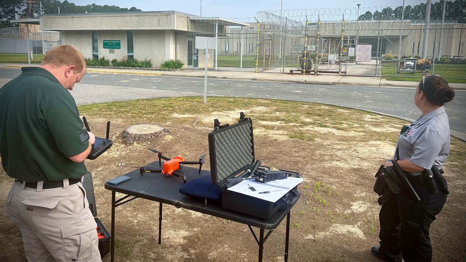
Regarding hardware, Public Safety UAS used an Autel EVO Pro V3 640T Enterprise RTK drone equipped with a smart controller. With the RTK drone, they covered 853,000 square feet, successfully capturing a total of 1200 images.
Despite using a computer that was slower than the recommended specifications for the software, the team managed to process the images in nine and a half hours. Even without the help of a GPU to process the images, they experienced no difficulties, and the entire project, including flight time, was completed within 10 hours.
Photogrammetry assists public safety
Although they considered other software, Public Safety UAS (PSU) felt PIX4D would deliver the best output. The project resulted in a reliable and accurate map, which was easy to share thanks to PIX4Dcloud. The Southern Correctional Institution, who had never had this sort of map before, were very impressed with the results.
“Working with PIX4D's software has shown me how easy it can be to create and share high-quality maps” - Jon Denotter, Instructor/Sales for Public Safety UAS
PIX4D enabled Public Safety UAS (PSU) to quickly gather the data needed to generate a precise 3D map and promptly share it with their client. The project was successful, and showcased PSU's use of photogrammetry and technology to gather vital information for public safety situations. The project was shared on social media and received an overwhelmingly positive response. PSU, with the help of PIX4D's software, demonstrated the role technology can play in public safety, inspiring others to use these tools effectively and showing the valuable applications of photogrammetry for the public good.