Building new roads with drone mapping in India
India, now the world’s most populous country, is rapidly expanding its road networks. Current regulations for road infrastructure projects require developers to submit orthomosaics, digital surface models (DSM), digital terrain models (DTM), and volumetric analysis. This is to ensure the quality of new roads across the country and improve regulations and record-keeping.
However, this can require extensive surveying for road builders. As a result, drone mapping is now being used to provide data for infrastructure surveys. Using aerial imagery to create maps for road surveys can be implemented to build new roads or carry out maintenance without stopping traffic.
Drone service providers in India
Skytek Drones is a drone service provider based out of Hyderabad. The company began in 2022, and since then has been working on projects in infrastructure, real estate, and mining. The team is made up of surveyors and geologists who use drones to capture and process photogrammetry data. Skytek Drones was recently asked to survey an area before road development to ensure all necessary data was available for the authorities. This would ensure the project team was complying with the latest regulations as well as help record the state of the land being developed.
India is rapidly expanding its drone services across the country thanks to government-backed initiatives to map terrain with drones. As a result, companies like Skytek Drones are able to benefit from wider awareness of drone technology and its capabilities.
Project details
| Location | Hyderabad |
| User | Skytek Drones |
| Software | PIX4Dmatic PIX4Dsurvey |
| Hardware used | DJI Mavic 3 Enterprise RTK |
| Area surveyed | 2 km2 |
| Images collected | 4,000 |
| Processing time | PIX4Dmatic: 10 hours PIX4Dsurvey: 32 minutes |
| GCPs | Emlid Reach RS2+ |
| GSD | 3.2 cm |
Drone mapping for road development
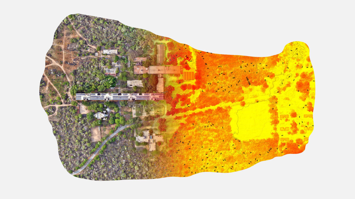
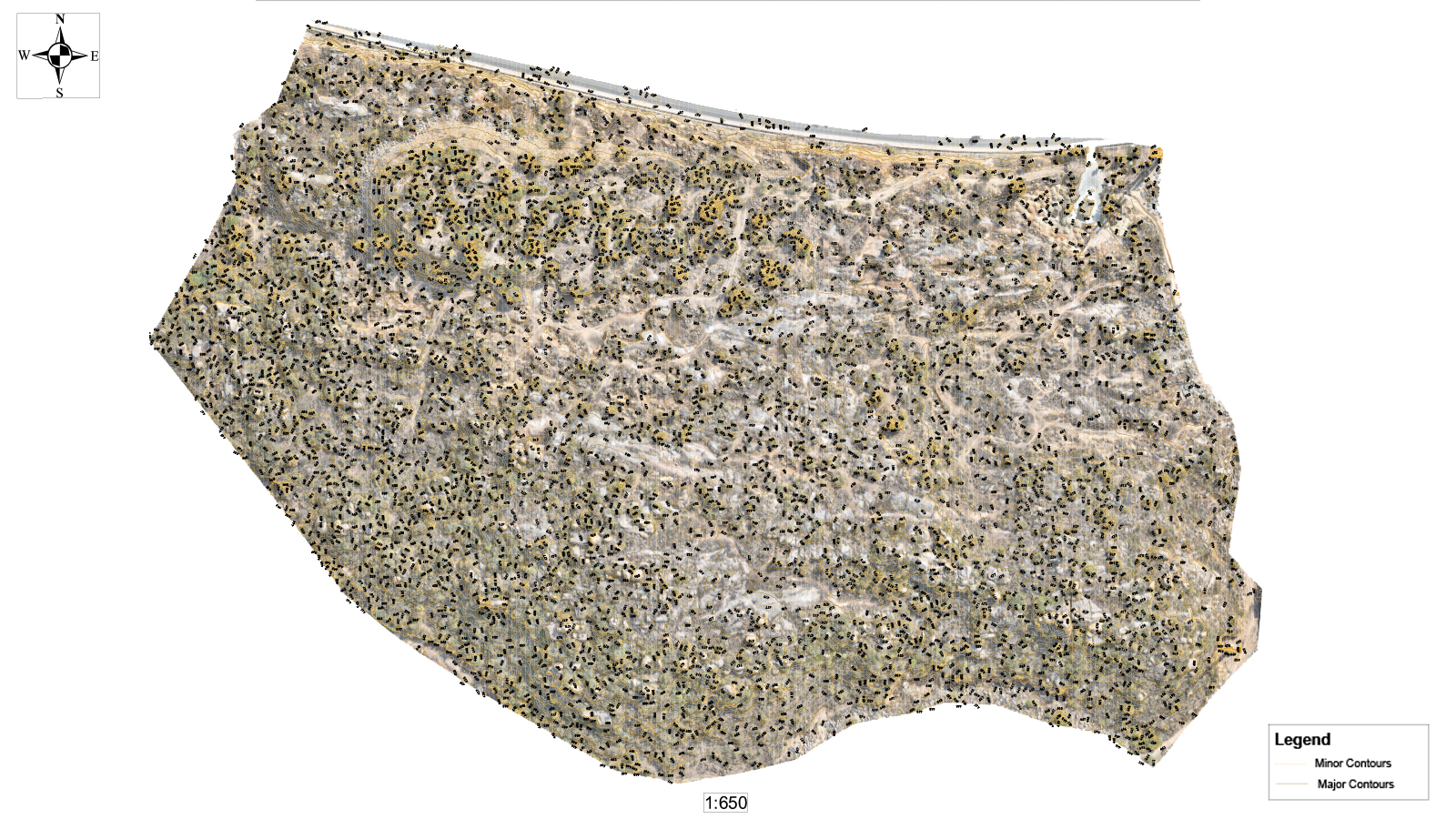
The benefits of generating DTMs, contour lines, and extensive stockpile analysis is that they help constructors keep track of material movement and follow compliance requirements. Generating them can quickly be done with aerial mapping using accurate photogrammetry software; in this case, Skytek Drones used PIX4Dmatic and PIX4Dsurvey. PIX4Dmatic is tailored for large scale mapping projects as well as corridor projects, which is ideal for bigger terrain surveys. Meanwhile, PIX4Dsurvey is a digital surveying tool that can convert point cloud data into CAD-ready files, as well as create measurements for volumes or contour lines.
The Skytek Drones team set out with a Mavic 3E RTK drone to gather data. Over the course of three flights, they gathered 3,880 images which were then imported to PIX4Dmatic.
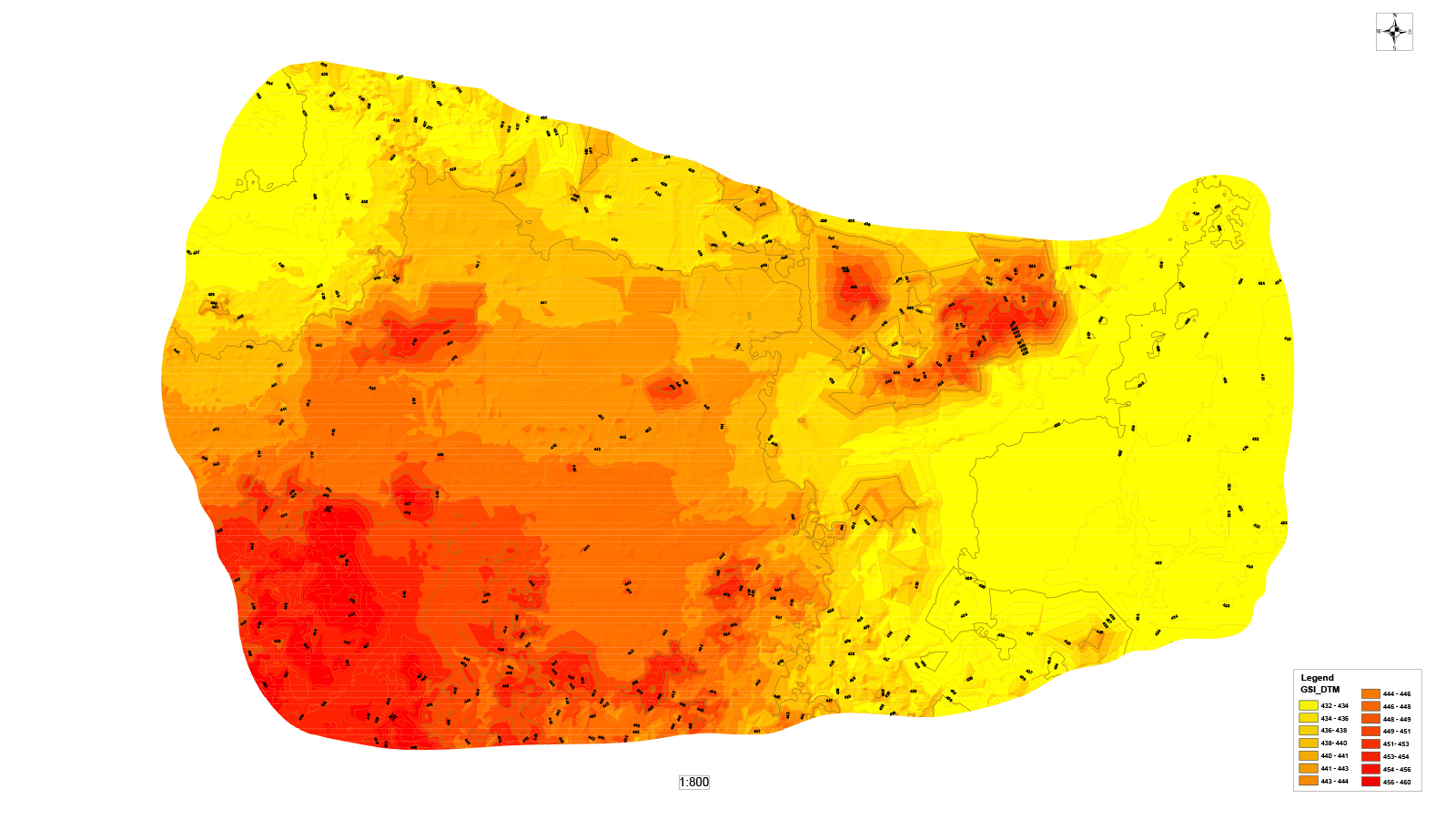
Processing with PIX4Dmatic converted the images and geolocation data into an orthomosaic as well as a point cloud which was then exported into PIX4Dsurvey. With PIX4Dsurvey, Skytek Drones’s team generated a DTM and measured the volume of stockpiles around the site. Finally, they mapped out the contours of the area, completing all of their results.
The benefits of drone surveying
The drone mapping workflow with PIX4Dmatic and PIX4Dsurvey saved the Skytek Drone team days of work. The results were entirely compliant with the Indian government's regulations and were generated faster than the clients had ever seen before. Skytek’s results were incredibly accurate, which also impressed the clients. With the drone surveys, the Skytek Drone team generated a GSD of 3.2 centimeters being represented per pixel which is a high level of detail.
"Pix4D’s results gave us the accuracy needed and saved us a lot of time in generating contour lines and measuring stockpile volumes. This process instilled confidence in our team to take on big projects and execute them with a quick turnaround time." - Nani Rayavarapu, CEO
Thanks to the government-mandated use of surveys, drone mapping is becoming more and more popular as a faster, more innovative surveying method. Skytek was able to demonstrate the benefits of photogrammetry with drones to their clients and save time with this technology. With this project in their portfolio, they can demonstrate their skills and services to new clients and expand their business reach.