
PIX4Dfields
Hybride Drohnen- und Satellitenkartierungssoftware für die Pflanzenanalyse aus der Luft und die Präzisionslandwirtschaft
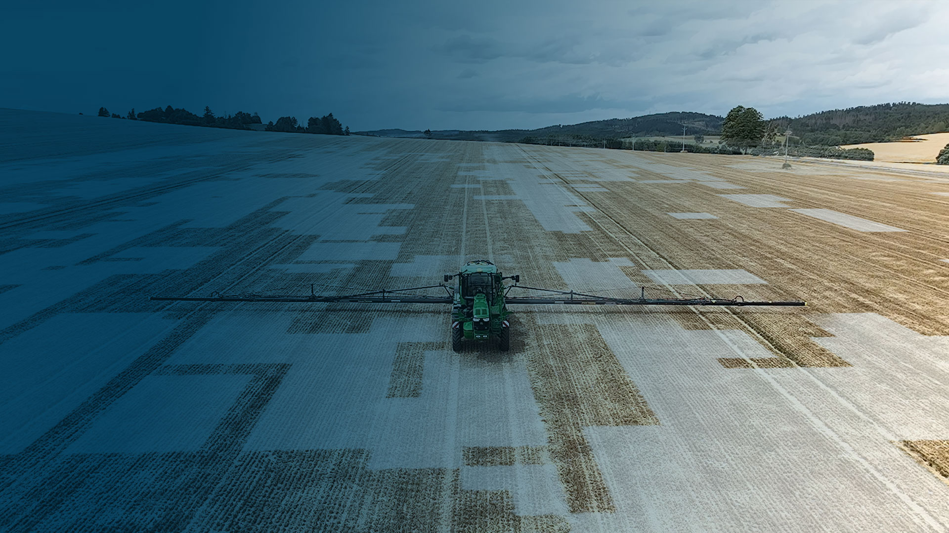
Sparen Sie Zeit und Geld: Landwirtschaftliche Betriebsmittel effizent einsetzen.


Verfügbar für Windows & macOS
Kompatibel mit Branchenführern
Gebrauchsfertige und anpassbare Karten für variable Mengen und Punktspritzungen für Sprühdrohnen, Traktoren und Feldspritzen.
ISOXML für Standard-ISOBUS-Maschinenterminals
Kompatibel mit


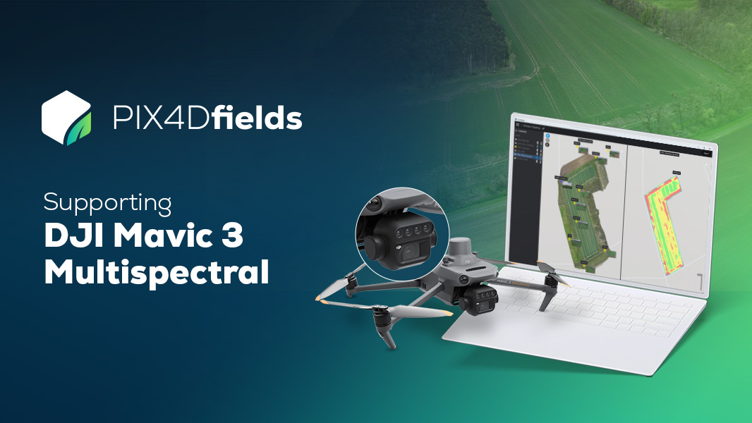
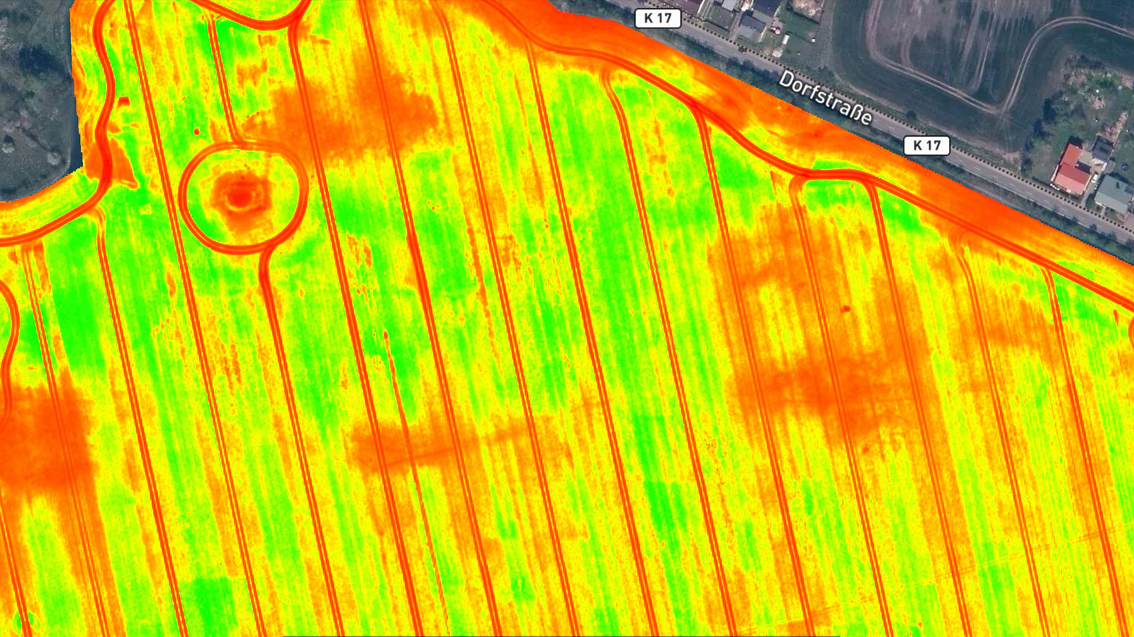
[DJI Mavic 3 Multispectral: Beispieldatensatz]
Pflanzenstress frühzeitig erkennen und Bestandsführung optimieren.
Testen Sie unseren Demodatensatz der DJI Mavic 3 Multispectral (Mavic 3M). Verarbeiten Sie die Aufnahmen direkt in PIX4Dfields zu aussagekräftigen Indexkarten (z. B. NDVI). Nutzen Sie präzise Daten, um den Ressourceneinsatz zu optimieren und fundierte Entscheidungen für Ihre Schläge zu treffen
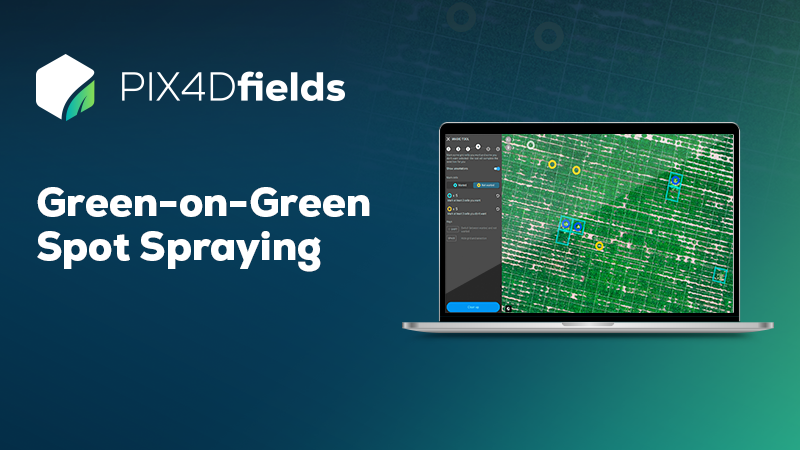
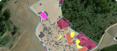
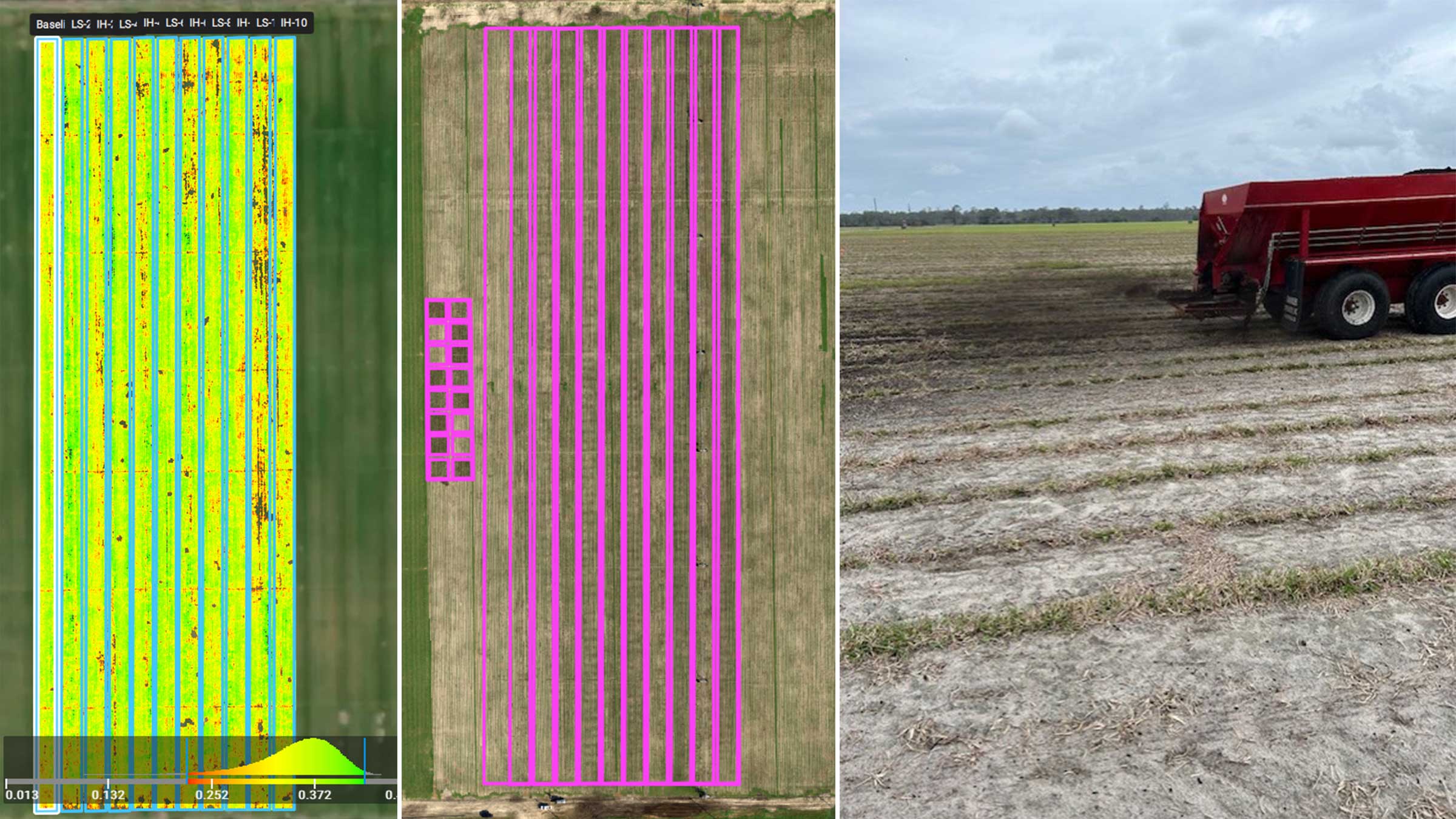
Datensatz für Grün-auf-Grün Spot-Spraying
Landwirten weltweit helfen, Kosten zu sparen
Testen Sie selbst einen Green-on-Green Demo-Datensatz! Verarbeiten Sie ihn mit PIX4Dfields und erleben Sie, wie Sie mit dem Magic Tool Unkräuter im Bestand sofort erkennen. Erstellen Sie im Handumdrehen eine einsatzbereite Applikationskarte für die gezielte Herbizidausbringung
<a href='https://www.pix4d.com/pix4dfields-helping-farmers-worldwide-save-money/' class='btn btn--primary' style="font-size: 18px">Jetzt herunterladen</a>
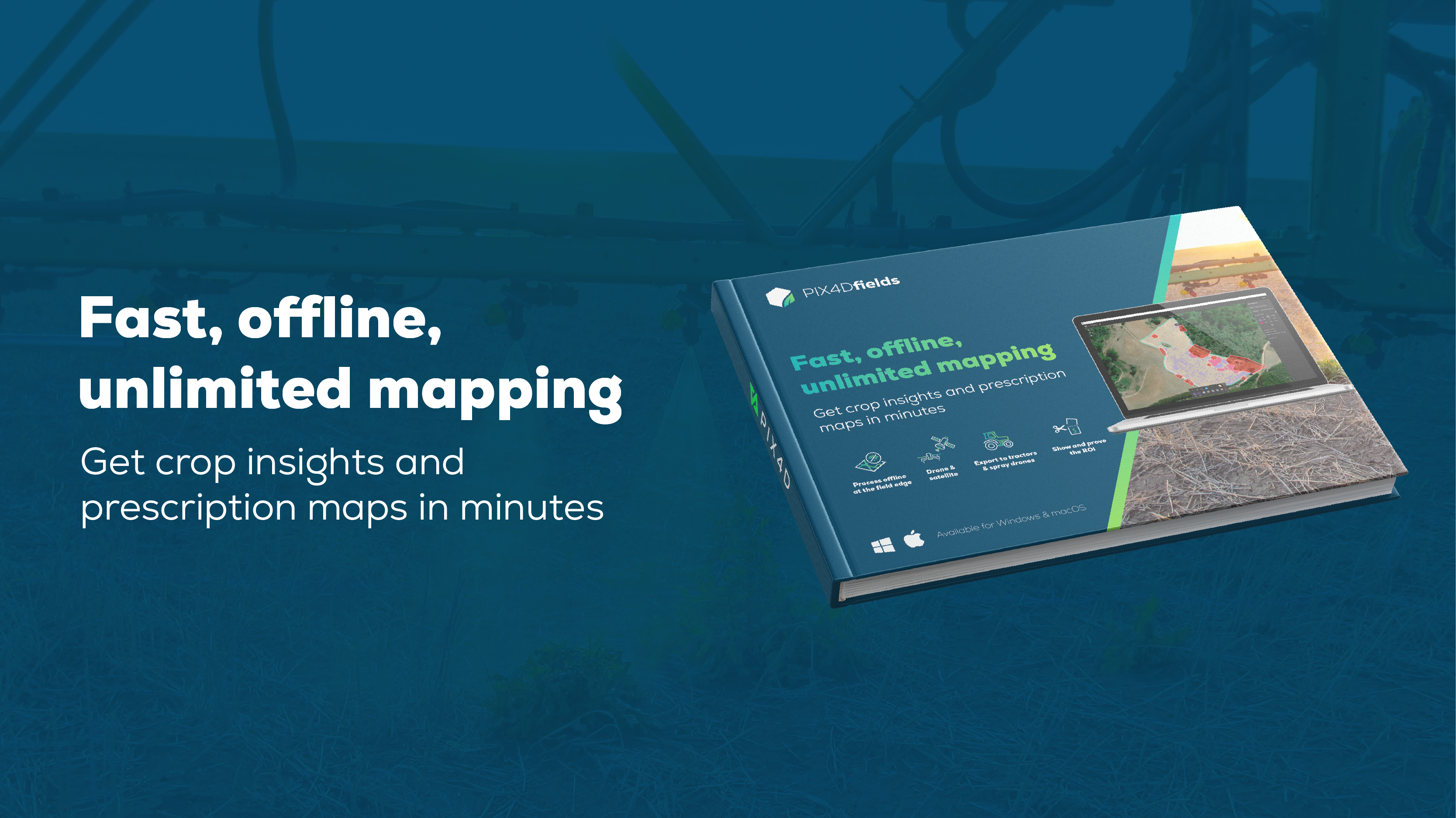
Schnell, offline, unbegrenzt kartieren
Ernteeinblicke und Rezeptkarten in wenigen Minuten
Entdecken Sie, wie PIX4Dfields die Präzisionslandwirtschaft verbessert, indem es Bilder (Drohnen- und Satellitenbilder) in Minutenschnelle in Rezepte und Erkenntnisse umwandelt. PIX4Dfields ist auf Schnelligkeit ausgelegt und ermöglicht eine vollständige Offline-Verarbeitung auf dem Gerät am Feldrand.
Jetzt herunterladenErstellen und verwenden Sie Applikationskarten direkt mit Ihren Maschinen - keine Software von Drittanbietern erforderlich
Das ultimative landwirtschaftliche Werkzeug.


Prüfen Sie hier, ob Ihre Drohne unterstützt wird
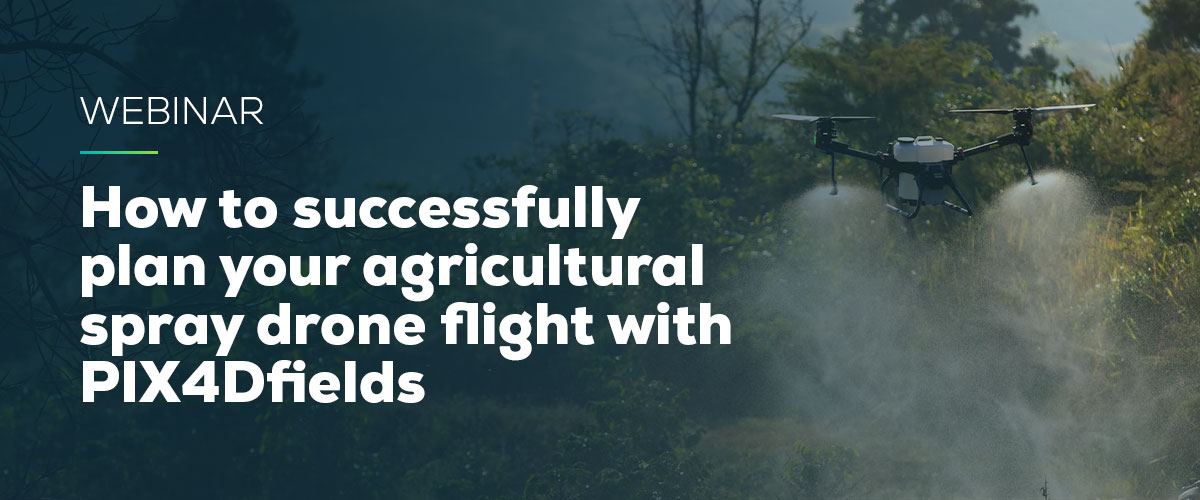
WEBINAR
How to successfully plan your agricultural spray drone flight with PIX4Dfields
Join us for a discussion on how to use PIX4Dfields RTK field boundaries and obstacle editing for spray drone applications, and talk about the importance of ensuring an efficient and profitable flight.
Watch now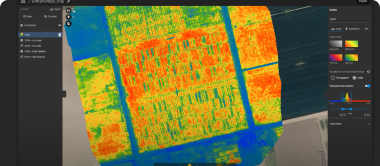
 Schnelle Verarbeitung - Genaue Verarbeitung
 Indizes generieren
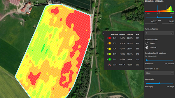
 Zonieren und verschreiben
 Messen und annotieren
 Magisches Werkzeug
 Gezielte Operationen/Rezeptkarten
 John Deere Betriebszentrum

„PIX4Dfields ist einfach zu bedienen und bietet viele Anwendungsmöglichkeiten. Es wird ständig mit neuen, nützlichen Funktionen aktualisiert, die einen zusätzlichen Mehrwert bringen.“
Digital Agro
„Ich war einfach beeindruckt von der Geschwindigkeit der Verarbeitung. Ich kann offline arbeiten, so dass ich Fotos mit der Drohne machen und sie vor Ort verarbeiten kann. Ein weiterer wichtiger Punkt ist, dass es sogar auf einem PC mit niedrigen Spezifikationen verwendet werden kann.“
Northern Innovation
„PIX4Dfields ist die einfachste und praktischste Software, um Rezepte auf Basis von Pflanzengesundheitskarten zu erstellen. Wir verwenden die Software, um Anwendungen mit variabler Rate auszuführen, was wir als erste in der Türkei erreichen.“
Paksoy Technische Lösungen
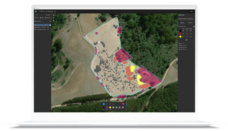
Erstellen und analysieren Sie Karten Ihrer Kultur in Echtzeit, um Ihren landwirtschaftlichen Arbeitsablauf zu verbessern.
Bonitieren Sie Ihren Betrieb auf einfache Weise und generieren Sie den passenden Export für Ihre Bedürfnisse, siehe PIX4Dfields Outputs
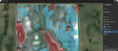
Anwendungsfälle für Smart Farming
Richtung nachhaltige Landwirtschaft: Kostenersparnis bei der Düngung
Die Gesetze Floridas koordinieren die Entwicklung von Wasserressourcen; Schutz, Erhaltung und Wiederherstellung von Ressourcen unter Berücksichtigung der Qualitätsanforderungen.
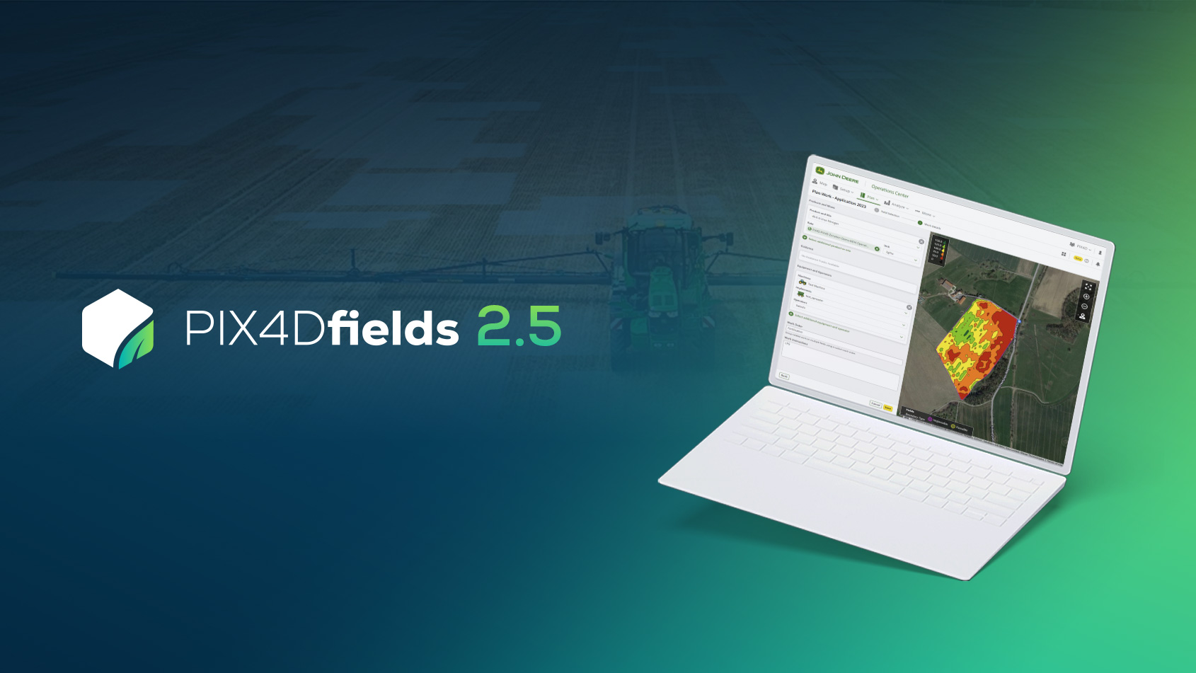
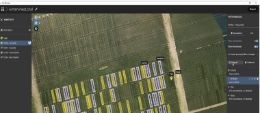
PIX4Dfields 2.5: Integration mit John Deere und ISOBUS-Export!
PIX4Dfields 2.5 bietet Ihnen Integration mit dem John Deere Operations Center, das landwirtschaftliche Datenformat ISOXML, erweiterte Zonierung und mehr.
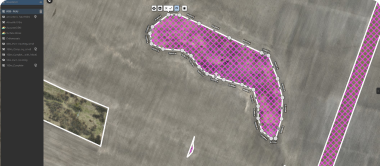
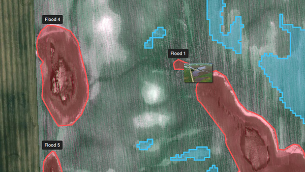
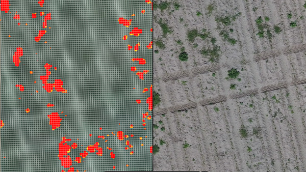
Bewertung von Schäden an Feldfrüchten auf einem Bauernhof mit PIX4Dfields
Die Überwachung von Feldfrüchten und die Bewertung von Schäden mit genauen Felddaten trägt zur Verbesserung der Ernteerzeugung in betroffenen Gebieten bei und verhindert Ernteverluste.
Erfahren Sie mehr über die Anwendungsfälle von PIX4Dfields oder melden Sie sich für unseren Newsletter an.