
PIX4Dfields 2.5: John Deere integration and ISOBUS export!
Aerial maps to your John Deere tractor
PIX4Dfields quickly processes high-resolution drone and satellite images, allowing you to create prescription maps in minutes. These maps can be directly sent to your machinery for agricultural applications.
No more USB sticks needed! You can now upload your field boundaries, aerial maps, and crop health and prescription maps for variable rate applications and spot spraying directly to your John Deere Operations Center account. Get a unique, seamless workflow and save money, time, and resources with just your John Deere machinery and PIX4Dfields!

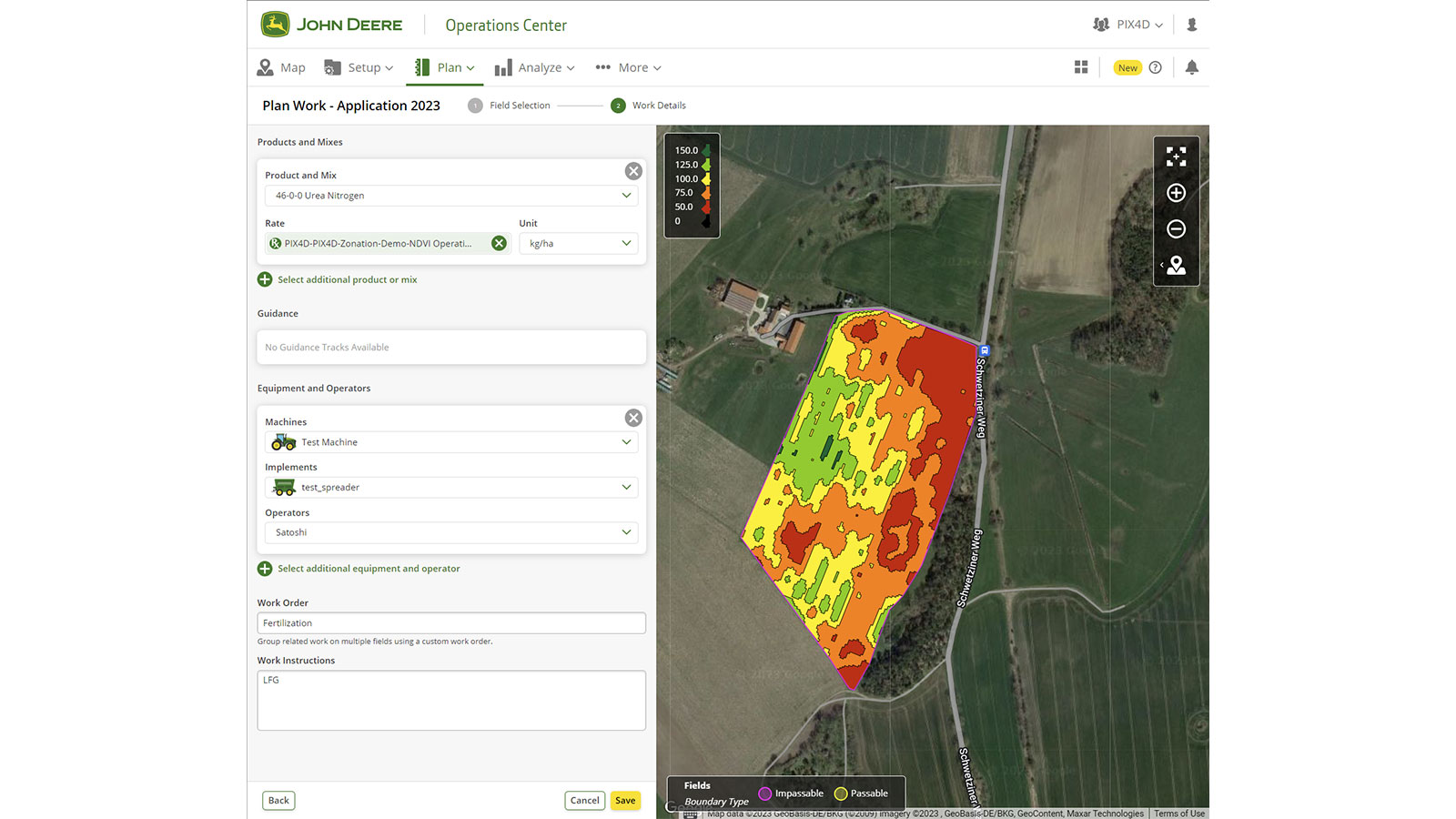
Learn more in our PIX4Dfields support article.
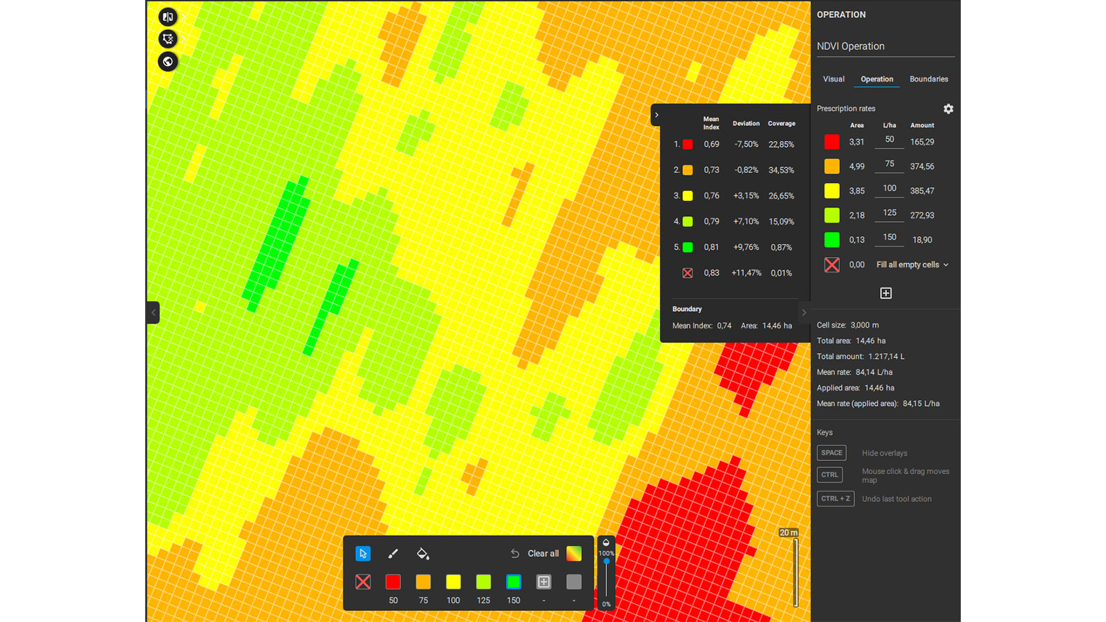
Targeted Operations - variable rate application maps for spray drones and tractors
Could your agricultural applications get even more precise? PIX4Dfields’ Targeted Operations allows you to target your crops with the right amount of inputs and only where needed, increasing operational efficiency. Create prescription maps based on vegetation indices data to use with your tractor or spray drone.
The new zonation feature is located within Targeted Operations and operates on a fully configurable prescription grid similar to the Magic tool and the existing Targeted Operation workflows. Simplifying vegetation index data for agricultural machines, you now have full control over the number of zones (1 to 7), zonation algorithm (linear and quantile interval), selection of areas based on the amount of visible pixels per cell, level of detail per zone, and manual editing functionalities.
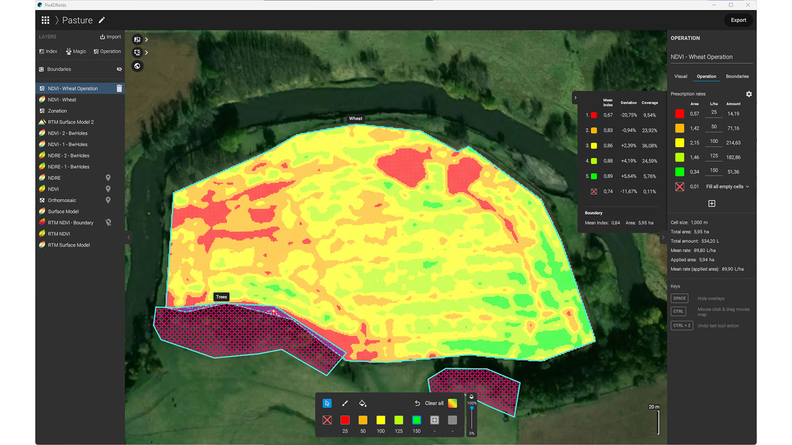
This new update allows you to create variable-rate prescription maps with obstacles and no-spray zones. This allows your machine to identify the designated no-spray zones that you defined while editing your prescription map in PIX4Dfields. Prescription maps with embedded strip trials to test different crop varieties or treatments are also now possible.
And to make spot spraying even easier, you can now create green-on-brown large-scale spot spraying maps based on vegetation indices. Save up to 90% of inputs and know your exact savings before the application. No need to worry about additional equipment; you get all maps, including green-on-brown spot spraying maps, in PIX4Dfields. Export them directly from PIX4Dfields to your tractor, spray drone, or field sprayer.
Learn more in our PIX4Dfields support article.
ISOBUS compatibility - PIX4Dfields maps directly applicable from your machinery
ISOXML is a standardized data exchange format designed to facilitate interoperability between agricultural equipment and software from different manufacturers. It was developed under the ISO 11783 standard, also known as ISOBUS, which defines communication protocols for electronic systems used in agriculture. When PIX4Dfields exports prescription maps in ISOXML format, it packages the necessary information in a way that is compatible with equipment that supports the ISOBUS standard.
The latest update offers compatibility with terminals from brands like Case, New Holland, AGCO, Trimble, ClAAS, Amazon, CCI, Müller, Topcon, Deutz-Fahr, Valtra, Kubota, and more!
Learn more in our PIX4Dfields support article.


