
PIX4Dfields 2.2: the Magic tool - spot spraying made easy
PIX4Dfields 2.2 offers the Magic tool, an AI-assisted selection tool to quickly detect and select weed nests, damage, and other anomalies in orthomosaic and index layers (exportable as Shapefile, GeoJSON, KML and PDF report). Now, thanks to the new "Magic tool", farmers can achieve major savings for crop care inputs like herbicides, fungicides and growth regulators with spot spraying applications.
What is the Magic Tool?
The Magic tool is straightforward to use. It is powered by a machine learning algorithm developed by Pix4D that works offline and in the field. Using it can save a significant amount of resources for treatment applications by specifically identifying problem areas and helping the farmer plan spot-spray or spot-treatment applications.
How does the Magic tool work?
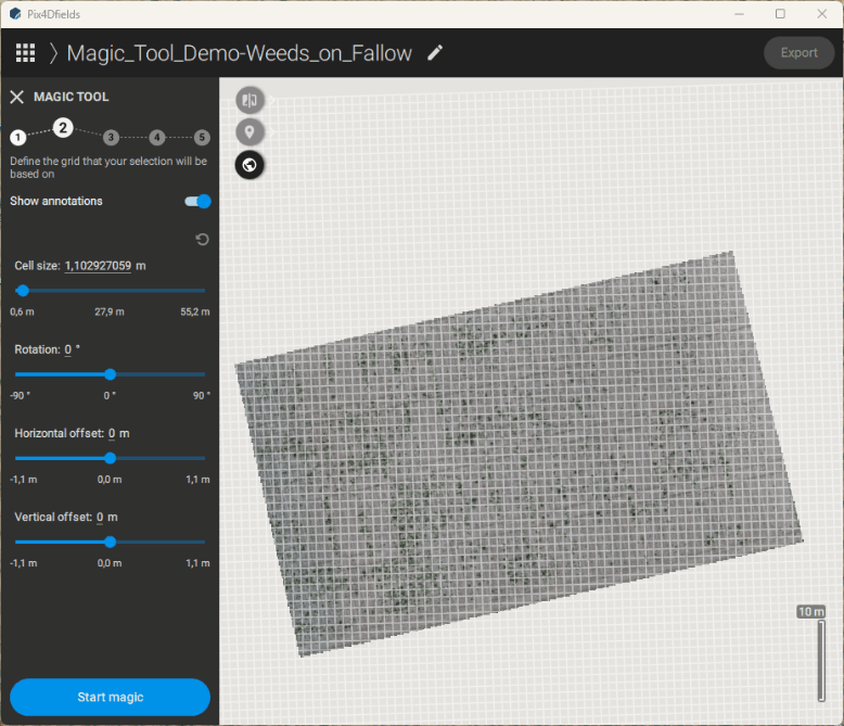
We have created a dedicated YouTube tutorial to explain how the Magic tool works. Essentially, the feature works on a user-defined grid and classifies each grid cell according to the underlying layer information based on two different labels given by the user. In the case of a spot spraying application, one label indicates an example area to be spot sprayed while the other label is of an example area where no treatment needs to be applied. The Magic tool can then identify all areas based on these two given labels and provide the user with a high accuracy prescription map in under 10 minutes. This map can be used for herbicide spot spraying, with input savings potentials of up to 80%.
By targeting the right areas at the field, it is possible to eliminate weed competition and prevent weeds becoming herbicide resistant.
With the Magic tool, users can also accurately measure & quantify areas of the field for crop protection, insurable damage (animal damage, wind lodging, green snap, fire damage), fertilizer application and planting or sowing applications. The result can be exported as a Prescription Map for targeted spraying applications, Annotation or PDF Report.
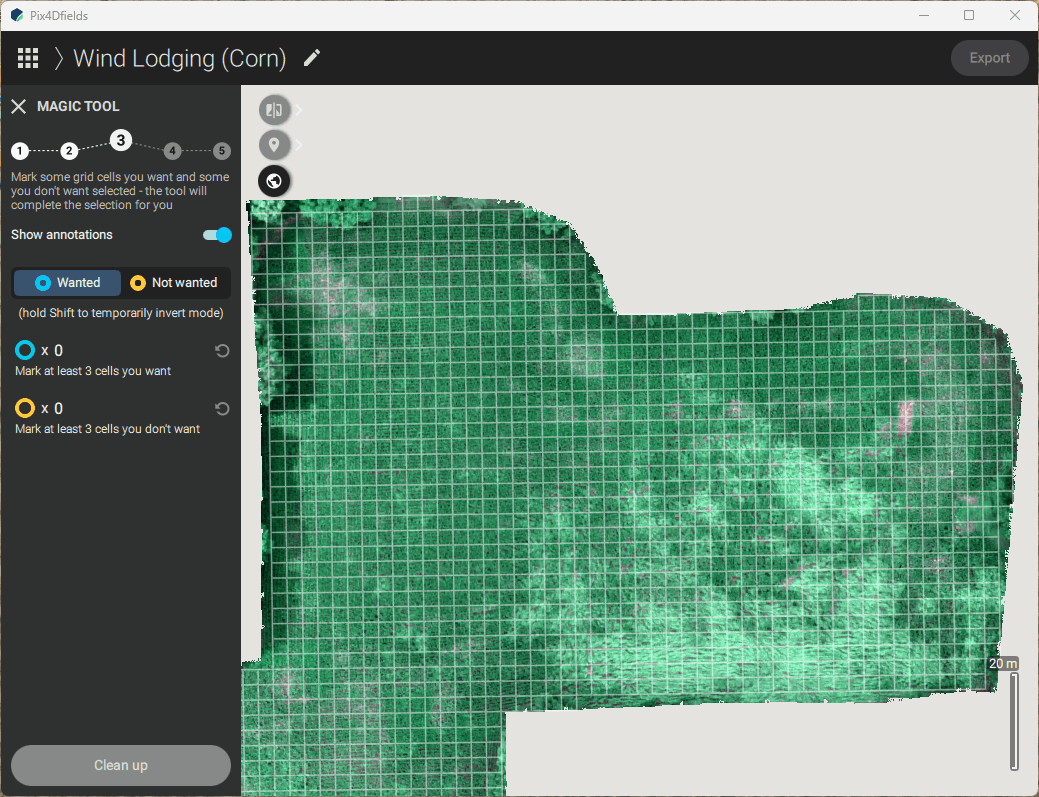
The Magic tool detects affected areas in the fields in minutes. Total area affected can be quantified and exported as a PDF report for insurance claims.
Check out the PDF report for the wind lodging analysis
PIX4Dfields continues to develop precision agriculture technology
PIX4Dfields is designed to use data and knowledge to improve farming practices. Whether you want to identify invasive plant species or quantify damage after a flooding or animal event, the Magic tool can tell you more about your field. Even better, its results can be directly exported to your machinery to deal with weeds and other problems immediately. This is a perfect example of Smart Agriculture, where high-resolution drone imagery and AI algorithms are leveraged to promote more eco-friendly farming practices and help save money and resources.
More information on this release and about PIX4Dfields is available on our Support site. You can also check out our PIX4Dfields demo projects to explore how the software works and how it could help you!


