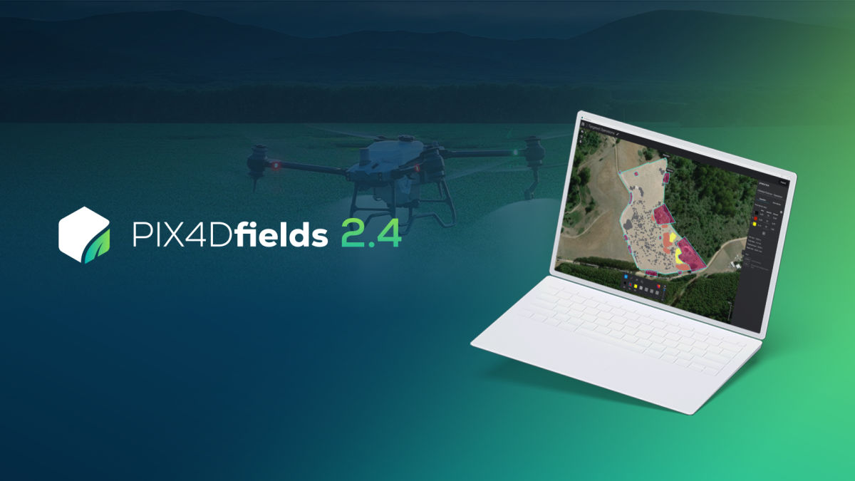
PIX4Dfields 2.4: targeted spraying for precision agriculture
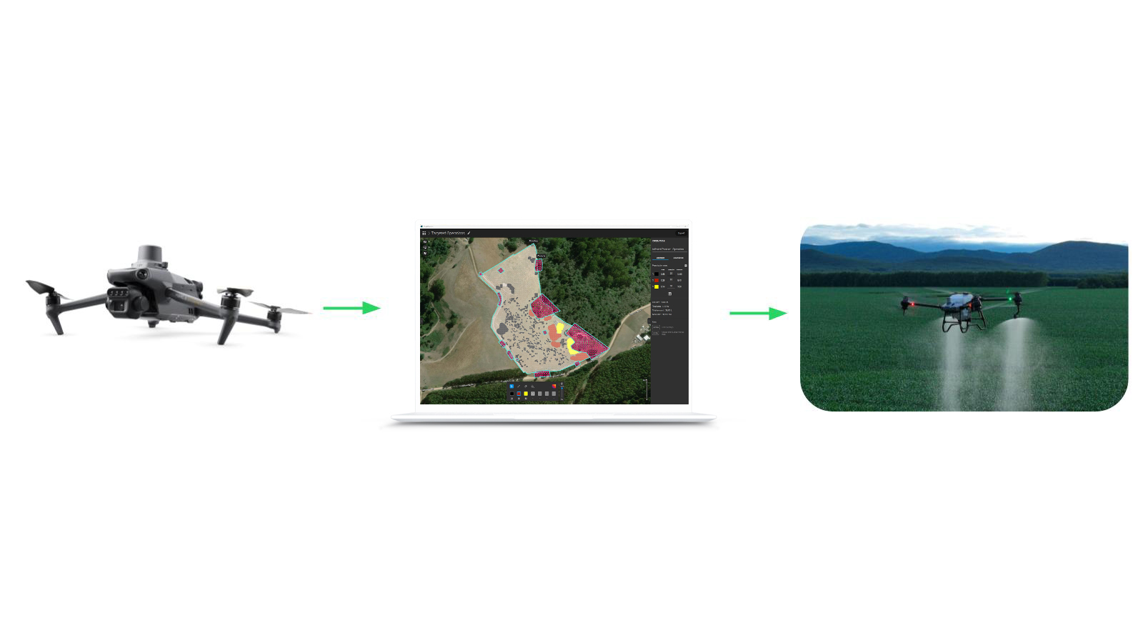
PIX4Dfields 2.4 brings you Targeted Operations, a seamless and cost-effective workflow for precision agriculture applications and spot spraying. Get ready-to-use and highly customizable variable rate and spot spraying prescription maps for spray drones, tractors, and field sprayers. Start with an automatically generated map, adjust rates using painting tools, and then export to the format you need.
What is Targeted Operations?
PIX4Dfields now offers you a streamlined workflow for your precision application scenarios. Targeted Operations creates highly customizable prescription maps for variable rate or spot spraying applications. You can use these directly with your spray drone, tractor, or field sprayer.
With Magic Tool as a foundational building block, this workflow is unrivaled for Precision Application use cases and primed for the future of autonomous machinery in the field. Maximum flexibility and customization, with full compatibility for DJI Agras and XAG spray drones. Achieve variable rate and spot spraying with obstacle marking for more efficient and safer flight routes.
How does Targeted Operations work?
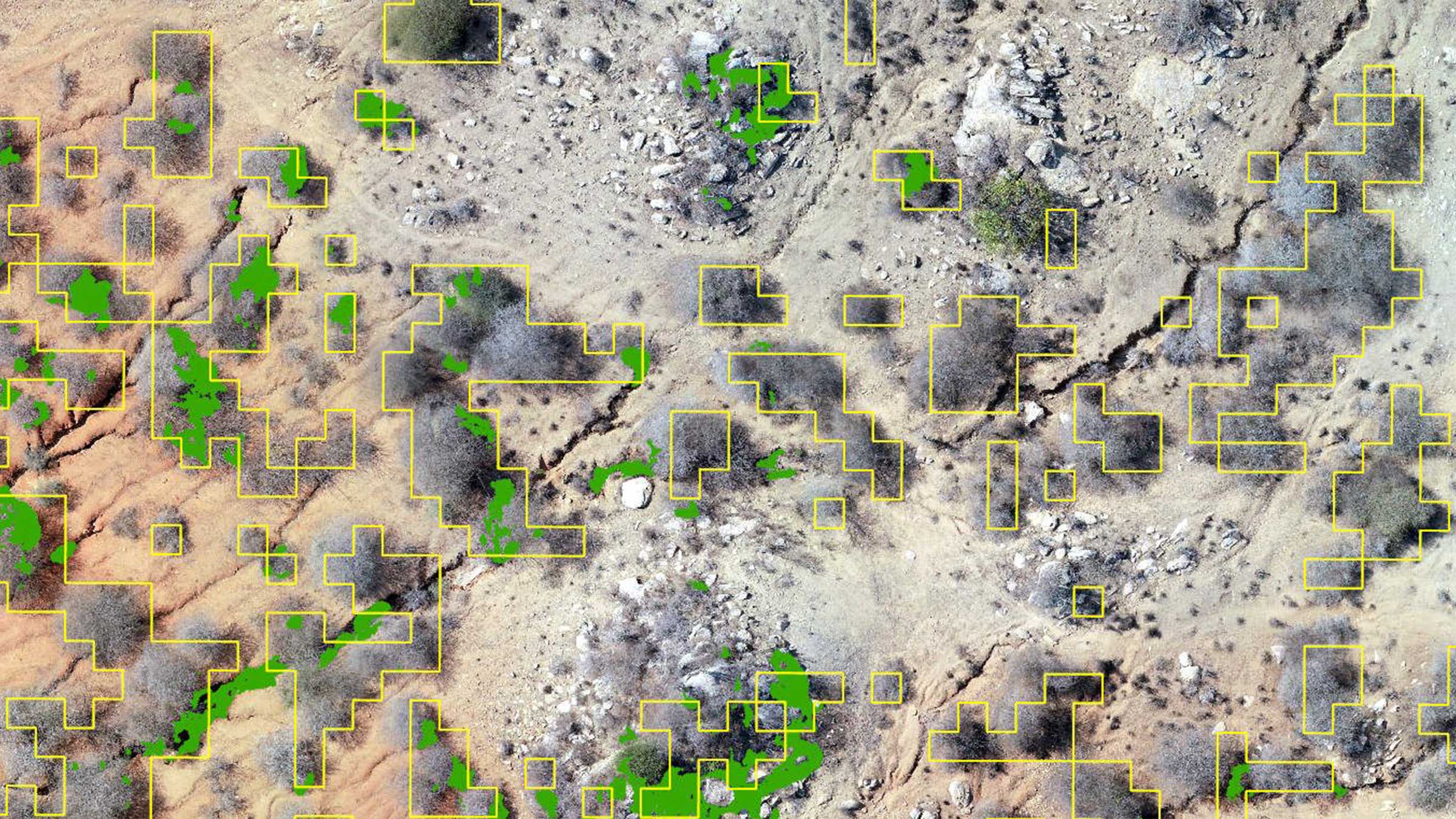
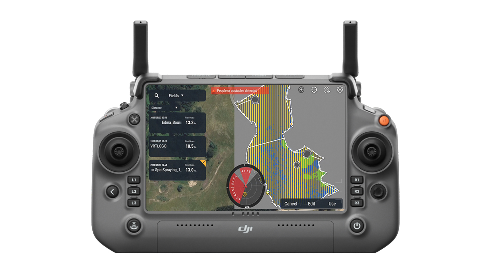
First step is to create your field’s boundaries as well as draw and define areas on your field as obstacles.
Then you can create an “Operations’’ layer, which could be based on an Orthomosaic or Index layer. With your boundary and obstacles, you define the outline of your application area. Now you can either use the automatic detections from Magic Tool or manually draw your application zones.
You can use various tools on the Targeted Operations layer to create and fine-tune up to 7 different rate zones. Obstacles will be recognized as non-passable areas for spray drones and tractors. Areas within your field boundary without any rate assigned will be no-application areas, however, your machine will be able to pass through.
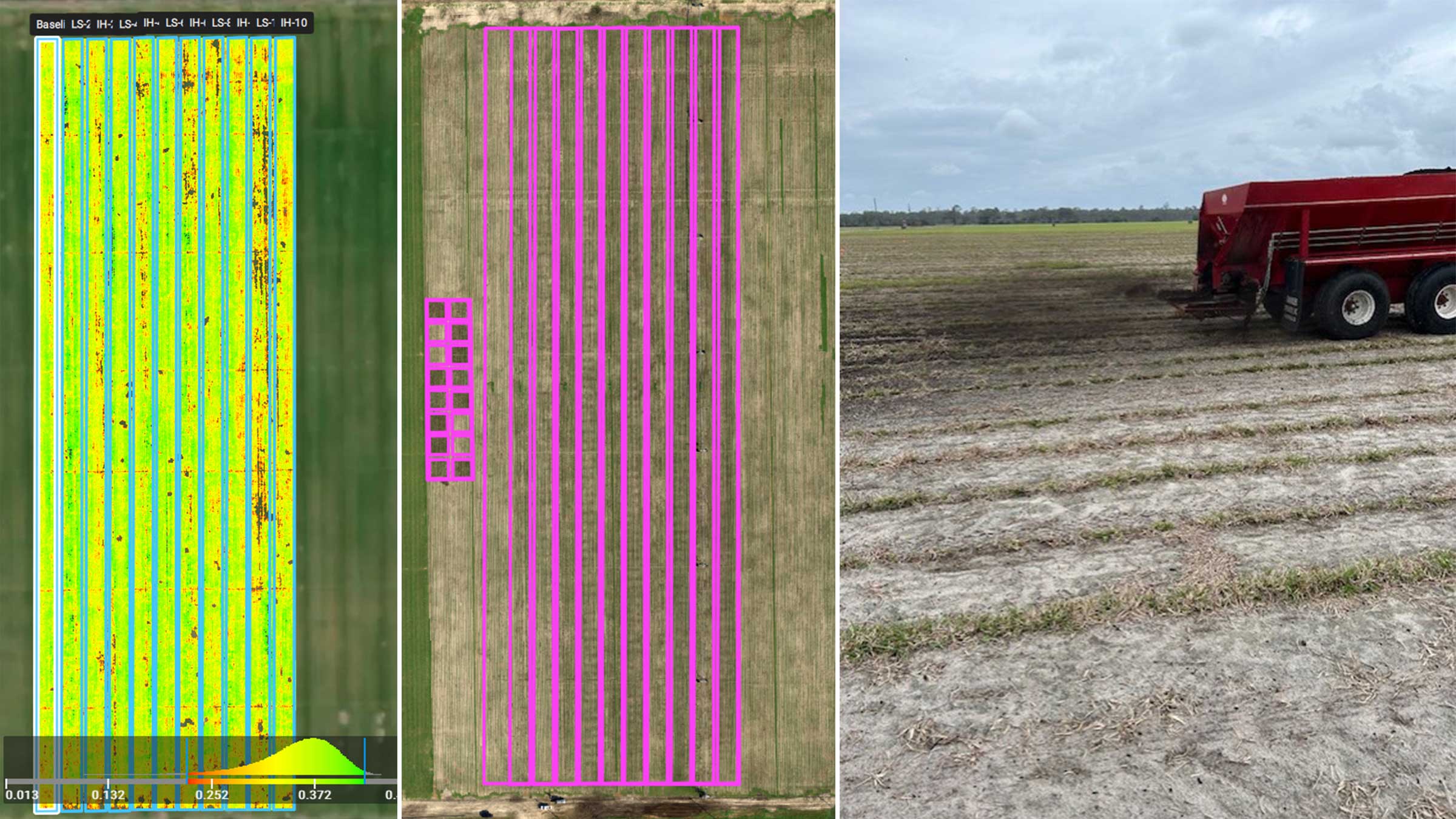
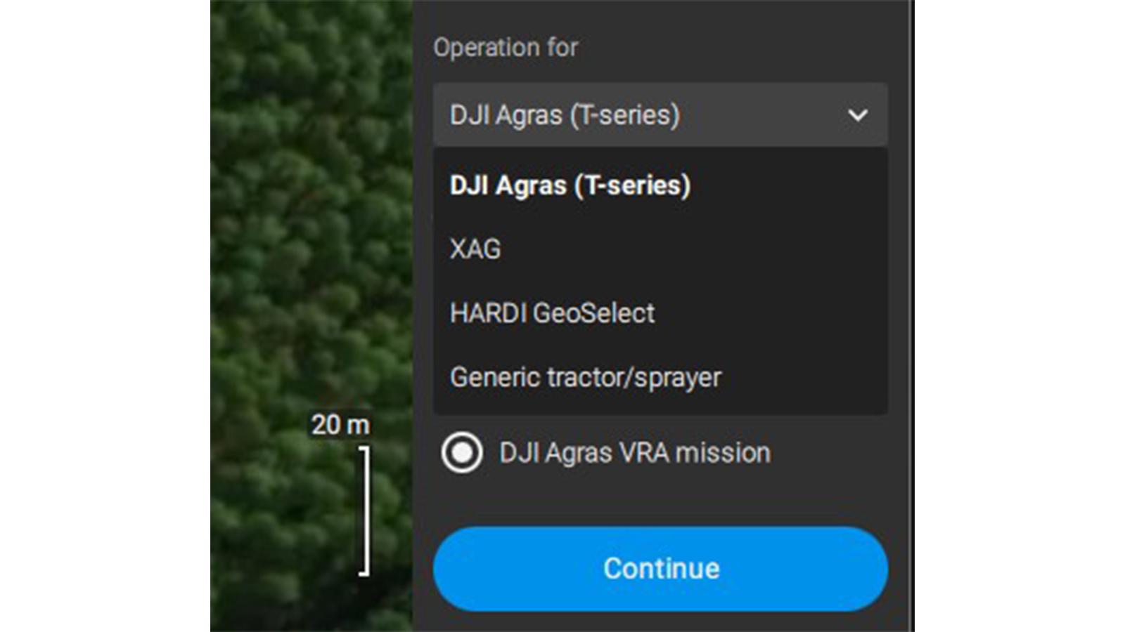
And now the exciting part has come, time to export your Targeted Operations layer to your spray drone, tractor, or field sprayer. Select an export format via the top right Export Button. Different options include XAG and DJI Agras Spraydones with support for variable rate and spot spraying missions. Export as a HARDI Geoselect compatible .tiff file is also possible, as well as shape and geotiff files for a wide range of tractor terminals. Say goodbye to unnecessary spraying and hello to saving time and resources with PIX4Dfields’ unique Targeted Operations workflow.
Learn more in our PIX4Dfields support article.
A unique targeted applications workflow for agriculture
Are you wondering how to save time and costs while increasing farm revenue? PIX4Dfields’ new Targeted Operations workflow is here to help you maximize efficiency with an optimized input of fertilizers, herbicides, and pesticides, increase yield potential and farm productivity, and actively contribute to agricultural sustainability by reducing the environmental impact of your farming operations.