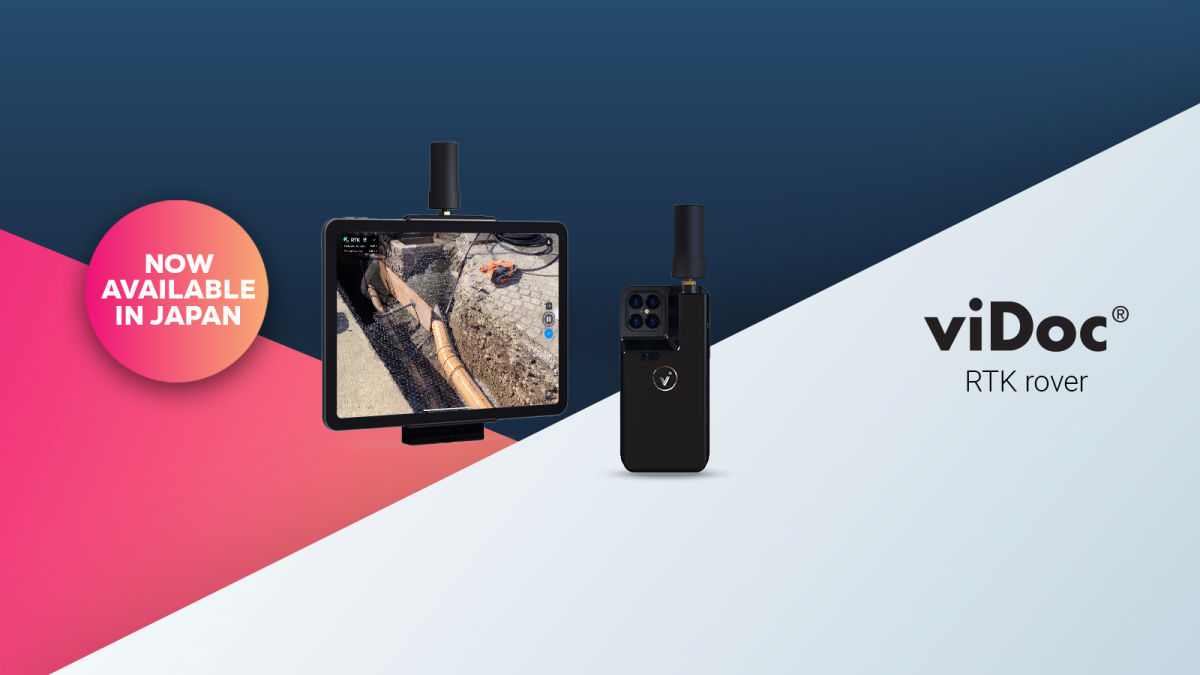
Pix4D launches viDoc RTK rover in Japan
The viDoc is a handheld device used in construction, emergency response, and public works. Sale of the device will be managed via official Pix4D resellers in Japan.
The viDoc RTK rover pairs with Pix4D’s free mobile app PIX4Dcatch to gather images for terrestrial site scans. The rover pairs with Pix4D’s free mobile app PIX4Dcatch to gather images for terrestrial site scans. viDoc is a handheld case with an RTK antenna that attaches to the outside of iPhones or iPads. When used with the appropriate device, the complete dataset includes RTK data, images, and LiDAR points from the sensors built into certain iOS models. This means that everyday consumer devices are transformed into accurate terrestrial scanning devices with accuracy to within 5 centimeters.
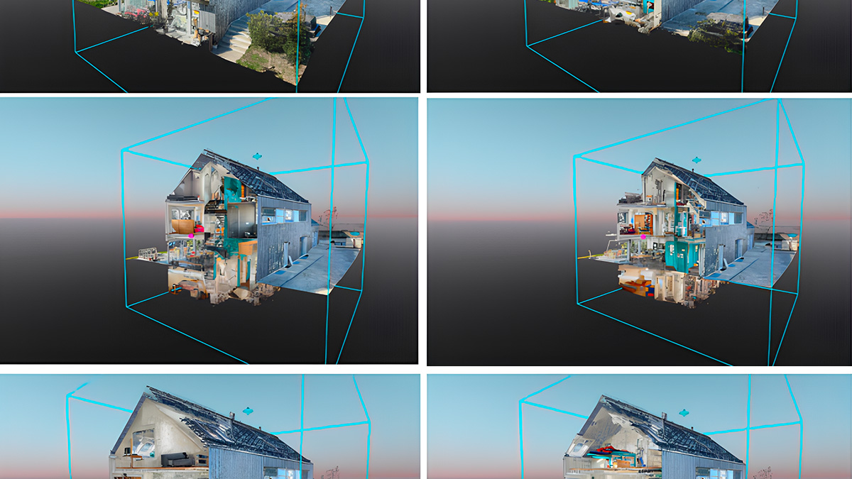
German company viGram was the creator of the viDoc, and it is exclsuviely sold by Pix4D outside of Germany. The partnership between viGram and Pix4D meant that the hardware was specially designed to interact with the Pix4D software suite. Together, the hardware and software collect geolocational data as well as photos. The results can be processed with other Pix4D products, including desktop solutions PIX4Dmapper and PIX4Dmatic, or the online platform PIX4Dcloud. The outputs include point clouds and 3D models that can be annotated, measured, and shared. With PIX4Dmatic, users can choose between using LiDAR and photogrammetry point clouds, or merging the two together.
“We have already seen success with the viDoc in the wider APAC region, with a case study in Singapore showing it made construction site surveys for pipe laying more efficient by 30 - 50%,” explains Matteo Gismondi, head of Pix4D Tokyo. “We can’t wait to demonstrate this device to our network at the Pix4D Tokyo User Conference on June 24th.”
The viDoc RTK rover will be sold through official Pix4D partners and resellers in Japan, and is natively integrated in the Pix4D software suite. With PIX4Dcatch, the viDoc combines the power of photogrammetry, LiDAR, and RTK accuracy to provide 3D terrestrial site data.