Swift action: the importance of drones in disaster response
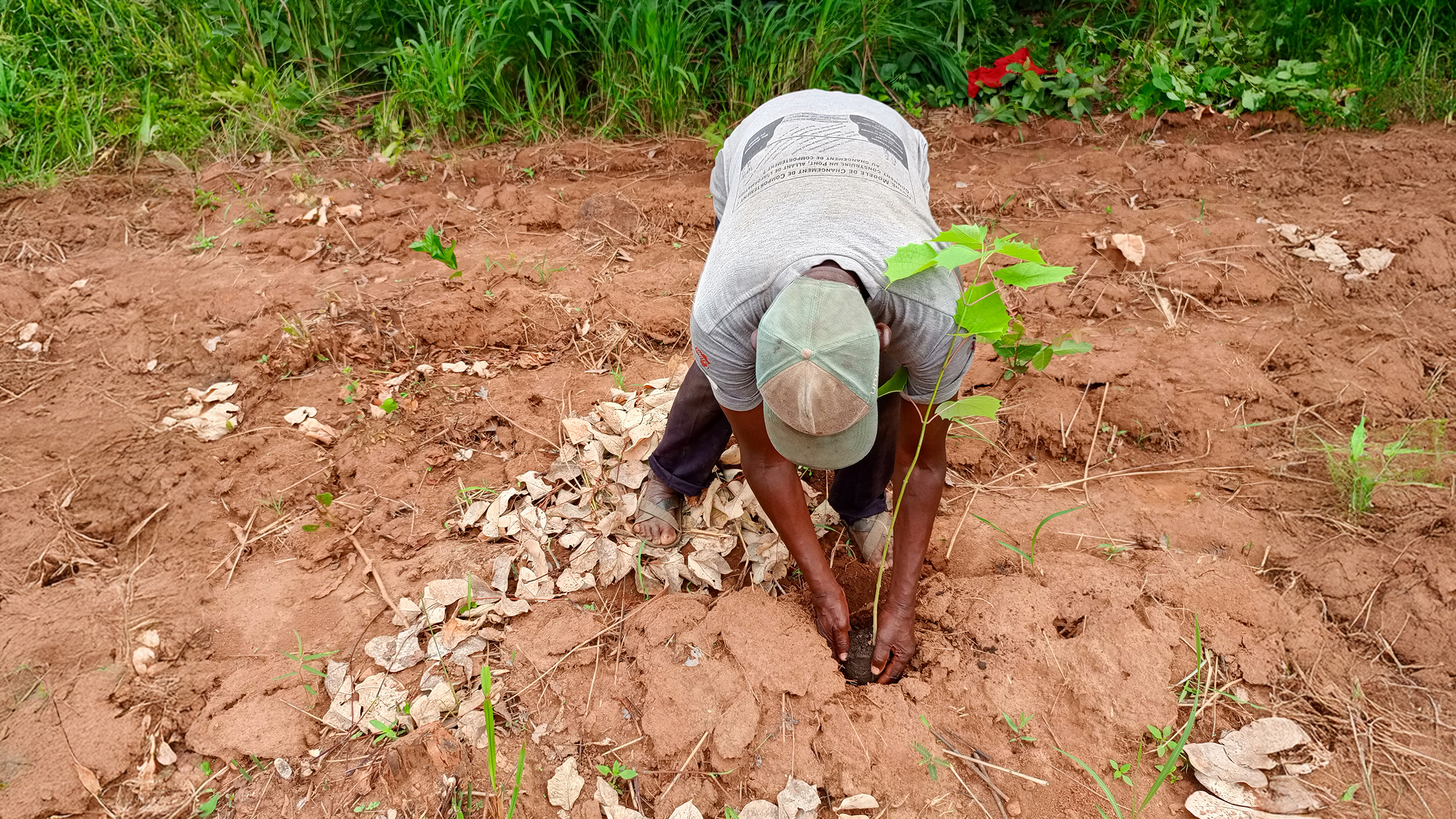
Natural disasters like earthquakes, floods, and forest fires can cause serious damage to buildings and infrastructure. Being able to rapidly identify these buildings is crucial for effective response, rescue work, public safety, and reconstruction planning. In the event of a disaster, every minute counts, and the faster the authorities detect the collapsed buildings by performing change analysis, the faster they can respond to the situation. Drone images are an extremely effective means of getting quick results.
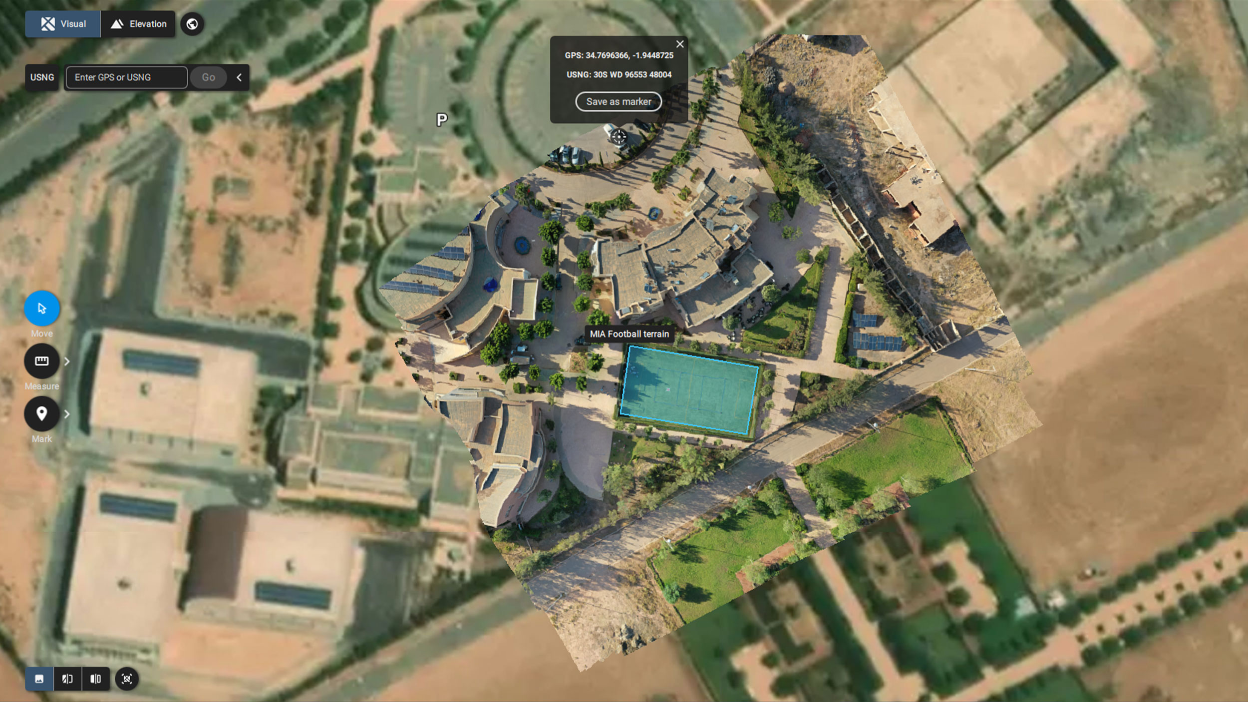
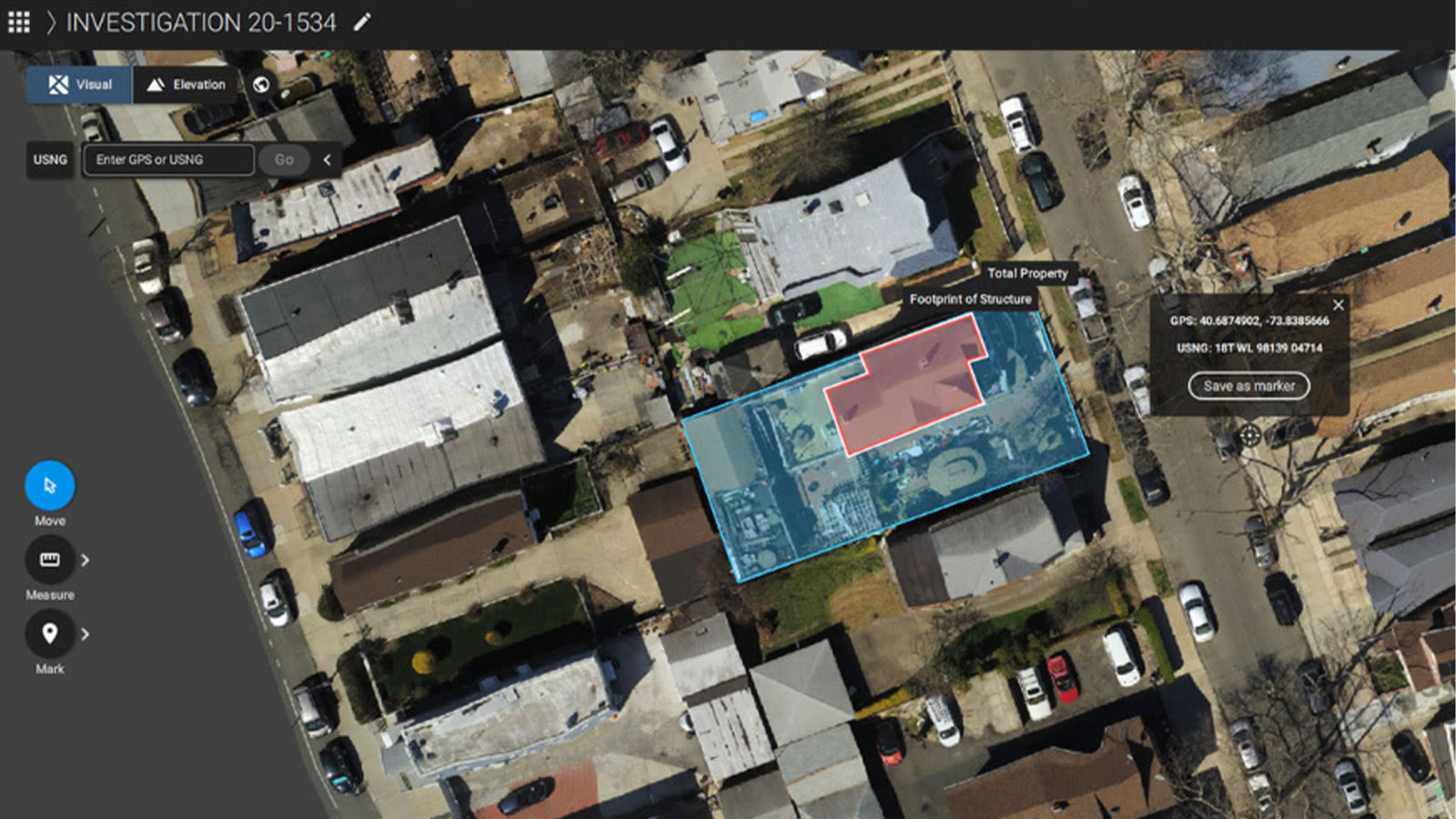
PIX4Dreact is a simple and intuitive fast-mapping desktop software that rapidly processes drone-captured images into accurate 2D maps without the need for an internet connection. The use of drones to capture images from a safe distance, along with its speed and efficacy, makes PIX4Dreact an ideal choice for improving situational awareness and providing critical information in stressful and complex emergency situations.
The Kahramanmaraş-centered earthquake.
On February 6, 2023, an earthquake with a magnitude of 7.8 struck Turkey and Syria. It was the strongest earthquake in Turkey for more than 80 years, and there was widespread destruction in over 11 provinces. Around 9 hours later another earthquake of the same magnitude hit the region, leading to a devastating humanitarian disaster.
Photogrammetry for public safety and disaster response
Based in Ankara, Turkey, Atay Mühendislik is a premium partner of Pix4D. They have been offering technological and photogrammetry solutions since 1995. In addition to sales, they have tested their hardware and software across a wide range of industries, successfully engaging in projects spanning crime scene investigation, disaster response, surveying and restoration, and agriculture.
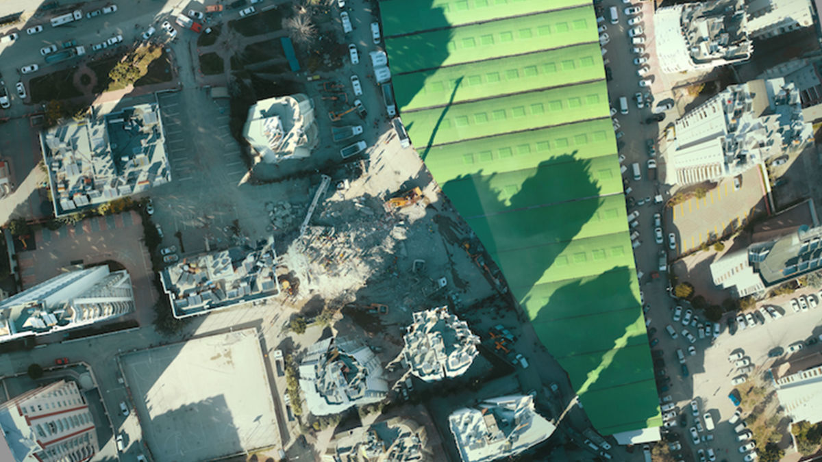
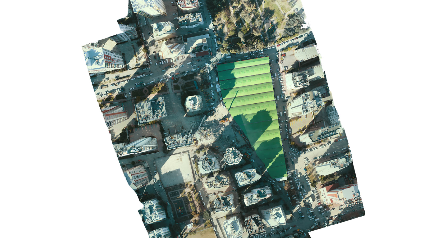
The importance of drones and rapid mapping came to the fore for Atay in the wake of the Kahramanmaraş-centered earthquake. In the aftermath of the earthquake, the Atay team used PIX4Dreact to assist with recovery efforts, by gathering data in collaborating with local authorities and respecting the privacy and safety regulations of the area. They managed to quickly map the disaster zone. The collected data was processed in minutes, an orthomosaic was produced, and Atay could quickly offer valuable information to disaster response and rescue teams.

How drones help with disaster response
The experience with PIX4Dreact, helped the Atay team identify ten critical uses for drone mapping and photogrammetry in emergency response situations.
1- Rapid assessment and situational awareness: Drones efficiently survey affected areas with real-time imagery, and aid emergency responders and authorities in making better decisions and allocating resources.
2- Safety and accessibility: In the aftermath of an earthquake, some areas may be inaccessible or too dangerous for human responders to enter due to debris, unstable structures, or other hazards. Drones can access these hard-to-reach areas without putting human lives at risk.
3- Cost-effective: Drones are more cost-effective than traditional aerial surveys using manned aircraft. They have lower operating costs, do not require piloting crews, and can cover large areas in a shorter time, reducing the overall expenses of disaster response efforts.
4- Flexibility and versatility: Drones can be equipped with various sensors and cameras, including infrared and thermal imaging, which allows them to detect survivors, assess structural damage, identify hazards like gas leaks, and monitor changes over time.
5- Real-time communication and coordination: Drones can serve as communication relays in areas with disrupted communication networks. They can help establish temporary communication links, enabling responders to coordinate more effectively and connect with survivors.
6- Search and rescue support: Drones equipped with thermal imaging cameras can aid in locating survivors trapped under debris by detecting body heat signatures, making search and rescue operations more efficient.
7- Damage assessment and infrastructure planning: High-resolution aerial imagery captured by drones can be used for detailed damage assessment, helping urban planners and engineers strategize for rebuilding and reconstruction efforts effectively.
8- Post-disaster monitoring and mapping: drones can be deployed for monitoring and documenting the progress of recovery and reconstruction efforts over time. This data can be invaluable for assessing the effectiveness of response strategies and making informed adjustments.
9- Public awareness and information dissemination: drones can capture compelling visuals that illustrate the impact of the earthquake, helping raise public awareness and support for disaster relief efforts. Such images and videos can also be used to inform and update the public on the situation.
10- Environmental monitoring: In addition to damage assessment, drones can be used to assess environmental impacts, such as landslides, changes in river courses, or potentially hazardous material leaks, helping authorities respond to secondary threats.
Project Details
| Location | Ankara, Turkey |
| User | Atay Engineering |
| Software used | PIX4Dreact |
| Hardware used | DJI Mavic |
| Processing hardware | CPU AMD Ryzen 9 5900HS with Radeon Graphics, 3.30 GHz, 32GB RAM, 64-bit operating system, x64-based processor |
| Area covered | 80, 994m2 2 |
| Processing time | <17 seconds |
| GSD | 2.9 cm/px PIX4Dreact |
Using drones for disaster response and recovery efforts
As we have explored, using drones after an earthquake offers numerous advantages in disaster response and recovery. However, they should be used responsibly, following privacy and safety regulations, and in coordination with local authorities and stakeholders.
Using PIX4Dreact to map the damage after the earthquake Atay took 34 images, which took them just 17 seconds to process. With flight time and image processing the whole project took about 15 minutes. It was critical to map the region as quickly as possible to provide information such as roads to be used for ambulance routes or information regarding building debris for rescue teams.
“First image before first aid with PIX4Dreact." - Atay Mühendislik
They found the interface of PIX4Dreact easy to use and simple to understand, which is crucial in high-stress and emergent situations, such as this one. PIX4Dreact helped Atay to assist the rescue teams in a very short time, with high-quality results. They chose this software because they thought it would be the fastest and most effective solution.
The whole process had a heavy emotional toll on the Atay team. Their aim was to help people and to provide the rescue teams with information as quickly as possible. PIX4Dreact and drone mapping aided the team with a quick and efficient response, swiftly providing critical information to the rescue teams in the wake of the disaster.