Damage assessment after Hurricane Ian with drones
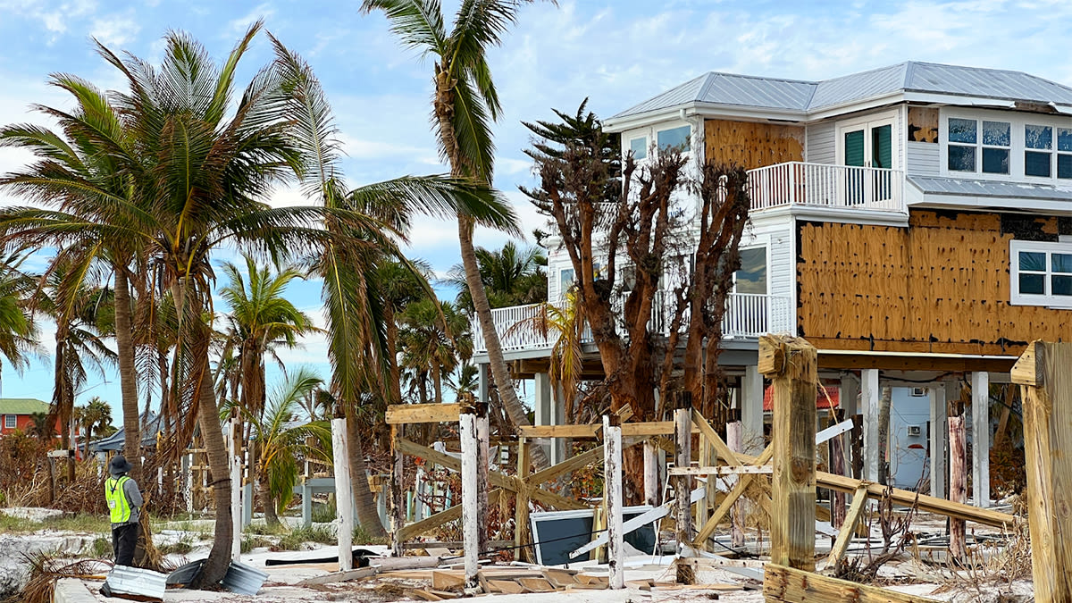
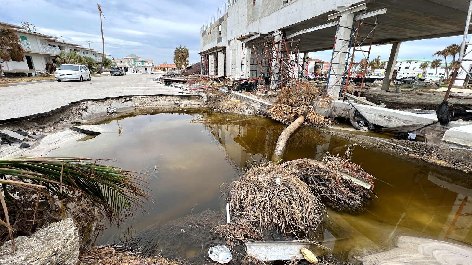
On September 23, 2022, a tropical storm was upgraded to the class of Hurricane, and named Ian. This storm continued to rage until the 2nd of October, 2022, and reached the status of a Category 4 Hurricane - meaning the winds surpassed 200 km/h (130 miles per hour). The hurricane had a devastating impact, killing over 160 people as it moved through Cuba, central Florida, and both North and South Carolina. The flash floods and storm surges caused huge damage, with the wind peaking at 250 km/h (150 mph). It is the fifth strongest storm to ever strike the United States.
Now, Yale University estimates that this was the third costliest weather disaster to strike the USA, following Hurricane Katrina and Hurricane Harvey. Hurricane Ian cost between 50 and 60 billion dollars in infrastructure losses. But in the immediate aftermath, dedicated teams were fast at work trying to save lives and assess the damage.
Disaster response with drones
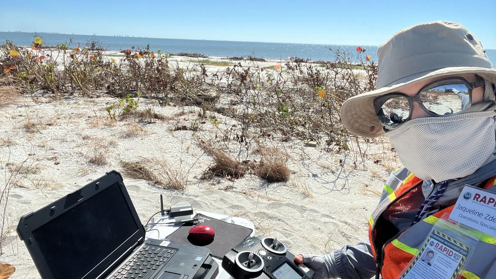
RAPID Facility is a National Science Foundation center that provides researchers with tools for collecting, processing, and analyzing critical data from natural hazard events. They will assess civil infrastructure performance and community responses to events to see how effective infrastructural design, response, and recovery efforts are in order to plan better in the future. RAPID is based at the University of Washington in Seattle.
After Hurricane Ian, RAPID’s goal was to create high-resolution maps of heavily damaged areas. They particularly focused on the barrier island areas of Sanibel, San Carlos, and Fort Myers Beach off the Florida coast. These aerial maps would provide insight into the resulting damage to the structures as well as the community’s responses.
Project details
| Location | Florida, USA |
| User | RAPID Facility |
| Software | PIX4Dreact |
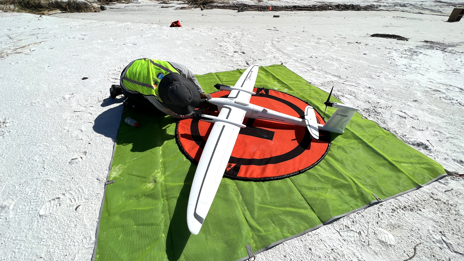
| Hardware | Trinity F90+ drone |
| Area surveyed | 9 miles2 (23.25km2) |
| Images collected | 253,500 images |
| Processing hardware | 768GB RAM server |
Data collection for disaster management
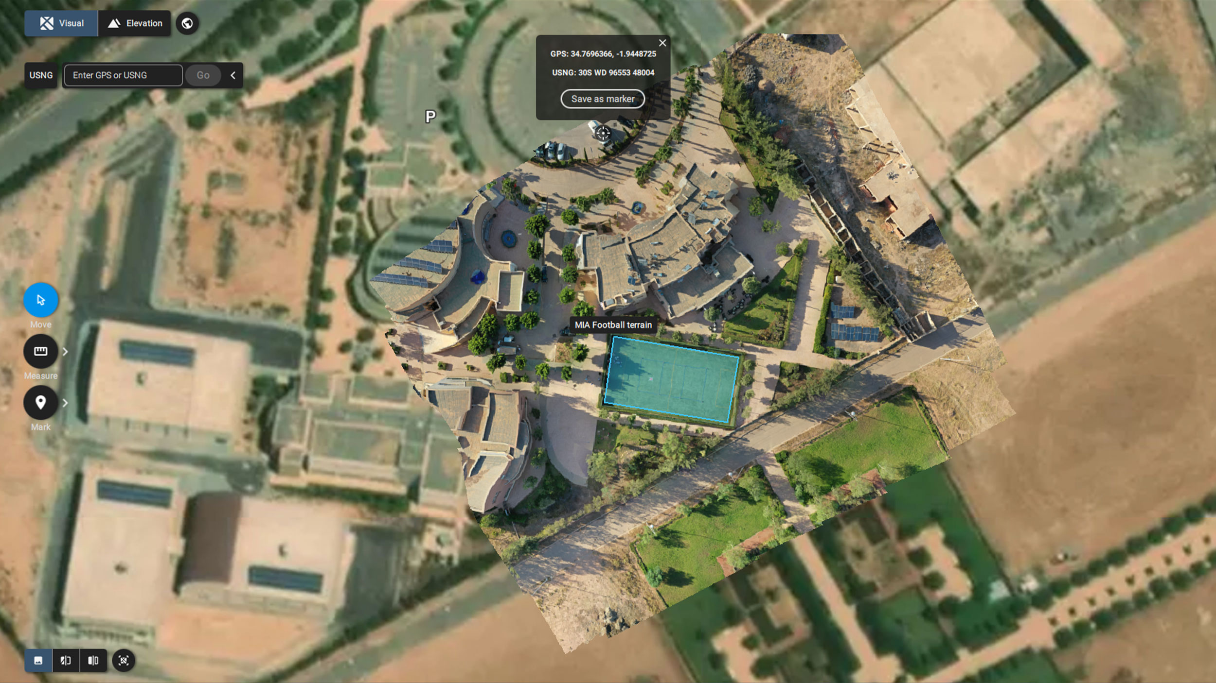
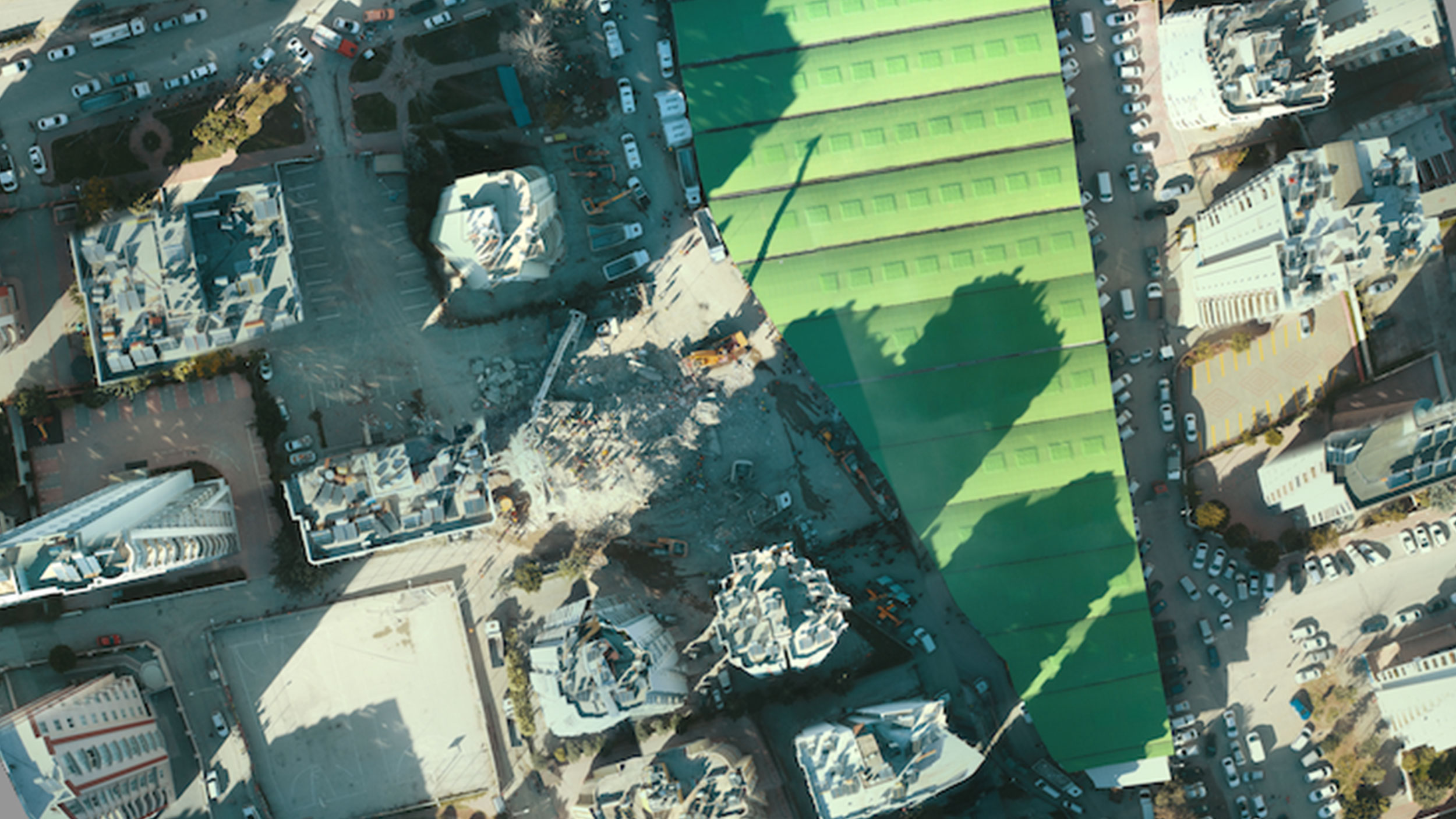
Armed with a Trinity F90+ drone, the RAPID team set out to cover 9 square miles of land (around 23.25 square kilometers). Over the course of 21 flights with the camera positioned in 5 different directions, the team collected 253,500 images. They collected so many images they consistently ran out of SD card storage space!
This is a huge amount of data, and to process it the team broke down the data into smaller chunks. They created 2D drone maps with PIX4Dreact which they then used to begin analysis of the damage done. In the future, they intend to convert these maps into 3D models.
PIX4Dreact is a specialized photogrammetry tool for creating 2D maps in the field without an internet connection. It is used for emergency response and disaster management to plan the deployment of resources and assess damage. It has been used to fight wildfires in Australia and California, aerially monitor landslides, and manage flood damage.
Assessing a natural disaster with aerial mapping
RAPID has been using its data to analyze these smaller islands that were heavily affected by Hurricane Ian. Hurricanes are strongest when over water, and thus, small islands are often battered more heavily than inland areas. This meant RAPID’s work was key in understanding just what had happened - and how much can be prevented in the future.
“Pix4D products have been instrumental in our data processing workflows. With Pix4D, we can quickly provide quality, time-sensitive data to our users.” - Karen Dedinsky, Data Scientist
This data acquisition and processing approach helped manage and process an immense dataset, and despite the size and scale of the project, RAPID has been able to get results. The aerial maps they create are being used to advise for better hurricane preparedness in the future - so hopefully future Category 4 hurricanes will have less of an impact thanks to better preparedness.