Drones in construction: the future of project tracking
| First published | September 1, 2017 |
| Updated | July 30, 2021 |
Unforeseen work and any change in plans, schedules, processes, or operations are costly.
Using drones, Pix4D’s construction mapping solutions, and a smart combination of desktop and cloud processing, with PIX4Dmapper and PIX4Dcloud Advanced, the construction company Isachsen routinely acquires real time data to monitor projects, track progress, document changes, and easily communicate the site status to all stakeholders, including their end-client.
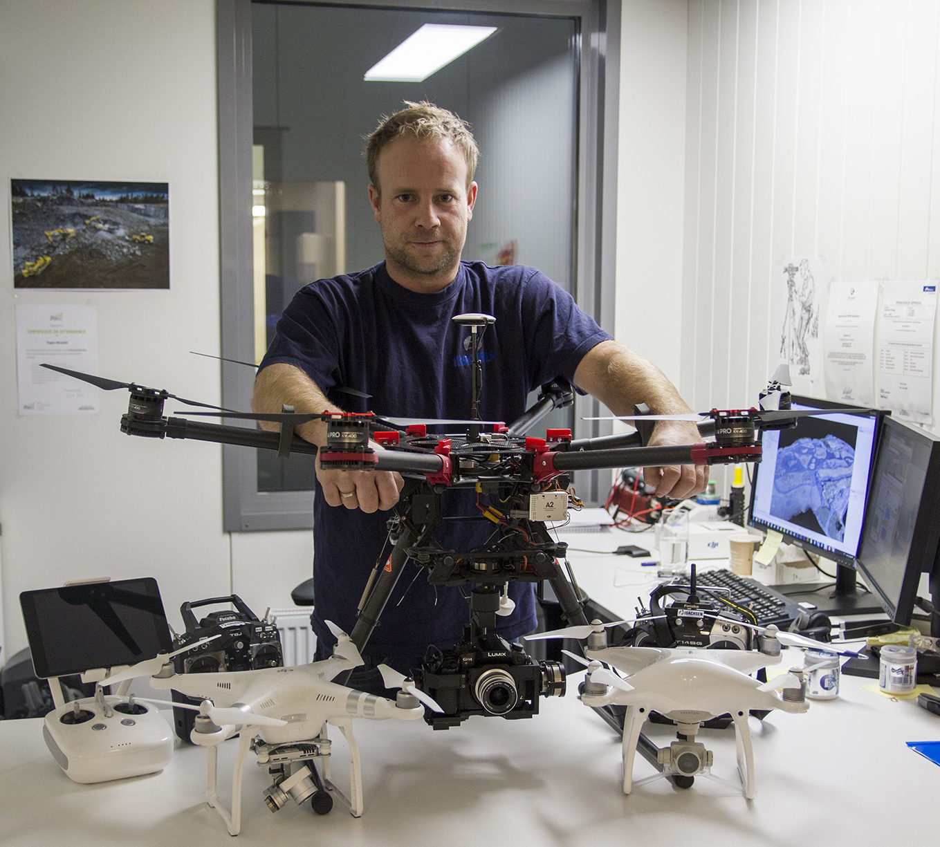
Trygve Almquist is a surveyor at Isachsen in charge of the drone fleet within the company. He uses construction drone software to improve their workflows using UAVs. Trygve’s role is to process all the images collected by the field operators then analyze and communicate the results.
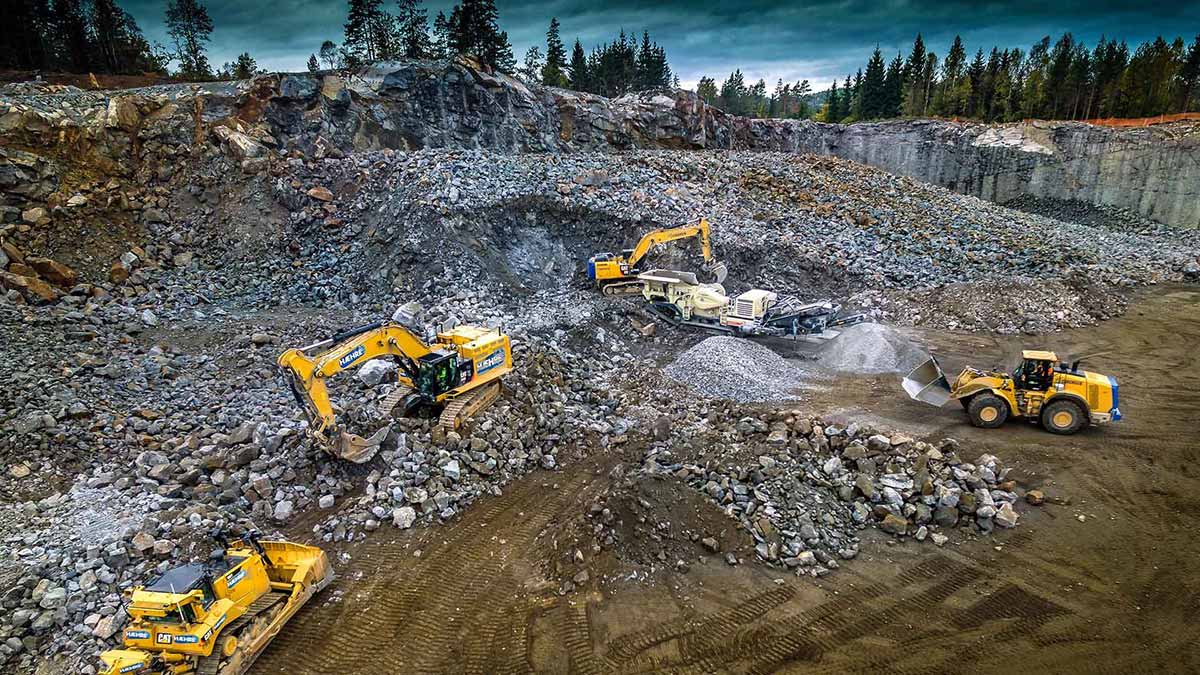
Working on earthworks for a big jobsite tunnel in the mountains, in Drammen, Norway, Trygve spoke about their well-oiled processes, why they use a drone to survey the site, and how they used PIX4Dcloud Advanced (formerly Pix4Dbim Cloud), to process data.
About Isachsen
Headquartered in Norway, Isachsen is a $280 million construction company, part of BetonmastHæhre, with 600 employees. The company specializes in the construction of roads, tunnels, and railways, usually working on multiple projects at the same time. With 25 drones, and the ambition to equip every field operator with a drone — 50 in total — Isachsen is a pioneer when it comes to using drones to map their large construction projects. Whether it’s for pre-construction topographic survey, earthwork calculations, or client documentation, they have been using Pix4D drone mapping software for a few years.
Project Info
| Project type | Earthworks |
| Project Size | 14.77 ha/36.529 acres |
| Number of Images | ~220-230 images per flight |
| Resolution | GSD 1.8 cm/ 0.71 inches |
| Drone | DJI Phantom 4 Pro |
| Processing & Analysis | Formerly Pix4Dbim - Now PIX4Dcloud Advanced |
Drones for regular site surveying and data collection
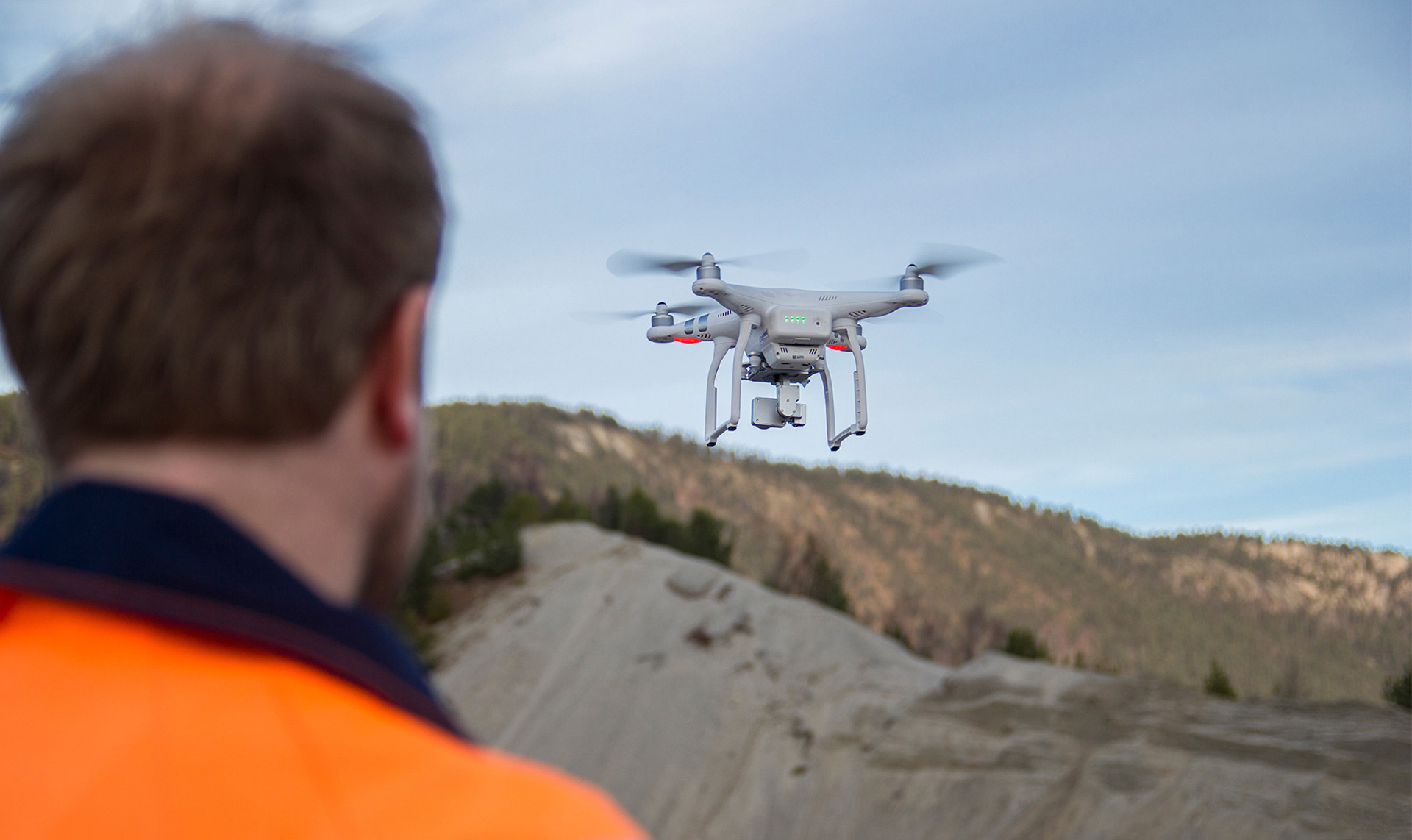
For the tunnel project in Drammen, the team flies three different sites. They use a DJI Phantom 4 Pro. Ground Control Points (GCPs) have been distributed permanently all over the area of interest and they are checked regularly. The objective is to fly once a week, or at least every two weeks, to get regular as-built updates. “With this type of site, we need to fly a lot – more often than mining for instance – because everything changes so quickly on the ground,” comments Trygve.
For Isachsen, drones have become one of the most cost-effective tools for surveying projects and help the ground decision-making process. Drone mapping is so inexpensive, non-intrusive and fast that the company can afford to do it over-and-over again during the entire project— something not possible before with traditional surveying. The cost-cutting and time-saving benefits of aerial surveying are clearcut.
Drones are the aerial eye of the jobsite, helping the company work faster and more productively. “Flying a drone is easy and benefits are huge,” continues Trygve. “Getting stockpiles surveyed for volume reconciliations is time-consuming, and costly – unless you use a drone to survey your site and drone mapping software to process your data. When surveyors deliver results in a couple of days, drone-mapping takes only a few hours. With a drone, we get the big picture of the overall site. We can quickly collect real-time data from projects to make on-the-ground decisions quicker and identify potential issues before they become costly”.
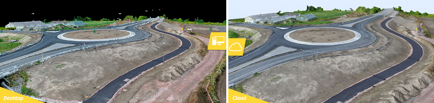
A smart processing combination for higher flexibility and control
Trygve could choose to process the captured images either on the cloud or on desktop and then upload results from one application to the other. Now with PIX4Dcloud Advanced, the projects can be processed with GCPs directly on the cloud.
Because the team mainly needs 2D orthophoto and 3D point cloud outputs to share with the project stakeholders, many of the flights are only processed on the cloud. “Processing data with Pix4Dbim cloud [now PIX4Dcloud Advanced] is very efficient and time-saving”, explains Trygve. “I need 5 to 7 minutes to arrange and upload the dataset. To get the finished results, it’s usually about an hour and twenty minutes. You receive an email notification when the work is done, this is a nice feature.”
When some surveys require more complex measurements and higher accuracy, such as cut and fill information for earthworks, Trygve used the PIX4Dmapper application to process the data. Processing takes a bit longer but enables him to better control his results by being able to edit or add ground control points (GCPs). The results are then used to calculate volumes and generate contour maps.
“I like the simplicity of the desktop software. I have full access to my data, full control over my GCPs, large editing possibilities, and a very high level of model details. It was easy for me to choose Pix4D rather than other mapping software. As an example editing point cloud with Pix4D, in order to remove noise or features, is very efficient. Visualization and control of the points are easy. It’s better than with any other programs tested. With Pix4D, I am confident to deliver accurate and high-quality results”.Having the flexibility to decide on the most adaptable workflow for his project and combine both applications is strongly valuable for his work. With the cloud platform, Trygve can benefit now from more advanced editing options. Most importantly, in just a few clicks, he can process the project on the PIX4Dcloud platform where he takes full advantage of additional assets such as-built comparison and collaborative tools.
Collaborating to improve efficiency
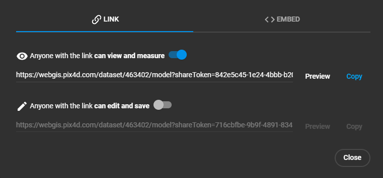
One of the biggest challenges for a large construction project lies in the number of stakeholders that need to work together and be informed about site progress. Well aware of the challenge, Trygve uses the PIX4Dcloud platform to facilitate work between all the project teams, from the engineers to the field operators. All surveys are available on it, “even if we don’t process it on the desktop, we process the survey on the cloud, so people know we have the dataset from that specific day if needed. If they need a volume calculation, they can call me, I have all the data”, explains Trygve.

By sharing a link to the project, all project members have remote access to the site to visualize and analyze the situation from the drone-generated maps and 3D models. They are able to extract powerful insights using built-in tools to measure distances and areas, make annotations, follow progress on a timeline, and compare the as-built with CAD drawings. Using this design comparison means deviations can be identified more quickly, the team can be more proactive and make decisions more quickly based on the latest and most accurate facts rather than estimates.
“It definitely enables fast communication between the site and the office. Problems and delays are just avoided. The quality of the 2D orthophoto is very good. The scale is impressively good. The 3D function is also a good addition. We can see the basemap and change its opacity, that’s very useful for comparing the before-and-after situation. The timeline is great! We can go back and forth in time, so we can compare datasets, see the site evolution and better plan the operations.”
For Trygve, it has never been so easy to communicate the as-built status of the project. “I like the simplicity of it. The interface is very user-friendly. It’s very visual, it’s easy to understand how it works. That makes it easy to use for people with basic computer-knowledge. Everyone can learn how it works in 15 minutes, you don’t need a special training to read the results. That means everyone related to the site can quickly use the data collected. It gives us a great overview of our sites and contributes to establishing a more efficient workflow for many people related to the project.”
Offering better client communication

“PIX4Dcloud Advanced platform is good for georeferenced documentation when billing. The site evolution is fully documented. We keep track of what is done and what remains to be done. We track piles, differences made from original ground to present time, but also differences between contract and what is actually constructed. This is why the timeline is so valuable to us. If there is any disagreement or changes made to the contract, we use those surveys. Those are proofs in case of disputes. Keeping track and documenting through PIX4Dcloud Advanced potentially saves us thousands of dollars by proving our client the work has been done, and why it was necessary”.