PIX4Dsurvey 1.26: new stockpile detection and more!
With the latest version of PIX4Dsurvey you can now combine and align photogrammetry projects processed in any Pix4D software, even if the projects are in different coordinate systems. This means you can delineate a stockpile with a single click and can create bookmarks in order to revisit views of interest. Scroll down to find out more about PIX4Dsurvey, the software that simplifies your connection to GIS and CAD to make planning and design easier.
Creating combined photogrammetry projects
Photogrammetry projects of the same area are not only being processed in different tools but also in different coordinate systems. The reasons behind this include different specifications for every project or different capabilities of the software chosen each time or differences in data capture methods (terrestrial + drone!). This can be a challenge in eventually processing all projects as one and slows work down. Now, you can use PIX4Dsurvey to bring multiple PIX4Dmatic, PIX4Dmapper, PIX4Dcloud or external photogrammetry projects together with point clouds from any source. You can work seamlessly between all the point clouds and datasets or combine projects with different coordinate systems. PIX4Dsurvey can transform the coordinate system of an imported project to the same system of the PIX4Dsurvey project.
New feature: stockpile detection
To bridge the gap between photogrammetry and CAD, it requires software with automation capabilities for vectorization that allows enough control and feedback to manage automatically extracted results. Every release of PIX4Dsurvey includes new features to make the detection of objects and their vectorization more automated whilst simultaneously ensuring that access to the images maintains control over the project. The stockpile detection tool enables you to delineate a stockpile with a single click.
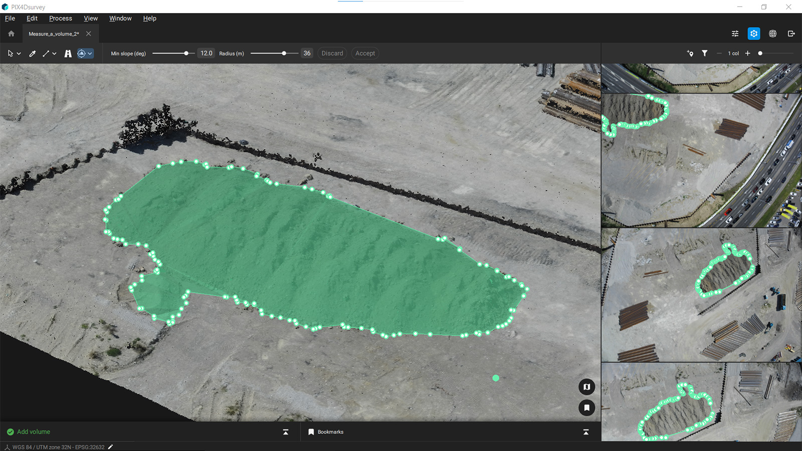
With this tool you can automatically select the base of the stockpile whilst still having the freedom and flexibility to adjust the radius and the slope as needed and extend it to fit the base of a very large or complex pile. Whether surveying a construction site or mine, you can save time by cutting unnecessary clicks and then measure stockpile volumes with a workflow that already exists in PIX4Dsurvey. Finally there is a complete graphical volume report, ready for delivery to the client
Bookmarks on PIX4Dsurvey
PIX4Dsurvey has many tools that make your life easier by saving time and effort. Many times you work on vectorizing a particular area of your project and then you move to another focus area or stop working. Finding and revisiting the same area can be time consuming and difficult. With the bookmarks feature in PIX4Dsurvey, you can save views of important parts of your project and revisit them through the bookmarks panel that makes navigation easy. The saved view consists of the exact 3D location and camera orientation, which allows you to go back exactly to where you were. Bookmarks can also be very convenient when you want to highlight a particular area of interest.
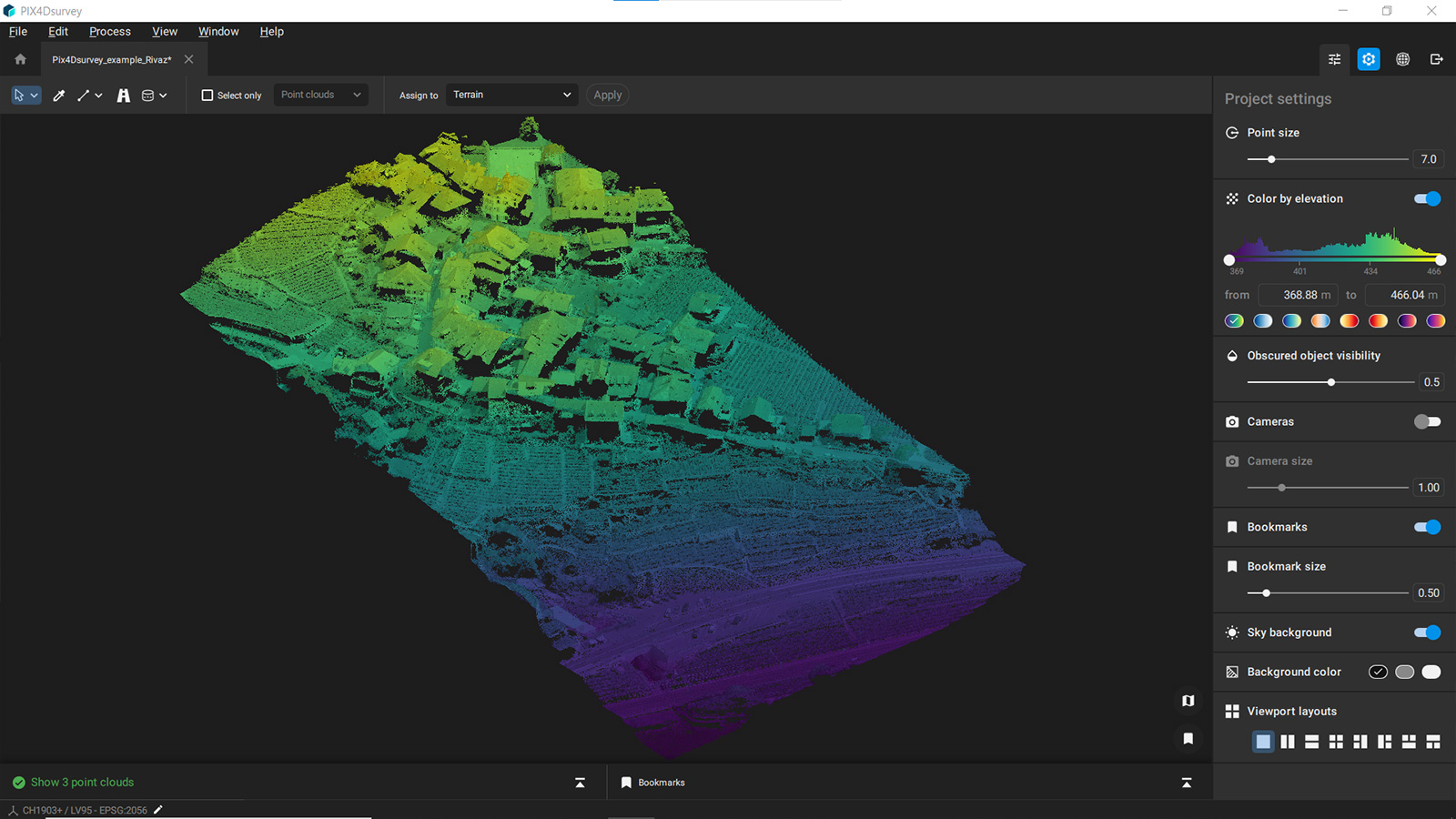
Display by elevation value
In its latest version, PIX4Dsurvey introduces a very convenient and comprehensive way to display the elevation values of the point cloud by color. You can use a histogram and choose from a range of spectrums that best represent your area in order to display the surface in an intuitive way. Need to focus on wires? You can include only the highest points in the color spectrum. Need to refine the ground? Shift the displayed part of the histogram and keep working - you easily flip from elevation display to classes to RGB.
PIX4Dsurvey is rapidly expanding the toolset with more features than ever! Apart from the tools mentioned above, it has a more intuitive interface layout with the project settings in the right panel. In addition, PIX4Dsurvey now supports macOS Monterey as well as Windows 11. Finally, the software is currently available in Chinese, English, French, Japanese and Spanish.