
Out in the blue: mapping along the Indian Ocean
Drones were once technology-of-the-future; now they’re part of planning for a better one. When the UN released their Sustainable Development Goals in 2015, many targets revolved around taking care of the environment, and this has become a driver for conservation in Tanzania.
Tanzania has almost 1,500 kilometers of coastline (885 miles) along the Indian Ocean. Much of this beautiful coast has a tropical environment in the water, teeming with coral and fish. Protecting these areas helps preserve fish as a food source, as well as a valuable tourist attraction - when travel restrictions allow. Setting up Marine Protection Areas (MPAs) therefore benefits not just conservation efforts but has a wider economic impact on the whole.
The biggest MPA in Tanzania is Mnazi Bay-Ruvuma Estuary Marine Park (MBREMP). It covers 70 square kilometers of mangrove forests (as of 2000), which makes up over 10% of Tanzania’s remaining mangroves. These ecosystems are important for fish repopulation as well as natural coastal storm defenses. 40,000 people also live in the vicinity of this MPA, relying on resources there to help feed the communities. MPAs are very beneficial at helping reduce poverty alongside the environmental benefits, requiring knowledge of how people interact with the local habitat, as well as pressures on resources.
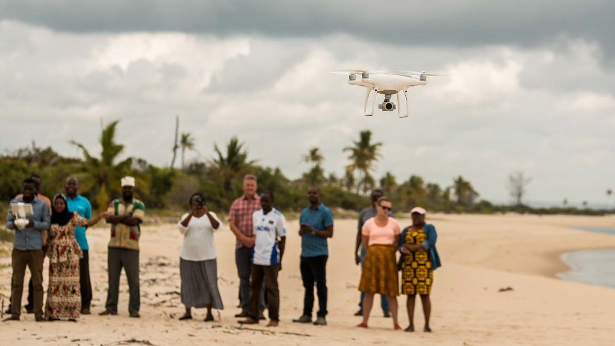
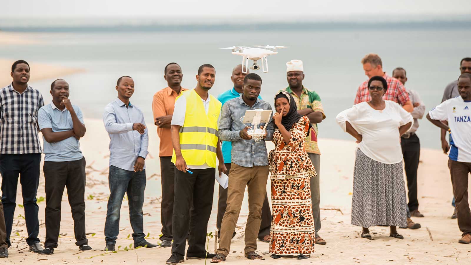
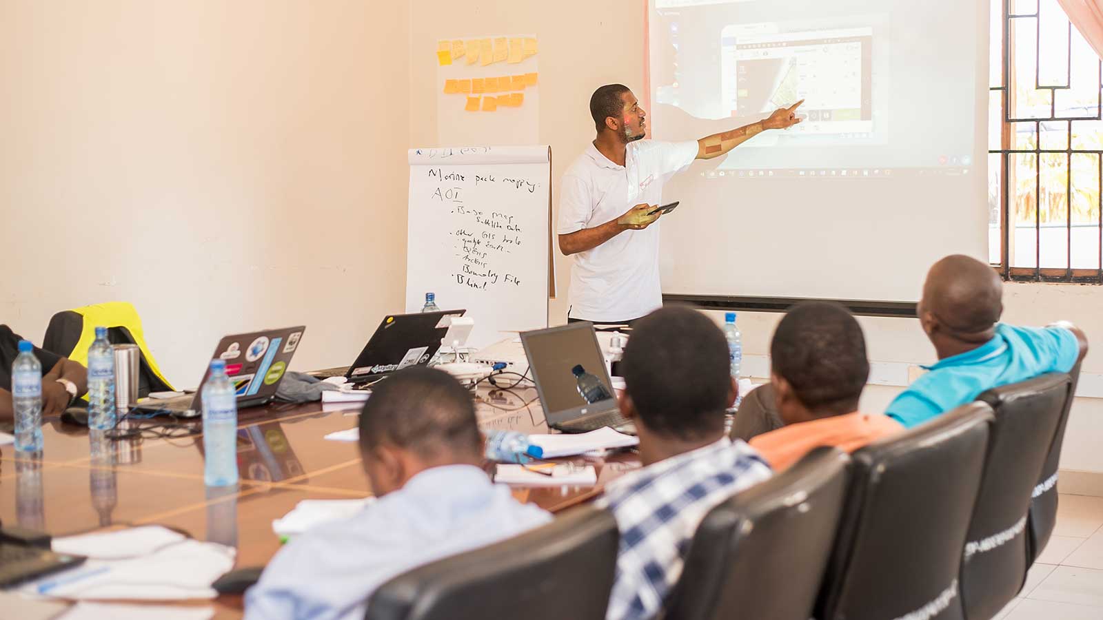
Tanzania Flying Labs, backed up by WeRobotics, went to Mnazi Bay-Ruvuma to build and encourage a local capacity for working with drones. They planned a 3-day workshop using PIX4Dmapper and PIX4Dfields, coordinating with the WWF, Duke University Marine Lab, and the Tanzania Marine Parks and Reserves Unit to use drones and photogrammetry to map the MPA. Drone mapping workshops have a great success rate in terms of gathering data as well as encouraging local drone use.
They hoped to achieve several outcomes with this drone mapping workshop: Gather data on endangered species and habitats in the area
- Define the size and extent of the MPA
- Build local drone use capacity
- Assess the socio-economic situation around the MBREMP
- Analyze resource use and pressures from local communities on the environment
Project Details
| Location | Tanzania |
| User | Tanzania Flying Labs |
| Software | PIX4Dmapper |
| Hardware | DJI Phantom 4 Pro, SenseFly eBee Classic |
| Total number of images | 1,710 |
| Flight height | 310 meters |
| Area surveyed | 673.5 hectares |
| Output | Orthomosaic |
Planning a successful drone workshop
Drones have a proven use in surveying coastal areas. In California, two conservation groups used aerial photogrammetry to investigate the reasons for and extent of kelp forests disappearing.
Check out Pix4D workshops
Find a workshop
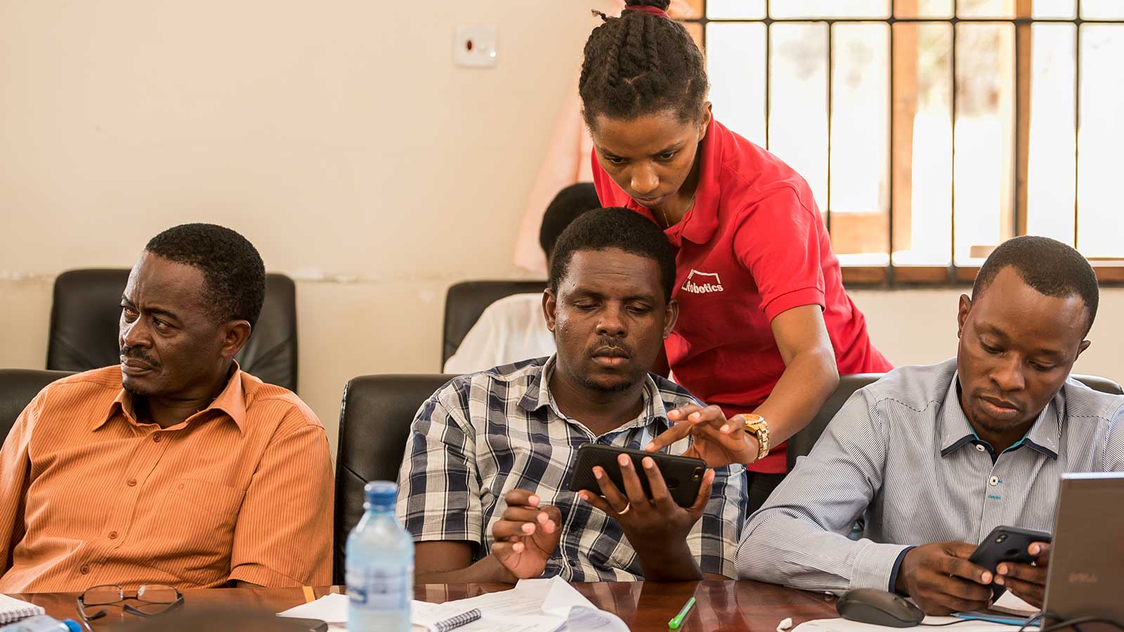
The workshop run by Tanzania Flying Labs was organized with the local MBREMP management office. They used both a rotary and fixed-wing drone to show participants the differences and advantages of either design. The people taking part in the workshop included local park managers, community residents, academics, and researchers. They learned how to capture, process, and use drone data. Understanding the data is just as important as capturing it - if you can’t interpret the information you gather, it renders all the work beforehand useless.
Processing coastal photogrammetry data
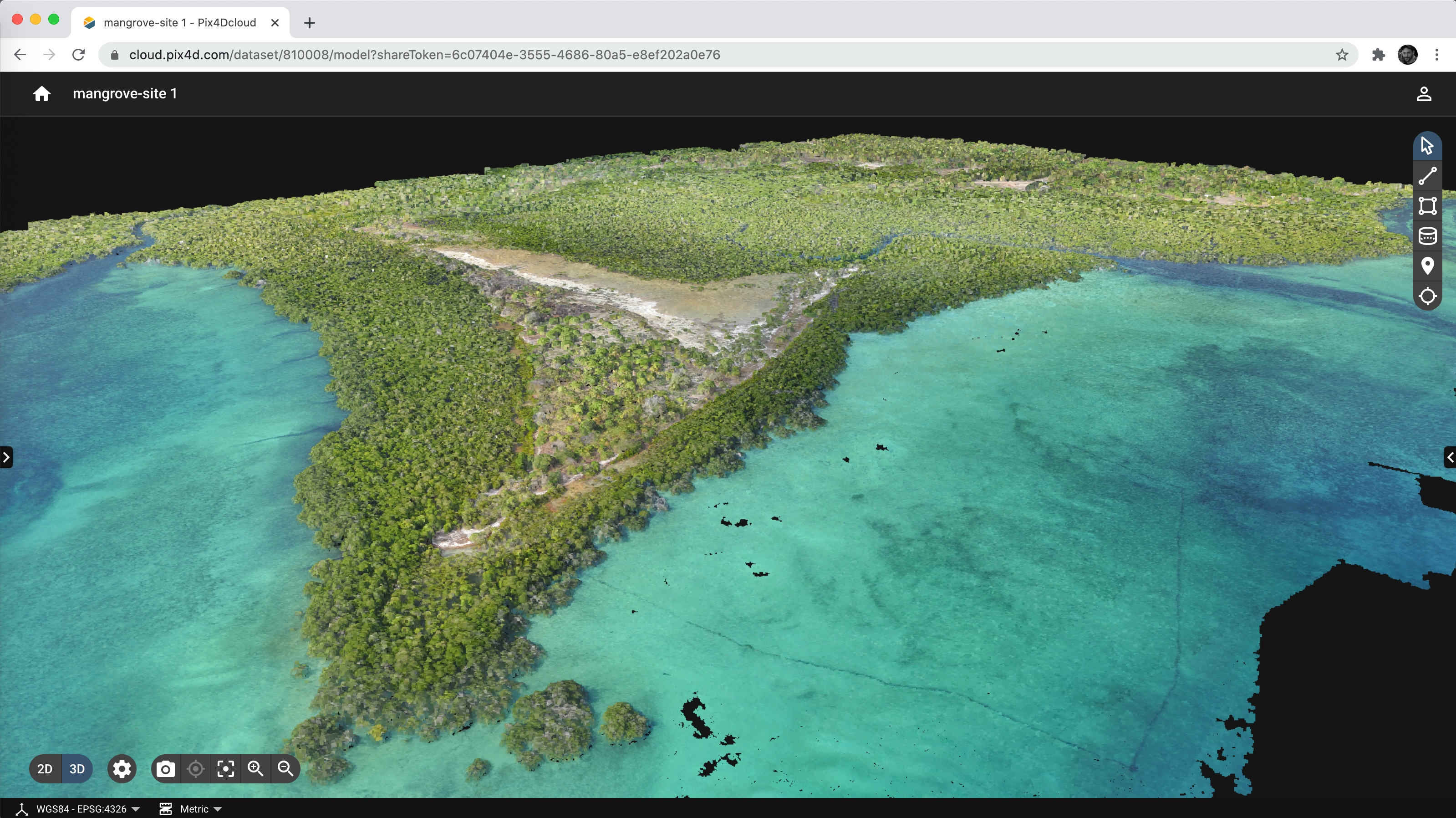
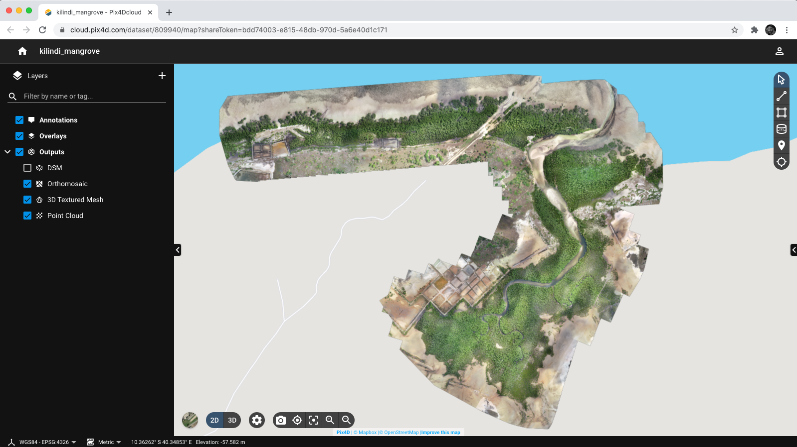
The workshop was lucky to have perfect conditions for flying the UAVs. After collecting the aerial data, which totaled 1,710 images, it was all imported into PIX4Dmapper. Some of the data was processed in the field and some was processed later in an office. This is because of the difference between the location data and sensor data. The S.O.D.A. camera provided more detailed information than the DJI Phantom 4 Pro and was therefore processed differently from the other dataset.
Data collection occurred at 3 separate sites, which were all processed separately to render an orthomosaic. After processing was completed, the GSD was 7.21 cm for the Phantom 4 results, and 3.96cm for the eBee. This is more precise and detailed than Google Earth, meaning that features can be easily identified in the water and nearby shoreline.
Using photogrammetry for conservation
The result of this project meant there was a new, comprehensive understanding of human activities in MBREMP as well as the current state of the environment there. This included seeing how the presence of saltwater and salt pans was affecting the estuary and mangrove swamps, as well as the presence of deforestation by people.
As a group the instructors, researchers, and participants achieved several outcomes:
- Maps of identified critical habitat extent and distribution (and determining overlapping areas)
- Strengthening management and technical capacity for using drones in marine biodiversity conservation
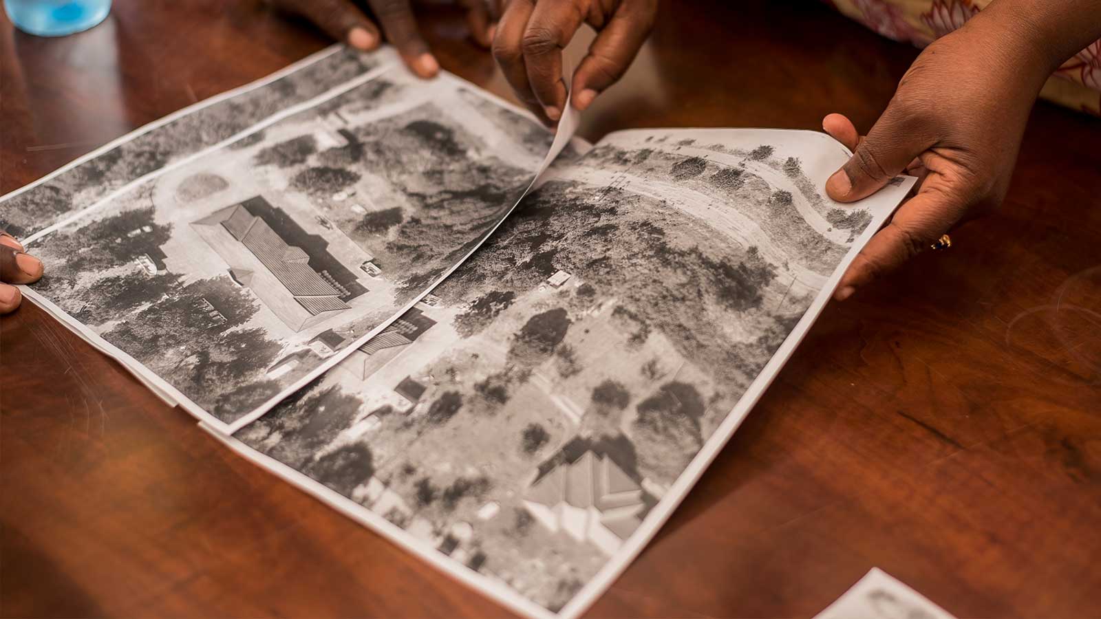
- Creation of shared data platform of all raw imagery
- Strong professional network between all project partners and participants, which can be leveraged for future work
- A better understanding of community activity, well-being, and conflict areas
- Information to influence policy recommendations at local and national levels
This information is critical to the survival of MBREMP: understanding the scale of deforestation as well as reasons for it can help design education and outreach programs in the community to help prevent further deforestation and find sustainable alternatives or management plans. By linking deforestation to the further destruction of the mangroves, the conservation teams can help the community protect their local habitat in a way that benefits them.
Outcomes of using Pix4D software
WeRobotics and the Flying Labs network operate around the world, with a strong presence in East Africa. They appreciate the benefits of working with Pix4D software for its user-friendliness, as well as a flexible range of outputs.
“For us, we always favor Pix4D tools in our training as they provide straightforward steps and do not require a user to code anything.” - Yussuf, Tanzania Flying Labs
Thanks to using photogrammetry, Tanzania Flying Labs and their partners have been able to gather and share important knowledge that will inform significant decisions made in the future. By working with the local authorities, they also showcased and proved how useful drones and aerial mapping can be, as well as how they can be learned. This will in turn encourage further adoption of drones and other technology in working towards a better future.


