

A big map for a small island: surveying the Faroe Islands
With a global population of 7.8 billion, and 55% living in urban areas, the world is rapidly shifting from being mostly in rural areas to built-up cities. This is happening everywhere - from huge countries like China to the smallest of island nations, like the Faroe Islands.
The Faroe Islands, in the north-west Atlantic Ocean, have just 52,967 inhabitants across 18 islands - and more sheep than people! There are 120 urban areas spread over these islands. Mapping and tracking urban development is key to helping record land use across the territories as well as changes to the nearby coastline that is frequent in island territories.
The Faroese Environment Agency, or Umhvørvisstovan, takes charge of mapping and tracking progress across the islands, including coastline mapping. These maps are used for land planning as well as for the national register. However, being in the middle of the Atlantic, aerial mapping of the islands is rare and difficult. Since 2017, Umhvørvisstovan has collected 117,130 images at a rate of roughly 30,000 per year. There are only 6 employees to carry out all the responsibilities of a governmental agency. Three work on land with surveying and mapping, whilst three others work on nautical charts for ships and ferries.
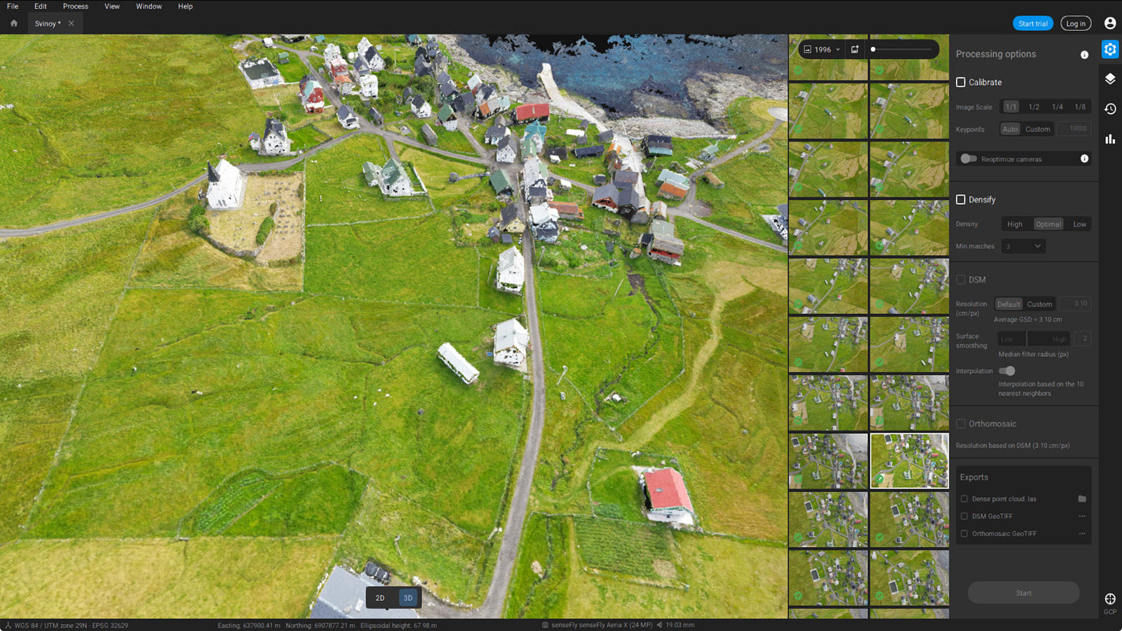
In 2015, Umhvørvisstovan chose to work with drones instead of planes. When they started using drones for mapping, they researched the strengths of drone photogrammetry. Part of the appeal is that the maps could generate orthophotos with less effort and strain than airplane-based photogrammetry. As for selecting the right drone mapping software, with a large-scale project, the power of PIX4Dmatic is perfectly suited for producing an accurate Faroe Islands map.
Project details
| Location | Svínoy, Faroe Islands, Denmark |
| User | Faroese Environment Agency |
| Area surveyed | 2.341 square kilometers (578 acres) |
| Software | PIX4Dmatic Esri ArcGIS |
| Hardware | eBee X RTK Aeria X camera |
| Processing hardware | Intel (R) Xeon CPU E5-1650 v4 |
| Total images | 1,997 |
| Processing time | 10 hours 30 minutes |
| GSD | 3.12 cm (1.2 inches) |
Why drone mapping is the best choice
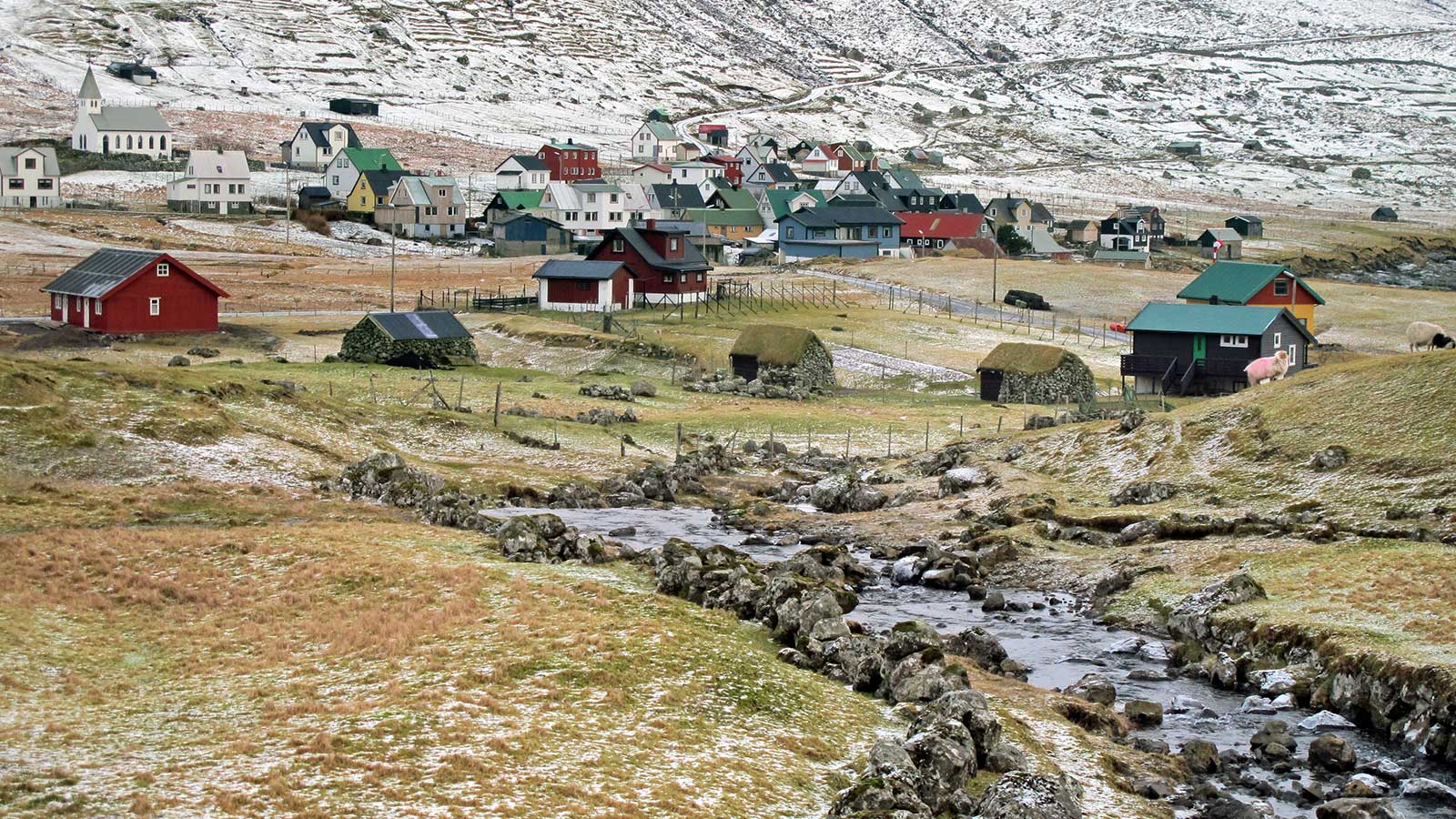
Svínoy is a tiny island, with just 31 inhabitants. However, the last time the island was mapped was in 2009. It was long overdue for an up-to-date survey.
Several significant challenges are present with aerial mapping remote locations. The islands have mountainous terrain with strong winds. The Faroe Islands weather is notoriously unpredictable. Airplanes struggle to penetrate the cloud cover and the risks of flying beneath the clouds with such rough terrain mean it is very difficult to fly safely for aerial mapping.
The benefit of drones is already clear: they can be deployed with less notice and planning than a plane, and take advantage of short gaps in favorable weather. Furthermore, drones fly below the clouds which is an advantage in that their visibility is not prevented by cloud cover, and the continuous grey skies cause a consistent light that does not change dramatically, which is ideal for photogrammetry data collection. However, fixed-wing drones do sometimes struggle due to the uneven terrain making it hard to find appropriate locations to take off and land.
Land surveying a remote island
When the Environment Agency’s pilot flew, the data collection mission was separated into 3 flights that gathered a total of 1,997 images. This careful flight planning can save pilots lots of time when flying large or complicated sites. Luckily, the wind was gentle that day. There was some turbulence and difficulty from the layout of the terrain, although luckily Svínoy has some flat spaces from which the eBee X could take off and land safely.
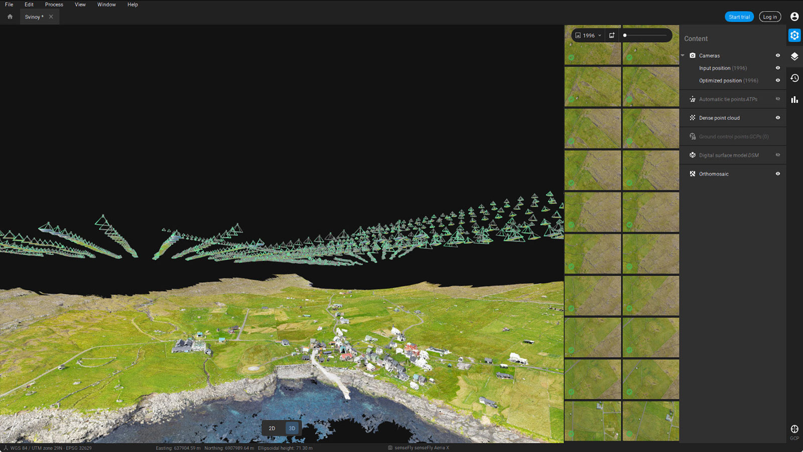
The data was then processed in PIX4Dmatic, taking just over ten hours to crunch the whole dataset. The final map was then edited and annotated to add important details, including:
- Coastlines
- Housing (including road names and addresses)
- Pastures and agricultural plots
This map is provided as an open-access resource for anyone to download - although it is in Danish. Open maps are a useful resource, enabling everyone to better understand the lay of the land.
Benefits of remote surveying
This transition to having up-to-date records is highly valuable to the government. Whilst it is free to download for the public, it gives an insight into the progress and development of the Faroe Islands, even on the smallest isles. The variety of outputs from PIX4Dmatic also means Umhvørvisstovan can use them for mapping or planning further development.
“PIX4Dmatic is even easier to use than PIX4Dmapper and the processing time was faster. So if time is an important factor in your projects, you can speed up your delivery on large projects by using PIX4Dmatic”. - Andreas Arnbjerg, pilot for Umhvørvisstovan
By working with drones and photogrammetry, Umhvørvisstovan can save the costs of using airplanes to gather data, as well as be more flexible according to the weather as they do not need to use a more labor-intensive flight. UAVs cut hours spent in the field and the processing power of PIX4Dmatic renders incredibly detailed results that both authorities and community members benefit from.


