Landscape management with PIX4Dcatch
Landscape management during construction brings a unique challenge: preserving the old environment whilst building something new. The use of photogrammetry and terrestrial scanning in this industry has already been proven - it resulted in a 64% increase in profits when combined with Pix4D's construction platform, PIX4Dcloud. Now, PIX4Dcatch with an RTK device is being integrated into landscape management projects for construction.
Proland Surveys, part of Archibeque Land Consulting based in Colorado, are geospatial experts providing geomatic solutions. With 50 years of land surveying experience, they use modern surveying technology as well as old records to track their projects. They have mapped 5,000 acres across Eagle County properties and created land survey records.
Recently, Proland Surveys was contracted by a property owner building an extension for their house. Proland Surveys were asked to help map trees across a property. The trees had to be surveyed as a requirement for planning permission and the local homeowners association. The construction work was going to involve some trees being removed, which could potentially create a view corridor. A neighbor was concerned that too many trees would be removed during the construction process. Proland Surveys used the PIX4Dcatch with an RTK device to survey and measure the trees to update plans and ensure responsible management of the forestry.
Project details
| Location | Eagle County, Colorado |
| User | Proland Surveys Archibeque Land Consulting |
| Hardware used | RTK rover iPhone 13 Pro |
| Software used | PIX4Dcatch PIX4Dcloud |
| Time on-site | < 1 hour |
| Processing time | < 1 hour |
| Trees surveyed | 20 |
Mapping trees before construction
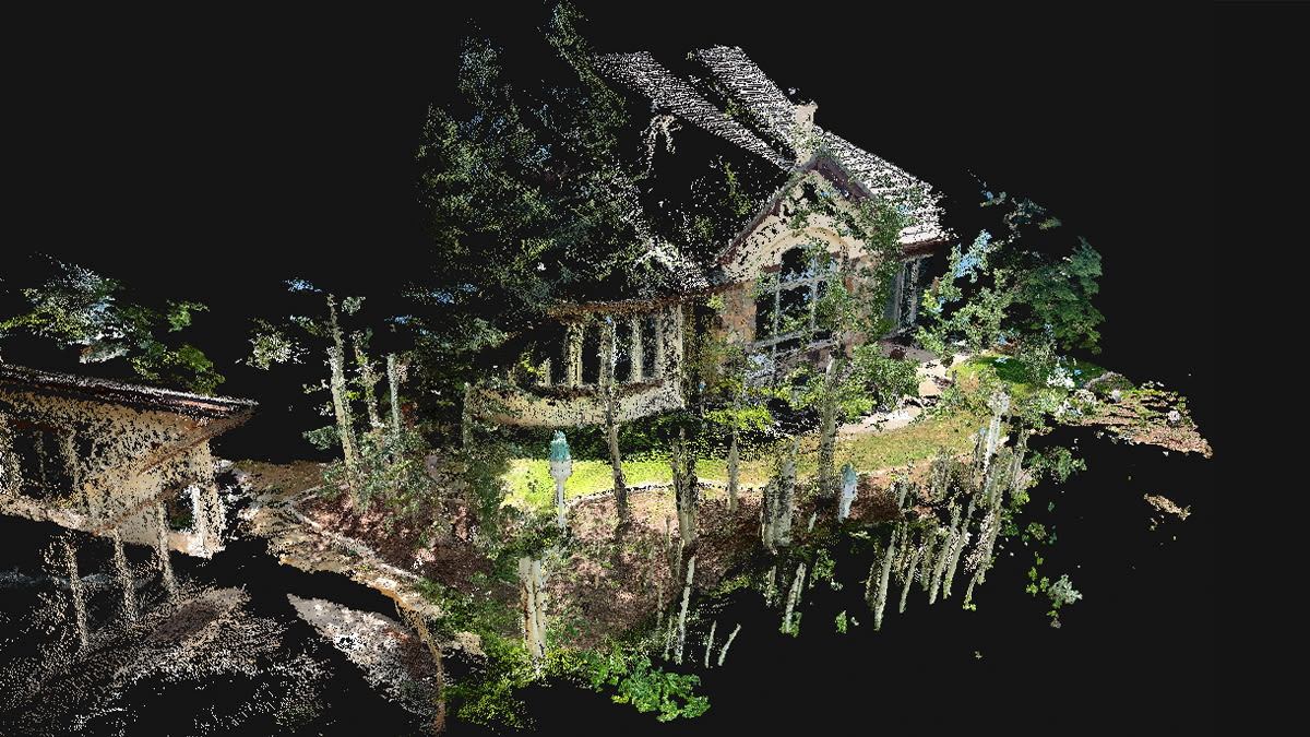
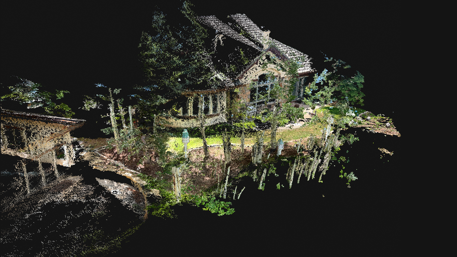
Mapping the trees with an aerial map would not have been ideal for this situation due to foliage cover obscuring the camera view. This means that geotagging the tree and its size/width would not be 100% accurate - instead, a terrestrial workflow could get the necessary data.
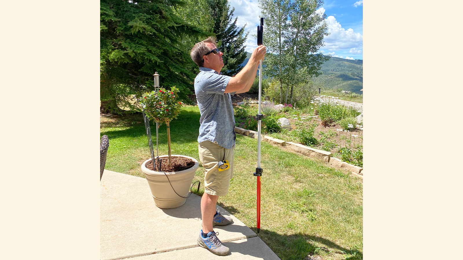
Ted Archibeque instead visited the site with an iPhone 13 Pro and PIX4Dcatch with an RTK device attached. He then connected the two via Bluetooth, and started the PIX4Dcatch app. Once PIX4Dcatch was connected to an NTRIP network via the RTK device, Ted set about measuring trees around the property.
In total, Ted walked around the area for an hour and measured 20 trees. The diameter of each one ranged from 4 - 10 inches (10 - 25 cm). This data would be used to decide if a tree could be moved and the logistics of planning that to ensure safe removal. The single point measurement with the RTK device provided accurate geolocation data which was processed on the PIX4Dcloud platform. The data was then exported as a .dxf file for CAD as part of planning for the new extension.
Solving problems with PIX4Dcatch
The range of applications with PIX4Dcatch are immense - from digitizing construction sites, as with a pipelaying project in Singapore, to planning the restoration of an old bridge in Turkey.
For this project, the use of PIX4Dcatch was a way to get accurate site data without disrupting the foliage or delaying construction. The data collected with PIX4Dcatch was automatically uploaded to PIX4Dcloud. The processing took less than an hour, and Ted received an email when it was completed. He could then view the 3D models of the trees as well as their locations around the site. This scene reconstruction was used in CAD software to plan the new extension for the house and reassure local property members that trees would be properly protected or managed. PIX4Dcatch brought accuracy to the project planning and site management - exactly what you need from a tool for terrestrial site scans and single point measurements!