Leveraging DXF files in AEC with PIX4Dcloud Advanced
Accuracy, efficiency, and precision are of paramount importance in the architecture, engineering & construction (AEC) industry. Architects, engineers, and construction professionals rely on various tools and technologies to ensure accurate and successful project execution. One such technology is the use of DXF (Drawing Exchange Format). DXF is a file format widely used in the AEC industry to facilitate the exchange of design data between various software applications.
What is a DXF?
DXF files are a type of CAD file format which contain vector-based geometric data. DXF files enable accurate representation of 2D and 3D models and can be opened by most CAD software programs, serving as a bridge between different software solutions.
Working with DXF and PIX4Dcloud
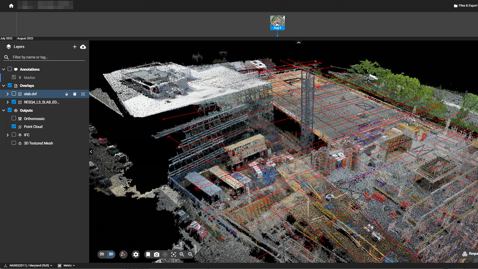
With PIX4Dcloud you can import DXF files into the software and further overlay and visualize them into a 2D map or 3D model. Additionally, with the 2D/3D comparison tool, two datasets can be compared side by side, one of which can have the DXF overlaid. The DXF files may include information such as architectural drawings, floor plans, elevations, or other design elements.
Utility locations, property boundaries, and elevations can also be created and exported as DXF files directly from PIX4Dcloud. Below is a step-by-step workflow guide on how to import and export DXF files with PIX4Dcloud.
Applications
Some of the applications for working with DXF files in PIX4Dcloud Advanced include visualization, progress tracking, documentation, and more.
Visualization
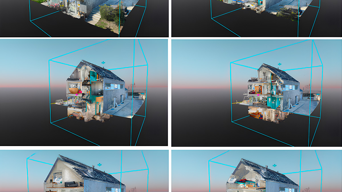
With PIX4Dcloud Advanced you can import DXF files onto 2D and 3D models and see both at the same time. The DXF files can provide you with realistic and accurate visual representations of architectural designs, incorporating materials and other visual elements, while the orthomosaic and 3D point cloud can show the current state of the project. This is useful for project communication with stakeholders and client presentations.
Progress tracking
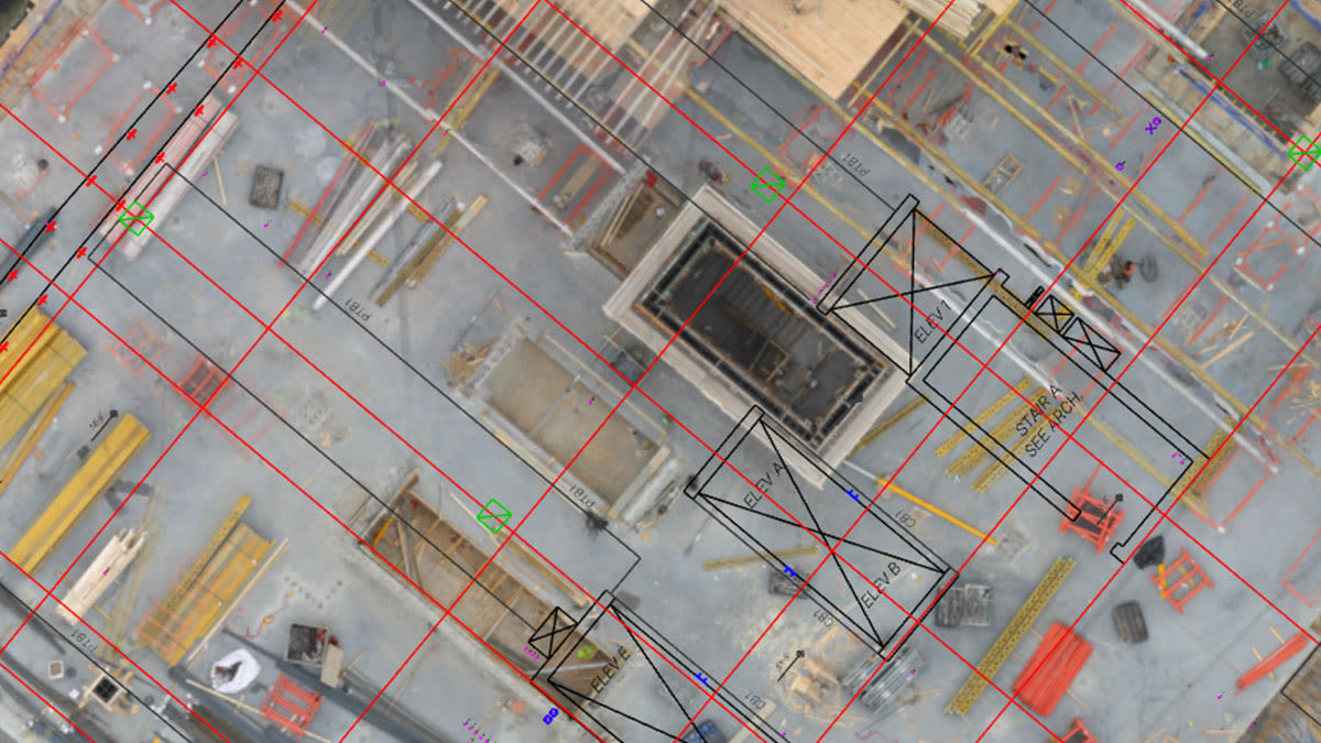
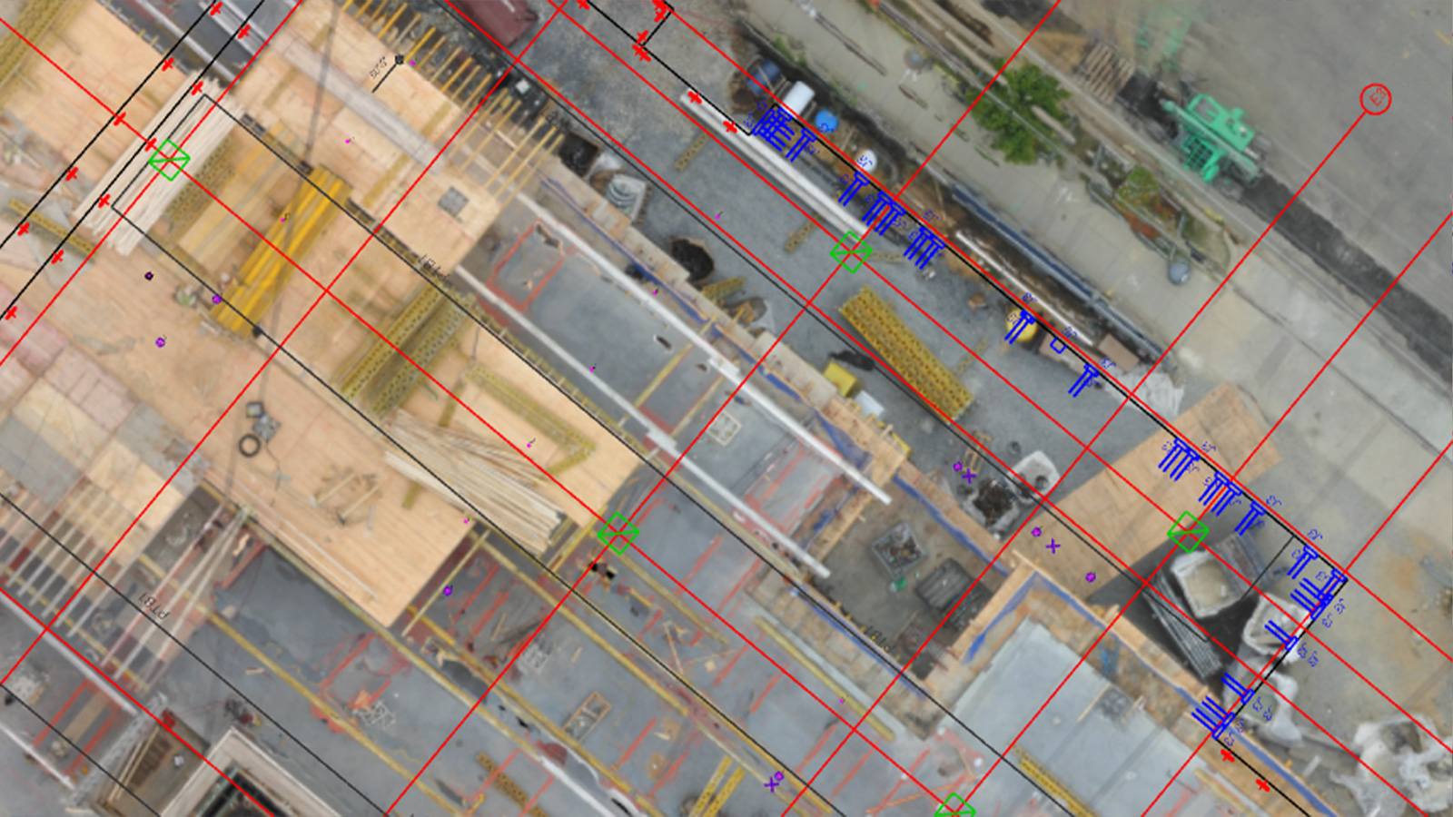
Thanks to PIX4Dcloud Advanced and its 2D/3D comparison tool, DXF files can easily be compared with the 2D and 3D outputs. By doing so, you can visually compare and analyze the differences between the as-built and the as-designed to identify deviations, discrepancies, or areas where the as-built condition differs from the intended design. This comparison allows for effective quality control, verification, and documentation of construction progress.
Sometimes the building floors are kept in separate DXF files with no 3D information. In these cases PIX4Dcloud allows a manual set up of the height of each floor, so that they can be visualized together with the 3D point cloud at the right altitude. This enhances vertical progress, the monitoring of the building, and the verification of vertical elements such as pillars.
Accurate terrain reconstruction with contour lines
Contour lines provide crucial information about the shape and elevation of the terrain. By importing contour lines in PIX4Dcloud, you can incorporate precise elevation data and detailed terrain models, improving the overall quality of the outputs. Additionally, visualizing the contour lines together with the 3D model allows for a comprehensive representation of the terrain that can be used for various analysis and design purposes.
If the quality of the 3D model is challenging, contour lines can serve as a reference by comparing the model to the known topographic features (i.e. the contour lines).
Digitizing
In PIX4Dcloud, elevation data, property boundaries, and utility locations can be digitized and converted into DXF files for further analysis and integration with other software, which aids in understanding site conditions and optimizing design decisions based on accurate geospatial information.
BIM integration
DXF files play a significant role in Building Information Modeling (BIM) workflows. They allow the integration of design data from various sources, including 2D/3D design elements and annotations, within the BIM environment. This seamless integration enables efficient data exchange.
Importing and exporting DXF files: step-by-step workflow
Capture - data can be captured using either drones or terrestrial tools such as the PIX4Dcatch RTK workflow for precise data collection.
Process - once captured, the data is processed online in PIX4Dcloud and automatically converted into 2D maps and 3D models, ready to be analyzed and shared.
Import the DXF files to PIX4Dcloud - DXF files can be easily imported to PIX4Dcloud for different purposes such as visualization, progress tracking, documentation, and more. To do so, go to the Design overlays and click the + button. Once imported, you can select the layers you want to see. There is no need to align it as the software will read the coordinates of the file automatically.
For more information about importing DXF files, please refer to our technical support documentation.
Digitize - utility pipes and cables, property boundaries, or elevations can easily be digitized in PIX4Dcloud by annotating their precise locations on the 3D model.
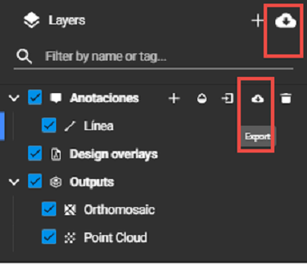
Export to other software - once created, the annotations can easily be exported as DXF files to other software, such as AutoCAD, maintaining the same layer structure and naming. To export, click on one of the buttons shown in the image below.
For more information on exporting annotations on PIX4Dcloud, please read our support documentation.
Please note that step 3 and 4 are not connected and can be performed independently.
Enhancing collaboration across the entire construction lifecycle
DXF files have revolutionized collaboration and data exchange in the construction industry. Their universal compatibility and support across various software applications make them an invaluable tool for architects, engineers, and construction professionals. When combined with photogrammetry software such as PIX4Dcloud, DXF files enable the integration of accurate 3D data into design and construction processes, improving overall project outcomes, reducing errors, and enhancing collaboration across the entire construction lifecycle.