Everything you need to know about drones in construction
The global construction market is a trillion-dollar industry. Statista projects that the market will grow from 6.4 trillion USD in 2020 to 14.4 trillion in 2030. That’s an astronomic growth for an industry that is already constantly developing, innovating, and changing to match modern construction practices and preferences.
In comparison to the immense industry, a drone seems like a small tool. How can a drone make a difference in construction? Can flying a small device with a camera attached really bring a noticeable change or even return on investment for constructors?
The answer is yes. But there can be obstacles.
The barriers to drone adoption in construction
As with any industry, adopting unfamiliar technology can take time. Investors and project managers alike do not want to commit to technology they don’t believe in.
The key barriers slowing down drone technology in construction are:
- Training concerns: constructors do not want to spend excessive amounts of money or time training employees to learn new skills.
- Accuracy: if you’re going to use drone imagery, you need to be sure it is accurate and you can trust your results.
- Drone legislation: as drones operate in the air, there may be air traffic controls or special licenses required.
- Scalability: can drone mapping be used across different sites? Or is it a one-hit wonder?
- The unknown factor: if you are choosing your tools, you are likely to prefer what you already know. Constructors need to be convinced of drone technology’s viability before investing in it.
So how are these barriers overcome? Well, it depends on the project, the site, and the contract. Each and every one of these obstacles can be overcome. In terms of training, you can select specific products and workflows that are more intuitive and require minimal training. The effort here will come from effective research before choosing a drone mapping solution but will save site workers and managers time in the long term by identifying an easy-to-use product.
Meanwhile, the accuracy of drone mapping in construction can be guaranteed by analyzing case studies for different solutions and determining the cost-versus-accuracy trade-offs. Certain drones are capable of capturing data that can be accurate to within the centimeter - but this can be costly, so project managers need to use their best judgment to choose the optimal products for them.
What have constructors said about drone mapping?
"We use the PIX4Dcloud data to verify that the project is progressing according to the schedule. Being able to plan and weekly track the progress of the project has been invaluable to our superintendents who are coordinating and planning the work. If there is an issue with the Internet and they cannot access the online platform, it is maximum an hour before they call to check what is wrong. That’s how valuable PIX4Dcloud is for them." - Ryan Fluckiger, Sr. Integrated construction coordinator and Reality capture lead at Mortenson.
Moving further down the list of barriers, we reach drone legislation. This is a natural concern, with strict legislation already in place around construction. Contractors and constructors are no strangers to enforcing strict health and safety regulations to ensure the protection of their employees, clients, and the surrounding public. The same can be done with drone restrictions: a designated employee can do the research and disseminate the necessary information and licenses between their teams.
As for scalability - at Pix4D we already know that drones have a place in construction. You can see this with the range of use cases about drones in construction on our blog. The applications of aerial mapping technology in urban and rural development are widespread and variable - making it a flexible tool.
Finally, we reach the “unknown factor”. The technology is unfamiliar, so how can you trust it? To answer these questions, and see how a major construction company is putting aerial mapping to work, we interviewed Trygve of the Isachsen Gruppen in Norway. His interview on drones in construction is a peek into the innovations this technology is bringing to the industry.
The benefits of drones in construction
1. Drone mapping improves site awareness
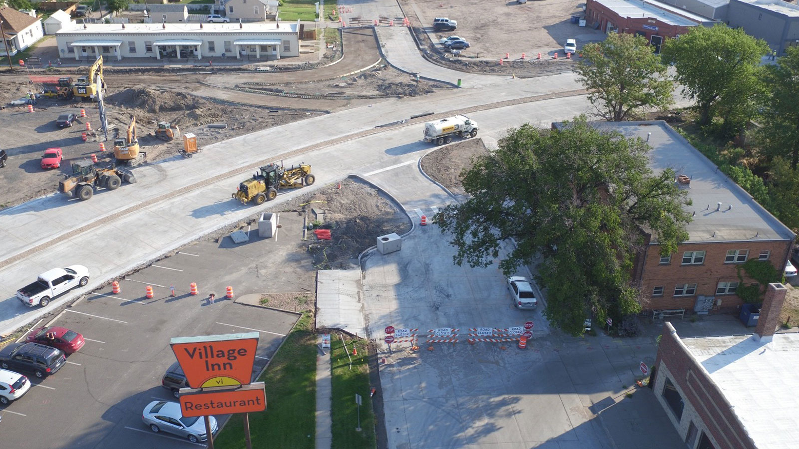
You can use a drone to get a bird’s eye view of a construction site. One option is to take still photos and collect these. However, with drone mapping software, you can enhance these images by creating 2D and 3D models for analysis. Through an aerial map you can enact better site practices and management using data that accurately reflects your site.
A site flight can be completed without having to stop work on-site, which saves time. The 2D and 3D models can be hosted online to enable easy sharing and communication, with annotations and comments added by various stakeholders.
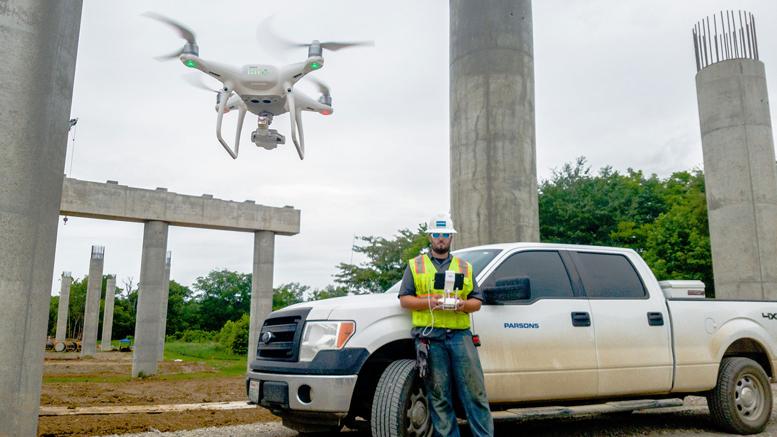
Example: Parsons, a technology firm working in the USA, uses PIX4Dcloud Advanced to create site maps and track construction progress on their projects. Their aerial maps are regularly created to follow how the site has changed with time. Typically, they will collect 500 images per site and have results within 1 hour of processing. The outputs are shared between site managers, architects, and engineers to monitor the site and ensure they are on-track with the construction plan.
2. Identify problems early with aerial maps
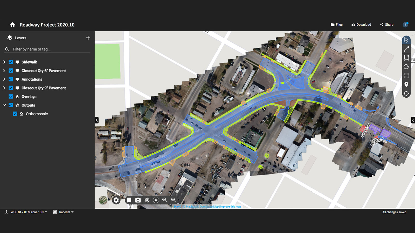
If you’ve ever been on a plane or looked through a drone’s camera, you’ll be struck by how much more is visible from above (if the weather permits…). This aerial perspective in construction helps you to spot mistakes before they get out of control. When drone photos are converted to photogrammetry outputs in 2D and 3D, they can be compared to plans.
With a map that shows the status of a site the foremen and project managers or contributors, including architects, can check on the progress of work. The as-built elements can be compared to as-designed plans. By making these comparisons, problems can be identified early. This helps to save money and time by avoiding rework.
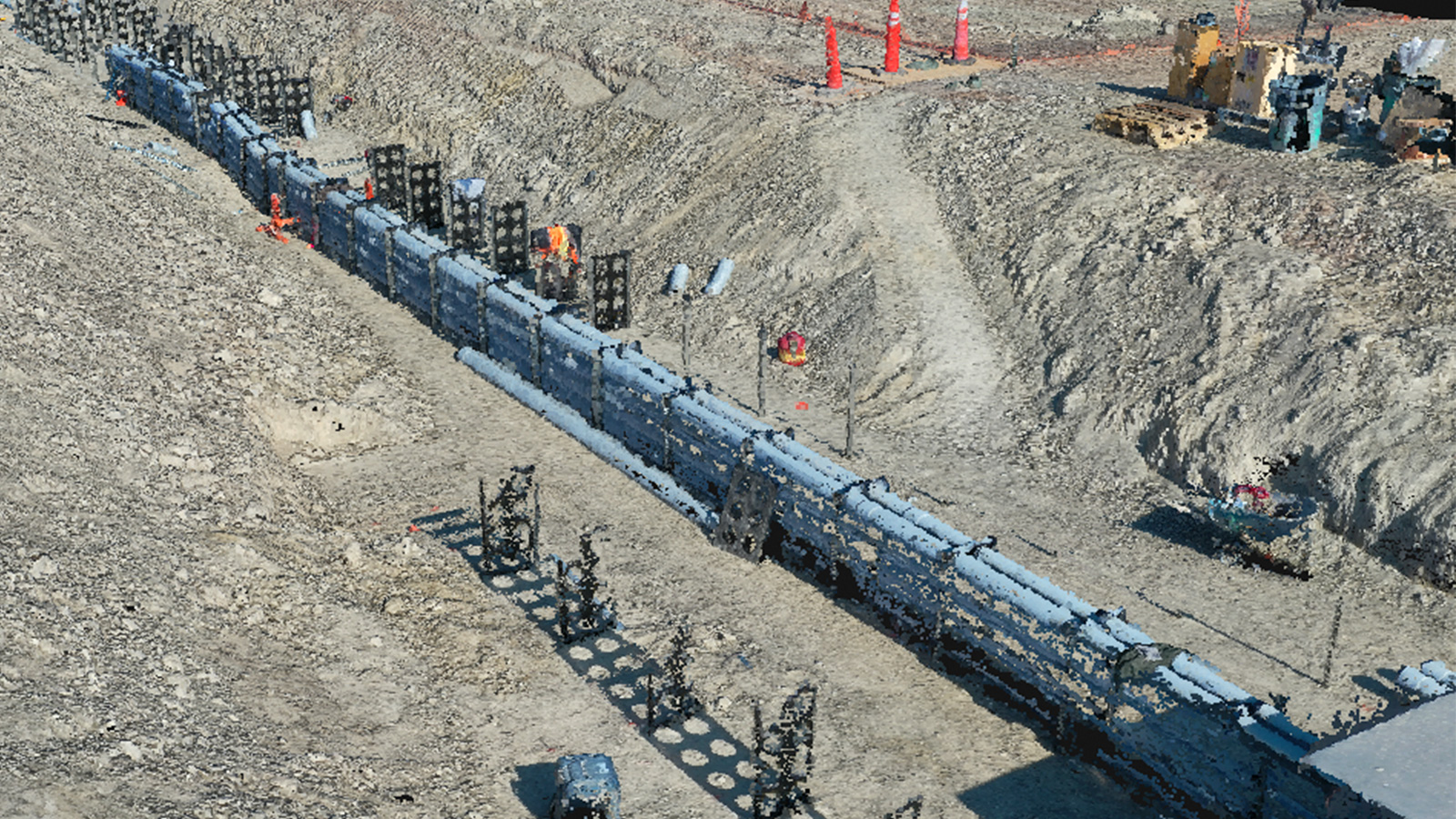
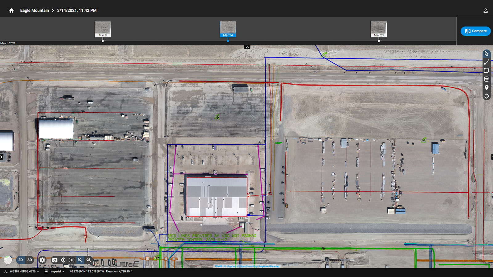
Example: Mortenson was working on a data center construction project in Eagle Mountain, in the USA. The plan compromised of 3 buildings that were designed to be 1 million square feet each. Mortenson was using PIX4Dcloud Advanced to track the progress of buildings and share it with trade partners. They monitored utility lines on-site with PIX4Dcloud. Accidentally hitting a utility line could result in an explosion or accident. To prevent this, the team overlaid a CAD file with a utility map over the PIX4Dcloud orthomosaic on a weekly basis. During the excavation phase, an incorrect map of the utilities was received, which falsely labeled a gas line. With PIX4Dcloud, the team identified an unknown pipeline which they reported and sent someone to inspect. The inspector saw it was a gas pipeline, and the team stopped excavation around this pipeline - preventing an accidental explosion.
3. Maximizing efficiency
Another benefit of drone mapping in construction is improved efficiency. Thanks to using an aerial view, builders can plan site operations more efficiently. Anything from the movement of stockpile quantities to the digitization of new building levels can be pre-planned and annotated on the aerial maps, allowing for clear communication and faster operations.
Example: W.E. O’Neil Construction, based in Chicago, work on a range of urban and residential projects. They use PIX4Dcloud Advanced and drones to visualize projects and track progress. On a multi-storey apartment complex, they were adding post tensioned concrete slabs. The steel cabling used would be added in a sleeve. If a sleeve was missed, it would be reworked using ground penetrating radar or an x-ray scan of the deck, both of which can be expensive and slow. Each missed sleeve would cost $2,000 to re-work. To save money, PIX4Dcloud was used to map each concrete deck to align coordinated penetrations with as-designed plans. Over 2 months, W.E. O’Neil mapped 12 stories and identified 48 missing sleeves before it was too late - saving the company almost $100,000!
4. Measuring and monitoring assets
As you can see from the examples so far, accurately monitoring and measuring assets makes construction faster. For this reason, many people are utilizing drones to track individual elements of construction sites, such as stockpiles.
Accuracy with drone mapping can be achieved with several techniques, including RTK and PPK. For a brief summary: RTK (real-time kinematic) is when a drone has an onboard GNSS receiver that gathers data from satellites and a base station to geotag photos with accurate location data as they are captured. PPK (post-processing kinematic) is done after the flight, when the drone attaches geocoordinates to each image with its GNSS receiver whilst simultaneously a base unit (such as a CORS network) records positional information. These two sets of data are corrected after the flight, rather than during (which is what RTK does).
By using RTK and PPK, you can create drone maps that are accurate to a sub-centimeter degree. A regular drone flight without either of these techniques can also get fairly accurate results. Measurements with this data can be made on PIX4Dcloud to accurately measure and analyze a site. This in turn improves asset management and planning.
Example: Linke & Linke Surveyors work in Australia on geospatial and surveying projects around the country. They have been using drones since 2013 and part of their work is focused on monitoring stockpiles. Every month, their client asks them to measure asphalt stockpiles to track stock levels. The team use a drone to map an area of 41,000 square meters. The 2D orthomosaics and 3D models created with drone mapping are used to create monthly reports for the client and easily monitor changes.
5. Integrate with other tools
A final benefit of drones in construction is the flexibility of the tool and how it can be integrated with other platforms. This means that drones and aerial mapping are not a single-use application, but part of a wider workflow.
PIX4Dcloud alone can integrate with the Trimble Connect platform in addition to overlaying IFC files. The integration opens the door to making drone mapping a scalable solution across all the projects a contractor may be working on. It saves money, resources, and time - making it easier to move on to the next assignment and avoid errors.
What if it is not an option to fly a drone? Then you can turn to terrestrial options such as the PIX4Dcatch RTK workflow or the on-site tool CraneCamera.
Planning the future with drones
There is a huge range of benefits to using drones in construction, and how this can work. Whether it’s for small, rural projects or large scale developments, aerial mapping with drones has a place in the industry.
For more information on drones in construction, follow our blog via our social media, or sign up to our dedicated construction newsletter.