The future of hotwashes: drone mapping and firefighting
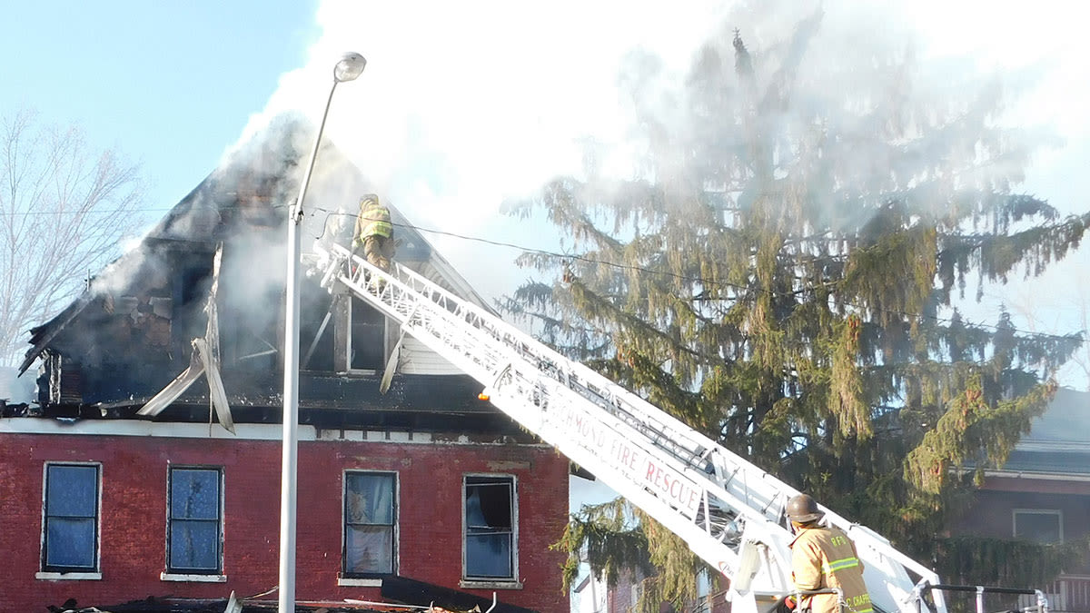
Firefighting has changed over time, and modern developments have turned an age-old art contemporary. For some departments, this has included incorporating drones and photogrammetry into their workflow. This use case overviews how the Richmond Fire Department in the State of Indiana uses photogrammetry outputs from Pix4D for debriefings, enforcing city zoning laws, and fire investigations.
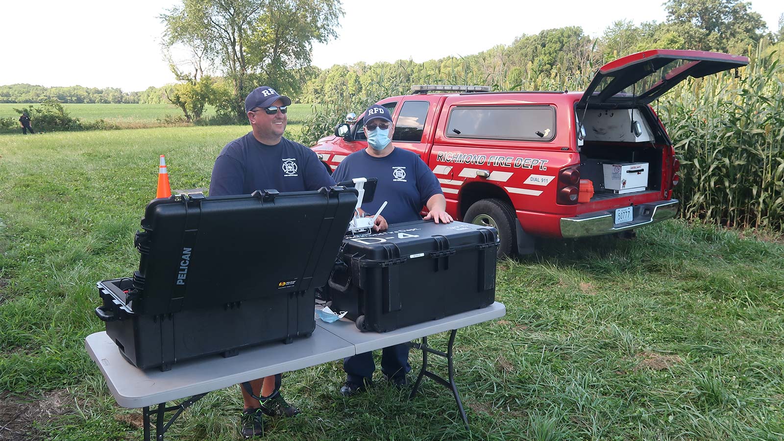
This 80 firefighter-strong department used a grant from a local bank to kick start their drone program. With 5 stations serving a city of 40,000 citizens, just 3 of the 80 are part of the drone team. This group uses photogrammetry for modeling sites after a fire event for post response debriefs, or hotwashes.
Firefighter Jamey Miller leads the drone unit. Founded a year ago, their current method is to fly a scene within 24 hours of a fire event. They want to map the location after they are sure the fire event is truly over, but also when they have the best lighting conditions to capture imagery for processing. Diffuse light, or a cloudy day with no shadows is ideal. If the event happened late at night, they may wait until the middle of the next day to capture their imagery. All of their imagery is processed with a desktop computer at the fire department which can handle PIX4Dmapper and other resource intensive software.
Project details
| Users | Richmond Fire Department |
| Location | Richmond, Indiana, USA |
| Software | PIX4Dmapper, PIX4Dcloud, PIX4Dcatch |
| Hardware | DJI Phantom 4 Pro, iPad Pro 2020 |
| Total number of images | 1,142 |
| Image resolution | 20 MP |
| GSD | 0.28cm /0.011 inches |
| Time on-site | 1.5 hours |
| Processing time | 5 hours |
Typically, Miller’s unit fly the DJI Phantom 4 Pro in double grid missions, using the drone’s 20 megapixel camera to capture imagery of the site and process the data in PIX4Dmapper. In the last few months, following the release of PIX4Dcatch, a iOS app which allows individuals to walk around a site capturing imagery with a mobile device, Miller and his team have explored implementing this application for capturing the interior of scenes. The app automatically extracts the correct number of images required to reconstruct scenes, and geotags the photos to ensure the models have real world location.
The team has found ensuring proper lighting is useful for capturing interior scenes post fire with PIX4Dcatch, since you can't rely on the sun to light up the interior of a burnt structure. They set up powerful LED work lights that supply ample light, minimize any shadows inside, and allow their mobile devices' cameras to clearly capture soot covered walls.
The effective fire fighting drone response workflow
When working with external bodies, such as the police, Miller uses Pix4Dcloud to share data and results. This is vital when using drones for vehicle crash investigations, where there is a priority on fast responses for the investigation and avoiding public disruption with traffic. Uploading outputs processed in PIX4Dmapper to PIX4Dcloud only takes a few minutes with their department internet. Using Pix4D software has dramatically changed how Miller's team completes their hotwashes and created a valuable, shareable resource for use within the Richmond Fire Department and externally with other agencies. Working together, they have found the best techniques for using PIX4Dmapper to get the best out of the software.
“Understanding how processing options will affect the outcome has been mostly trial and error experience. If you truly want to take advantage of PIX4Dmapper you must be willing to learn the finer details." - Jamey Miller
The data is typically collected the day after a call out - this means the lighting is better as Miller's unit can capitalize on daylight. The drone response team can then take their time gathering all of the data needed for an accurate 3D model. The unit's experience has also added to the accuracy of their models, as improving image collection techniques positively affects the whole project.
Innovating conventional fire fighting debriefs
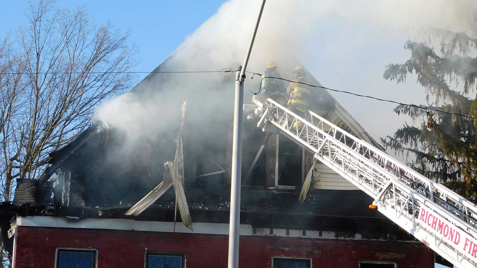
Debriefs, or hotwashes, are a crucial part of firefighting. Those on duty will present to their colleagues about what happened in a response and how their team reacted. This allows firefighters to share techniques, discuss challenges and educate each other. In the past, this was only possible with drawings and verbal accounts.
It's an innovation to have a realistic 3D model in the form of a point cloud for the firefighters to use as a descriptive tool. They can overview events by showing exactly where each of their teammates moved and narrating amongst their colleagues. Given the department has 3 shifts of A, B, and C, even if a firefighter was not at an event, the digital twin of the post fire site enables them to imagine being there more effectively than a simple verbal description. With better insights and discussion of the emergency response, they can be better in the future.
In addition, these models are valuable to the city authorities. Richmond authorities enforce city planning code which means demolishing buildings that are dilapidated and unable to be repaired. Abandoned buildings can pose a risk to the public, or be a site for arson. Demolishing them is a preventative measure for public safety.
The accuracy of creating 3D maps of a site very soon after an incident is invaluable to the Richmond FD. Where Google Maps or similar programs can be several years out of date, PIX4Dmapper can be used to get a full, immersive impression of a location and show the damage that occurred in a fire. It also gives fire fighters the chance to show colleagues where they applied what techniques to a building.
“Being able to utilize the 3D model from the drone has assisted in multiple fire & life safety inspections and preplans. Oftentimes we are unable to get the overall picture due to limited access of the property until we see the 3D model. I see the use of this program growing due to the benefits we have gained from this technology.” - Deputy Chief of Fire Prevention Douglas Gardner
The variety of uses of photogrammetry by Miller's unit show the multi-outcome advantage of using Pix4D software. No longer reliant on hand drawn diagrams and outdated satellite maps, the Richmond Fire Department create their own replicas of buildings, giving their team an unparalleled level of detail and insight into their own work.