
Leveraging drones to quantify agricultural insights
Nearly three years ago, Pix4D opened up its Berlin office. Since then, Pix4Ders have been working hard to develop technology and agriculture-specific workflows to facilitate in-farm insights for farmers, service providers, or anyone interested in precision agriculture.
Since the initial release of Pix4Dfields on June 7, 2018, there have been several updates, each bringing new agriculture-specific functionalities and tools.
Pix4Dfields Evolution at-a-glance
Localized agriculture workflows
Today’s farm decisions need to happen in an instant, with the right tools and data, when and where you need them the most. Pix4Dfield enables our users to capture and analyze in-field insights in near-real-time. We are excited to continue to develop features that will provide you with actionable insights into implementing critical prescriptions, decreasing operational costs, increasing yields, and improving and maintaining the overall health of crops and soil.
Our Pix4D webinar series showcases how users have established Pix4Dfields as the foundation for agricultural decision making. To cater to our global user base, webinars are available in the following languages:
Learn more about Pix4Dfields in your language


Pix4Dfields licensing
Perpetual licenses to Pix4Dfields were a missing piece and a long-time coming, so we are happy to make it available just as we hit the 2nd year mark.
The Pix4Dfields perpetual license allows service providers, agronomy businesses, and others to count on our software as an asset to their company. It enables them to turn Pix4Dfields into a core part of their daily workflow, but also serves as a comprehensive tool for research and development - the key to scale and differentiate oneself from competitors.
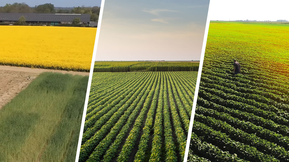
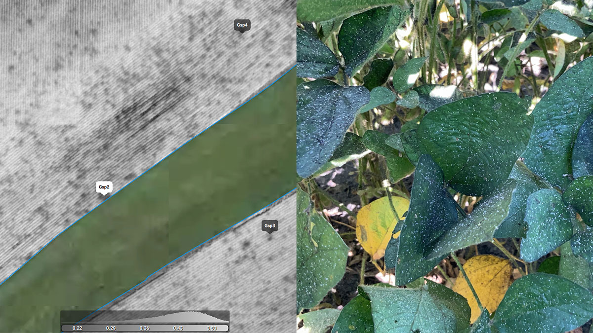
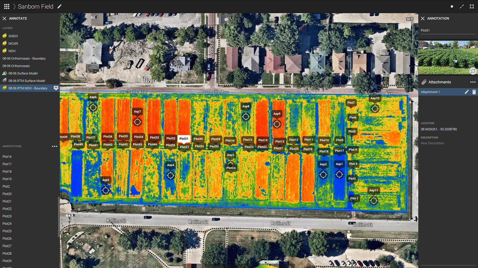
Drones equipped with sensors enable season-long mapping of crops. The question is how to extract meaningful information for decision making from large datasets in the form of simplified maps and outputs.
The Pix4Dfields EDU license, enables educational institutions to teach precision agriculture mapping technology and brings the power of multispectral data in agriculture to students worldwide.
Your digital boots on the ground
At Pix4D, our priority when developing and upgrading software is to listen to what our users need. We want Pix4D to be an extension of your agriculture drone workflow, to get you to the result faster and in a more intuitive way.
Each crop, project, and hectare mapped matters. Thank you to all of our users and partners, and the agriculture community for always challenging us to deliver better solutions. Happy birthday, Pix4Dfields.


