
Drone survey for solar panel installation on rooftops
In the last few years, solar power has proven to be a clean and economical alternative to fossil fuels. Today, in the U.S, an estimated four million students attend schools with a form of solar power which subsequently results in an increase in rooftop solar panel installations1.
Installing solar panels on school roofs starts with a survey, which is exactly what the Borbas Surveying and Mapping company based in New Jersey specializes in. Leveraging drone mapping and Pix4D technology, the Borbas team has been optimizing their workflow on a series of surveying projects since late March 2020. An additional benefit of the roof survey is that it gives the school a good overview of the roof strength and stability before the solar panel installation.
Using remote sensing techniques was always necessary to survey areas under strict safety and security measures and is particularly advisable during the current COVID-19 pandemic.
Project details: surveying school roofs for the installation of solar panels
| Location | New Jersey, USA |
| Survey team | Borbas Surveying and Mapping, LLC |
| Hardware | DJI Phantom 4 Pro |
| Software | Pix4Dsurvey Pix4Dmapper |
| GNSS receiver | Precise GNSS receiver connected to the Leica Smartnet |
| Total station | Leica TCRP 1203 |
| Processing time | 8-10 hours |
| Digitizing time | 4-24 hours (depending on the project size) |
For capturing images, Borbas’ FAA-certified UAS pilots use a DJI Phantom 4 Pro and perform two or three flights to cover all sections of each roof. Using a drone for outdoor surveying has already helped to cut the time spent on traditional surveying methods.
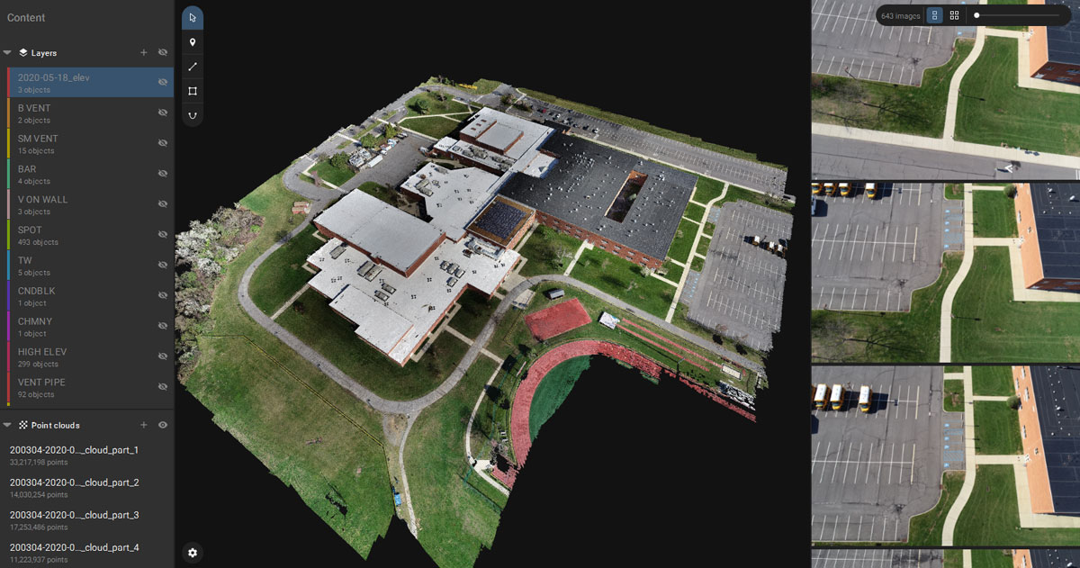
The next step in the workflow consists of using a total station to do a traverse routine around the building to measure the location of the building corners and of additional points in the project area. These measurements are incorporated as ground control points (GCPs) in Pix4Dmapper to better georeference the results. An accurate dense point cloud is then generated with Pix4Dmapper. This point cloud is a complete 3D representation of the project area and the work of digitizing features can start!
Digitizing 50% faster with Pix4Dsurvey
Since Pix4Dsurvey’s launch this spring, the Borbas team has been using the software’s vectorizing functionality to digitize the features, either points, lines, or polygons, that need to be exported from a point cloud to CAD software.
Learn more in our exclusive webinar
Discover how to optimize your surveying and mapping workflows and create engineering-ready CAD files from photogrammetry projects.
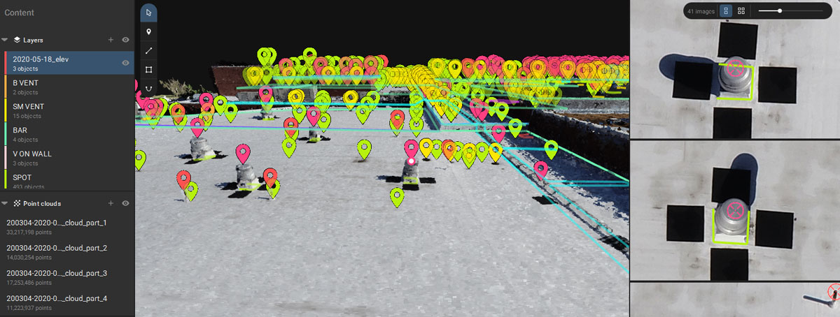
“It’s a lot faster to move the vertices around by adding and removing them directly in the 3D view than having to click through all the different images to get the exact spot that we wanted. Also, being able to have it in a format that’s easily transferred to CAD in multiple layers has also been an exciting feature to add and speed up our workflow,” says Dakota Hettel, Geospatial Technician at Borbas.
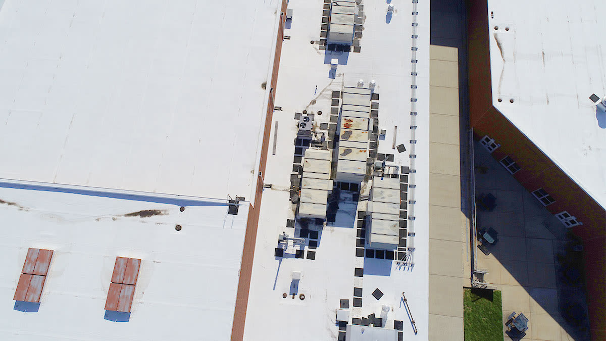
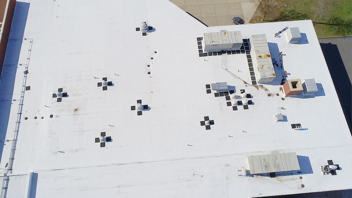
There are several features the Borbas team has to digitize on the roofs to export to CAD software for further analysis: features that might prevent the installation of the solar panels such as pipes and ventilation units, the top and bottom edge of the building walls, shaded sections of the roofs, doorways, and elevation spot shots to define drainage.
A faster workflow for a brighter future
The Borbas team will continue using Pix4Dsurvey in their next projects and are looking forward to new exciting features coming in the near future. By using a streamlined drone-based workflow, the Borbas Surveying and Mapping company saves time in data collection and vectorization while achieving the level of detail they need for their projects.
By using Pix4Dsurvey we could significantly speed up our work, especially when it comes to digitizing. What usually took two and a half - 8 hr days, now takes less than a day or only a few hours depending on the project size.
Dakota Hettel, Borbas Surveying and Mapping, LLC
References
| 1"A Brighter Future: Solar for Schools", Back to top |


