Ground control points: why are they important?
If you’ve attended a Pix4D training session, or spent any time on the Pix4D community or documentation, you’ll have heard the term ground control points.
Ground control points are ‘those big square things’ - right?
Right - but they’re a whole lot more than that too.
In this article, we’ll cover what ground control points are, and why they’re important in an aerial mapping project.
- What is ground control point in photogrammetry?
- Why do GCPs look like that?
- How do I create ground control points?
- GCPs, automatic and manual tie points - what’s the difference?
- How many GCPs are needed for an accurate aerial map?
- How do I choose where to place ground control points?
- Hand painted ground control points: sacrificing accuracy for speed
- Adding GCPs to a Pix4D project
- Do I always need to use ground control points?
- Accuracy above all
What is ground control point in photogrammetry?
Ground control points (or GCPs) are points on the ground with known coordinates.
In an aerial mapping survey, GCPs are points which the surveyor can precisely pinpoint: with a handful of known coordinates, it’s possible to accurately map large areas.
Why do GCPs look like that?

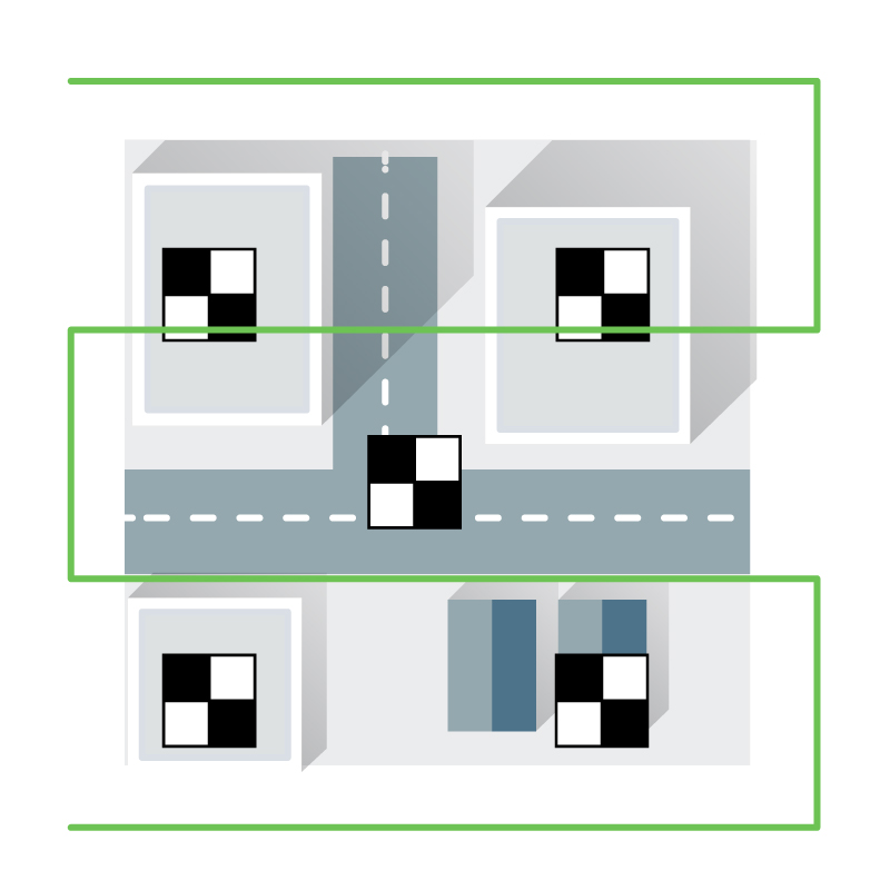
Ground control points can be anything that can be easily recognized in the images. Typically they look like a small section of a checkerboard. The shape leaves very little ambiguity about where the ‘point’ of a ground control point is.
They’re almost always black and white because it’s easier to recognize high contrast patterns.
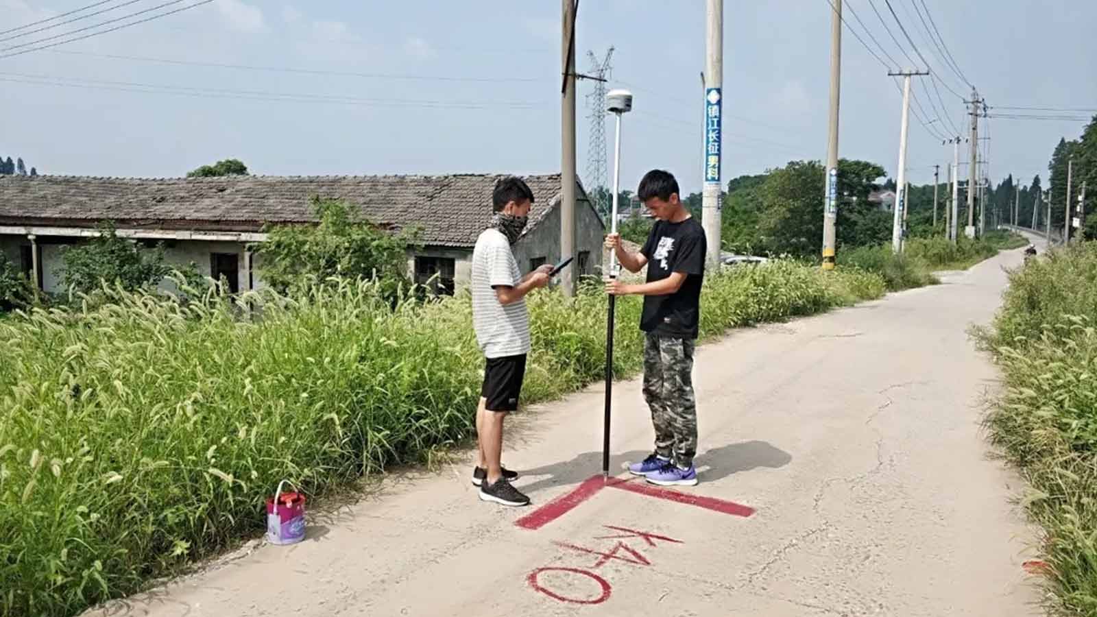
The points may be measured with traditional surveying methods, or have used LiDAR, or an existing map - even Google Earth.
The accuracy of Google Earth coordinates is variable at best. One study found that accuracy varied from 0.1 meter to 2.7 meters. Even if this is not sufficient for a surveyor, it can be useful for projects which need to be overlaid on a Google Map.
How do I create ground control points?
There are many ways to make your own ground control points and in theory, GCPs can be made out of anything. The go-to rule is to use high-contrast colors - which is why ground control points are usually black and white - and be sure that they are large enough to be identified from your particular flight altitude.
It is better to use water-proof materials if you plan to use them again, and use a matte finish to reduce glare and improve visibility.
Our users have made ground control points out of concrete posts (because painted GCPs kept getting washed away in the rain), vinyl flooring, baseball bases, and cardboard.
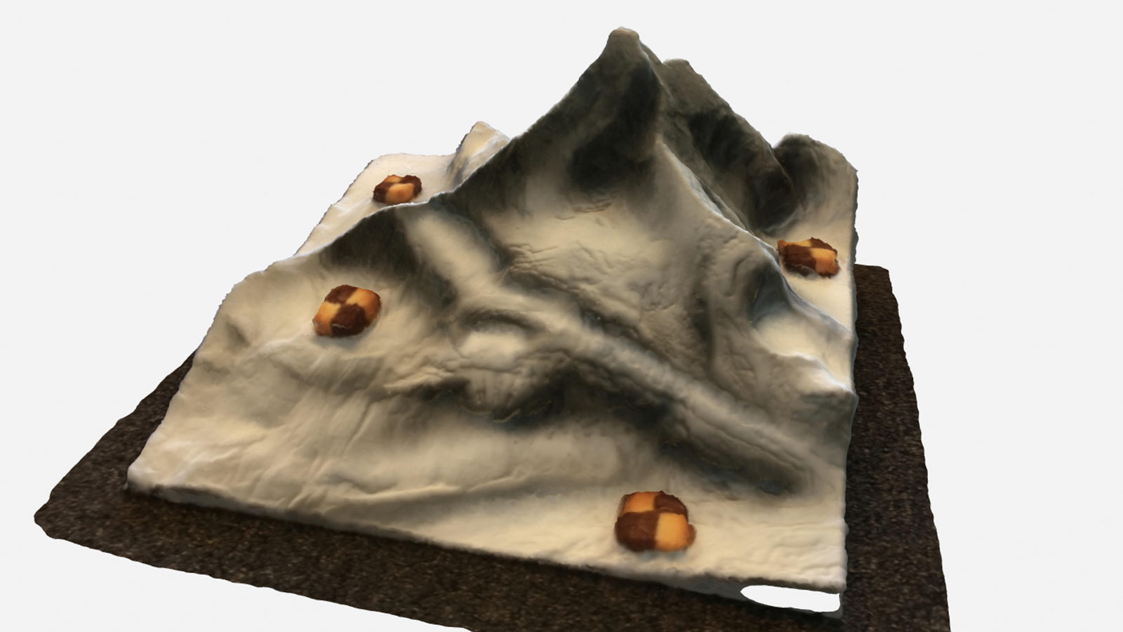
A team of Pix4Ders baked cookie GCPs to test this theory - they worked well as manual tie points, but because we didn’t know the precise coordinates we can’t say the model was correctly georeferenced.
GCPs, automatic and manual tie points - what’s the difference?
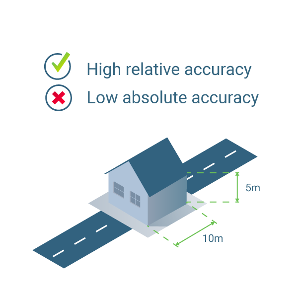
In Pix4D software, tie points are points which exist in multiple images. These can be detected by the software (automatic tie points), or added manually by the user (manual tie points).

Manual tie points help improve the relative accuracy of a project, but don’t help with absolute accuracy, as their location in space has not been defined.
How many GCPs are needed for an accurate aerial map?
You may be surprised - independent tests show you need fewer GCPs than you think for accurate results.
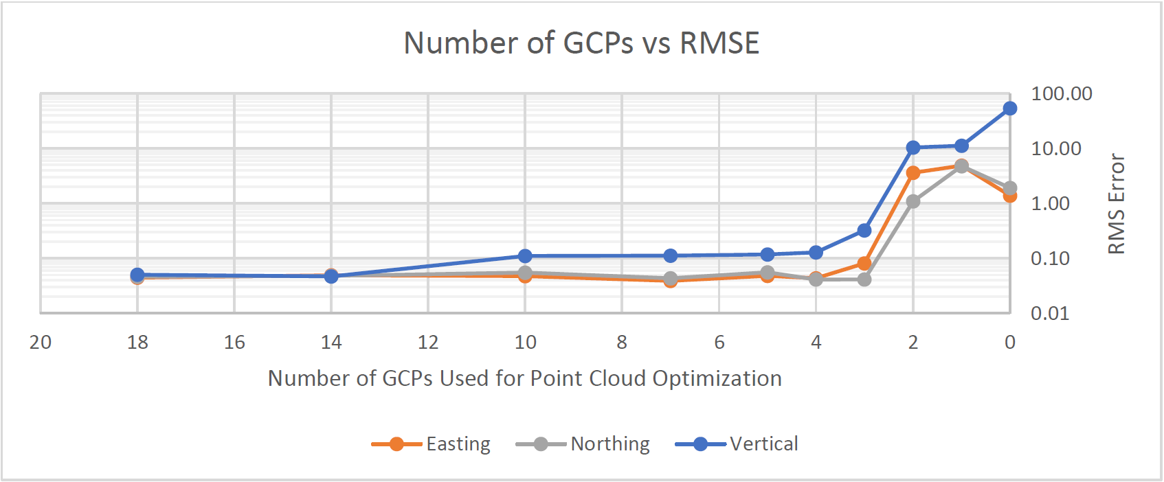
While placing ground control points can be time consuming, it takes less time than reflying a project to improve accuracy. We recommend using at least five ground control points.
How do I choose where to place ground control points?
If you were surveying a perfect square, it would be easy to answer that question: one ground control point at each corner, and one in the center.
Things are seldom as simple as that. These quick tips will help you place ground control points for better accuracy.
- Stay low. Ground control points should be on the ground for consistent results.
- Be careful when choosing ‘naturally occuring’ ground control points. Some features (such as parking spaces or the corner of buildings) may be too repetitive to be useful. Shadows are tempting - but they may move even in the time it takes to fly a site.
- If the area isn’t perfectly flat, place GCPs across the different elevations - at the top and bottom of a hill, for example.
- External tests show there’s generally no need to place dozens of ground control points: aim for between 5 and 10.
Hand painted ground control points: sacrificing accuracy for speed
Mappers in a hurry sometimes slash an X on the ground with spray paint to use as a GCP. The jury’s still out on whether or not this is better than nothing.
Imagine a line of spray paint: it might cover a handbreadths of the site. Small in relation to a building, but the 'center' is unclear compared to a traditional GCP.

Where is the center of each of the above images? It’s easy to spot the center of the printed GCP on the right. On the spray painted X on the left, the ‘center’ is could be anywhere within a 10cm area: enough to throw off your results.
We always recommend checkerboard GCPs over spray painted ones. If you must use spray paint, paint a letter L rather than an X and pinpoint the corner, rather than the center.
Adding GCPs to a Pix4D project
You’ve placed GCPs in the field, marked them accurately, and flown your survey - what’s the next step?
Do I always need to use ground control points?
It depends.
GCPs have been a traditional part of aerial mapping projects. However, this is changing.
If you are using an RTK drone, then our tests have found ground control points do not meaningfully improve accuracy.
If your drone is not RTK enabled, then we will always recommend using GCPs.
Skipping ground control points may yield perfectly fine results, but your reconstruction might not have the correct scale, orientation, or absolute position information. GCPs or RTK geotags can help you verify the accuracy of the reconstruction.
The future of accuracy: AutoGCPs
Pix4Dengine is a powerful platform which drives photogrammetry at scale. And it’s just had a major upgrade.
AutoGCPs is a new module which is currently exclusive to Pix4Dengine. As the name suggests, they can automatically detect GCPs in your project, accurately completing a manual task faster. The combination of machine-learning and computer vision allows the software to pinpoint the exact center of a ground control point almost instantly.
Internal tests confirm that with RTK-enabled drones, AutoGCPs achieves “better than pixel precision,” says project lead Andrea Dotti. “When people take the measurements manually, the results are as accurate as they are.”
The technology is currently limited to Pix4Dengine: get in touch with the team to try it for yourself.
Accuracy above all
As surveying and mapping professionals (and enthusiasts) know, accuracy is key to the success of just about any project.
Using a drone for aerial photography can yield impressive-looking images, but aerial photogrammetry requires precision and accuracy.
There’s a number of tools you can use to achieve this goal, as we will continue to outline in this series of posts. GCPs are just one of them.
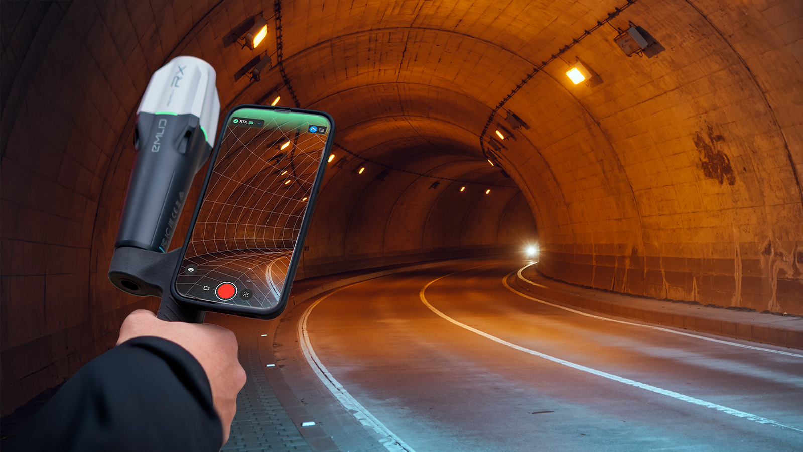
| Lead image courtesy of All Drone Solutions |