
Maximizing crop production using precision agriculture
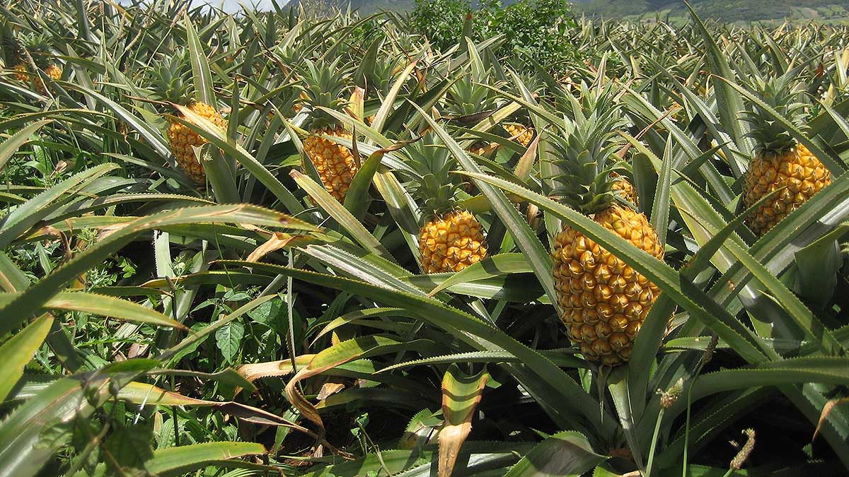
The world loves pineapples - and they’re big business.
The sector has grown more than 3% year-on-year for almost a decade. As one of the top 10 producers of pineapples, Mexico grows an average of 741,000 tons of the fruit every year. This satisfies its domestic demand and allows for international export - a sector which is expected to grow by 62% by 2030.
Accessing the inaccessible with drone mapping
One of the main challenges with managing crops like pineapples is crop accessibility.
If it’s difficult to access crops, there is a bigger chance of missing an issue during the initial stages, when preventive actions can still be taken. Using drones and PIX4Dfields for scouting and crop analysis makes the monitoring workflow easier and more efficient.

Piñas Peralta, a Mexican pineapple grower, initiated a drone mapping project in the area of San Juan Evangelista, Veracruz in March 2019. This area has the largest pineapple production in the country, which accounts for 65% of the national volume.
To perform multiple drone flights and crop analysis over pineapple fields, Piñas Peralta hired Coatza Drone, a Mexico-based precision agriculture company. The main goal of the project was to verify the status of the crops in order to make correct decisions for the production optimization of the pineapples.
Project details
| Company | Coatza Drone |
| Location | San Juan Evangelista, Veracruz, Mexico |
| Project description | Support local producers in order to optimize the production of pineapples by incorporating new technologies |
| Project size | 11.7 ha |
| Data capture & processing | Flights:40 minutes Processing: 10 minutes |
| Hardware | DJI Phantom 4 Pro & Parrot Sequoia multispectral camera |
| Software | PIX4Dfields agriculture mapping software |
| Outputs | Orthomosaic, index map |
| GSD | 1.28cm |
Coatza Drone used a DJI Phantom 4 Pro with a mounted Parrot Sequoia camera and performed two flights - each taking 20 minutes.

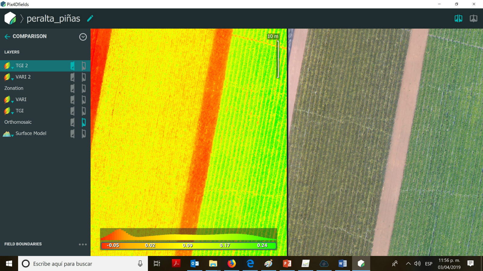
Crop status verification with PIX4Dfields
Once collected, data from the drone’s SD card was plugged into a standard laptop. Processing around 500 images with a ground sampling distance (GSD) of 1.28 cm took 10 minutes using Pix4Dfields.
“The speed of processing algorithms helps to make the scouting more efficient coupled with the tools that complement the software, making it very versatile to use,” says Coatza Drone COO, Álvaro Ruiz Molano.
Both multispectral and RGB imagery was used to produce analytical maps in PIX4Dfields. These outputs were used for digital scouting and crop status verification.
“We use the indices to see details of the state of the crops,” Álvaro Ruiz Molano points out. “When using the comparison tool we can more clearly see the difference of the plants in good condition and those that are suffering from a state of dryness.”
Sharing results
Once all the maps were created, Coatza Drone generated a PDF report to share with their client Piñas Peralta. “Something very useful is the power to generate a PDF report to send to the client showing exactly what they requested and in a short turnaround,” says Álvaro Ruiz Molano.
PDF reports are a new feature bundled in the latest PIX4Dfields release. Creating a PDF report is easy. Simply navigate to the export tool in your PIX4Dfields toolbar. Select export type as PDF report, choose outputs you want the report to contain and hit export. The PDF report will be saved in the same folder you predefined for your outputs.
“To obtain fast and reliable results by using drone mapping technologies and the possibility to share them directly from the field, helps our clients to make quick and precise decisions,” says Álvaro Ruiz Molano.
By inspecting the dry hot spots in the maps, Piñas Peralta was able to take actions such as covering the plants with mesh to protect them from further sun damage.
Continued sun damage may have degraded the crops or even rendered them unsellable - PIX4Dfields had a real effect on the company’s bottom line.
Reducing operational costs by 30%
By implementing precision agriculture, Piñas Peralta estimate that by the end of year they will have a harvest of 70 tons insured per hectare and will increase their gains by 15-20%.
By putting the right tools in their hands, Pix4D helped Piñas Peralta with crop health analysis, pest detection, weed detection, water stress and stagnant water issues.Piñas Peralta will continue working with precision agriculture technologies as they result in higher assured production, operational cost reduction, and overall farm efficiency.
They estimate that by the end of 2019 the company will be implementing the technique proposed by Coatza Drone throughout their production ultimately reducing operational cost by at least 30%.


